The truth behind the clichés
USA – Canada | Anno 2005
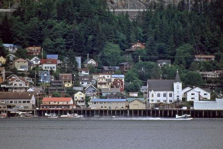
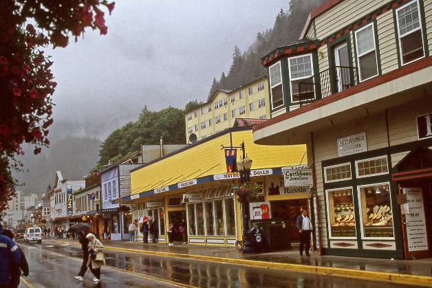
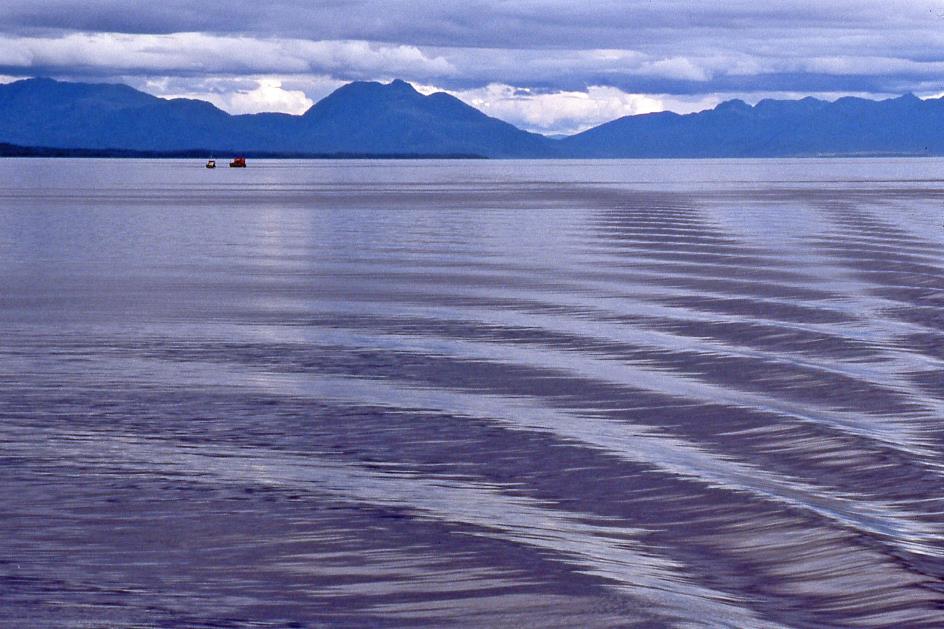
Friday, July 15 | Prince Rupert
Saturday, July 16 | Prince Rupert – Petersburg
Sunday, July 17 | Petersburg – Juneau
Friday, July 15 | Prince Rupert
Hunting buffaloes, living in tipis, chasing covered wagons, occasionally claiming someone else's scalp – these are the activities that spontaneously come to mind when we think of 19th-century Indians. Thanks to Karl May, Winnetou, and Old Shatterhand.
Hunting buffaloes, living in tipis, chasing covered wagons, occasionally claiming someone else's scalp
But that image is not accurate, explains Brandon. To the extent that there is any truth behind those rough clichés, they only apply to the Plains Indians – the Indians who inhabited the vast North American plains between the Mississippi and the Rocky Mountains. And Brandon should know because, despite his Anglo-Saxon appearance, he proudly identifies as Tsimshian, one of the original inhabitants of this inhospitable region.
We noticed it immediately earlier when our Bombardier Dash 8 pierced through the dense cloud cover with its two propellers. The rugged coastline of northwest Canada emerged, with deeply cut bays, numerous islands, and densely wooded hills. Survival is not a given in this semi-wilderness. Even finding a landing place for our Bombardier seemed impossible.
Prince Rupert
Fortunately, the pilot had a different opinion. After a flight of about two hours from Vancouver, he landed us on the relatively flat Digby Island, a few kilometres from Prince Rupert. High mountains surround this town of 26,000 inhabitants. However, few are granted the opportunity to enjoy this picturesque setting because nowhere in Canada does it rain more than here. Rain, snow, clouds, mist, or a combination thereof usually obscure all that beauty from view. So too today. But, for now, the drizzly rain fails to dampen our enthusiasm.
Rain, snow, clouds, mist, or a combination thereof usually obscure all that beauty from view
Before Europeans made their appearance here, about twelve tribes lived in the northwest of Canada. In addition to the Tsimshian, there were the Nisga’a, Gitskan, Tahltan, Heiltsuk, Haisla, Tlingit, Haida, Kwakwaka’wakw, ... and many more. However, grouping all these tribes together does them injustice, emphasizes Brandon. Because some differ more from each other than, say, the Finns from the Portuguese in Europe. The five languages they speak show greater diversity than European languages. These peoples prefer to call themselves First Nations.
It was only when the glaciers finally retreated 9,000 years ago that the first Tsimshian appeared on the banks of the Skeena. However, it would take about four thousand years before one could speak of a large-scale presence. Fishing communities of five thousand inhabitants, complete with houses, smokehouses, and drying racks for fish, were no longer exceptional at that time.
Prince Rupert
The Skeena supplied salmon, while the Nass also yielded eulachon, a nutritious fish that produced a significant amount of oil. This oil not only helped them bridge the difficult period at the end of winter but also played a crucial role in trade with southern peoples. The Tsimshian even managed to trade with the Kwakwaka'wakw on Vancouver Island – a journey of about four hundred kilometres by canoes over turbulent waters.
The Tsimshian even managed to trade with the Kwakwaka'wakw on Vancouver Island – a journey of about four hundred kilometres by canoes over turbulent waters
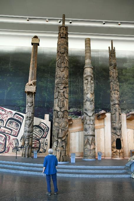
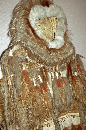
Tipis wouldn't be of much use in this harsh climate. Traditionally, the Tsimshian lived in longhouses. Massive tree trunks formed the skeleton of the dwelling, with planks forming the walls. Such a longhouse could accommodate 80 to 200 people, making it the centre of social, economic, and even political life. The museum where we currently find ourselves, the Museum of Northern British Columbia, is constructed entirely in the style of such a First Nations Longhouse, Brandon is quick to point out.
Imagine several families living together in the same space. It must have been a bustling environment. However, there was a strict social hierarchy within the longhouse. The family with the highest status had its place at the very back, while the one with the lowest status was situated at the front near the door.
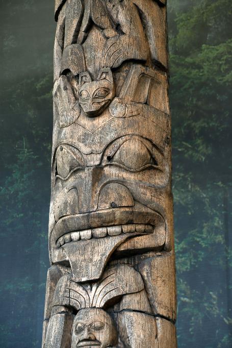
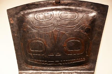
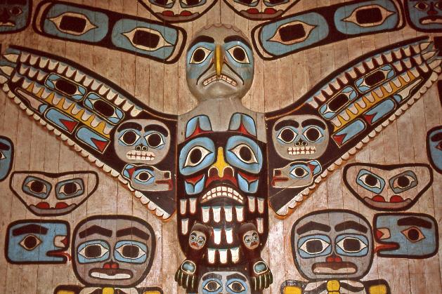
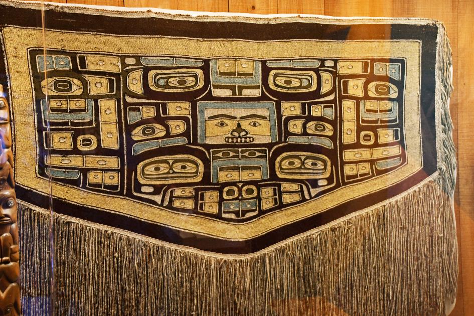
In the peak of the roof, the family cherished their crest. This was family property – the family had somehow acquired the privilege to bear that family symbol. There is a story of a family allowed to bear a grizzly as their crest because they had given food to an unknown stranger. The totem pole in front of the dwelling also reflected the history and social status of the family. These were impressive structures, ranging from six to twelve meters in height. Experts could decipher the meaning of each of the representations.
The totem pole in front of the dwelling reflected the history and social status of the amily
Totem poles |
|
Canadian Museum of History, Gatineau |
Raising a totem pole or installing a crest was not something done overnight. Such privileges had to be acknowledged by the community, and this recognition occurred during a potlatch. These ceremonies were organized only for significant events such as weddings, births, power transfers, or the most important of all – the erection of a totem pole.
After the festivities, guests received valuable gifts. This was the host expressing gratitude for their presence and willingness to witness the event. Only with these witnesses could the event become part of the adawx, the oral tradition that everyone was expected to know. The higher the status of the host, the richer the gifts. It could take years for the host to gather enough gifts to organize their potlatch. Sometimes, they never fully recovered from the financial strain. Towards the end of the 19th century, missionaries and authorities felt compelled to ban these practices, yet they would persist for almost a full century.
Hereditary lineage played a significant role. Your lineage determined who you were, what you could do, and what you were allowed to do. Each person belonged to one of the four clans – eagle, wolf, raven, or orca. Marrying within the same clan was not allowed, and descent followed the mother's line. If a raven man married a wolf woman, their children were considered wolf. Mater semper certa est, as the Romans used to say – who the mother is, is always certain.
Inland, the Tsimshian led a nomadic existence. Their settlement locations were determined by the season and the availability of food. When they moved, it was, of course, by canoe, as there was no alternative in this inaccessible area. They transported all their belongings, including the planks of the longhouse, across three canoes, forming a kind of trimaran ahead of one’s time. However, they left the skeleton of the house standing. Who knows, they might return themselves or others might move in. This way, the precious cedar was also preserved.
Nowhere on Earth has there been a greater concentration of nomads who lived solely by hunting and gathering, not relying on agriculture
While the northwest of Canada may be difficult to access, nowhere on Earth has there been a greater concentration of nomads who lived solely by hunting and gathering, not relying on agriculture. It once again illustrates the immense richness of this region.
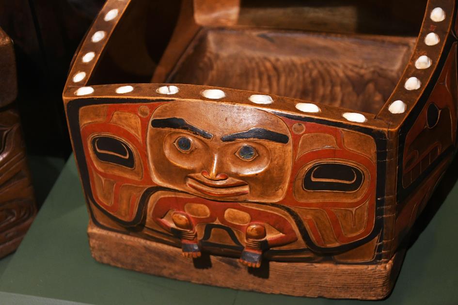
Bentwood box (Canadian Museum of History, Gatineau)
Christina guides us through the museum, showcasing artefacts from her ancestors – intricately woven baskets made from rye grass, combs, cups, masks. Our eyes are drawn to the renowned bentwood boxes, a fine example of woodworking technology. These cedar boxes consist of only two planks. One forms the flat bottom, while the other receives deep transverse cuts in three places. The plank is then steam-bent at those three locations, allowing it to fold perpendicular to form the four upright sides of the box. The result is a waterproof box made of bentwood.
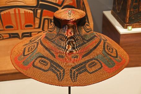
Hat woven in rye grass (Canadian Museum of History, Gatineau) |
|
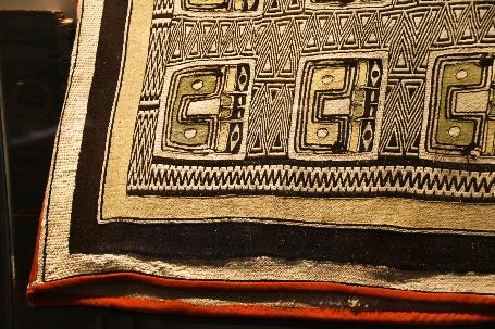
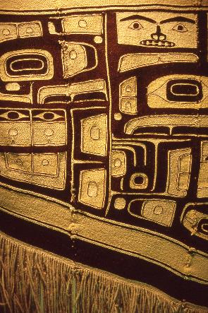
Chilkat (detail, Canadian Museum of History, Gatineau) |
Several exquisite examples of the famous T-shaped copper shields, known as coppers, are also present. These shields had nothing to do with warfare but were closely associated with the prestige of their owner, reserved for the aristocrats.
Copper (Canadian Museum of History, Gatineau) |
|
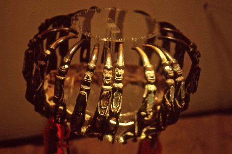
Metal crown (Museum of Northern British Columbia, Prince Rupert) |
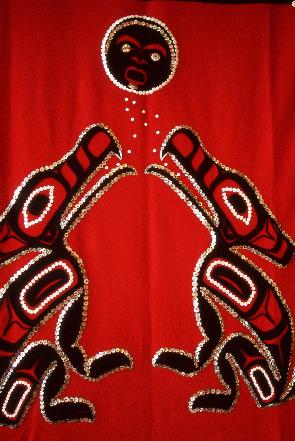
Equally beautiful are the chilkats. These intricately woven dance blankets were worn by the chief, the sm'oogit, during ceremonies. Christina points out depictions of a raven, orca, eagle, and frog – symbols of wisdom, wealth, peace, and prosperity, respectively. During the dance, the sm'oogit would shake his head, causing eagle down feathers to cascade like a cloud over the onlookers. This was his way of wishing them peace.
Chilkat (Canadian Museum of History, Gatineau)
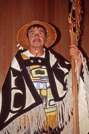
Sam, a sixty-year-old, considers it a great honour to share the stories from the oral history of the Tsimshian. He wears a splendid chilkat over his shoulders. These stories have been his passion for six years, but obtaining permission from the elders was not automatic. It was something he had to earn.
We owe the ebb and flow to a curious raven, who wanted to know what was happening at the bottom of the sea
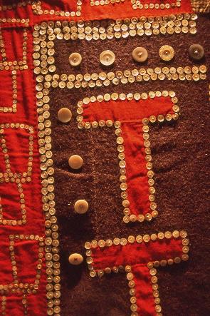
Button blanket with mother-of-pearl buttons (Museum of Northern British Columbia, Prince Rupert) |
|
Sam with chilkat |
|
Button blanket (Museum of Northern British Columbia, Prince Rupert) |
So, Sam teaches us how the ebb and flow originated. We owe this phenomenon to a curious raven who wanted to know what was happening at the bottom of the sea. He lifted the water, peeked briefly over the seafloor, and then let the water drop again – thus, the tides were born. We also become acquainted with the story of a grandmother and her granddaughter who, entirely self-reliant, learned from the spider people how to create a net for catching fish. Sam delivers his stories calmly, without any raised voice, almost monotonous, interspersed with numerous pauses and repetitions. Ancient wisdom tolerates no other storytelling style.
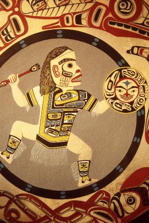
Warrior (Museum of Northern British Columbia, Prince Rupert) |
|
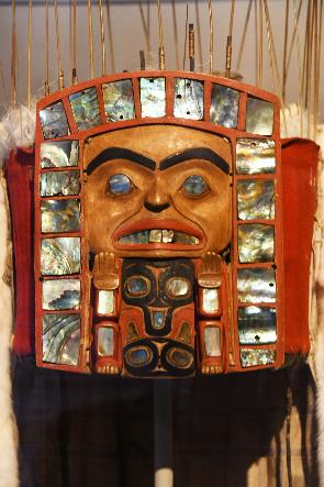
Wooden mask with mother-of-pearl (Canadian Museum of History, Gatineau) |
|
Chilkat (detail, Museum of Northern British Columbia, Prince Rupert) |
This in-depth introduction to the First Nations has somewhat overwhelmed us, and it won't end here. In the coming days, we will get to know the other protagonists in this region – the Russian fur traders and, especially, the gold seekers whose footsteps we will follow.
Saturday, July 16 | Prince Rupert – Petersburg
Quite normal, Father Harriot responds to our question about the weather in the Panhandle. He would know since he just returned from there. However, his playful eyes suggest that we can fully enjoy what is ironically referred to as liquid sunshine in this region.
At the breakfast table, we converse with this 79-year-old Anglican priest. He served in Alaska from 1952 to 1962, first in Point Hope, the most northwest point of Alaska, which, to us, seems one of the most challenging places to live. Then in Nenana, a village relatively close to Fairbanks, representing the civilized world. Finally, in Ketchikan in the Panhandle. In Point Hope, Father Harriot experienced the icy temperatures of the far north, in Ketchikan, the annual precipitation of 4,500 mm – almost six times that of Belgium. And in Nenana, he had to hastily relocate his wooden church in 1953 because it was threatened by the ever-changing course of the Tanana River.
If you recognize in the silhouette of Alaska a saucepan, then the Panhandle forms the handle of that pan
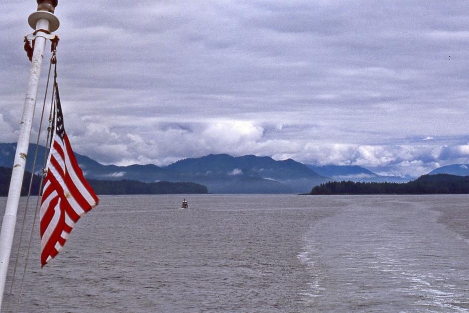
A journey of almost fifteen hundred kilometres lies ahead of us, with Dawson City on the banks of the Yukon River as our final destination. The first part of this journey will take us over water through the American Panhandle, a patchwork of thousands of islands and waterways with an infinite number of inlets, bays, and fjords. The second part will lead us through the Canadian interior to Dawson City.
If you recognize in the silhouette of Alaska a saucepan, this narrow coastal strip forms the handle of that saucepan – hence the name Panhandle. Like a finger 650 kilometres long, it points southeast to what is affectionately called the Lower 48, the 48 states of the USA that form a contiguous whole.
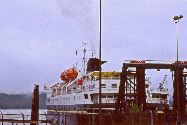
It won't be crowded in the Panhandle. On an area roughly the size of Portugal, there are at most 70,000 people. This may not come as a surprise because you cannot reach this area by land. The impenetrable coastal mountains take care of that. However, with its 11 ferries, the Alaska Marine Highway System makes the area perfectly accessible. Here, you take the boat as you would take the bus elsewhere.
The Matanuska in Prince Rupert |
|
|
In the early morning, we walk to the ferry terminal. But first, we check with the hotel receptionist for today's weather forecast. Maybe sunny, maybe rainy, maybe both, is his confident response.
"Maybe sunny, maybe rainy, maybe both," is what we are told when we inquire about the weather.
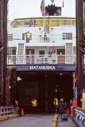
Checking in on the ferry is treated as a border crossing here, even though it's still a 70-kilometer sail to the territorial waters of the USA. Americans still have 9/11 fresh in their memories. During the journey, MarSec II, Maritime Security Level II, will be in effect, as indicated on a panel. Even in this remote corner, they assume a significant risk of attack. On board, for instance, the luggage lockers will not be allowed to be used.
People like us, it turns out, are considered 8CFR217 citizens. We obediently swear with our hands on our hearts that we are neither spies, nor Nazis, nor communists. That we don't use drugs and don't kidnap children. That we are free from infectious diseases, and especially free from HIV. Customs subject us to the classic interrogation about our luggage's past and our activities' future, but we know our lesson and pass the rigorous exam unscathed.
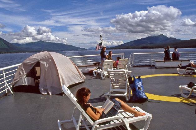
Forty-five minutes later, we stroll aboard the Matanuska, take our place in our cabin, and set our watches an hour behind. On board, they use Alaska time. The time difference with Belgium is already ten hours. For twenty-four hours, the Matanuska will navigate us northward through many densely wooded islands, sometimes along narrow and winding natural waterways. This route, from Prince Rupert in the south to Skagway in the north, is part of the Inside Passage and is renowned for its impressive landscapes, as long as rain and mist don't obscure the view.
Salmon perform acrobatics, a bald eagle chases a seagull, and the head of a sea lion briefly appears above water
It's twenty past seven when the Matanuska, with 152 passengers on board, disconnects from the dock for its 2,525th voyage. Immediately, the local wildlife puts on a show: salmon perform acrobatics, a bald eagle chases a seagull, and the head of a sea lion briefly appears above water. Gradually, the sun manages to burn away the thick cloud cover, painting the grey water surface postcard blue. We leave the calm waters of Chatham Sound behind us and head towards the turbulent open sea of Dixon Entrance.
Shortly afterward, we enter the territorial waters of the USA – our first contact with the vastness of Alaska. Indeed, this 49th state of the USA is immense. With its area of 1.5 million square kilometres, it is as large as Great Britain, France, Germany, Italy, and the Benelux combined. Yet, barely 635,000 people inhabit it.
Approximately one Alaskan in seven has Native American ancestry
Approximately one Alaskan in seven has Native American ancestry. We might spontaneously think of Eskimos, the most imaginatively captivating inhabitants of Alaska. To them, we owe inventions such as the parka, the kayak, and the dog sled. However, that's a double mistake. Because these people do not call themselves Eskimos but Inuit. They perceive the name Eskimo as an insult. Furthermore, within the rich diversity of Native American peoples, the Inuit are a minority that only recently appeared on the scene.
Today, we know that the indigenous peoples of America migrated not in one but in two waves from Asia. First, it was the ancestors of groups like the Tsimshian, Tlingit, and Haida who crossed the Bering Land Bridge. Today, you mainly find them in the interior of Alaska and Northwest Canada. Only thousands of years later did the Inuit emerge. They almost exclusively stick to the coasts. Then it was a few thousand more years of waiting before whites made their appearance in the 18th century.
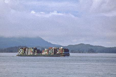
Container ship |
|
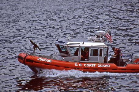
United States Coast Guard |
While the Matanuska searches for Revillagigedo Channel, ranger Matthew provides some explanation. What we see around us, he explains, is part of the Tongass National Forest. The largest rainforest in North America, it covers about three-quarters of the Panhandle – more than twice the size of Belgium. Year after year, four to five meters of rainwater fall on the densely wooded hills here. Meanwhile, the sky becomes increasingly overcast, and clouds nestle lower around the islands.
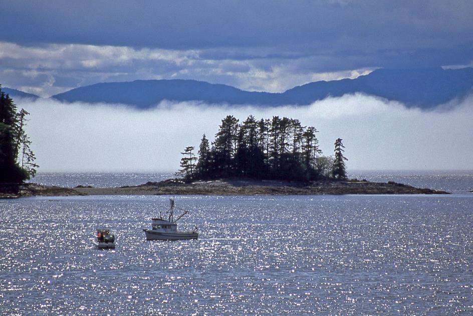
Mary Island and Annette Island make their appearance to the left. They belong to the Alexander Archipelago, a vast archipelago of eleven hundred islands stretching nearly five hundred kilometres off the northwest coast of the American continent. These islands shield these coastal waters from the open sea, allowing for busy shipping. Sailing between the islands is calm – Inside Passage owes its name to this.
In the 1930s, Ketchikan even claimed the title of the Canned Salmon Capital of the World
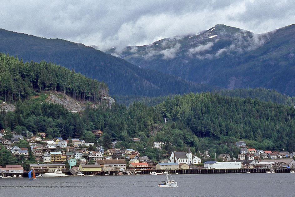
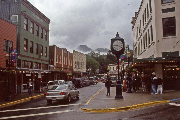
Ketchikan
Our first stop is approaching. Just after one o'clock, we dock near Ketchikan, a town of 15,000 residents and also the home base of the Alaska Marine Highway System. Like most settlements in the Panhandle, Ketchikan originated around a river where the salmon come to spawn every year. In the 1930s, the city even claimed the title of the Canned Salmon Capital of the World because nowhere else in the world was more salmon canned than in Ketchikan's twelve canneries.
Ketchikan |
|
|
The unloading and loading of people, vehicles, and cargo happen surprisingly quickly. A little over an hour later, we are on our way again. The sun is back in full force. Almost all hilltops are visible, the sky is mostly blue, and it's warm on board. Only in the distance, some sea mist drifts just above the water surface.
On the sun deck, a backpacker's tent has already appeared – not everyone stays in a cabin. An hour and a half later in Clarence Strait, it becomes a bit cooler under dense cloud cover.
|
|
|
Just after eight, we make a stop at Wrangell, one of the oldest non-indigenous settlements in Alaska. It derives its name from its founder, the Russian Ferdinand von Wrangel. The fur trade with the Tlingit brought the Russians here in the early 19th century. Later, the British Hudson Bay Company briefly took over the trade. But nowadays, the town is self-contained, like many in Alaska. This is evident from the banner that a resident conspicuously hangs against his house facade. Get US out of United Nations, we read. In 2005, isolationism is still alive in the USA.
For a large vessel like the Matanuska, caution is required in Wrangell Narrows
An hour later, the Matanuska continues its journey. Petersburg is our next destination. This is less straightforward than it seems, as the captain informs us through the speakers, because this route will take us through the notorious Wrangell Narrows. It's a narrow, winding waterway between Kupreanof Island and Mitkof Island. At some points, it is no more than a hundred meters wide and barely 7.35 meters deep. For a vessel like the Matanuska – one hundred and twenty-two meters long, 5.1 meters deep – caution is indeed required. Despite the captain's alarming tone, we are quite confident. After all, this is the 2,525th voyage of the Matanuska, if we remember correctly.
Due to the river's winding course, the red lights sometimes appear on our left, and the green on our right
It's half past ten when we approach the beginning of the gorge in complete darkness. Dozens of onlookers have gathered on the bow. We anxiously await the events. Initially, we can't see a thing until a strange play of light unfolds. On the right, triangular red navigation lights flicker at the edge of the fairway, on the left, it's square green lights guiding us. However, in the darkness, estimating the distances is challenging. Due to the river's winding course, the red lights sometimes appear on our left, and the green on our right. Occasionally, a white searchlight skims low over the water surface, searching for rock islets that make the passage even more exciting. We can't make head or tail of it. It takes precisely sixty minutes before we pass the last navigation light and can leave the 35 km long gorge behind us.
Only when we are in bed do we notice how the ship vibrates under the pounding of the engines. All metal parts of our cabin enthusiastically dance along. However, this doesn't prevent us from falling asleep. Vaguely, we hear the Matanuska dock in Petersburg shortly after midnight.
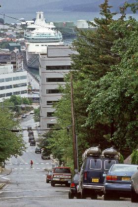
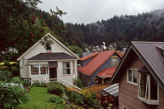
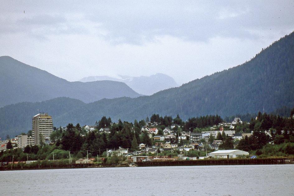
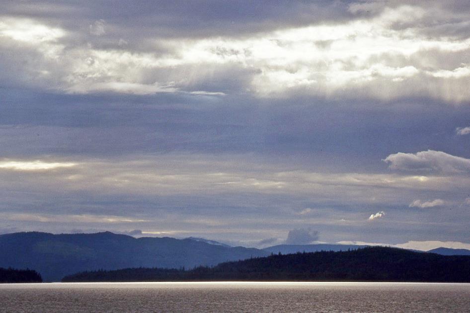
Sunday, July 17 | Petersburg – Juneau
The sky is overcast, the seawater is greenish-grey, the highest mountains are shrouded in clouds, and it's drizzling. It's half-past eight when we disembark in Auke Bay, 22 km north of Juneau. This means we have covered about three-quarters of the Inside Passage.
You won't find a bus or train here because that would deprive the taxi drivers of their livelihood. So, we set out in pouring rain in search of a taxi. Bruce takes care of that. During the summer months, he is a taxi driver in Juneau, and during the winter months, he hunts deer in the vicinity of his hometown, Petersburg.
In short, if you can't live with this self-imposed isolation, then you have nothing to look for here
Juneau – Franklin Street |
|
Juneau – Cruise ship |
If you were to ask for the capital of Alaska in a quiz, you might likely get Anchorage or maybe Fairbanks as an answer. However, it's the rather modest Juneau that claims that title. No capital in the world seems more isolated from its own hinterland than Juneau. The city is not even accessible by land, as the road network comes to an end at the foot of the mountains. Flying is not a certainty either, as dozens of flights are cancelled annually due to weather conditions.
The residents of Juneau don't seem bothered by it. Should the city be connected to the interior via a road? We see car stickers here and there that clearly answer that question: Want more roads? Move south! In short, if you can't live with this self-imposed isolation, then you have nothing to look for here.
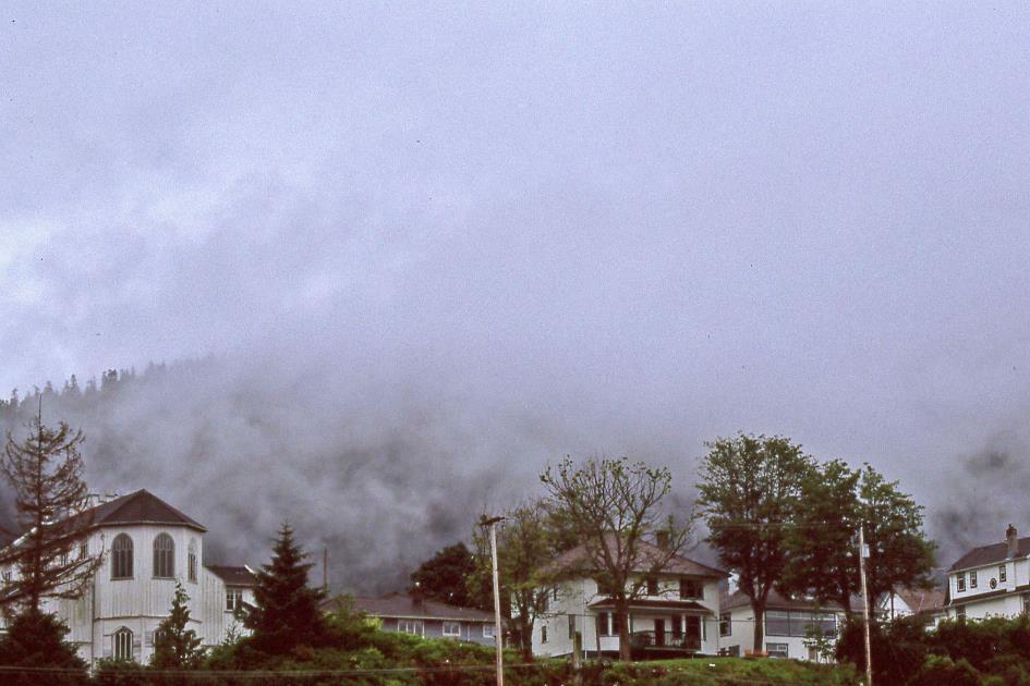
Mists still hang low over the water, and all mountain tops are hidden in the clouds as we climb the steep streets of Juneau. Down in the harbour, two gigantic cruise ships dominate the city's view. Wooden stairs against the steep mountain slopes take on the function of streets in some places – stairs that bear street names.
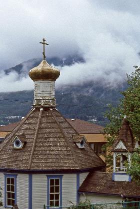
The Russian Orthodox church has been standing there since 1894 when it was built by Slavic immigrants and converted Tlingit people
Juneau |
|
St. Nicholas Church |
In the Russian Orthodox St. Nicholas Church, a service is currently taking place. The church has been standing since 1894 when it was built by Slavic immigrants and converted Tlingit people. The continued prominence of the Russian Orthodox Church in the Panhandle and the Aleutians can be partly attributed to the expansion policy of Peter the Great. It was he who, in 1728, sent Vitus Bering on an expedition to explore the strait that now bears his name.
When Bering died of scurvy in 1741, he had laid the foundation for the invasion of Russian fur traders in the area between Kamchatka and Alaska. The Russians were attracted by the abundant presence of seals and sea otters. However, the Russians themselves were not very skilled in sea hunting, an expertise mastered by the Aleuts. The Russians imposed a slave regime on the Aleuts by taking their women and children hostage, forcing the men to hunt for furs.
The Russians attempted a similar strategy in the Panhandle, but the resilient Tlingit people did not yield easily. The Russians faced several defeats, but eventually, the Tlingit had to surrender. From 1794 onwards, Russian Orthodox missionaries appeared in the region, leading to the construction of churches with their distinctive onion domes, such as the St. Nicholas Church.
As the lucrative fur trade declined, the Russians came up with the idea of selling Alaska to the young USA. In 1867, Secretary of State William Seward agreed to pay $7.2 million for Alaska – about five cents per acre. Many Americans at the time considered the Alaska Purchase a waste of money and soon dubbed it Seward's folly. Whether this perception still holds today is highly doubtful.
As the whites approached, the Indians thought the day of judgment had arrived
Strangely enough, one of the first encounters between whites and natives here followed a scenario similar to that between Cortez and the Aztecs or between Pizarro and the Incas. In 1786, the Chilkat Tlingit believed that the two ships they saw emerging on the horizon were large black birds with white feathers. Their ancestors' stories taught them that the Raven, the creator of the world, would return to reward those who had followed his example and punish those who had indulged themselves. As the whites approached, the Indians thought the day of judgment had arrived.
This isn't even an exaggeration. Although never more than nine hundred Russians lived in Alaska, their presence was as disastrous as Cortez's in Mexico and Pizarro's in Peru. When the Russians closed their trade, only 2,000 of the 25,000 Aleuts remained, mostly decimated by smallpox, tuberculosis, and influenza. The fact that Aleut families lived together in pit houses, sometimes with dozens of people, naturally increased the risk of mutual contamination.
With what they could gather in their natural environment, the peoples of Alaska managed to manufacture almost everything they needed. This is evident in the Alaska State Museum, where we learn that the entrails of seals and sea lions were the raw material for the waterproof parkas they wore during sea or ice hunting. Skilled seamstresses could fold the material in a way that the stitches never completely penetrated, keeping the parka waterproof.
Parka |
|
Alaska State Museum (Juneau) |
No image is more associated with the Inuit than the igloo. However, such snow huts serve exclusively as temporary shelters, for example, during the hunt when no other building materials are available. The bone goggles that allow only a very narrow slit of sunlight to pass through illustrate that the Inuit also feared snow blindness.
With such a fragile-looking vessel, we wouldn't dare to navigate even a shallow pond
Juneau – Front Street |
|
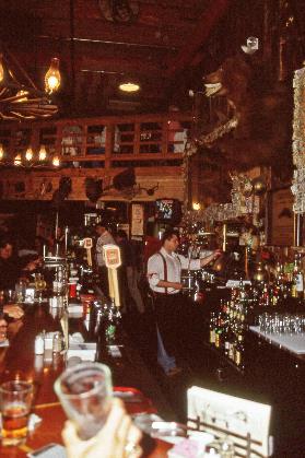
Red Dog Saloon |
For wickerwork, you had to turn to the Aleuts. Their baskets, bowls, and cups made from rye grass are unmatched masterpieces. On the other hand, the Iñupiat were skilled with the umiak, a boat made from sewn together bearded seal skins stretched over a driftwood frame. With an umiak like the one we see here, we wouldn't even dare to navigate a shallow pond; it looks so fragile. Yet, five to six hunters would board it to pursue bowhead whales on the Arctic Sea. These are massive creatures weighing sixty tons. The Iñupiat even crossed the Bering Strait with these umiaks.
For centuries, the Tlingit maintained their monopoly on trade between the northwest coast and the interior of Canada. Cedar was their specialty, and once again, it's the famous bentwood boxes that catch our attention.
Back outside in the drizzling rain, we come across a friendly lady selling hotdogs. Not just any hotdogs but genuine reindeer hotdogs. Worth a try. In the chill of the liquid sunshine, we can't help but acknowledge that this hotdog does not differ qualitatively from its European counterparts – neither in a bad nor a good way.
Sawdust on the floor and an abundance of paraphernalia on the walls and ceiling. That's the historical authenticity that the Red Dog Saloon tries to convey. Perhaps a bit artificial, but it's drier than outside. So, we settle in quietly behind our beer.
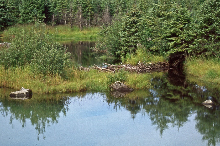
Beaver dam |
|
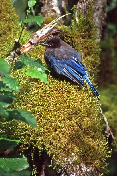
Steller's jay |
||
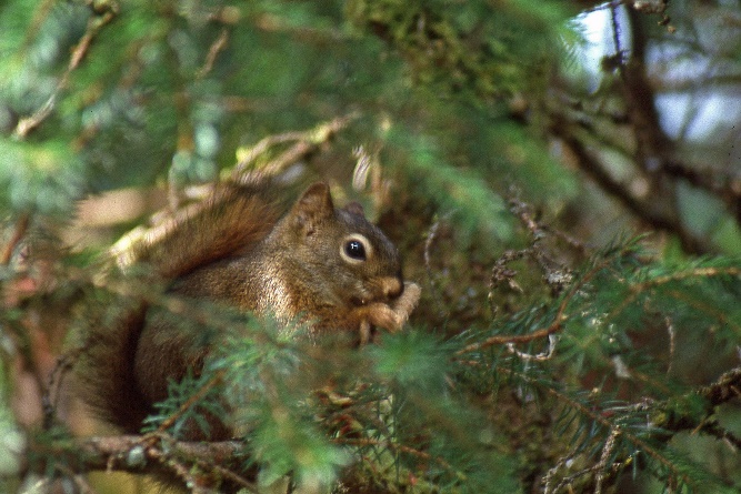
Squirrel |
|
|
||
Jaak Palmans
© 2024 | Version 2024-01-20 15:00
Continue reading in (2/4)