Brown bears like to bathe here
Russia | Anno 2019
Friday, August 2 | Kronotsky – Nalychevo
Friday, August 2 | Kronotsky – Nalychevo
Aeroport Khalaktyrka
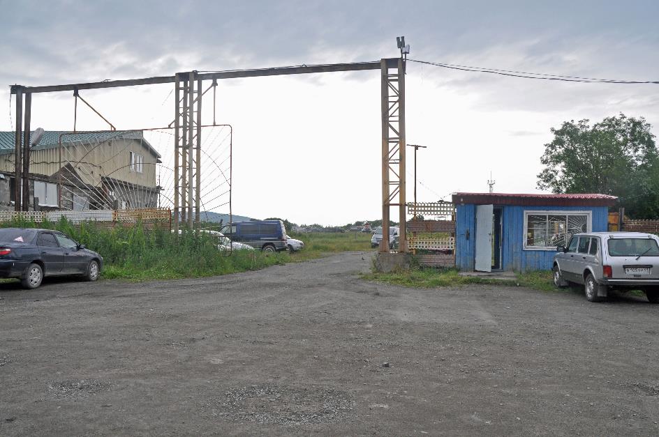
What a mess. An unpaved road full of potholes, knee-high weeds, dilapidated barracks, rusty debris, a gate not worthy of the name... This is not exactly the environment where you would expect to find a high-tech company. And yet, this is the place where the firm Kraj has established its helicopter business. The pricing policy is reasonable and acceptable for the customer is written in large letters on a sign at the entrance. In Russian, of course; foreigners probably have different conditions. Welcome to Aeroport Khalaktyrka, a would-be airport about eight kilometres east of Kamchatka's capital, Petropavlovsk.
In their heyday, Antonov An-2 aircraft were reputed to be very robust and reliable
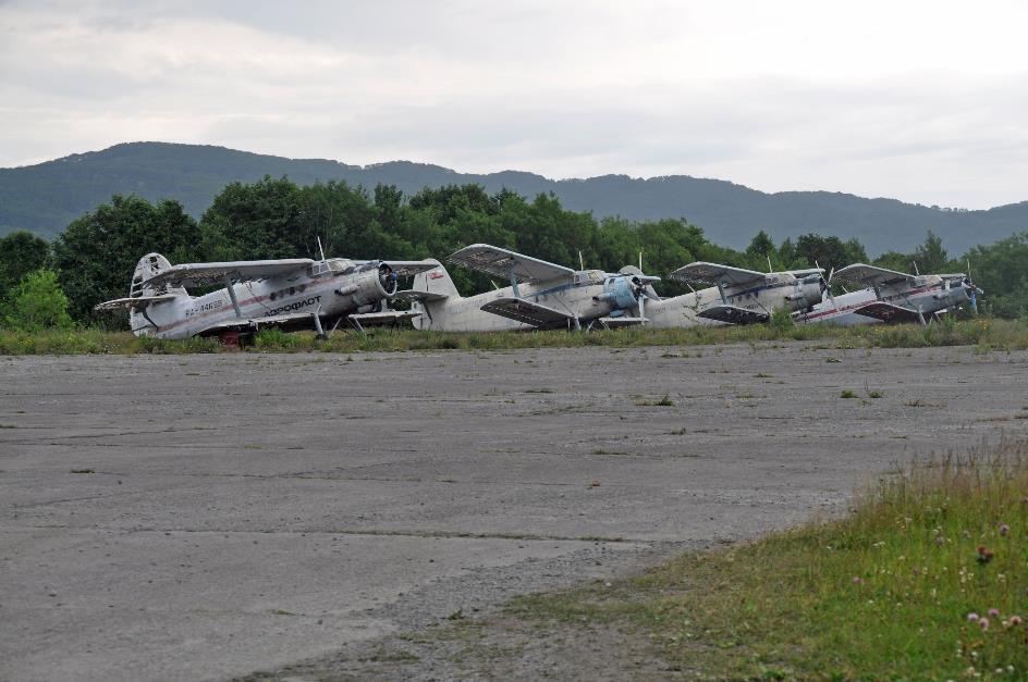
Antonov An-2 biplanes
In a remote corner of the compound, four biplanes are neatly lined up. They are no longer airworthy, these worn-out Antonov An-2 aircraft, but in their heyday, they had a reputation for being very robust and reliable. That made them extremely suitable for the tough work in Siberia. You could fit them with wheels, skis, or floats, so they could land in the most impossible places. And take off again.
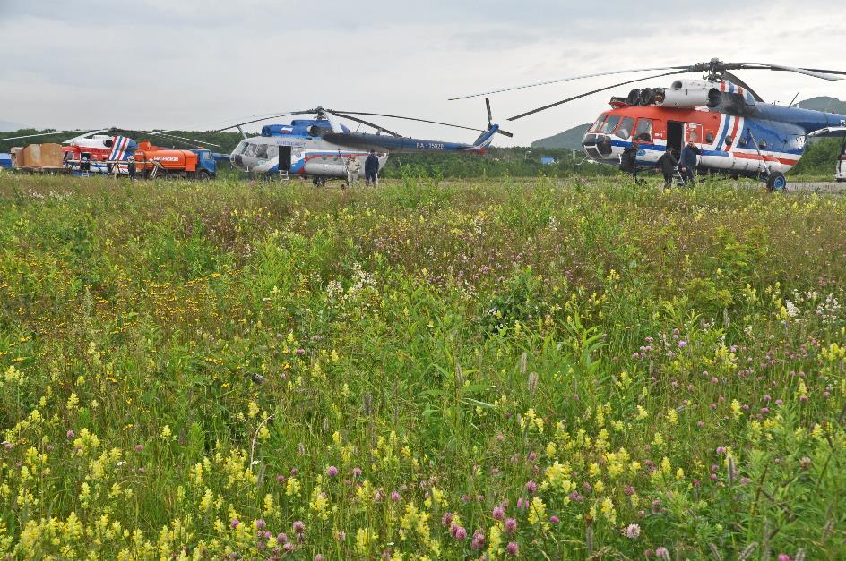
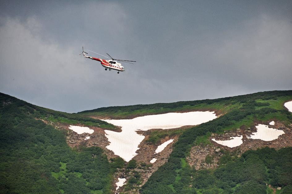
MI‑8 helicopters
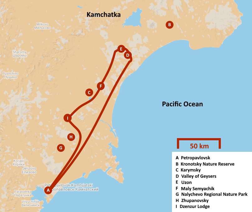
But what interests us most are the familiar MI‑8 helicopters waiting on the weathered concrete amidst patches of grass. One of those aircraft will take us northward today to the natural parks of Kronotsky and Nalychevo. This is something to look forward to because the Kronotsky Nature Reserve is consistently referred to as the crown jewel of Kamchatka. It has an area of one million hectares (2.5 million acres), but strictly speaking, you have to add 135,000 hectares (333,000 acres) to that because the sea is also protected territory up to five kilometres off the coast.
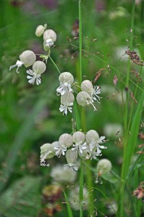
Bladder campion |
|
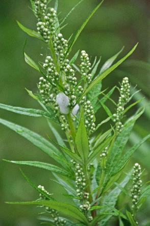
Nest of meadow froghopper |
|
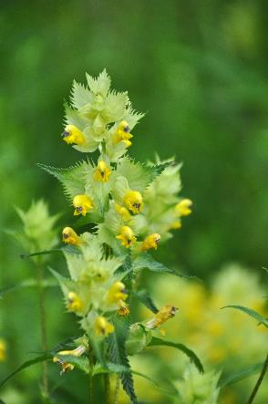
Yellow-rattle |
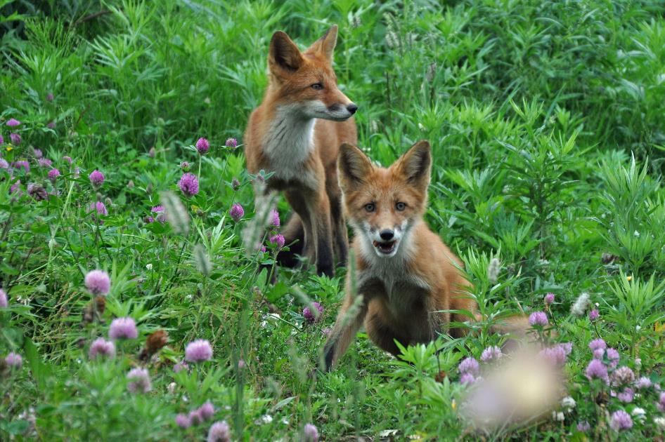
Semi-tame foxes
Discovering an enormous variety of ecosystems in such a vast area can't be a surprise. You'll encounter active and extinct volcanoes, hot springs and fumaroles, mud springs and geysers, glaciers and lakes, flower-rich tundra and salmon-rich rivers, dense birch forests and black beaches, high cliffs and remote bird islands, ... Far too much to explore in just a few hours, that goes without saying. We will be forced to limit our exploration to the two most popular sites – the Uzon Caldera and the Valley of Geysers.
The Kronotsky Nature Reserve is consistently referred to as the crown jewel of Kamchatka
As early as 1882, a large part of Kronotsky was declared a reserve. Not to protect this unique nature, as we would think nowadays, but to prevent the sable marten from extinction. Because the silky sable fur was so coveted that the sable marten was nearly wiped off the face of the earth. And that would, of course, be a disaster for the fur industry. Initially, it was therefore economic interests to which Kronotsky owed its protection.
In 1934, that changed. Kronotsky obtained the legal status of a full-fledged nature reserve or zapovednik. Although the concept was interpreted rather loosely by the Soviets. For example, in 1921, oil was discovered in the Bogachovka valley, an opportunity they couldn't pass up. Conservation is inefficient and contributes nothing to society, was the policy in the 1950s. Kronotsky lost its protection. In the Bogachovka valley, drilling could now take place without restrictions. An airport, a workers' village, roads, and no less than 88 boreholes appeared in the pristine landscape. Barely a few years after Stalin's death, Kronotsky was restored as a zapovednik, twice as large as before. In 1961, Khrushchev again considered nature conservation a 'far-fetched matter' and put an end to the protected status. Hardly had the flamboyant party leader been ousted, or Kronotsky regained its status. Permanently this time. The opportunistic yo-yo leadership came to an end. The fact that oil production had not proved profitable in 1965 may have played a role.
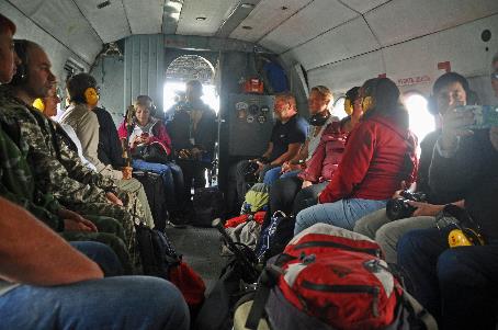
Cargo hold of MI‑8 |
|
|
Today, Kronotsky enjoys the highest level of legal protection in Russia. Even higher than the zakaznik status we learned about in South Kamchatka. Only three thousand tourists are allowed annually. Camping or staying overnight within the park is strictly prohibited, and there are no facilities for eating or sleeping. A visit is therefore necessarily limited to a day trip – a round trip by helicopter from Petropavlovsk. And strictly speaking, tourism is not even allowed.
Camping or staying overnight within the park is prohibited, and there are no facilities for eating or sleeping
Tourist day trips are therefore organized under the guise of scientific excursions, as these are tolerated by the government. You may also traverse the area on foot if you request permission in advance. It takes seven to ten days to reach the Valley of Geysers, and you are allowed to stay overnight in weathered log cabins. This is also tolerated because few feel compelled to do so.
For now, we have to wait for the MI‑8 to depart. The grey clouds above Petropavlovsk do not reassure us, and the raindrops that appeared on the bus windshield during our ride here are even more concerning. Apparently, a semi-tame fox family is living close to the airport. The mother and her two cubs are easily lured by tossing them some food.
Nalycheva River
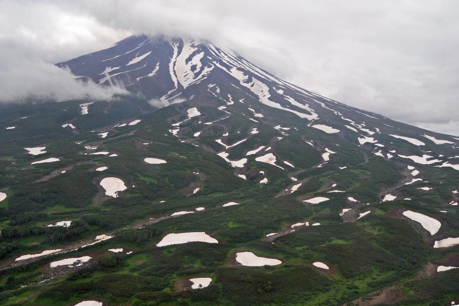
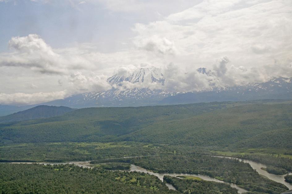
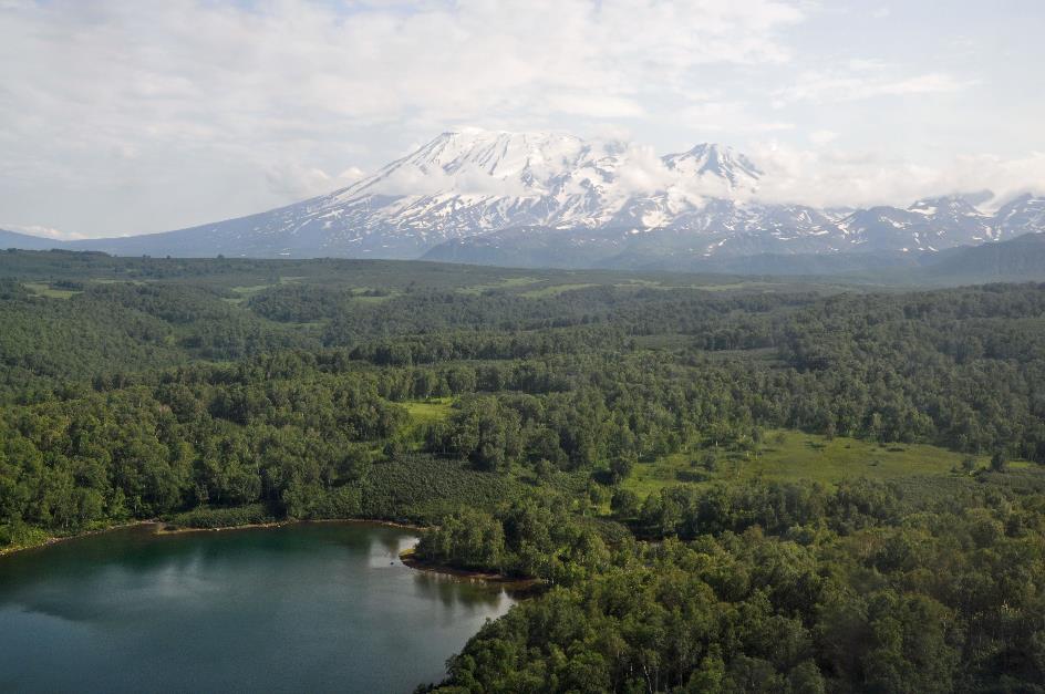
Just before half past nine, it's time. We are allowed on board an MI-8. Alexandra welcomes us; she will be our guide during today's scientific excursion. In a wide curve, we fly northward around the Avachinsky, one of the two volcanoes that dominated the horizon when we landed in Petropavlovsk last week. Although visibility is quite decent, the snowy peak of the volcano remains shrouded in clouds.
Zhupanovsky
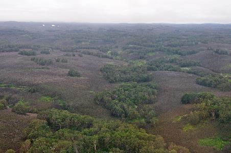
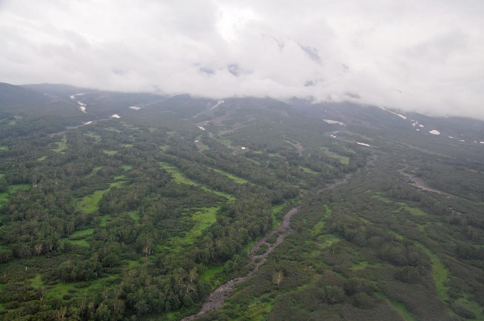
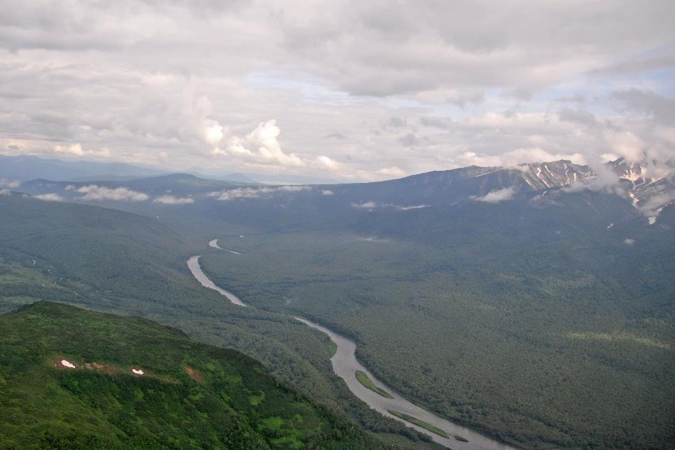
For now, it's a relatively flat landscape sliding beneath us, with dense forests, occasionally interrupted by barren patches of low shrubbery. Then, the Nalycheva comes into view at the window. Like a muddy-brown snake, the river meanders calmly through the green broccoli landscape without any rapids.
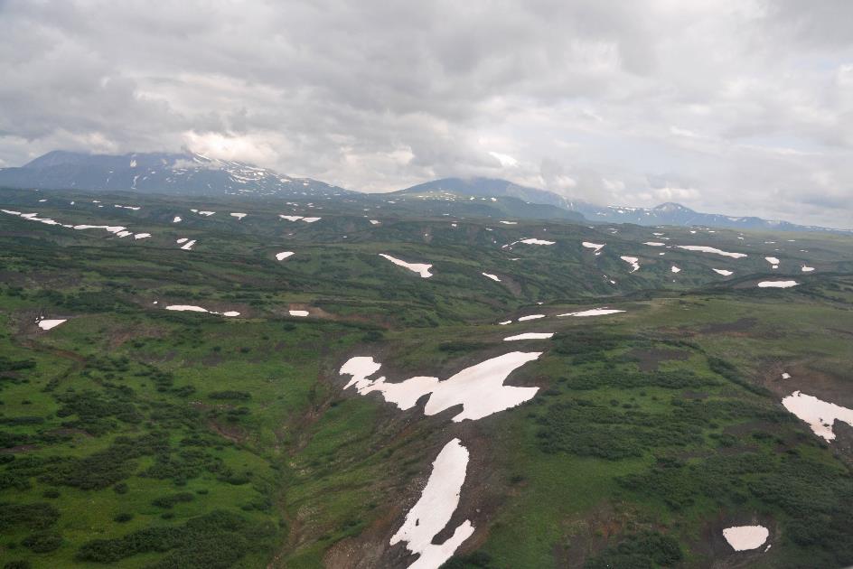
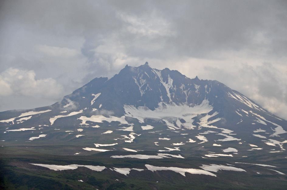
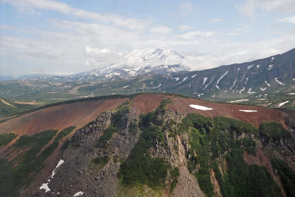
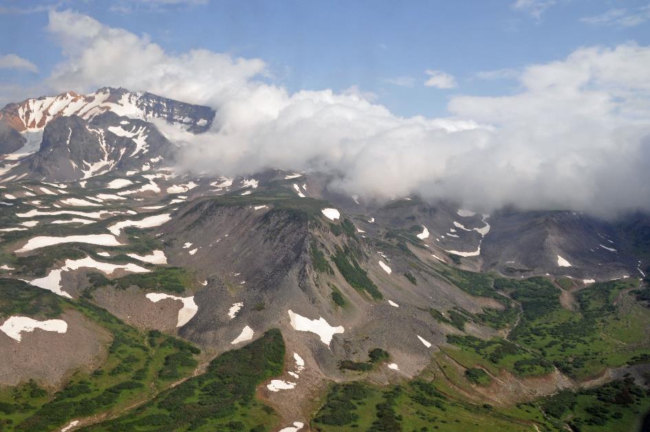
Zhupanovsky
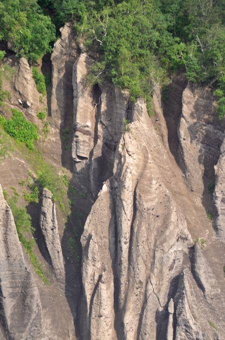
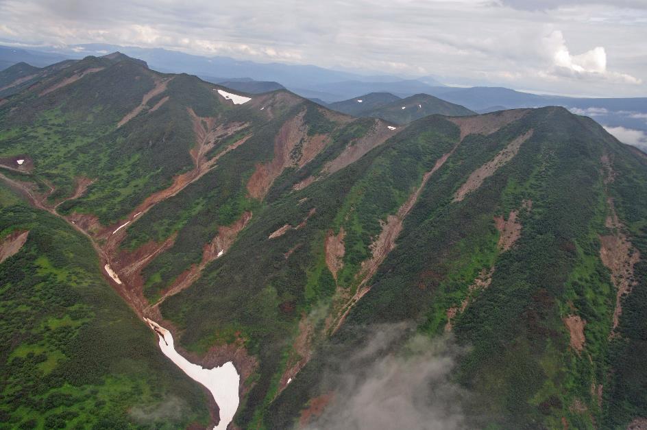
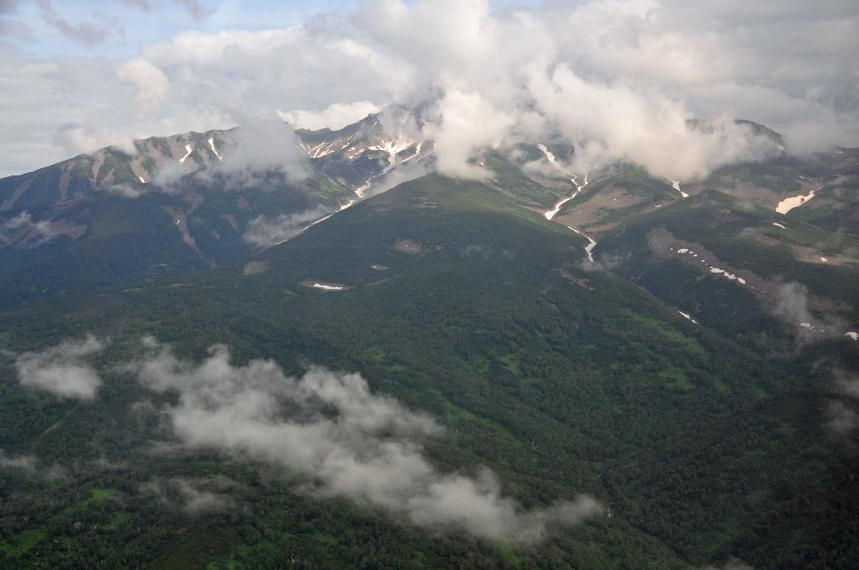
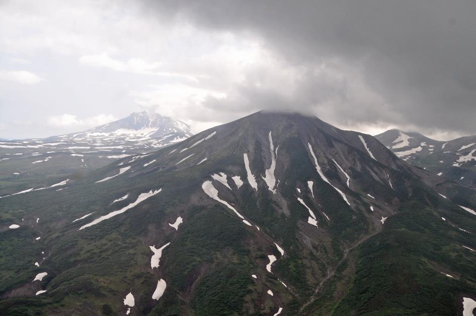
Gradually, the landscape evolves into green slopes with fewer and fewer trees. Rain and snow have carved vertical erosion channels into these slopes. Remnants of snow persist there as white specks on a grey-green carpet. One of these slopes belongs to the Zhupanovsky, a substantial volcano just under three thousand meters high. Unfortunately, we can't see anything of it due to the mist. In fact, this is a complex of four volcanoes that have emerged one after another over the past fifty thousand years, with only the youngest one still active. Its most recent eruption was in 2016.
Zhupanova
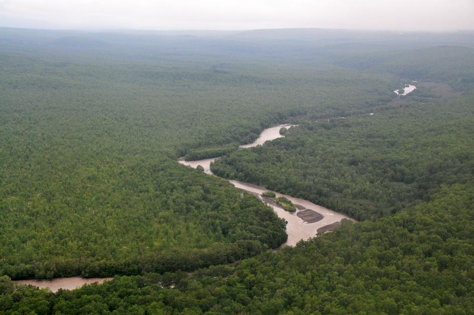
Through the valley now meanders – how could it be otherwise – the Zhupanova. Just like the Nalycheva, it appears to be a tranquil river guiding its muddy-brown waters to the Pacific Ocean without any haste. However, plans emerged in 2013 to build a cascade of hydroelectric power stations.
In 1996, there was a powerful underwater explosion in Lake Karymskoye that killed virtually all living organisms in the lake
Lake Karymskoye, Karymsky volcano
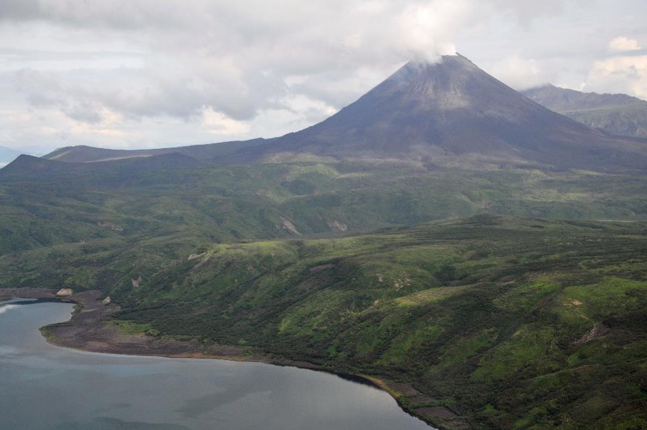
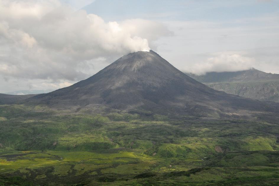
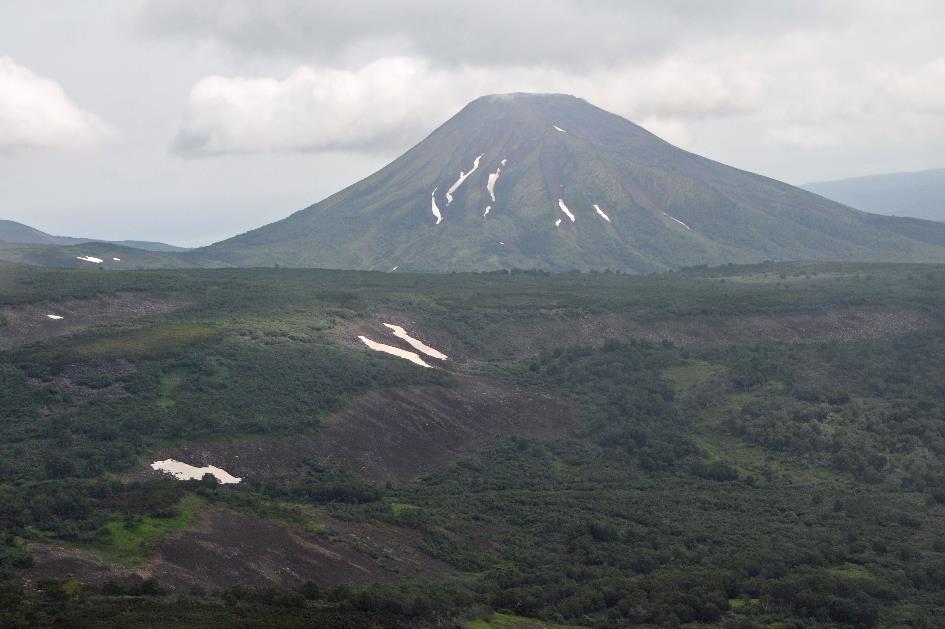
We have better luck with the Karymsky volcano. The sun has burned holes in the cloud cover, allowing us to distinguish its beautiful cone shape quite well in the distance. With its height of 1,469 meters, this volcano is considered one of the smaller ones, but that doesn't mean this guy isn't very active. Hot white gases continuously billow upward from its smooth, round crater mouth. The most recent time it made a serious statement was in 2015 when its column of smoke reached six to seven kilometres high, and volcanic ash was carried by the wind for fifteen kilometres.
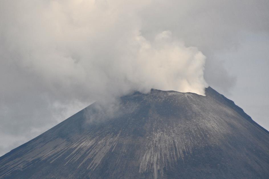
Hot white gases continuously billow upward from Karymsky’s smooth, round crater mouth
Karymsky
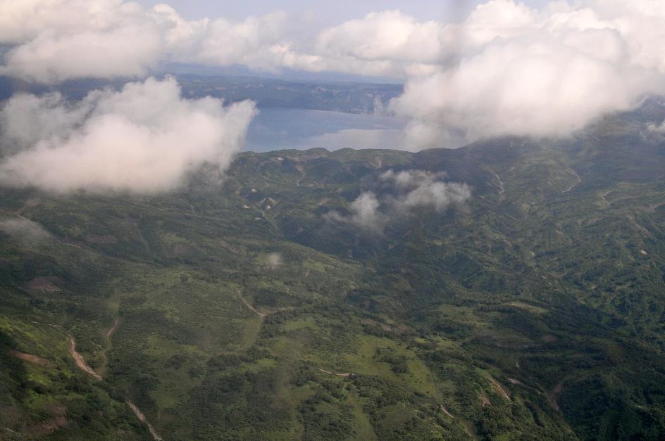
With its tranquil, blue waters, the relatively small Lake Karymskoye, barely 10 square kilometres in size at the foot of the Karymsky, may seem innocent. But nothing could be further from the truth. In 1996, there was a powerful underwater explosion that killed virtually all living creatures in the lake. Underwater, a massive crater formed, sixty meters deep and six hundred meters in diameter.
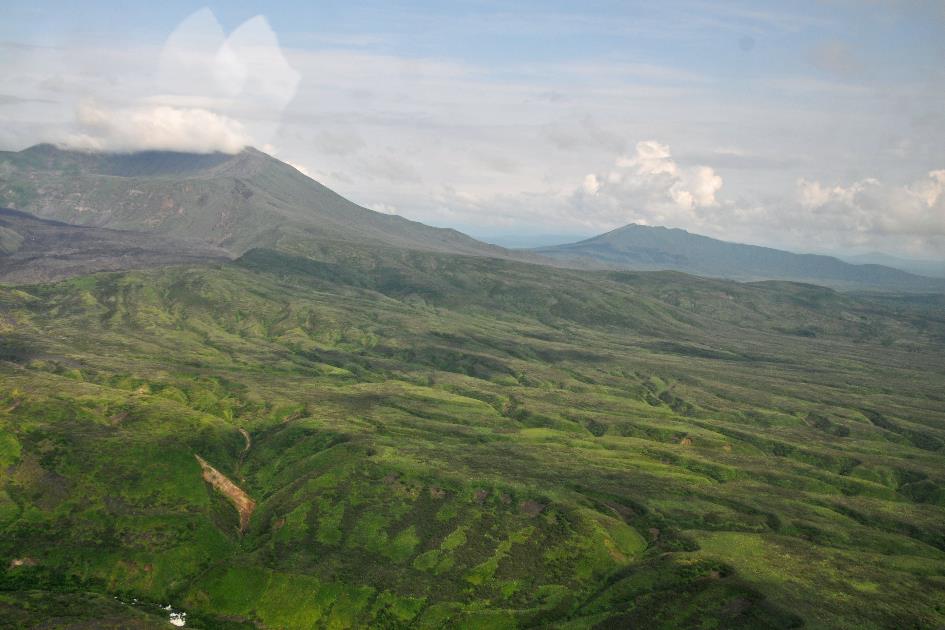
Maly Semyachik (on the left)
Another impressive sight is the Maly Semyachik, the ‘little’ Semyachik. However, we cannot confirm this for the time being as clouds completely obscure the top of the volcano from view. It's not a typical volcano, rather a mountain ridge with three craters side by side, with 1,560 meters as the highest point. We can just about make out the ridge in the distance, protruding from beneath the clouds. Only the southern crater is still active, although scientists in the surrounding area have found no traces of recent eruptions in the past four hundred years or so. Later, on our return, we'll fly directly over that crater so we can get a glimpse into its interior, Alexandra announces. Sounds promising.
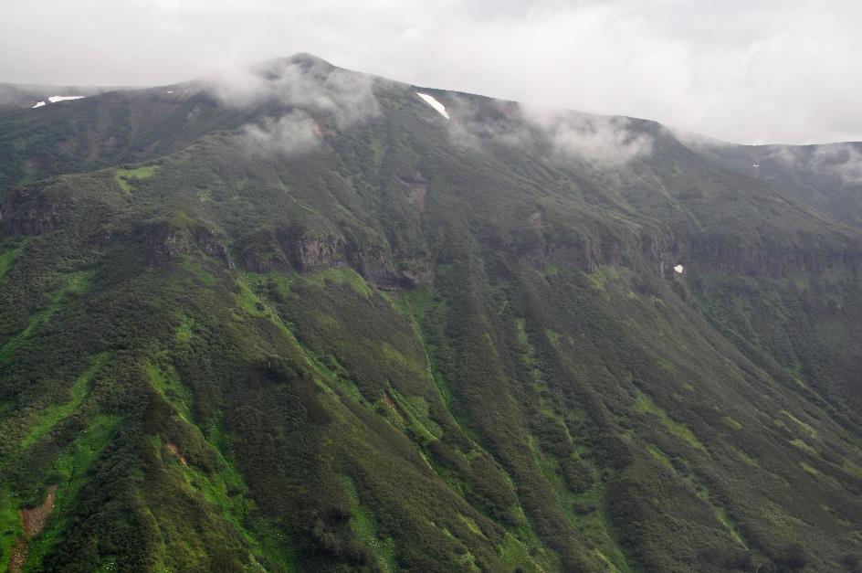
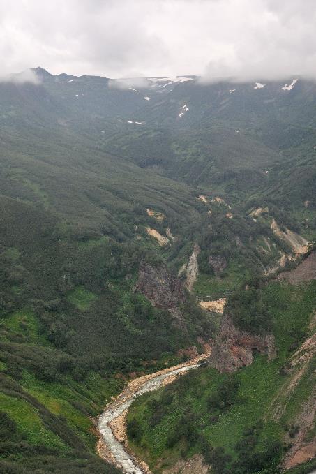
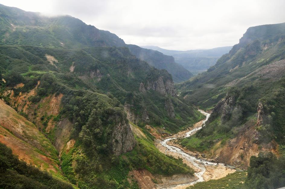
The steep, green valley of the Shumnaya River now guides us on our way
|
|
Shumnaya |
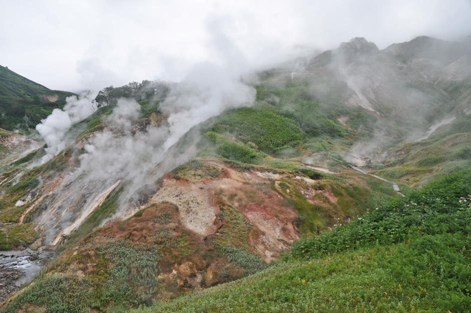
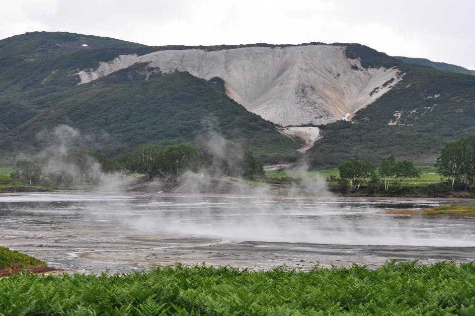
Slowly, we are approaching our destination, the famous Valley of Geysers. The steep, green valley of the Shumnaya River now guides us on our way. We follow the river upstream until the valley suddenly opens wide at the confluence with the Geysernaya River. A bizarre landscape unfolds below. A rugged, barren rock floor seems to have displaced most of the vegetation. Soon we will learn from Alexandra that this is the legacy of a massive landslide in 2007. In the distance, we can already make out the ranger station.
The Valley of Geysers is not only a geothermal but also a tourist hotspot
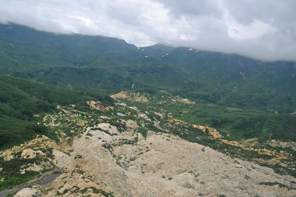
Landslide of 2007
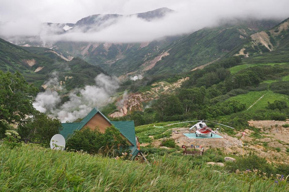
Ranger station, one of the helipads
It's half past ten when the pilot sets down his MI-8 on a helipad near the ranger station, 180 kilometres northeast of Petropavlovsk, at an altitude of five hundred meters above sea level. The flight took precisely 57 minutes. The fact that this site is equipped with five helipads is a telling sign. This is not only a geothermal but also a tourist hotspot. Helicopters will be taking off and landing all day long. For now, it's relatively quiet since we're one of the first groups to land here. But gradually, it will get – a bit – busier.
Sinking into the ground here is something you definitely don't want to experience
Valley of Geysers
Under the guidance of Alexandra, we set out to explore, not without first listening to her instructions. Straying from the boardwalk, you shouldn't even consider it, she says with a stern look. The vegetation is strictly protected; every footstep can cause lasting damage. If that isn't enough to spur us to discipline, she also points out that the ground can be quite hot – up to 90 °C (194 °F) – and in some places rather fragile. Sinking into the ground here is something you definitely do not want to experience. Furthermore, we always stay together as a group, with ranger Kolya bringing up the rear. He will accompany us the entire time and, if necessary, with his weapon he will deter any brown bears from taking unhealthy interest.
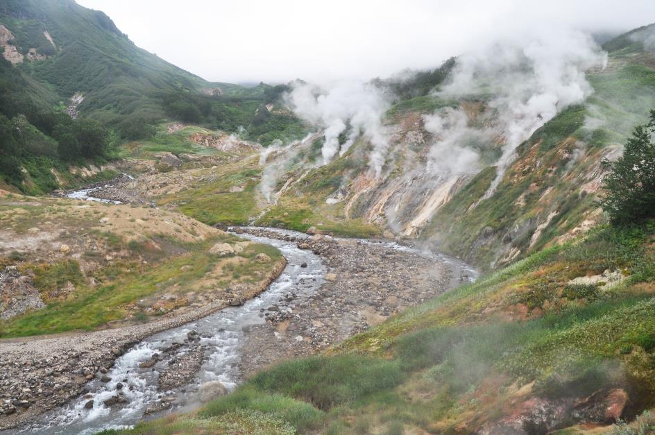
Valley of Geysers, Geysernaya
Geysers may be a widely known phenomenon, but in fact, they are extremely rare, explains Alexandra as we survey the surroundings from a platform. Worldwide, there are no more than a thousand of them, spread across only five countries – the USA, Chile, New Zealand, Russia, and of course, Iceland. We should take that with a grain of salt. Undoubtedly, Alexandra refers to the presence of large geyser fields. Because geysers are found in more than twenty countries. Even Chad, a desert country where you wouldn't expect it, has its geysers.
Geysers are very particular about the nature of the terrain
It's not difficult to find the reason why so few geysers occur on Earth – geysers are very particular about the nature of the terrain. Water must be supplied in sufficient quantity, and there must be a permanent heat source capable of heating that water above the boiling point. Moreover – and this is the most critical condition – geysers need a soil structure that can withstand high pressure and is permeated with narrow passages such as faults, fissures, porous rock, and cavities. This system must act as a kind of water pipeline.
The process begins with water seeping deeper into the ground and eventually coming into contact with glowing hot rocks. On average, this occurs at a depth of two kilometres. There, the water is heated to a temperature of 100 °C (212 °F) or more, but it cannot boil because it is trapped between the rocks and the overlying water layers. Pressure and temperature increase steadily in the underground water pipe; gradually, the higher-lying water layers are also heated. However, this takes time because boiling water must be able to bubble, and that is not possible in those narrow openings.
Once it even happened that a grazing horse suddenly sank with its hind legs through the ground just a few meters from their tent
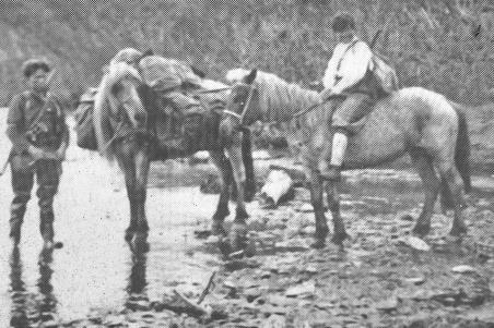
Anisifor Krupenin and Tatiana Ustinova |
|
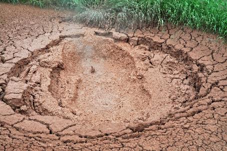
Red mud spring |
When finally the upper water layers are sufficiently heated, it's as if suddenly the valve of a pressure cooker bursts. The boiling mass of water is forcefully expelled from the opening. Once that is done, cold water can seep down again, and the process can begin anew.
There must be a previously unknown tributary involved, was her reasoning
The fact that we even know about the existence of a valley with dozens of geysers in Kamchatka is purely coincidental. Tatiana Ivanovna Ustinova is the local heroine who is credited with this discovery. It only happened in 1941, seven years after Kronotsky was recognized as a nature park. In fact, Ustinova, along with her Itelmen guide Anisifor Pavlovich Krupenin, was searching for an explanation for the mineral-rich composition of the Shumnaya River. It couldn't be otherwise, there must be a previously unknown tributary involved, was her reasoning.
|
|
|
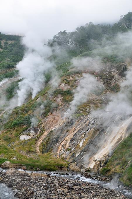
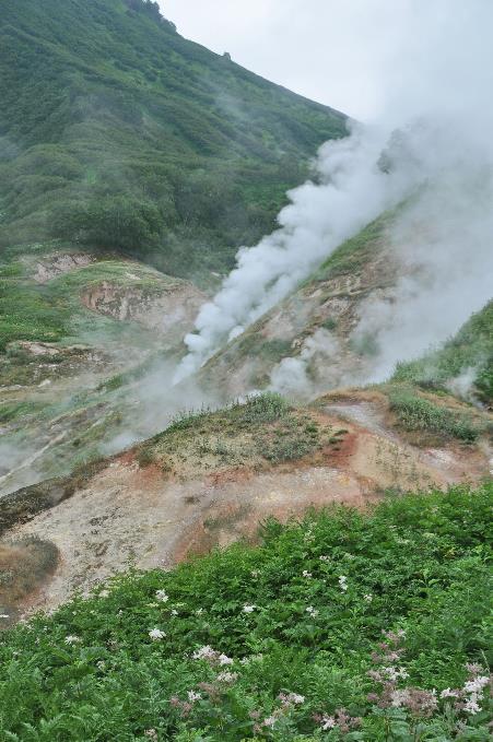
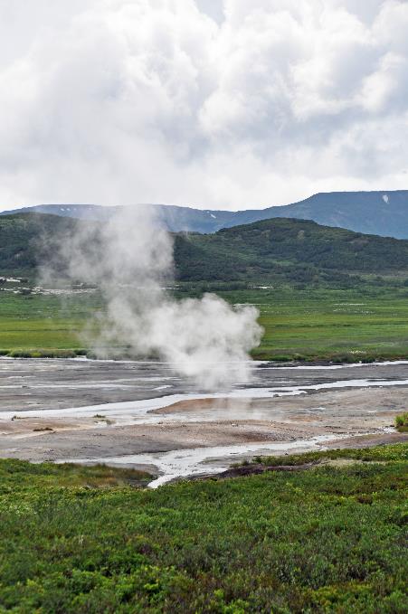
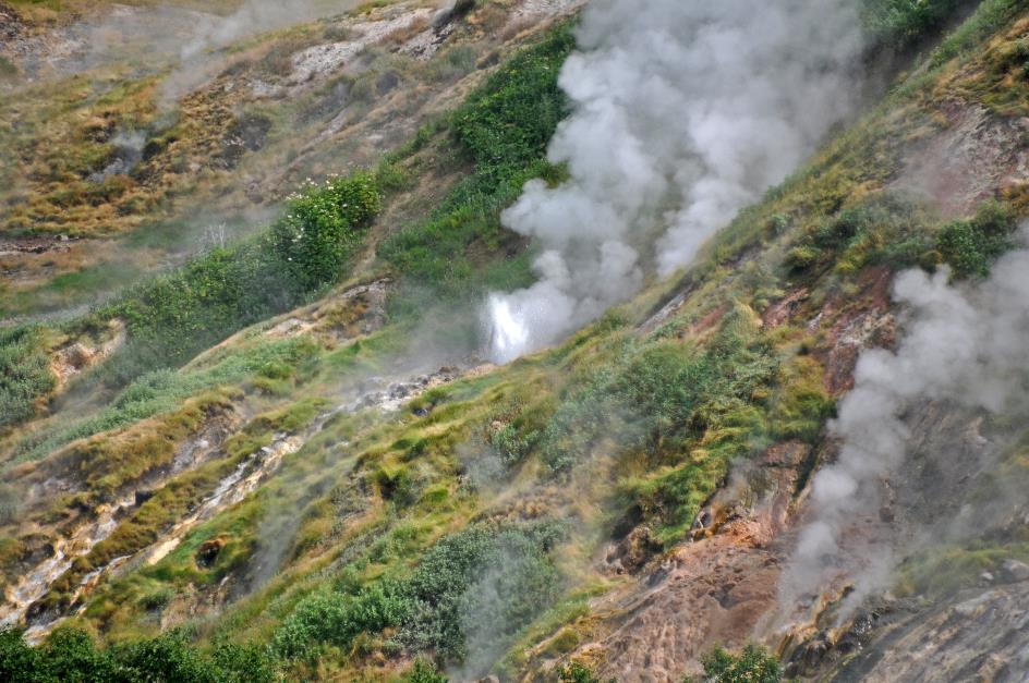
An apocalyptic scene, with plumes of smoke rising from the slopes, reaching heights of ten to twenty meters
|
|
|
Soon enough, Ustinova turned out to be right. During their journey along the Shumnaya, they came across a tributary that had not yet been mapped and would later be named the Geysernaya. But the exploration of that untrodden valley did not go smoothly. It was April, the snow was knee-deep, and the dog sled and skis were unusable on this difficult terrain.
In her memoirs, Ustinova describes how scared they were at that moment
Just as they had sat down in the snow to rest and eat before returning, a jet of boiling water suddenly erupted from nowhere across the river with a loud underground roar. In her memoirs, Ustinova describes how scared they were at that moment. After all, with all that snow, you could hardly tell what kind of landscape you were stepping into. But she was knowledgeable enough to immediately realize that it was a genuine geyser they had seen. Not an obvious conclusion, as up to that point, no geyser had been observed on the Eurasian continent.
Ustinova's perseverance led to the discovery of the second-largest geyser field in the world
A more in-depth exploration of the valley had to wait until the summer month of July. Once again, Ustinova and Krupenin set out, this time with packhorses and camping equipment. They managed to map dozens of geysers, give them names, and time their eruptions. It was a perilous undertaking because at any moment, a jet of boiling water from an unknown source could splash onto them. Inside the tent, the ground beneath their sleeping bags warmed up, making it feel like they were sleeping on a heater. Once it even happened that a grazing horse suddenly sank with its hind legs through the ground just a few meters from their tent.
Today, we know that Ustinova's perseverance led to the discovery of the second-largest geyser field in the world. More than forty geysers are active in this eight-kilometre-long canyon, alongside a diverse range of hydrothermal phenomena – mud springs, hot pools, fumaroles, pulsating water sources, you name it. Ustinova herself just lived to see tourism to this fascinating place take off in the 1990s.
Based on the thickness of the geyserite layer, you can estimate the age of the geyser
It is mainly sodium and chlorine that occur as minerals in geyser water, but also a lot of silicon. The latter precipitates as geyserite around the vent of the geysers. For geologists, this is useful information because if you measure the thickness of this layer, you can estimate the age of the geyser. In this case, the geysers were found to have been active for two to three thousand years. That's quite a long time, as geysers typically cease activity after only a few hundred years. This is not surprising, considering the forces constantly impacting the soil structure. By nature, geysers are temporary phenomena.
The mass of earth came to a halt barely a meter from the ranger station and one of the helicopters
Geological evolution occurs constantly, even on a much larger scale, emphasizes Alexandra. In 2007, there was an earthquake that didn't make much of an impression on its own, but was enough to trigger a colossal landslide. Twenty million cubic meters of material slid down in an unstoppable mudflow of water, snow, earth, and rocks. A few minutes later, a second portion came loose. This time it was dry earth that slid down like a compact mass over the sludge from the first landslide as if it were a slide. Down there, at the ranger station, they must have been terrified because eyewitness accounts show that the mass of earth came to a halt barely a meter from the ranger station and one of the helicopters. But fortunately, there were no casualties.
However, the course of the Geysernaya was blocked. The mudflow only came to a halt in the valley, forming a natural dam behind which the river water piled up to twenty meters high. That lake still exists, but the river has immediately begun its relentless erosion work. Little by little, it carves a channel through the dam.
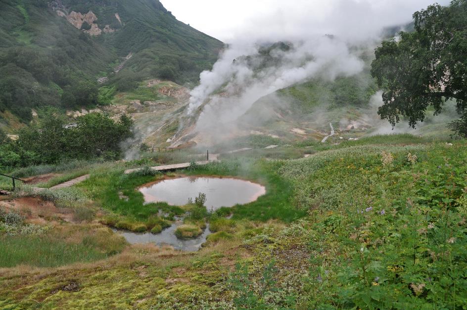
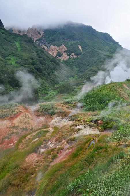
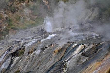
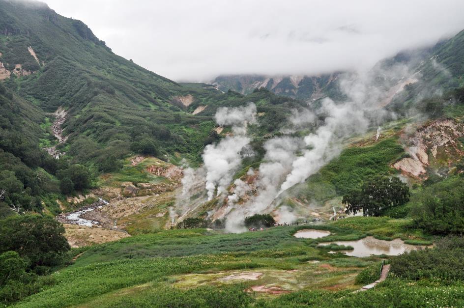
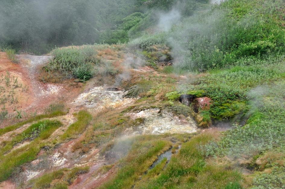
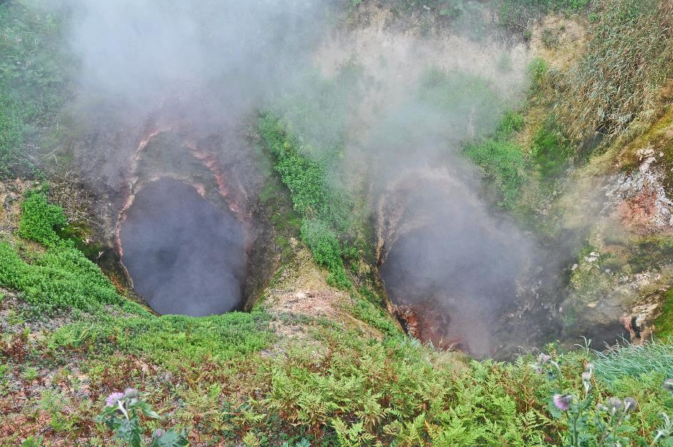
Brown bears like to bathe here, but apparently, they are not around today
Enough talking, it's time to get up close and personal with all this beauty. From the platform, we overlook the central section of the valley. It seems like an apocalyptic scene, with plumes of smoke rising from the slopes, reaching heights of ten to twenty meters. Closer by, there are some muddy brown ponds, but even they are less innocent than they appear, judging by the faint vapours wafting above the water's surface. To the left, the Geysernaya gurgles down like a calm mountain stream, a mixture of cold, crystal-clear mountain meltwater and hot, mineral-rich water from the springs.
Alexandra leads us along the boardwalk that brings us into the valley and will take us past the least dangerous spots of the site. She calls the ponds we noticed thermal lakes. Brown bears like to bathe here, she knows from experience, but apparently, they are not around today. Involuntarily, we glance over our shoulder to check if ranger Kolya is still on standby with his weapon.
|
|
|
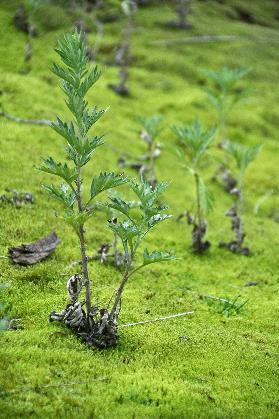
By the way, you'll mostly encounter bears here in early spring, Alexandra says. In May, when the rest of Kamchatka is still under a layer of snow, this valley is already snow-free, thanks to the many geothermal phenomena. And bears just waking up from their winter hibernation know that. They're attracted to the fresh green grass, which is extra fertile due to the mineral-rich water flowing over it.
It's mostly the males that show up so early. They haven't seen each other for seven months, and tensions can run high. How would you feel after seven months of fasting? A bear on its way to its first meal of the season doesn't want to be disturbed by anything or anyone. As a precaution, females stay in their winter dens a little longer with their cubs. It's only later in the season that the bears will head down to the rivers to feast on protein-rich salmon.
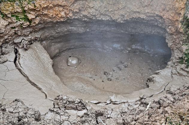
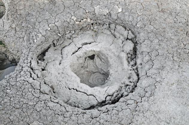
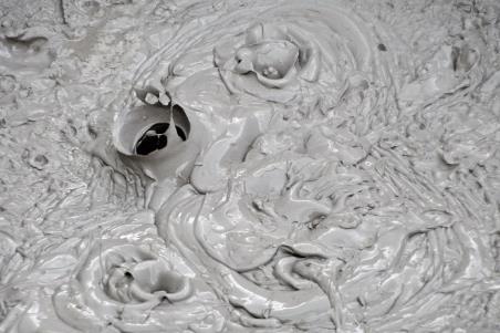
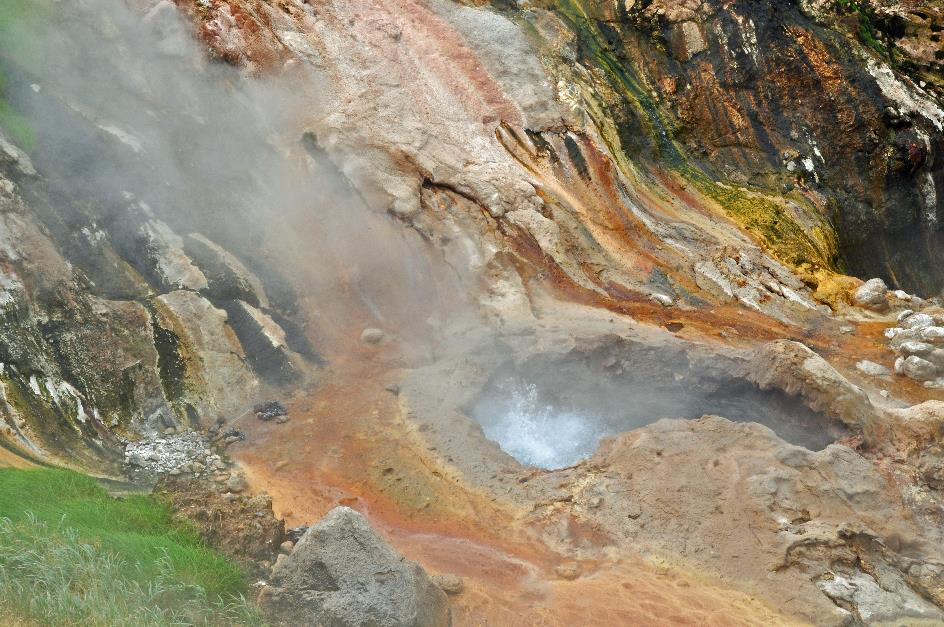
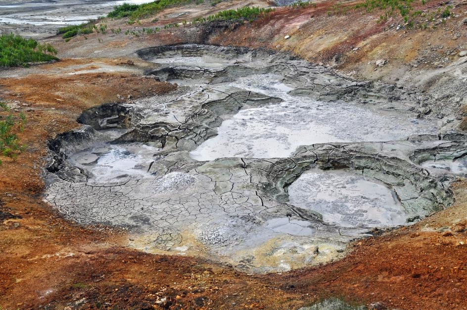
Where you might call a fumarole a failed geyser, you can call a mud spring a failed fumarole
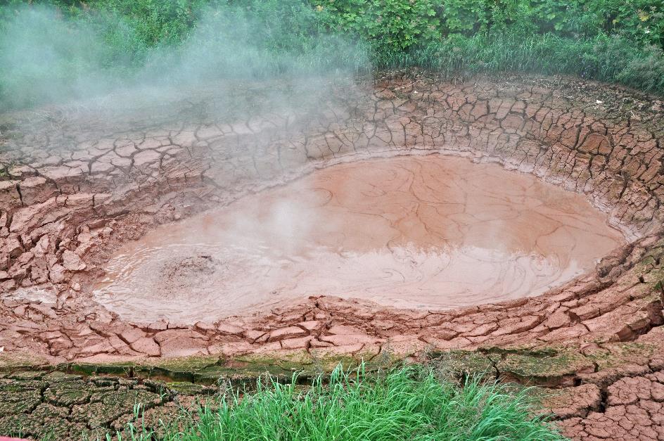
Red mud spring (Krasny)
Further ahead lies an impressive mud spring bubbling away. Its name is Krasny, which means red, a reference to the red clay surrounding the mud pot. At twelve meters by seventeen, it's by far the largest mud spring in the valley. Where you might call a fumarole a failed geyser, you can call a mud spring like this a failed fumarole. You see the water bubbling, you see puffs of steam escaping, but the spring fails to produce a constant plume of hot steam. There simply isn't enough water available. The result is scalding hot mud simmering in a bowl about two meters deep.
|
|
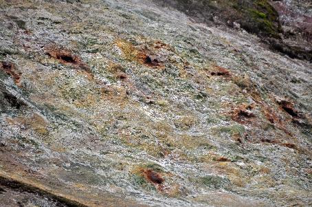
Grey mud spring |
That the mud and clay have formed due to the hot steam and high acidity softening the ground is only part of the story. The real work here is done by thermophilic microorganisms. These are microscopic creatures that consider temperatures of 60 to 70 °C (140 to 158 °F) as normal. Some of them are capable of breaking down rocks and converting them into mud and clay. Others break down sulphur into the gas hydrogen sulphide.
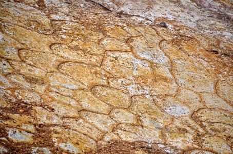
Each type of thermophile has its own comfort zone. They are the ones that determine the colour of the water
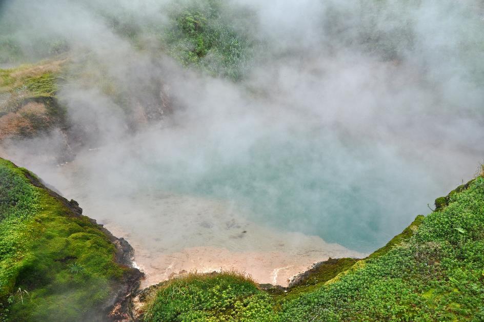
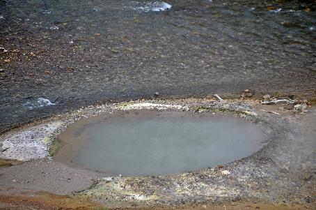
Hot water spring (Goluboy)
The azure surface of a hot spring appears remarkably tranquil. This pool, four meters deep, rightly bears the name Goluboy, meaning Light Blue. Originally, it was a deep well with a geyser at the bottom. But as hot water filled the well, the geyser was pushed aside. Geysers indeed do not have eternal life, as we already knew.
White puffs of steam billow low above the water's surface. Not surprisingly, as the water is 85 °C hot (185 °F). The temperature of the water determines which type of thermophiles are present in it. Each type has its own comfort zone. And it's these thermophiles that, in turn, determine the colour of the water. They do this through photosynthesis, just like plants. Thus, in hot springs, you can sometimes make an educated guess about the presence of different thermophiles based on the colour patterns.
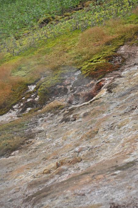
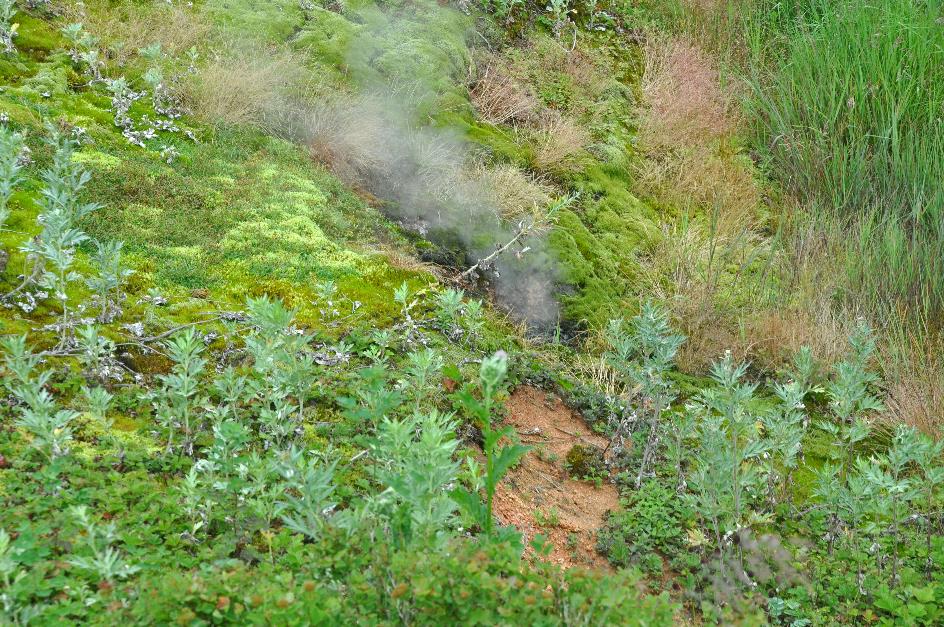
It's as if an underground creature is constantly puffing steam through its nostrils
Gate of Hell (Vrata Ada)
A bit further, hot steam constantly billows up from between the green grass. It emerges from two dark vents. There's something mysterious about how this white mist shoots out of the earth at high speed, as if an underground creature is constantly exhaling steam through its nostrils. It's no wonder they named this spring Vrata Ada, Gate of Hell. This, too, is a relic of the past, as it was once a splendid geyser.
Woolly geranium |
|
|
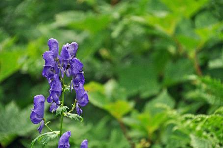
The furthest point on our loop along the boardwalks is this. What impresses us the most are not the geysers, the plumes of steam, the hot springs, the mud pots, and the like, but rather the quantity, intensity, and variety of all of these in one place, amidst a flora that has miraculously persevered amid this geothermal violence. Everywhere we walk amidst lush greenery, occasionally adorned with flowers like the blue monkshood, the lilac woolly geranium, and the lilium debile, the fragile orange blossom found only in the Russian Far East.
|
|
Lilium debile |
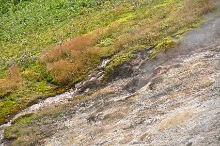
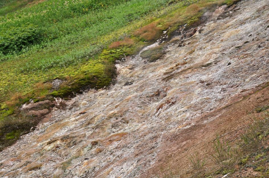
Admittedly, scattered bald patches mar the green landscape with brutal scars. The rocks exhibit strange colours – from ochre and brown to grey and black – and have a bizarre, pockmarked structure. They bear witness to the perpetual violence with which the earth torments its own skin. That was also the landscape that left us astonished just before landing.
The brutal scars on the slopes testify to the perpetual violence with which the earth ravages its own skin
Blue monkshood |
|
|
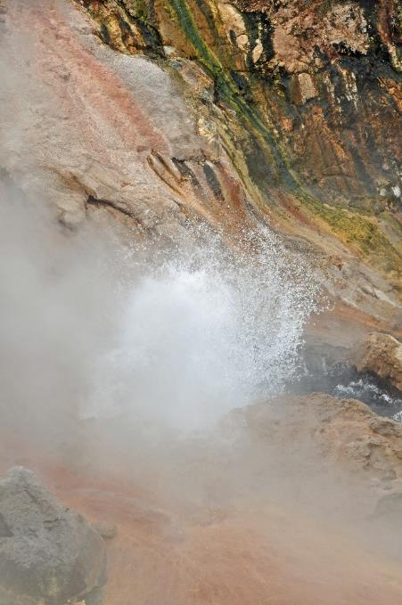
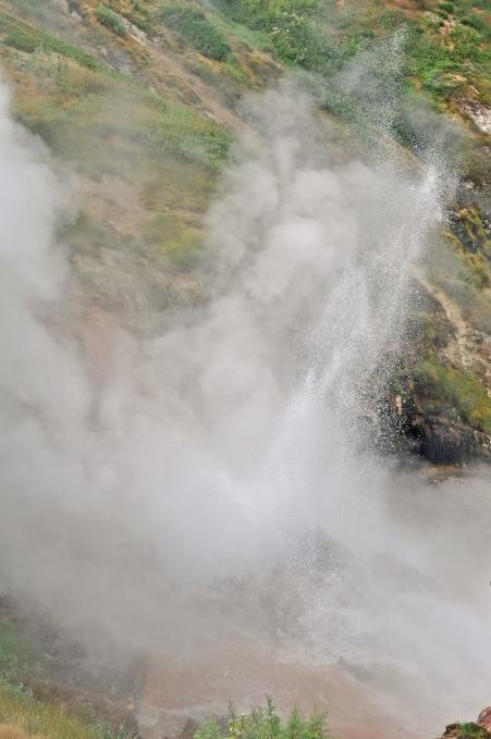
But we don't have much time to dwell on that. Alexandra urges us forward along the boardwalk, and she has a good reason for it. Bolshoi, the star attraction of the valley, is getting ready to erupt on the east side. As its name suggests, it is one of the largest geysers in the valley. Spectacle guaranteed, indeed. Although it has lost some of its former glory, as during the landslide of 2007, it was completely submerged. Now that the water has partially receded, Bolshoi has regained its old state. With quite a high reliability, it performs its act every 50 to 60 minutes. The boiling hot water jet can reach up to ten meters high.
A jet of eight to ten meters shoots loudly roaring from Bolshoi's nozzle
Bolshoi geyser |
|
|
From a small platform just about ten meters away from the geyser, we peer down into the nozzle. It's evident that something is about to happen. Boiling hot water vigorously bubbles in the opening, but for the time being, it fails to produce a significant jet. This goes on for about ten minutes. He can't do it anymore, this old boy, flashes irreverently through our mind. Suddenly, it happens. A jet of eight to ten meters shoots loudly roaring from the nozzle. It lasts for about three minutes. Then Bolshoi returns to a state of apparent calm – just a hole emitting clouds of steam.
Shumnaya
At quarter past twelve, we climb aboard the MI‑8 again and set off in search of our next destination, the Uzon Caldera. It's not difficult; the pilot just needs to follow the valley of the Shumnaya upstream. This way, we fly in a wide arc around the Geisernaya, the mountain that overlooks the valley of the same name.
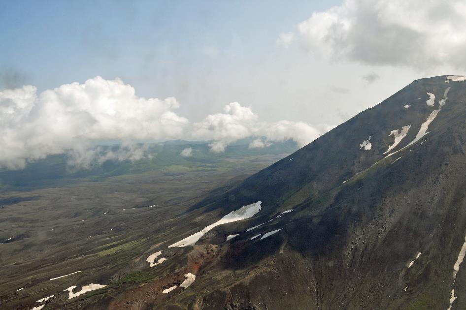
Uzon Caldera, Shumnaya
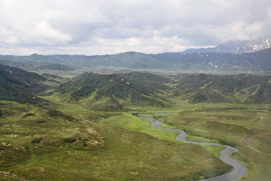
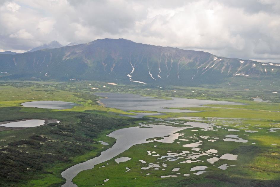
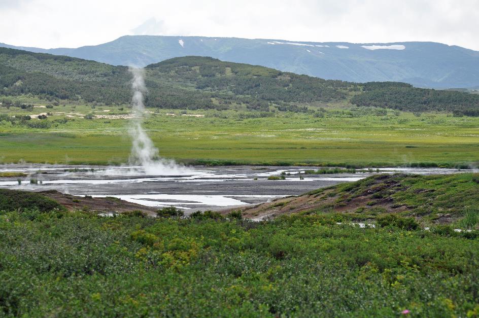
Barely a quarter of an hour later, the steep valley unfolds into a landscape of low hills, among which the Shumnaya winds its way out of the caldera. Gradually, the terrain becomes flatter, and we gaze out over an intensely green landscape with large grassy fields and clusters of shrubs and birch trees. In the distance, we see a remarkable number of lakes, both large and small. There must be dozens of them. That’s the place where the Shumnaya originates.
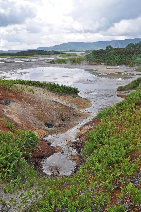
In the distance, we see a remarkable number of lakes, both large and small. That’s the place where the Shumnaya originates
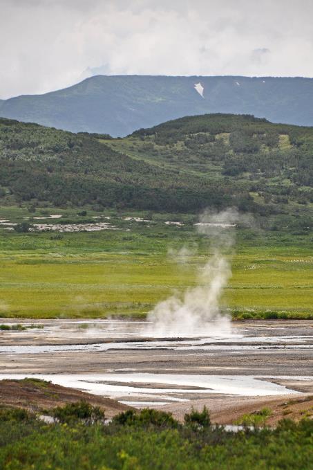
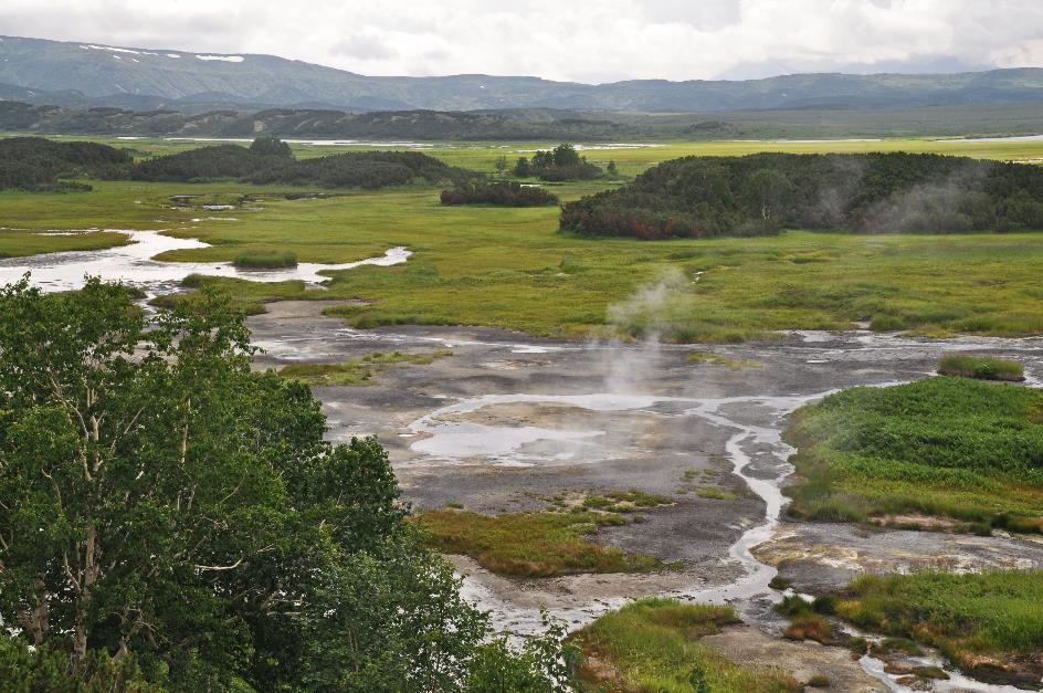
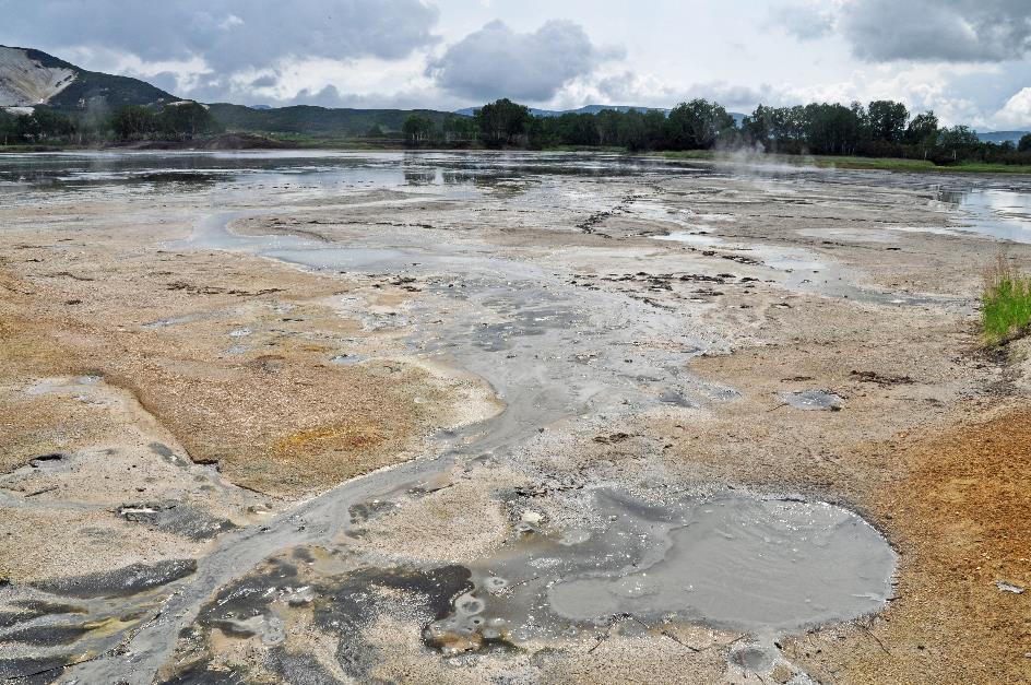
Uzon Caldera, Baranni
But it is mainly the large, pale spot near the lakes that catches our attention, a gigantic scar in the green landscape. This is called the eastern zone, and it turns out to be the centre of geothermal activity within the caldera. The hundreds of hot springs, fumaroles, mud pots, and related natural phenomena for which the Uzon is known are found there. Two helicopters have already unloaded their cargo, and we soon join their company.
About forty thousand years ago, things went terribly wrong with the Uzon
The Uzon, the volcano that is the basis of all this beauty, is believed to have formed approximately 300,000 years ago. It must have been an impressive cone, with a respectable height of three thousand meters. However, about forty thousand years ago, things went terribly wrong with the Uzon. Eruptions followed too quickly, and the volcano discharged so much magma that its underground magma chamber was no longer refilled in time, creating a cavity inside the volcano. The heavy mountain slopes no longer had the support they needed, and the whole thing collapsed. Often, a caldera is called a crater, but in fact, it is a sinkhole.
The Uzon Caldera hosts the largest geothermal field in Kamchatka
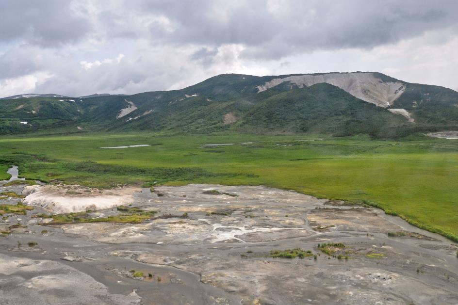
Eastern zone, Belaya
What remained was the bowl-shaped structure that we know today, nine to twelve kilometres in diameter, with walls averaging four hundred meters high. This makes it in every respect half the size of its famous counterpart in Tanzania, the Ngorongoro Caldera. All in all, the formation of a caldera is a relatively rare event. While worldwide 70 to 80 volcanoes erupt each year, this has only led to seven new calderas in the past hundred years.
But the Earth's crust is still very thin here, and the underground magma chamber still exerts its influence. As a result, the Uzon Caldera hosts the largest geothermal field in Kamchatka. Not exactly a pleasant place to linger, you might think. However, this generates a microclimate where fauna and flora thrive remarkably well. And we're not just talking about the thermophilic microorganisms that thrive in the toxic hot springs. Plants bloom earlier than elsewhere in Kamchatka and remain available longer in the season. Brown bears know this and eagerly come to graze on the green spring grass or feast on blueberries and pine nuts in the fall – a vegetarian addition to their salmon diet. Birds like the white wagtail have learned to use the heat from the ground to accelerate the incubation of their eggs.
While worldwide 70 to 80 volcanoes erupt each year, this has only led to seven new calderas in the past hundred years
Just before one o'clock we embark on our exploration of this fascinating environment, starting with section 1. Stick together, never leave the boardwalks – Alexandra emphasizes the instructions once again as an armed ranger joins our group. We realize all too well that the terrain here is even less trustworthy than in the Valley of Geysers.
Baranni
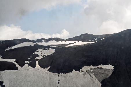
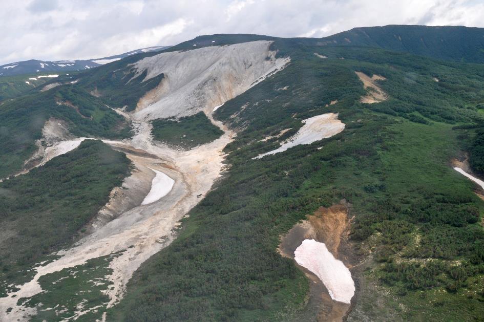
In the west, Alexandra points out the Baranni. At sixteen hundred meters, it is the highest remnant of the original volcanic cone. How immense must the Uzon have been back then, if that steep mountain range in the distance was just a part of it. Diametrically opposite, on the east side of the caldera, the enormous white spot on the flank of the Belaya stands out, as if an avalanche has rushed down. There, you can find kaolinite, the secret ingredient used by the Chinese in the production of porcelain, Alexandra explains.
Kaolinite is the secret ingredient used by the Chinese in the production of porcelain
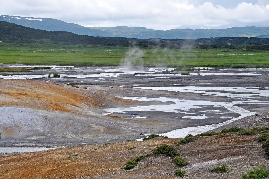
Belaya
White clouds waft above the lake on our left side, the water appears whitish-grey, strange mud stains mar the water. It doesn't look inviting, and that's a good thing. Because this is Chloridnoye, the Chloride Lake, Alexandra warns us. The water contains mainly sodium chloride. Harmless table salt, but it gave the lake its ominous name.
The real danger comes from the bottom of the lake
The real danger comes from the bottom of the lake. Continuously, methane and hydrogen sulphide gas bubbles are emitted from there. Diatoms in the water – the single-celled algae we learned about at Kurile Lake – produce pure oxygen, just like plants do. When you combine that hydrogen sulphide gas with oxygen, pure sulphur can form. This causes small yellow sulphur granules to swirl to the bottom of the lake, but also creates sulphur beaches along the lake shore – the only place on earth where this occurs, emphasizes Alexandra.
|
|
|
In fact, we're looking down at a large pool of sulphuric acid, albeit in diluted form
Chloridnoye
Anyway, it's quite a bustling scene down there, but the story isn't over yet. Because sulphur is, in turn, a delicacy for sulphur bacteria. They turn it into sulphuric acid. In fact, we're looking down at a large pool of sulphuric acid, albeit in diluted form. Not exactly a place where you'd want to go for paddling.
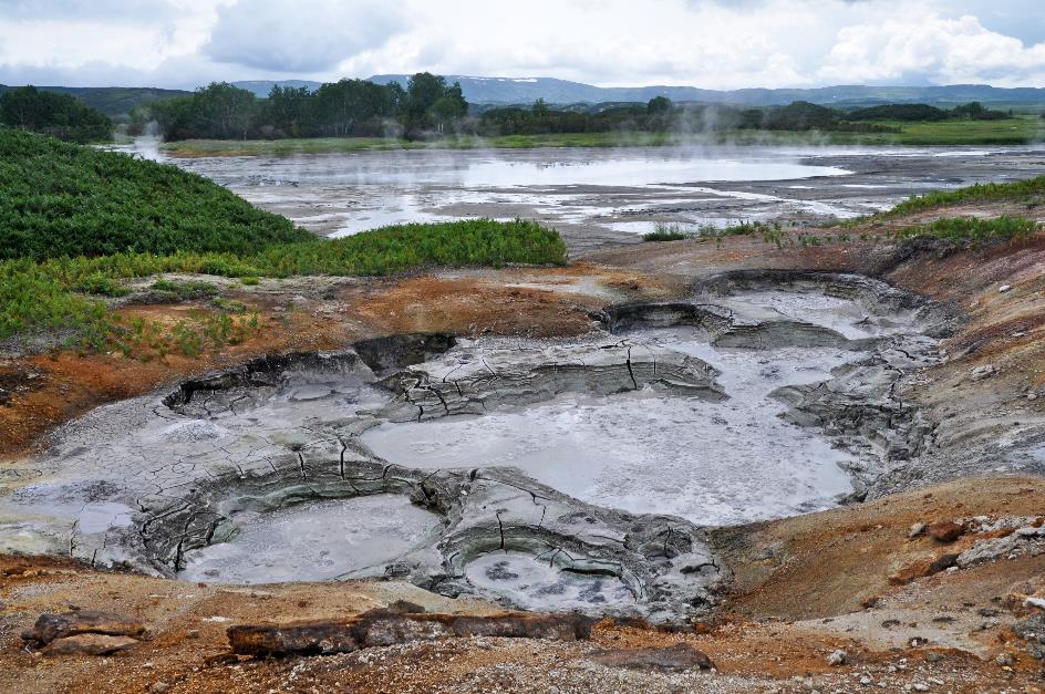
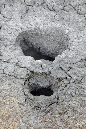
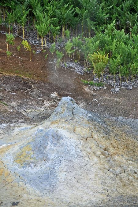
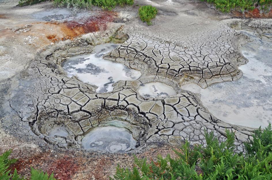
Mud springs
Alexandra leads us further to section 2. Here, it's primarily the enormous mud pots that captivate us. Their existence was kept secret by the local population because they wanted to maintain a monopoly on the diverse colours available here. We see how a hot spring has grown into a mini-volcano about a meter high, continuously emitting steam from its cone. Apparently, as the steam exits the crater, it deposits minerals as if it were an inverted stalactite.
The existence of the mud springs was kept secret by the local population because they wanted to maintain a monopoly on the diverse colours available here
|
|
|
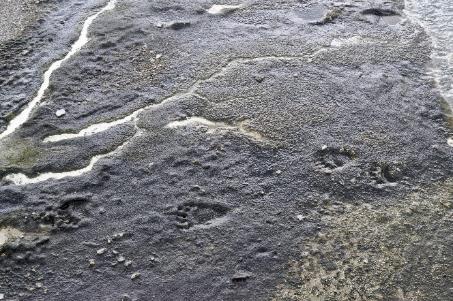
Reportedly, bears even find it pleasant to stroll over hot clay
Bear footprints |
|
|
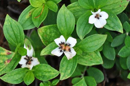
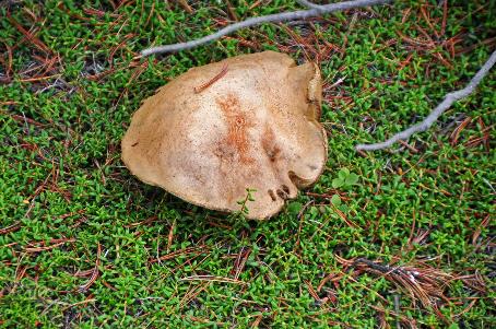
However hostile this environment may be, lush green ferns grow around it, albeit at some distance. Alexandra points out the difference in height – the hotter the soil, the smaller the plants, the colder the soil, the larger they are. But the vegetation consists of more than just grass and ferns. Alongside the boardwalk, we notice dwarf cornels with their small, white flowers and the fairly large dusky boletes.
|
|
|
However hostile this environment may be, lush green ferns grow around it, albeit at some distance
Dwarf cornel |
|
Dusky bolete |
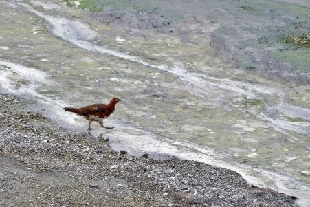
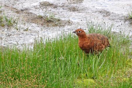
A willow ptarmigan tiptoes calmly through the toxic mud as if it doesn't bother it at all. It’s is a hardened bird indeed. For shelter, it digs tunnels in the snow during the winter. Its plumage is reddish-brown, but as winter approaches, it will turn snowy white.
Willow ptarmigan |
|
|
And what about Kamchatka's most famous inhabitant? Occasionally, we scan the vegetation in search of its characteristic brown silhouette. But unfortunately, there is no trace of it anywhere, except... in the hot clay. Because you can't deny it, a brown bear has been here.
Staying on the boardwalks, that’s an instruction a Kamchatka bear doesn't care about. Its paw prints are clearly defined in the grey mud, at a normal distance from each other. This was no bear running hurriedly over a hot surface. This was a bear leisurely strolling over familiar territory. Reportedly, bears even find it pleasant to stroll over hot clay, especially in spring, when they have just awakened from hibernation and there is still snow everywhere.
Healing qualities were attributed to the sulphur-containing water with its temperature of about 40 °C (104 °F)
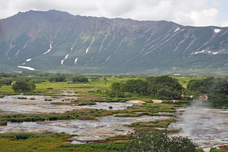
Surroundings of Bannoje
Dark rain clouds seem to be gathering in the distance, threatening to spoil the atmosphere, but fortunately, they quickly dissipate without causing any trouble. It's still sunny as we make our way back to the ranger station. However, this doesn't mean the visit is over. In section 3, Alexandra has a surprise in store for us.
At first glance, this lake called Bannoje doesn't seem particularly remarkable. Literally, its name means Bathtub. Bathing in Bannoje was indeed once a farewell ritual for anyone who had worked in the Uzon. The sulphur-containing water, with its temperature of about 40 °C (104 °F), was attributed with healing qualities. After swimming, everyone reportedly felt rejuvenated. Even bears felt bear-y good there.
Belaya
In 1991, that changed. After a minor gas explosion in 1989, volcanologists decided to examine the precise nature of the lake more thoroughly and lowered a container with measuring instruments into the murky water. As expected, it reached the bottom at a depth of twenty-five meters. It stayed there briefly before sinking further to the actual bottom of the lake, thirty-two meters deep. That was not at all in the scenario. It turned out that the presumed bottom was nothing more than a fragile crust of sulphur, beneath which lay a hell of molten sulphur. Since then, no one has felt compelled to enjoy the beneficial water of the Bathtub with the double bottom. For the bears, however, everything remained the same. No one thought to warn them. Incidentally, you can still admire the container in question in the museum, concludes Alexandra.
How the salmon got into Lake Dalneye is a mystery
Is there no 'normal' lake to be found in this caldera then? Yes, indeed, Lake Dalneye, or the Far Lake, at the northern edge, is one of the few lakes in the Uzon Caldera with a normal temperature and almost normal composition of the water. In fact, this is a maar, a circular basin as we mainly know from the German Eifel. They have about twenty-five of them there.
Such a maar is formed when water comes into contact with hot magma, causing the pressure to build up so high that the whole thing explodes and creates a round pit in the ground. A volcanic cone will never arise from such a one-off and small-scale explosion, but rather a pit with a diameter of a kilometre and a ring-shaped earthen wall fifty to sixty meters high. Because the bottom of the maar consists of solidified rocks, water can no longer penetrate the ground.
A fairly ordinary lake, except that even Lake Dalneye harbours its own mystery. Because there are salmon in the lake. How these fish got there is a puzzle, since Lake Dalneye is not connected to the ocean.
It's quarter past two when our MI‑8 takes off and we leave the Uzon Caldera definitively behind us. The flight will take us southward, towards Petropavlovsk, but not without making a stopover in the Nalychevo Nature Park.
Meanwhile, to the left, the immense volcanic massif of the Bolshoy Semyachik, the Big Semyachik, soon appears. It's a wild amalgam of volcanic cones and lava domes, of which the most important, the Bolshoy Semyachik, has long been extinct and even partly eroded. Hence, we are facing a strongly serrated mountain ridge. But that doesn't mean that peace has returned there. On the contrary, down below is one of the largest hydrothermal systems in Kamchatka, with hot springs, fumaroles, solfataras, and superheated vapours that can reach temperatures of up to 137 °C (279 °F).
One of the largest hydrothermal systems in Kamchatka surrounds the Bolshoy Semyachik
Bolshoy Semyachik, Shumnaya
Gradually, the Tsentralnyy Semyachik, the Central Semyachik, comes into view. Unlike its big brother, it is classified as an active volcano. The exact timing of its last eruption is unknown. Presumably, it occurred in the recent past, given the fresh lava flows on its slopes. In its northern crater, a small lake has formed, covered with a black film, likely composed of iron sulphide. This makes it difficult to observe from the air.
Bolshoy Semyachik
However, our main interest lies in the Maly Semyachik, the Little Semyachik, about thirty kilometres further south. We haven't forgotten Alexandra promised this morning we would fly directly over the volcano. A promise is a promise, and the pilot keeps his word by climbing above the 1,560-meter-high crater.
Maly Semyachik
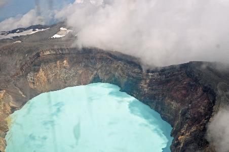
Immediately it becomes clear why the Maly Semyachik is the chosen one. To our surprise, Troitsky, the active crater, contains water. This oval crater lake formed in the 1940s. The water level rises by about ninety centimetres annually. Nowadays, the lake averages eight hundred meters in diameter and three hundred meters in depth. Clouds surround the crater mouth, but the lake remains visible.
As charming as the scene may be, this is one of the most acidic lakes in the world
As charming as the scene may be, this is one of the most acidic lakes in the world, with a pH level of approximately 1 – comparable to the sulphuric acid in an old-fashioned lead battery. In addition to the usual hydrochloric and sulphuric acids, there is also hydrofluoric acid. If this toxic substance comes into contact with your bare arm, it relentlessly eats its way down to the bone.
Whenever the volcano's activity increases slightly, the surface temperature of the water easily rises to 30 to 40 °C (86 to 104 °F) or even higher. Yet, ice regularly forms on the water surface in winter. Between 1996 and 2002, the lake even froze completely every winter. It's fascinating how these geothermal phenomena contend with the subarctic environment they inhabit.
Maly Semyachik |
|
Zelyonoye |
Between 1996 and 2002, the lake even froze completely every winter
Zelyonoye, the Green Lake, that's what scientists called it when they discovered it in 1946, so impressed were they by its unusually rich, green colour. This colour arises from very fine sulphur particles in the water. These, in turn, originate from the fumaroles at the bottom of the lake. These continuously release their hot gases and vapours into the water. But in the late sixties, early seventies, things began to change. Gradually, the colour of the water evolved to turquoise, and from 2008 onwards, it even began to turn cyan, the colour we observe now.
Karymsky
Initially, we are among the clouds, given the high altitude at which we continue our journey. But there is no dense cloud cover. It remains sunny down there, and visibility is quite good. In the distance to the right, we recognize the large Lake Karymskoye, but the volcano itself, the Karymsky, still has its head in the clouds.
Lake Karymskoye
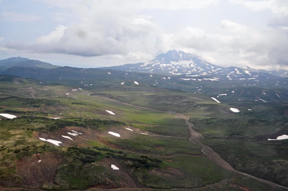
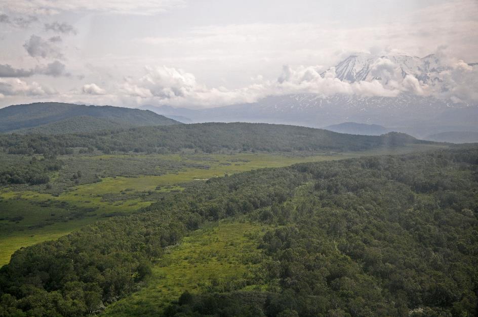
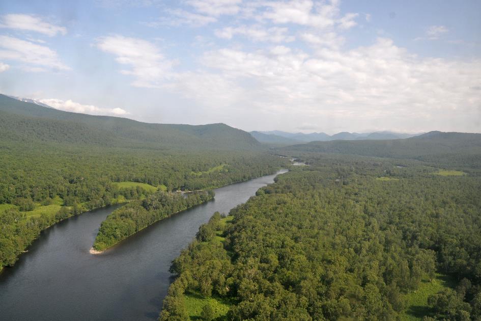
The rugged, volcanic terrain has now given way to rolling green landscapes of tundra and forests. Then, the Zhupanova River comes back into view. Majestically, it flows through the green landscape of endless forests, occasionally forming elongated islands that are also densely forested. But it's the impressive mountain range on the horizon that draws all the attention. This signifies that we are approaching the Nalychevo Nature Park, as these are the Zhupanovsky and Dzenzur, two of the four active volcanoes in the park.
It's the impressive mountain range on the horizon that commands all the attention
Zhupanovsky
It wasn't until 1995, following a petition from the local population, that Nalychevo was recognized as a nature park. This was urgently needed because, at that time, the Soviets did not prioritize nature conservation. Natural resources were squandered without any restrictions, poaching decimated animal populations, and there was even a dumping ground for pesticides and mercury preparations.
Natural resources were squandered without any restrictions, poaching decimated animal populations
However, the level of protection in Nalychevo is not as high as that of Kronotsky or South Kamchatka. This is a deliberate choice, as authorities want to give ecotourism a chance. Every year, several thousand tourists visit the park. These are not only Russian and foreign tourists but also locals. For them, Nalychevo is one of the most popular destinations – offering opportunities for sport fishing, rafting, kayaking, trekking, horseback riding, skiing, and more.
Zhupanova, Zhupanovsky
If you live in Petropavlovsk, the park is within easy reach, so to speak. Visitors still need to be flown in by helicopter like us – a flight of half an hour. Alternatively, they can embark on a trek, a journey of approximately forty kilometres along one of the two hiking trails. Compared to elsewhere in Kamchatka, these hiking trails are pure luxury. There are excellent maps of the route with precise GPS coordinates available, there are fire pits and huts along the way, and – the height of decadence – there are even bridges over some streams and rivers.
Then there's also a track used to supply the central infrastructure. Only park employees are allowed to use it, but the locals don't necessarily abide by that rule. In any case, it's an extremely difficult route. You need a 4WD with high clearance and a good deal of experience to make it through unscathed.
In short, this may not seem like the rugged Kamchatka we've come to know over the past week. But that's a misconception. Of course, bears may be less easily spotted now, but they're still there, rest assured. With four active and nine extinct volcanoes, Nalychevo has quite a bit to offer. Moreover, those imposing volcanoes form a protective horseshoe around the area, creating interesting microclimates here and there. And the Zhupanovsky, a giant nearly three thousand meters high, is not to be trifled with. For over half a century, it remained dormant until very recently, in the years 2013, 2014, and 2016, when it experienced serious eruptions.
Imposing volcanoes form a protective horseshoe around the area, creating interesting microclimates
Zhupanovsky
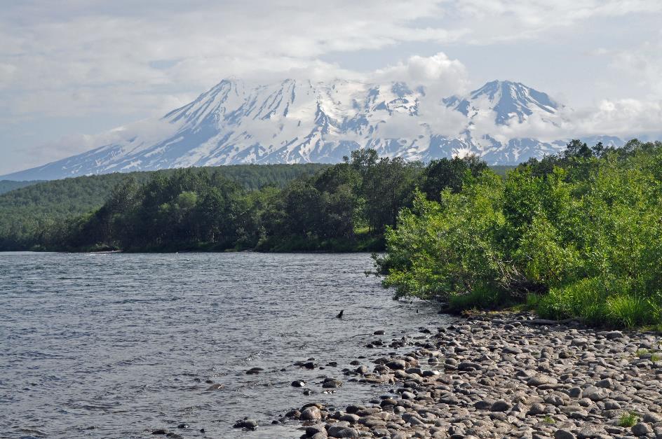
At ten minutes to three, we land on one of the helipads at Dzenzur Lodge, on the right bank of the Zhupanova River. The imposing silhouette of the Zhupanovsky dominates the southern horizon. The view of the snow-capped volcano is breathtaking, with visibility almost perfect and clouds hardly obstructing the view. And we will be able to enjoy it in peace, as there are hardly any other visitors around. The busy hub of human activity is located at the central infrastructure, on the other side of the volcano, about forty kilometres from here.
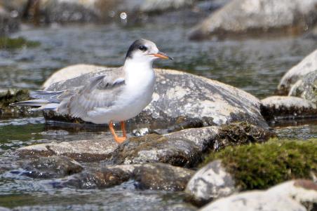
We descend to the riverbank for a moment. The water of the wide Zhupanova River gently ripples over the rocks toward the ocean. Dense forests extend right up to the bank. Thick, smooth round stones form a small beach near the lodge. It must have seemed like the ideal spot for a nest to a pair of common terns. Like all terns, they are not very choosy when it comes to the location of their nest. Flat ground without vegetation, close to the water but still dry, that's all they need. However, in terms of protection, it's quite poor. This probably explains why terns are so aggressive when it comes to defending their nest.
With loud cries, the terns make it clear to us that we are not welcome here
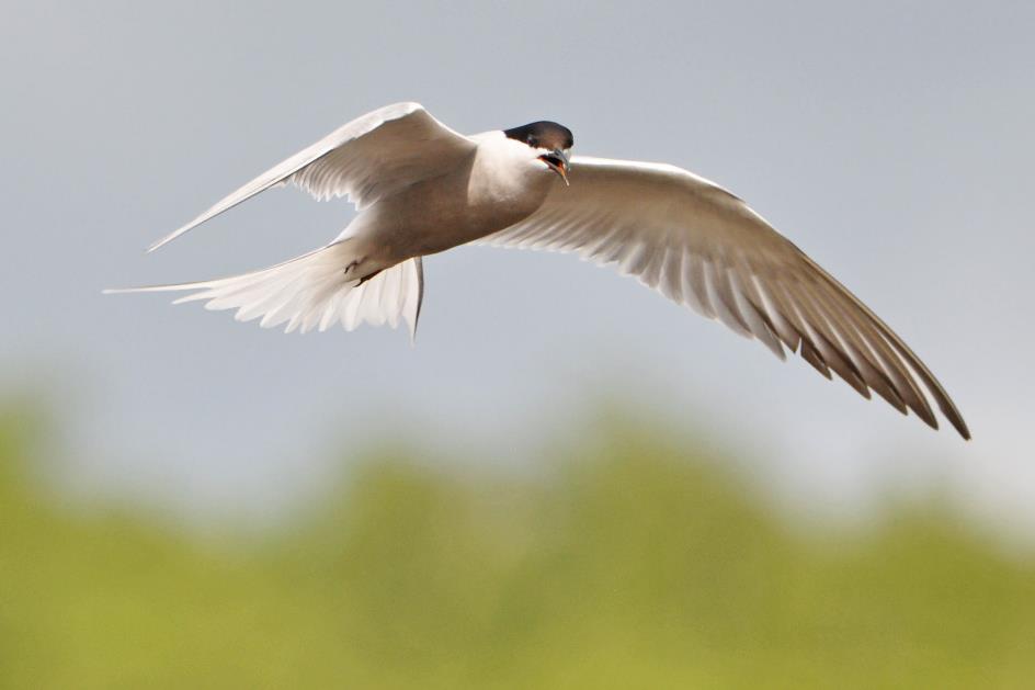
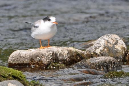
Common tern (longipennis) (m)
Common tern (longipennis) (f) |
|
Common tern (longipennis) (juvenile) |
Barely are we in the vicinity when the game is on. Loudly screeching, the birds make it clear to us that we are not welcome here. Get lost, is their message, even though we respect a distance of about ten meters. Besides the parents, we only spot one chick, whereas a typical clutch consists of two or three eggs. Perhaps they’ve already had one or more unpleasant experiences.
It's a lunchbox featuring exactly what Kamchatka is renowned for – boiled salmon, smoked salmon, salmon caviar
Then the male takes off and starts bombarding us with his cries from the air. Terns are generally known to try to drive away their intruders by swooping close to their heads. Fortunately, it doesn't come to that. While it hangs in the air, we can clearly see its black legs and black beak. These features are typical for the sterna hirundo longipennis. This subspecies is found in China, central and eastern Siberia, and Alaska. The black cap on its head extends all the way from its beak to deep into his neck. This indicates that it has put on its breeding plumage.
Zhupanova
Meanwhile, Alexandra has a late lunch prepared. Unlike in the Kronotsky Nature Reserve, where there were no facilities, here we can use the kitchen of the rangers. It's a lunchbox that is absolutely delightful, featuring exactly what Kamchatka is renowned for – boiled salmon, smoked salmon, salmon caviar. All of it incredibly fresh, of course.
Zhupanovsky
Around half past four, we begin our journey back. The MI‑8 follows the valley of the Zhupanova downstream, with the impressive Zhupanovsky on our right, its snow-covered slopes sparkling in the sun. Further south, the clouds once again dominate the sky. But that doesn't bother us anymore; we've been fortunate with the weather, having had a stroke of luck with it.
In a wide arc, we fly around the Avachinsky and the Koryaksky, the other two active volcanoes of Nalychevo, just like we did this morning. At five o'clock, we reach Khalaktyrka Airport, east of Petropavlovsk.
Paralithodes camtschaticus, that's the name of the creature that restaurant Pastrami will serve us tonight as an appetizer upon our request. In culinary circles, this delicacy is better known as the red king crab, one of the largest and most popular king crabs. Although strictly speaking, a king crab is more closely related to a lobster than a crab. The hermit crab is its closest relative.
The fact that the red king crab has become the worldwide market leader – and not the blue king crab or the California king crab – is due to experiments by the Soviet regime. In the 1960s, they decided to release the red king crab into the Barents Sea to boost fishing in Murmansk. This succeeded remarkably well because the red king crabs liked it there. To such an extent that this underwater red army began to expand its territory hand over hand. Barely fifteen years after their introduction, the Norwegians also found red king crabs as bycatch in their nets. Gradually, the Russians and Norwegians would dominate the world market.
Strictly speaking, a king crab is more closely related to a lobster than a crab. The hermit crab is its closest relative
At Pastrami, the consumption of red king crab is taken very seriously. We are given a plastic apron to wear, we put on plastic gloves, and we take the tongs to dissect the long, red legs with surgical precision. This is done with varying success, but the consensus is unanimous – this is delicious.
Jaak Palmans
© 2024 | Version 2024-02-22 15:00
Continue reading in (5/5)