Land of bears and volcanoes
Russia | Anno 2019
Wednesday, July 24 | Moscow – Petropavlovsk
Thursday, July 25 | Petropavlovsk
Friday, July 26 | Petropavlovsk – Khodutka – Ksudach – Kurile Lake
Wednesday, July 24 | Moscow – Petropavlovsk
Grimness prevails, it seems, as the Boeing 737-800 of Aeroflot begins its landing manoeuvre. The tarmac is still wet from a previous downpour, although it's no longer raining. But the dense layer of clouds, low over the airport, suggests that there will soon be another change in weather. Welcome to Sheremetyevo, Moscow's second airport.
It's quarter to five in the afternoon now, with about four hours left until our flight to Petropavlovsk, the capital of Kamchatka, departs. A larger-than-life statue of Alexander Pushkin in the central hall reminds us that this airport is actually named after one of the greatest poets in world literature. Sheremetyevo Alexander Sergeyevich Pushkin International Airport, it's quite a mouthful.
Brussels comes closer is a message we didn't expect to see here. Information panels inform us that it's an initiative of the Brussels-Capital Region, which is celebrating its thirtieth anniversary this year. This occasion is being used to announce the new daily flight of Brussels Airlines between Brussels and Sheremetyevo.
Although Kamchatka may be a godforsaken corner on the edge of the Eurasian continent, the Ulyanovsk is packed to the brim
Just after seven, we shuffle aboard the Ulyanovsk, a Boeing 777-300 operated by Rossiya Airlines, the lesser-known sister company of Aeroflot based in St. Petersburg. Although Kamchatka may be a remote corner on the edge of the Eurasian continent, the Ulyanovsk is packed to the brim. More than three hundred travellers are getting ready for the long flight.
And they're not just tourists. As it turns out, the lady next to us is from Kamchatka. She's returning home with her daughter. She doesn't understand German, English, or French, just as we can't make ourselves understood in Russian. So, smooth conversation isn't in the cards.
But that doesn't stop her from astonishing us with a spectacular video on her smartphone. It turns out the footage was posted on YouTube barely two days ago and shows a nighttime recording from one of the surveillance cameras around the airport in Petropavlovsk. The fencing around that airport looks sturdy. Yet, it's no match for a brown bear who wants to see what's going on at such an airport. It only takes him about twenty pushes and pulls to make a hole big enough to crawl through. The tone is set – you don't mess around with a Kamchatka brown bear.
The tone is set – you don't mess around with a Kamchatka brown bear
At half past eight, we take off. It will take seven and a half hours before we reach our destination. Petropavlovsk is nine time zones away, and lies further east than Japan. And yet, from start to finish, this is a domestic flight. Only in Russia could this happen.
As the sun sets just behind us, we fly eastward into darkness, unaware that we won't encounter darkness at all. Because we will follow a geodesic line across the Earth's surface. This is the line you get when you stretch a thread on a globe between Moscow and Petropavlovsk. Thus, our flight path does not lead straight through Siberia, but rather follows the coastline more northward, partly north of the Arctic Circle, an area where the sun doesn't set at this time of year. In short, this will be a night without darkness. Perhaps to evoke the illusion of night, tiny specks of light appear on the ceiling above our heads as if a starry sky is sparkling there. We even recognize the Big Dipper, the Little Dipper, and the North Star.
To the left, the sun casts its golden glow over the polar regions, while to the right, a misty evening twilight hangs over the Siberian mainland. It was Ivan the Terrible who first set his greedy eyes on that immense wilderness. He believed that area urgently needed to be explored and colonized. His ambition led to the conquest of Siberia, an episode in Russian history much less known than the conquest of the American Far West, yet it bears remarkable similarities.
Everywhere in Siberia, the Cossacks left a trail of death and destruction.
In 1639, the Cossacks were already standing on the coast of the Pacific Ocean, almost six thousand kilometres from Moscow. They left a trail of death and destruction everywhere in Siberia. The indigenous people were enslaved and forced to pay a yasak, a tax in the form of skins from sables, martens, foxes and beavers. Those who didn't comply faced torture, executions, rape, and slavery. As if that wasn't enough, the Cossacks also brought smallpox, a viral disease against which these people were defenceless. In short, the indigenous population was decimated.
It wasn't until 1697 that the Cossacks also became involved with Kamchatka. At first glance, this elongated, narrow peninsula seemed to have little or nothing to offer. Until it turned out to be teeming with sables. Because sable fur was highly sought after at the time for its golden-brown shiny colour and softness.
As soon as Tsar Peter the Great laid eyes on the thousands of furs extorted from the local population by his troops, all hell broke loose. In 1724, he sent the Dane Vitus Bering to thoroughly explore Kamchatka. And while he was in the vicinity, Bering was also tasked with determining once and for all whether Asia and America were connected by a land bridge.
The Russians' secrecy was so effective that they themselves no longer knew what they had discovered
Funny enough, in 1648, the Russian Semyon Dezhnev had already sailed around the extreme northeast corner of Asia, thus discovering the strait we nowadays call the Bering Strait. So, a land bridge between both continents did not exist. He documented this discovery in a report that promptly disappeared into government archives because the results of Russian expeditions to Siberia had to remain strictly confidential. Imagine if that information fell into the hands of foreign powers and they got hold of the treasures of Siberia. Apparently, the secrecy was highly effective. So effective that the Russians themselves no longer knew what they had discovered. Thankfully, because otherwise, that strait would be called the Dezhnev Sea. The name Bering Sea is much easier to remember.
Tobolsk became for the Far East what St. Louis would be for the Far West a century and a half later
It must have been hellish undertakings, these journeys undertaken by explorers like Bering to map out the vast expanse of Siberia. After all, it's an area of 13 million square kilometres, twice the size of the American Far West, with a ruthless continental climate to boot. Tobolsk, a city just east of the Urals, became for the Far East what St. Louis would be for the Far West a century and a half later – a bustling hub of roads, a hectic gathering place for adventurers and fortune seekers, the ideal basecamp for venturing into the unknown wilderness.
It would ultimately take Bering more than two years – from February 1725 to the summer of 1727 – to reach the west coast of Kamchatka via Tobolsk and Yakutsk, partly overland, partly by rivers, partly by sea. This first Kamchatka expedition would yield a wealth of valuable information about Northeast Siberia. Unfortunately, Bering couldn't provide definitive proof of the existence of a land bridge to Alaska.
What took Bering two years to accomplish back then, nowadays you can do in just about eight hours
What took Bering two years to accomplish back then, nowadays you can do in just about eight hours. And in our case, partly sleeping. Because even if darkness is absent, we don't want to skip our nap.
Thursday, July 25 | Petropavlovsk
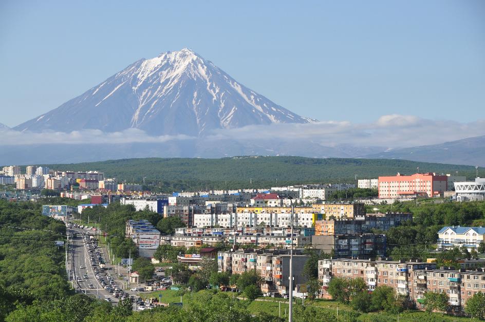
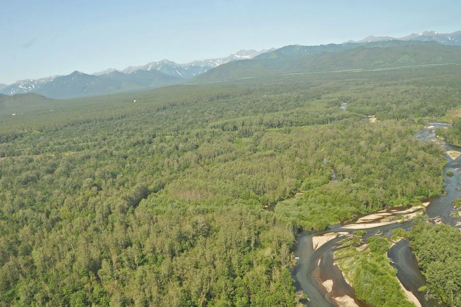
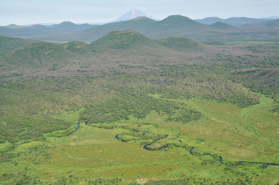
It doesn't take long before the onboard staff comes to wake us up for breakfast. A glance at our watch tells us that – at least in Moscow – it's two in the morning, and a look at the TV screens tells us that we are somewhere north of Yakutsk. Half an hour later, we are flying over Magadan, a Russian port city on the east coast of Siberia, over two thousand kilometres northeast of Vladivostok. Only the Sea of Okhotsk now separates us from Kamchatka, the enormous peninsula that dangles like an unnecessary appendix from the Siberian landmass.
Kamchatka is about as long from north to south as the Italian boot
Kamchatka is about as long from north to south as the Italian boot. With its area of 472,300 km², Kamchatka is more than one and a half times the size of Italy, and with its length of 1,250 km, it's about as long as the Italian boot. This makes it the largest peninsula in East Asia. However, the bottleneck connecting Kamchatka to the Asian mainland is at most a hundred kilometres wide.
The narrowness of this passage has had significant consequences. Humans and animals largely avoided the peninsula, so it remained largely untouched until recently. Reptiles have never even managed to penetrate Kamchatka. You won't find native snakes, lizards, or turtles there. Animals that did manage to reach the peninsula became isolated from their counterparts elsewhere in the world and evolved into endemic subspecies. Primitive humans also showed little interest in this inhospitable corner. Human activity and presence were more notable in Central America than in Kamchatka in ancient times.
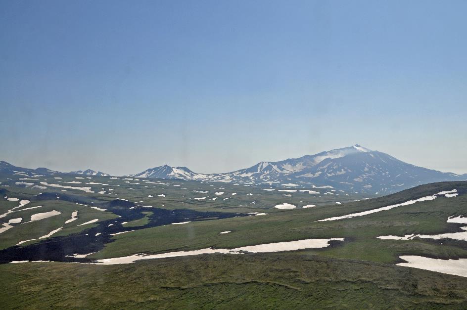
What you do find abundantly, however, are volcanoes. Kamchatka boasts about 160 volcanoes in total, 29 of which are considered active. That's a whopping ten percent of all active volcanoes worldwide.
Kamchatka boasts about 160 volcanoes in total, 29 of which are considered active
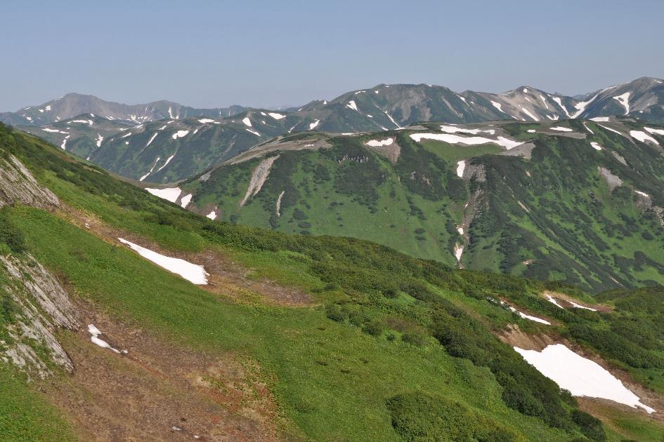
If you take a relief map in hand, you can't miss it. Along the southeast coast, dozens of volcanoes seem to stand side by side, as if they are expected to defend the peninsula against an enemy coming from the southeast. And in a way, that's true, because from there, the Pacific Plate moves about eight centimetre per year towards Kamchatka. There it is pushed beneath the Eurasian Plate – a phenomenon called subduction – causing the rock to be converted into magma. This magma finds its way to the surface, giving rise to the volcanoes that occasionally spread layers of ash and lava over the surroundings. Kamchatka is almost literally bursting with geothermal activity.
With perfect timing, our first volcano comes into view outside the window. It looks like it came straight out of textbooks, a perfect cone shape with white streaks of snow in the ravines where meltwater cascades down.
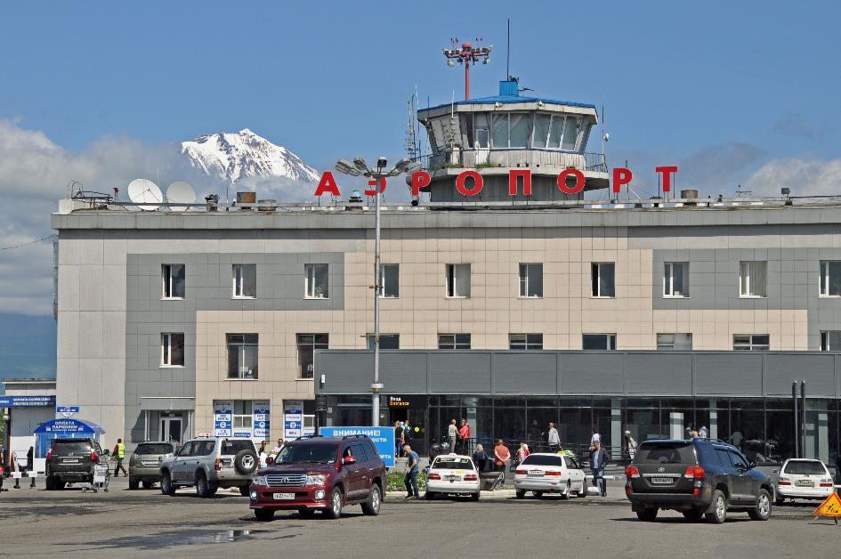
Airport of Yelizovo
Fifteen minutes later, we make a wide turn above the Pacific Ocean, heading towards the airport of Yelizovo. There, we land at 3:55 AM Moscow time under an almost cloudless sky. In a straight line, we are closer to San Francisco than to Moscow.
We need to adjust our watches by nine hours, as the local clocks show 12:55 PM. It's sunny and quite warm, with the thermometer reading a comfortable 17 °C (63 °F). Apparently, the weather in Kamchatka is putting its best foot forward today. Although water puddles remind us that it has recently rained here.
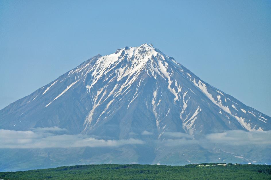
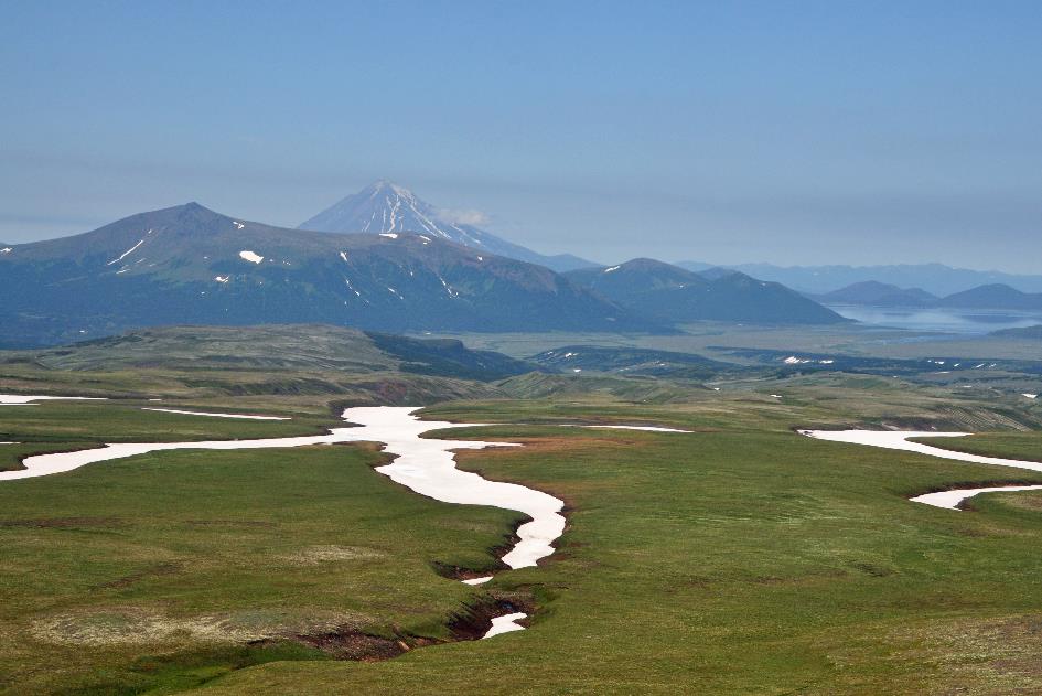
Koryaksky
In the distance, two impressive, partly snow-capped volcanic peaks dominate the horizon. These turn out to be the Koryaksky and Avachinsky, respectively 3,456 meters and 2,741 meters high. Both volcanoes are active, but it has been since 1991 that either of them has shown any activity. However, that is about to change soon. In a few months, on October 5th, volcanologists will raise an alarm due to increased activity in the crater of Avachinsky. This will cause some stir because the 180,000 residents of the capital, Petropavlovsk, live and work only 25 km away. But ultimately, there will be no eruption. On December 9th, a similar scenario will repeat itself, almost simultaneously with the eruption of White Island in New Zealand.
Without government support, the local economy in distant, sparsely populated Kamchatka would not have been viable
In the airport parking lot, Christina is waiting for us. Twenty-seven years ago, she was born here in Kamchatka. Her father is originally from Ukraine, and her mother is Kyrgyz. Both had migrated to Petropavlovsk, encouraged by the high wages paid out by the Soviets. Without government support, the local economy in distant, sparsely populated Kamchatka would not have been viable. The heavy investment by the Soviets in wages, food subsidies, and housing loans had solely a geostrategic reason. Nearby Vilyuchinsk hosts an important base of the Russian Pacific Fleet, with nuclear submarines having their permanent base there. That was also the reason why this area was strictly off-limits to foreign observers.
With the dissolution of the Soviet Union in 1991, things changed. The cash-strapped government lost interest in Kamchatka, and people had to fend for themselves. This became increasingly difficult, especially after the devaluation of the rouble in 1994. Since then, about a quarter of the population has turned their backs on the peninsula.
Nearby Vilyuchinsk hosts an important base of the Russian Pacific Fleet, with nuclear submarines having their permanent base there
So did Christina's parents. They have since divorced, and her father has returned to Ukraine, while her mother and brother have built a new life in Auckland, New Zealand. Christina herself also lived there for three years. However, in 2011, she returned to Kamchatka. Initially intending to help her grandparents for about six months, she ended up staying. She found a job here, working ten months a year in a medical supplies store and devoting two months a year to taking care of tourists like us. It seems to be paying off for her, as she drives around in a Lexus RX300, with the steering wheel on the right side and a dent on the left side.
It's only a half-hour drive from the airport in Yelizovo to the capital, Petropavlovsk. Technically, we should say Petropavlovsk-Kamchatsky, as the Russian Federation has a handful of similarly named Petropavlovsks. The original settlement was founded in 1740 by Vitus Bering during his second expedition to Kamchatka. He derived the name from the two ships of his expedition – the Saint Peter and the Saint Paul.
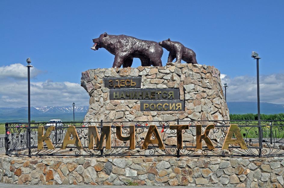
‘This is where Russia begins’
Barely leaving behind Jelizovo, we encounter a tribute to another icon of Kamchatka – the Kamchatka brown bear. A larger-than-life statue depicts a bear with a salmon in its mouth, alongside a cub. Somewhat presumptuously, the message reads Здесь начинается Россия – This is where Russia begins’.
Despite the region appearing very green and fertile, this is one of the few areas suitable for agriculture
Along the way, Christina points out some dachas. These are small summer cottages where people come to grow vegetables. However, most of the vegetables in the shops are imported from China. Despite the region appearing very green and fertile, this is one of the few areas suitable for agriculture. That's why the majority of the population resides here. Otherwise, Kamchatka is a vast wilderness. The total agricultural area of the enormous peninsula is only 475,600 hectares. For comparison, the small, densely populated region of Flanders has an agricultural area of 624,727 hectares.
Nevertheless, our attention on the way is mainly drawn to the horizon, where impressive volcanoes dominate the landscape – the Koryaksky and Avachinsky on the left, and in the far distance, the Vilyuchinsky on the right. Just after three, we arrive at Hotel Petropavlovsk in Petropavlovsk, a colourless blocky building in the uninspiring style that the Soviet Union seemed to have patented. We settle into our tiny, worn-out rooms. Though not hungry, we obediently head to the restaurant for lunch.
Then we head into the city. For buying roubles, Christina has a great contact. Not a bank office or anything official, but a man who conducts his shady transactions from his car. We get seventy roubles for one euro.
Next, like almost every tourist arriving here, we head to a specialty store for additional outdoor equipment. We especially need waders – waterproof boots extending from the foot to the thigh – because there are hardly any roads, let alone bridges, in Kamchatka. If we want to cross rivers, we'll have to wade through the water. We also need a sleeping bag, preferably one that provides enough warmth, as it can get quite cold even in the summer high up in the mountains. We opt for sleeping bags that guarantee thermal comfort up to –10 °C (14 °F).
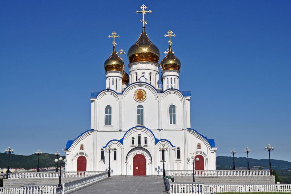
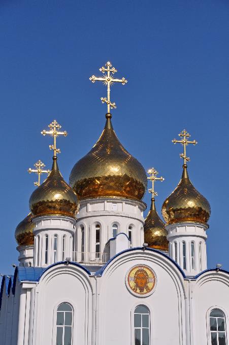
Cathedral of the Holy Life-Giving Trinity
It seems that in Petropavlovsk, despite the economic downturn, they still believe in the future. Our first visit teaches us this. In 2001, they even began the construction of a brand new cathedral. Initially, financing relied on donations from companies, charitable organizations, parishioners, and other citizens. However, this was not enough to raise the required budget of 230 million roubles. The shortfall – about 180 million roubles – was then covered by the Russian Gazprom. The cathedral was consecrated in 2010.
Iconostasis
It has indeed become an impressive building, this Cathedral of the Holy Life-Giving Trinity. Its location on a hill is unmatched, as is the view. On a clear day like today, you can see it from almost anywhere in the city, with its white walls, blue roofs, and five golden onion-shaped domes sparkling in the sunlight. The heavenly blue, cloudless sky adds to the splendour.
Cathedral of the Holy Life-Giving Trinity |
|
|
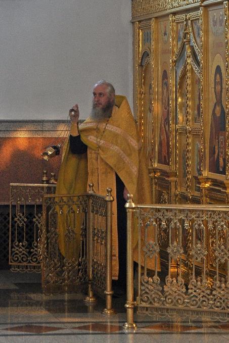
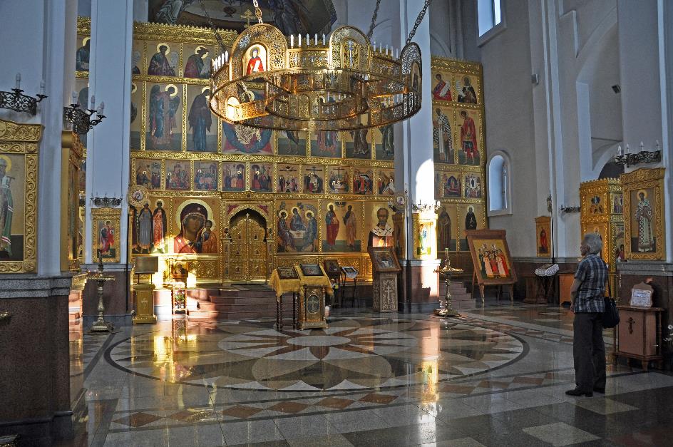
This is certainly not a sterile church building. That becomes evident as soon as we enter the interior. At the back of the choir loft, a women's choir is singing. Behind the iconostasis, an invisible priest responds to their chant. Once that dialogue comes to an end, he emerges and begins to cense the church, walking around with the censer. Several women, their heads covered with scarves, humbly bow their heads as he passes by.
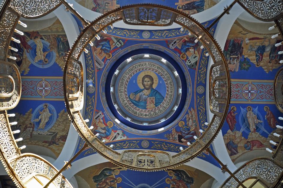
Christus Pantocrator
In the dome high above our heads, we recognize the image of Christ Pantocrator. The gilded iconostasis impresses mainly due to its size. It presents us with depictions of the Holy Trinity, Mary as Theotokos, several scenes from the life of Christ, and a number of saints. At the front, a worshipper kisses the image of the Holy Trinity on a lectern, caresses the glass in a gesture of religious devotion, and then repeatedly makes the sign of the cross. In doing so, he – unlike Western Christians – touches the right shoulder first, and then the left.
Koryaksky and Avachinsky
Tomorrow, the real work begins. We already knew that, but during an evening briefing at the hotel, Christina emphasizes it once again. In Kamchatka, there are no roads, as the saying goes, there are only directions. So, in practice, you only have two options for getting around – trudging through the wilderness on foot or flying over that same wilderness by helicopter. Believe it or not, we've opted for the latter.
In Kamchatka, there are no roads, there are only directions
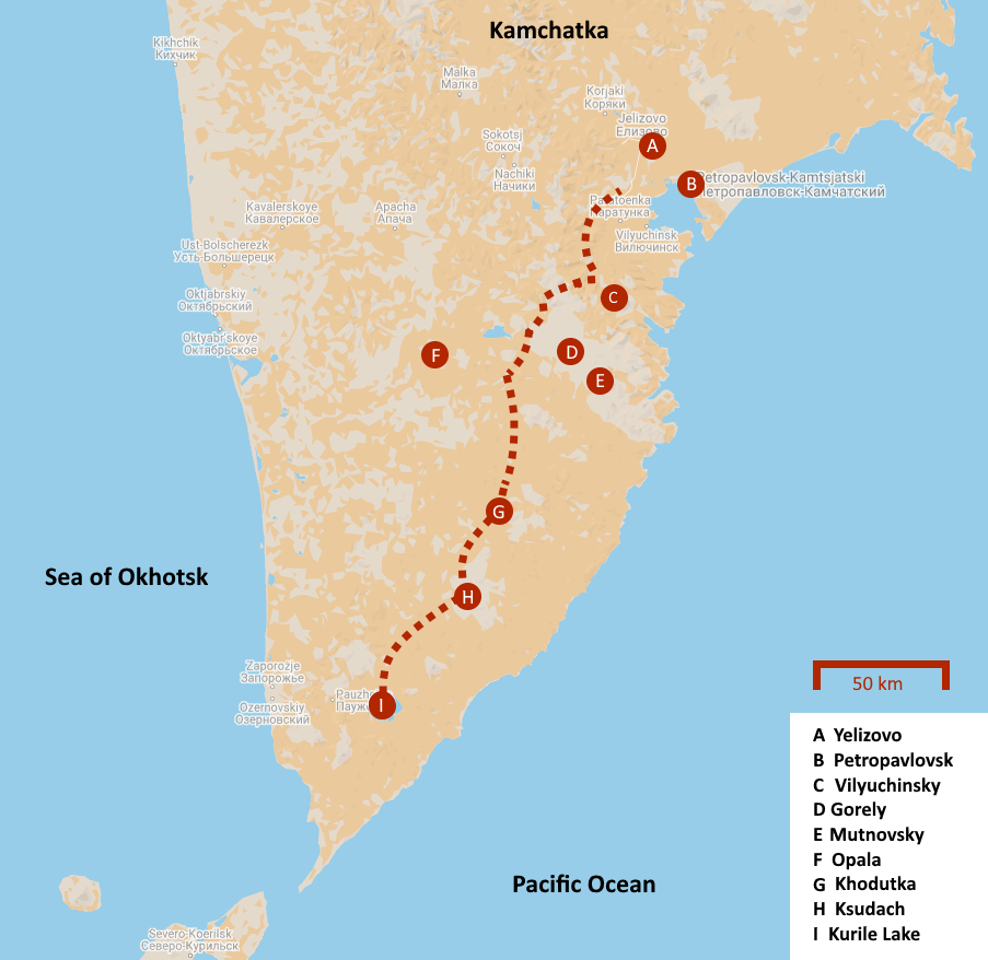
Our destination is Kurile Lake in the south of Kamchatka, just over two hundred kilometres from here. Normally, a helicopter would take a little over an hour to get there. But for us, it will take longer because we'll be making some stops to visit two volcanoes along the way. That's if the weather cooperates, at least.
Koryaksky, Petropavlovsk
Don't forget your hats and sunscreen, Christina advises us, and also your mosquito repellent and mosquito nets. Trying to swat mosquitoes, she adds, is simply futile – there are just too many of them.
Friday, July 26 | Petropavlovsk – Khodutka – Ksudach – Kurile Lake
Sparrows chirp cheerfully in the trees outside our hotel window. There isn't a cloud in sight as the sun rises in the east above the horizon. Being awake much earlier than usual due to the jet lag, we witnessed the sunrise with our own eyes.
In the southeast of the peninsula, rainfall peaks at 2,500 mm per year
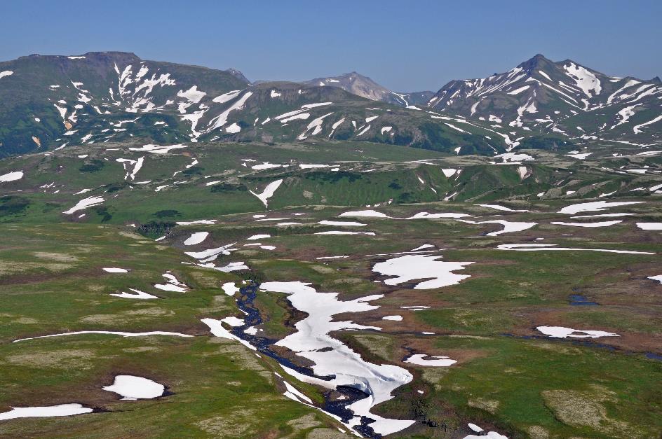
Our favourable prospects are later confirmed by the TV channel Rossia 1. The weather forecast for Kamchatka predicts a sunny day, with temperatures easily reaching 21 °C (70 °F) and no rain clouds in sight. We couldn't ask for better weather. In the southeast of the peninsula, rainfall peaks at 2,500 mm per year.
Whether the helicopters will fly today depends primarily on the weather. We think it looks promising. However, it's not until ten past nine that the long-awaited news arrives. In front of the hotel, an old-fashioned bus has appeared. Our bulky luggage is loaded, and we follow suit as the driver sets course for Yelizovo.
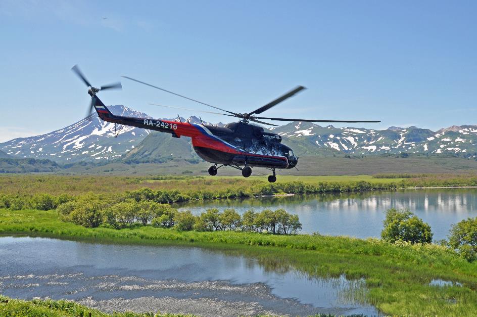
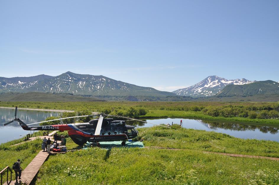
We can rest assured that the helicopter we'll be flying south in is much more reliable than this rickety bus. With its robust reliability in the most extreme conditions, the MI‑8 has been the workhorse of the Russian military for over half a century. Nowadays, it's mainly used as a transport helicopter, although it also serves as an attack helicopter. Two gas turbines power five rotor blades, effortlessly lifting the seven-ton behemoth, even with a five-ton cargo on board. If needed, you can even drive a vehicle inside through the open rear hatch.
However, that unwavering reputation will take a significant blow on August 12, 2021, when an MI‑8 crashes into Lake Kronotskoye with 16 people on board. Only eight survivors will be rescued from the icy waters.
The MI‑8 has been the workhorse of the Russian military for over half a century
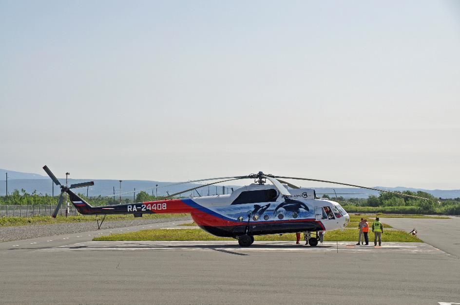
MI-8
Just before ten o'clock, we arrive at Vityaz-Aero, the largest helicopter company in Kamchatka. On the tarmac, we count about ten transport helicopters. The administrative formalities are completed, the luggage is loaded, and then we climb aboard the Victor Pogokshonov, a shiny black MI‑8. There are nineteen of us, including Christina, our tour guide from Lost World Tours, and Vitali, an employee of Vityaz-Aero. Two pilots have taken their seats in the cockpit.
MI-8 – Interior
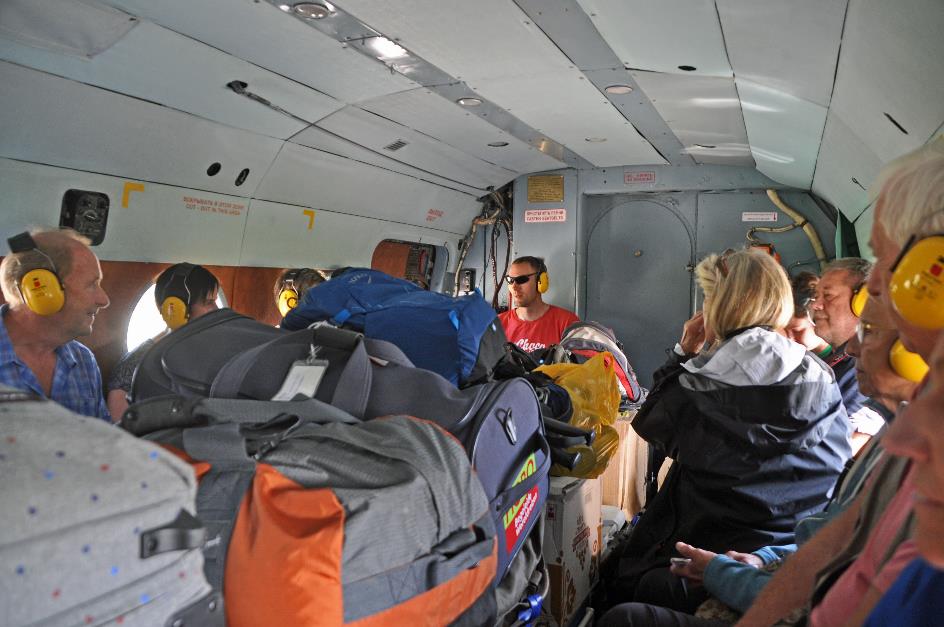
The interior of the MI‑8 looks rather Spartan – an empty, open space with benches against the walls on either side. Our luggage is stacked in the middle, while we take our seats on the benches. The ear protectors provided are more than welcome, as the gas turbines and rotor blades produce quite a few decibels. Five round windows on both sidewalls will allow us to enjoy the landscape, as long as our seat belts don't prevent us from doing so.
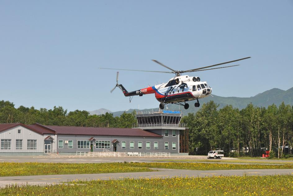
Yelizovo – Vityaz-Aero
With a lot of noise, we rise above the helicopter base and immediately veer southward. A broad valley, remarkably green and densely forested, guides our way. Very occasionally, we notice traces of human activity. However, it doesn't last long. We climb higher and higher through the valley, and the terrain becomes increasingly barren. Here and there, a crystal-clear river meanders through the valley.
As we progress, the terrain gradually evolves into a tundra landscape, with patches of snow on the mountain slopes and in the water channels. Our seatbelts have now become an redundant curiosity, and the windows are more often open than closed. Because we don't want to miss any of those spectacular views.
Our seatbelts have now become an redundant curiosity, and the windows are more often open than closed
Vilyuchinsky
And then the real superstars have yet to come, the volcanoes jostling each other in the southeast. As we fly over the Vilyuchinsky Pass, it seems as if the Vilyuchinsky is within arm's reach on the left. It's an impressive volcano, not so much because of its height – which is only 2,173 meters – but because it rises more than 1,600 meters above its surroundings. Its slopes are deeply carved by erosion, especially on the north side where it is still covered with snow.
The turbulent history of the Gorely and the Mutnovsky has created a mishmash of overlapping crater mouths
Mutnovsky
A bit later, the Gorely and the Mutnovsky appear on the left side of the window. Both of them are among the most active volcanoes in Kamchatka. But there is nothing left of the typical profile of a volcano here. Their turbulent history of large and small eruptions has created a mishmash of overlapping crater mouths. We will be able to experience this ourselves next Tuesday when we climb the Mutnovsky.
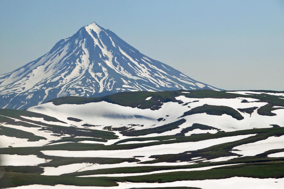
Opala volcano, Tolmachova lake (in the distance to the right)
Opala volcano, lava flow
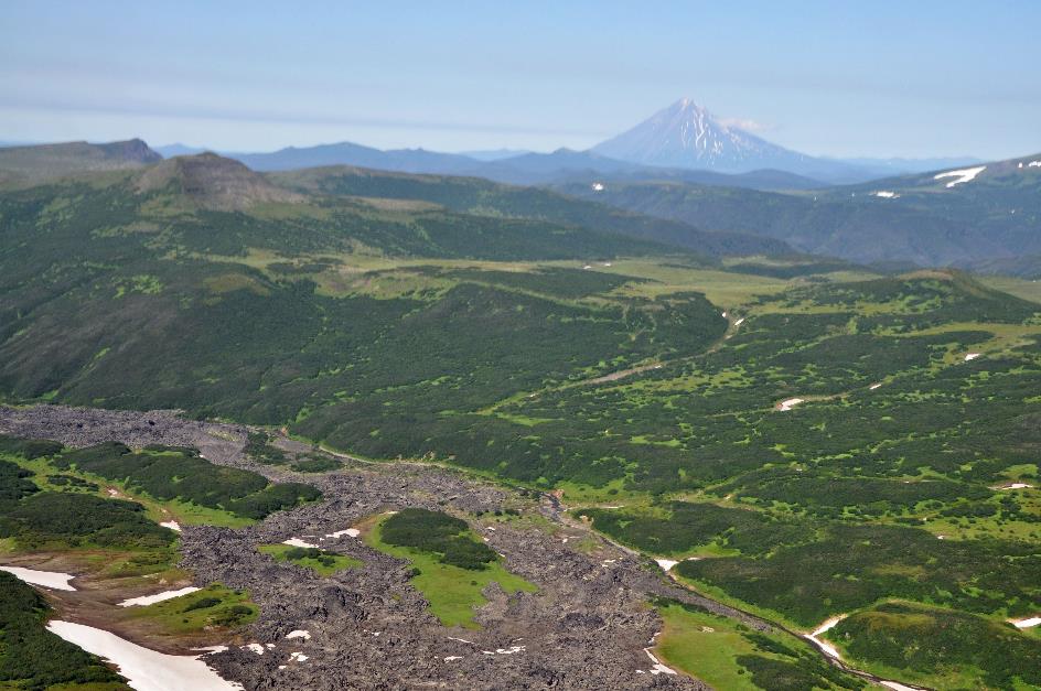
In the distance to the right, the Opala volcano stands out with its perfect cone shape. Its history has been relatively quiet; the last eruption of this volcano dates back to 1894. It's a prominent sight, rising more than two thousand meters above its surroundings. We can also just make out the calm surface of Lake Tolmachovo.
Lava flow
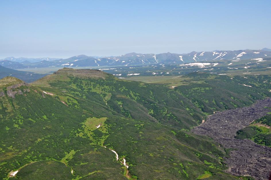
Meanwhile, we find ourselves flying over an old, solidified lava flow. Our first stop is now approaching. Half an hour after our departure, we land near the Khodutka volcano, approximately 130 km southwest of Petropavlovsk.
All the ingredients are present to attribute medicinal properties to this water
Khodutka
But we're not here for the volcano; rather, we're interested in the hot water of the Pravaya Khodutka, the river flowing through the caldera. Over a distance of about a kilometre, the water of this river is heated to a temperature of around 40 °C (104 °F). Add to that the mineral composition of the water, and all the elements are present to attribute medicinal properties to this water. A hot bath is therefore a must when visiting this site. Although it usually doesn't last long due to the high temperature of the water.
With their strongly branched growth and curved structure, these Erman’s birches give the forest a wild appearance
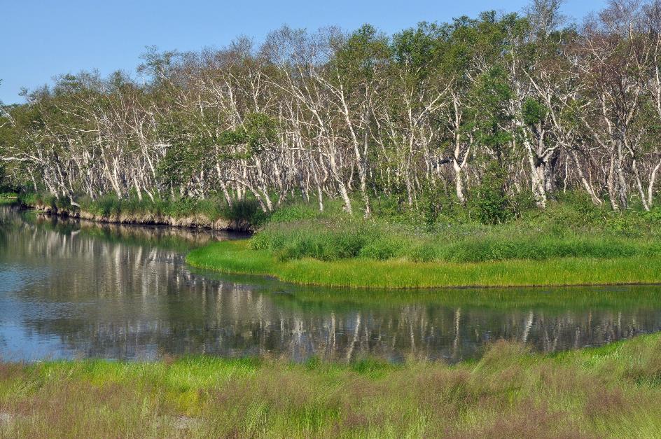
It's remarkable, the forest on the other side of the river. They are birches, but not as we know them. With their strongly branched growth and curved structure, these Erman’s birches give the forest a wild appearance. The German Adolf Erman was the first to scientifically describe them in 1828. Hence their name, although locally they’re also called stone birches while they’re capable of colonising thin and poor soils. They don't grow taller than ten meters, probably because the snow load in winter would otherwise become too heavy. In this watery environment with a mild climate, Erman’s birches feel at home. Their light crown is very typical, allowing sunlight to easily reach the ground and allowing low shrubbery to thrive there in great variety.
Beneath those large, colourful compound eyes, they wield a set of blades that can slice through your skin, even through thin clothing
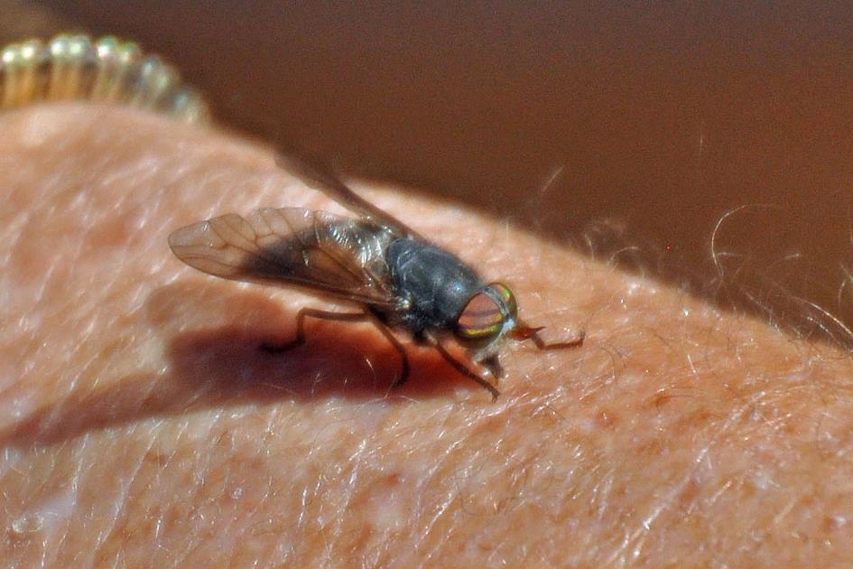
Horsefly at work
With its tranquil waterways, numerous blooming wildflowers, enchanting stone birches, and the majestic Khodutka rising above it all, this seems like a pleasant place to stay. Several wooden chalets even offer the opportunity to do so. However, appearances can be deceiving. The area is teeming with horseflies. Half of them – which means the female ones – are after our blood. You might say horseflies have this in common with mosquitoes. However, the difference is that mosquitoes sting, while horseflies bite. And you'll definitely feel it. Beneath those large, colourful compound eyes, they wield a set of blades that can slice through your skin, even through thin clothing. Such bites will leave a lasting memory.
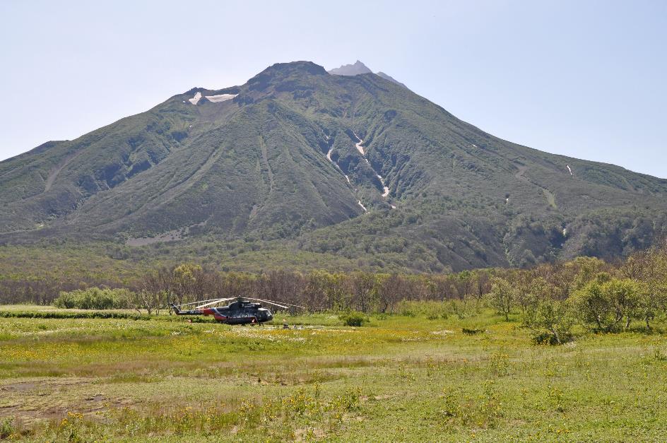
Khodutka volcano
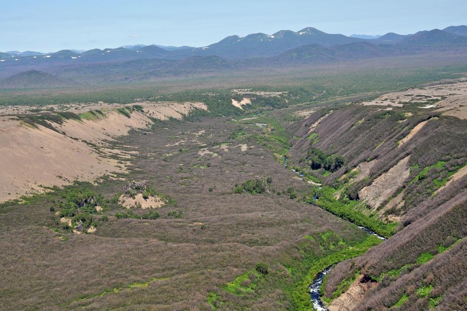
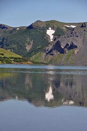
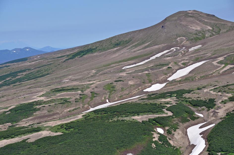
Just before noon, our MI‑8 continues its flight southward. We're in luck, as the sun is still shining brightly and there are hardly any clouds in the sky. It doesn't take long before we spot a crater lake. Shortly after, we realize there are actually two of them. High crater walls surround the tranquil water surfaces. The slopes are mostly covered with shrubs, grass, and tundra vegetation, with patches of snow lingering here and there. In short, it seems like an innocent environment.
The eruption of the Ksudach is still one of the largest in the past two thousand years
Ksudach
But it is not. Because this is the Ksudach, a volcano with a history. It is a complex volcano, with two large calderas within which lie three more calderas. These are mainly the result of five major eruptions. One of those eruptions occurred in 240 AD. It is still one of the largest volcanic eruptions of the past two thousand years. At that time, a whopping 15 cubic kilometres of material were ejected into the air. With that, you could cover the whole of the United Kingdom with a ash layer 6.2 cm thick. The effect of that eruption must have been catastrophic. An area of at least 400 to 500 km² must have been completely destroyed, while an area of more than 10,000 km² must have suffered severe damage to vegetation.
Lake Klyuchevoye and Lake Shtyubelya (in the background)
Much more recently, specifically on March 28, 1907, there was an eruption comparable to that of Krakatau in 1885, Vitali mentions. For the time being, it's the last one, he adds with a hint of cynicism. Within a radius of 100 km around the volcano, there were no trees left. Even a thousand kilometres to the north, the layer of ash was still 2 cm thick. Longer twilight and unusually reddish sunrises were reported in Europe, and the American Rocky Mountains experienced unusually cold weather. Meanwhile, the local population didn't even know what was happening. Sand fell from the sky, turning day into night. It wasn't until 1910 that they managed to identify the source of all the trouble.
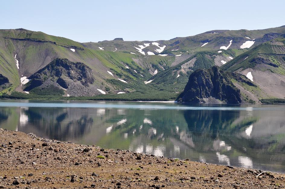
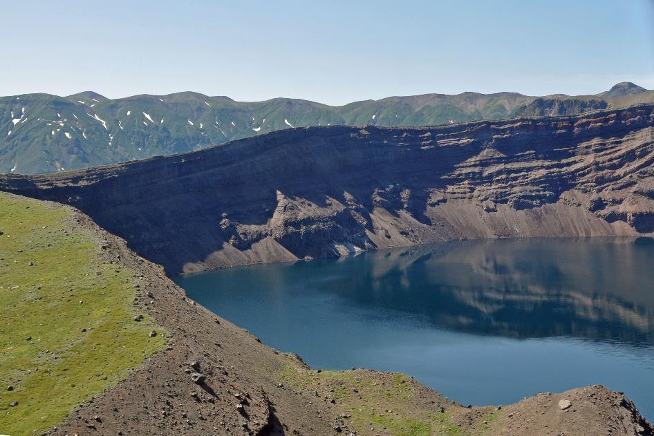
The crater wall is beautifully reflected on the calm water surface of Lake Klyuchevoye
Hardly a quarter of an hour after our departure from Khodutka, the pilot lands his MI‑8 on a beach of volcanic rock on the shore of Lake Klyuchevoye. The crater wall is beautifully reflected on the calm water surface. Behind the hills on the opposite side, Lake Shtyubelya should be located. Nowhere is a sign of life to be seen, except for a solitary Kamchatka gull. Although, a huge bullet casing on the beach suggests that both a bear hunter and one of his prey may have been here.
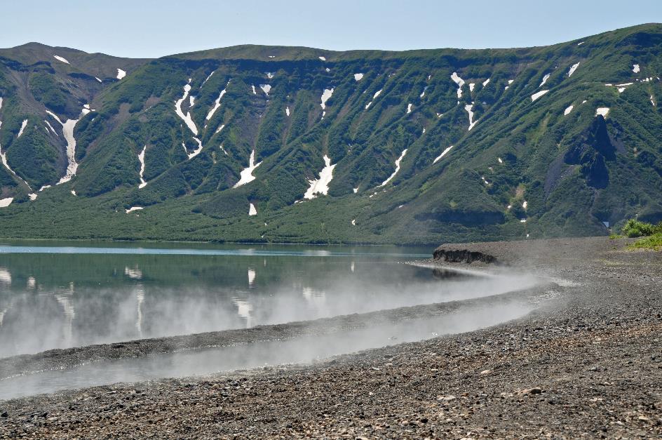
Hot Beach, that’s what they call the place where clouds of water vapour constantly hover above the water
Lake Klyuchevoye |
|
|
But most striking are the wisps of water vapour that constantly hover above the water. Hot Beach, that’s what they call this place. And that has nothing to do with the sun, which bathes the crater with its warm rays. Hot water springs are located throughout underground. Therefore, the temperature of this lake varies widely – from 30 to 70°C (86 to 158 °F). Even in the heart of winter, the water here cannot freeze.
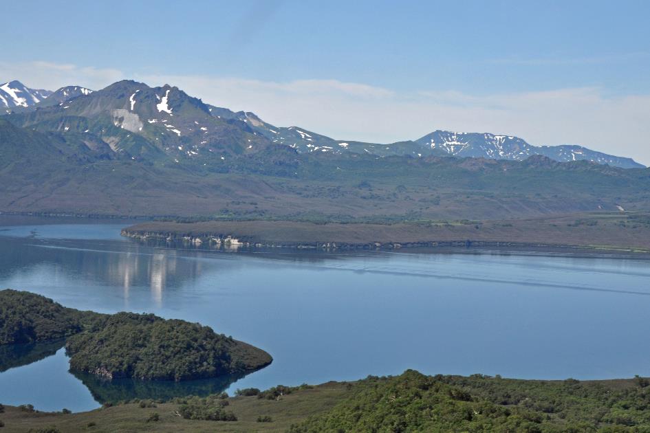
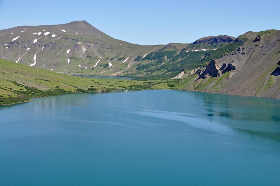
Kurile Lake
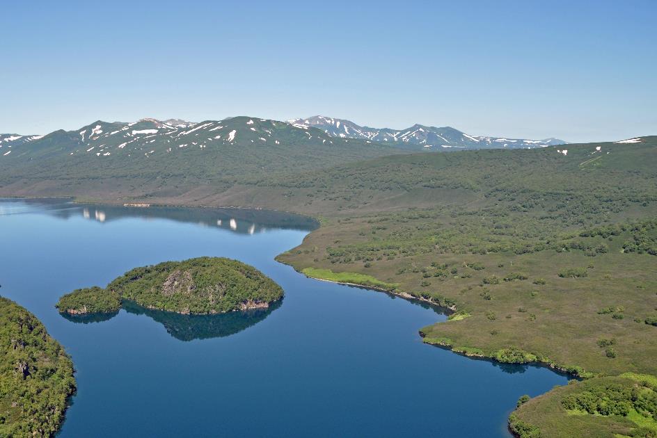
After another fifteen minutes of flying, Kurile Lake comes into view. Our destination for today is located on the southern shore of that lake. As we fly over the middle of the lake, we pass a tiny rocky island occupied by a colony of chattering Kamchatka gulls.
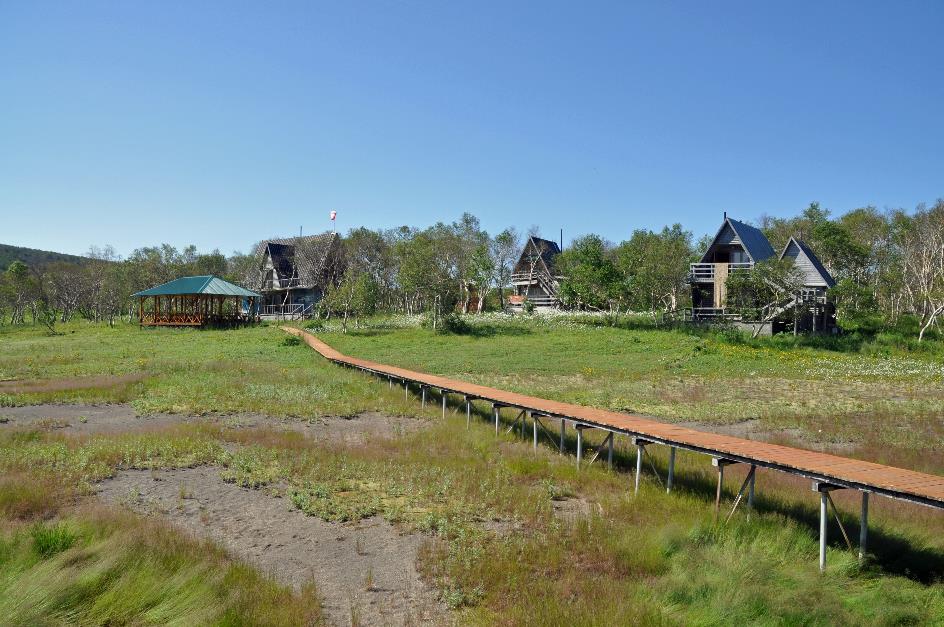
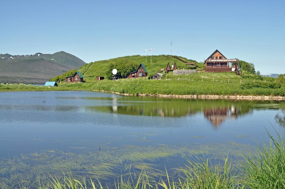
In the distance, Grassy Point Lodge appears, our base for the next three nights
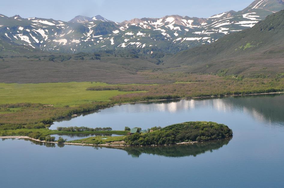
Grassy Point Lodge
In the distance, Grassy Point Lodge emerges, our home for the next three nights. The previous group, a Korean party, is already on the balcony, ready to depart, eagerly awaiting our arrival. At exactly 1 p.m., the pilot lands his MI‑8. The unloading process goes smoothly – the pilot opens the rear hatch, both tail halves separate, and some of our luggage tumbles onto the grass. Welcome to the South Kamchatka Nature Park.
Grassy Point Lodge
Jaak Palmans
© 2024 | Version 2024-02-18 15:00
Continue reading in (2/5)