Carved out by a giant
New Zealand | Anno 2019
Friday, March 22 | Queenstown – Te Anau
Friday, March 22 | Queenstown – Te Anau
Like pearls on a string, the national parks on the West Coast of the South Island are strung together. At 12,607 km², Fiordland in the far southwest is the largest of them all.
Fiordland is by far New Zealand’s least accessible national park
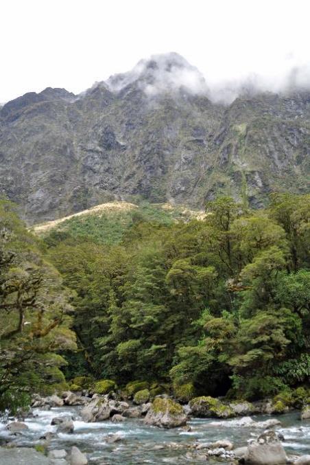
Since the glaciers retreated after the last Ice Age, it has become clear what they have caused here. The west coast is dotted with fjords carved into the rocks by the glaciers – reminiscent of Norway. Hence the name of the park. Although the early fur traders had never heard of a fjord. They preferred to call these wide, deep bays sounds – Milford Sound, Doubtful Sound, Dusky Sound.
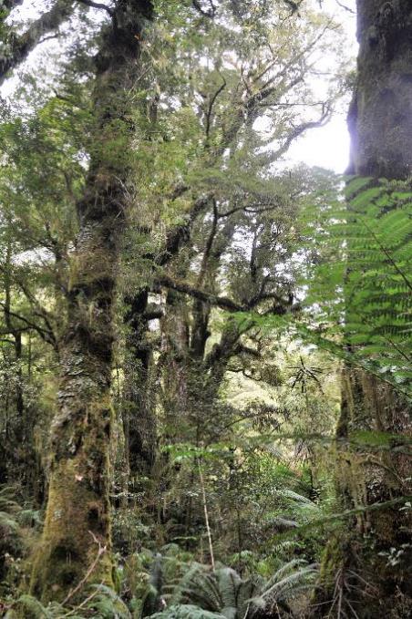
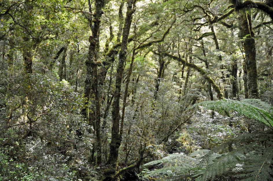
With its steep mountain ranges, deep fjords, wild rivers, and dense vegetation, Fiordland is by far the least accessible area in New Zealand. This has its advantages because the nature is largely untouched. No lumberjack has ever thought to lay down podocarps or southern beech trees. Many native animals feel safe, including the takahē, rediscovered in 1948. They are safe from humans, but unfortunately not from invasive species. Red deer thrive here but damage the vegetation, putting the regeneration of some plants at risk. This is a source of sorrow for native species, including the kea, a rare mountain parrot. And by now, we know what possums can do.
Penetrating deep into this pristine area is not an option for tourists, nor is it desirable. However, sniffing around the edge of this enormous park to appreciate its beauty is quite feasible. In short, Fiordland is a paradise for nature lovers. And for sandflies.
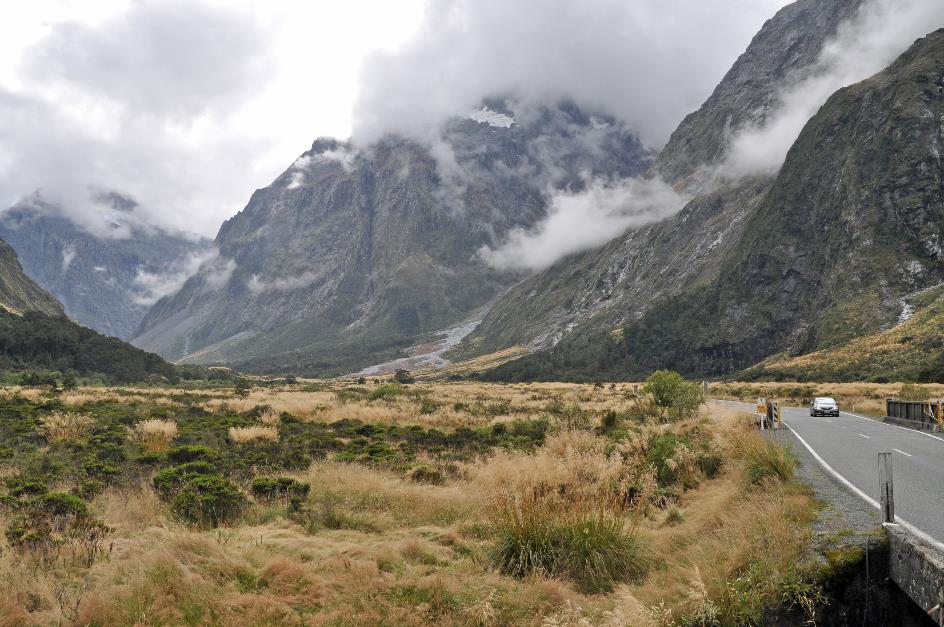
Milford Sound, one of the fourteen major fjords that Fiordland is endowed with, is our main destination today. With over four hundred kilometres ahead, there's work to be done. We leisurely let the fascinating landscape unfold before us.
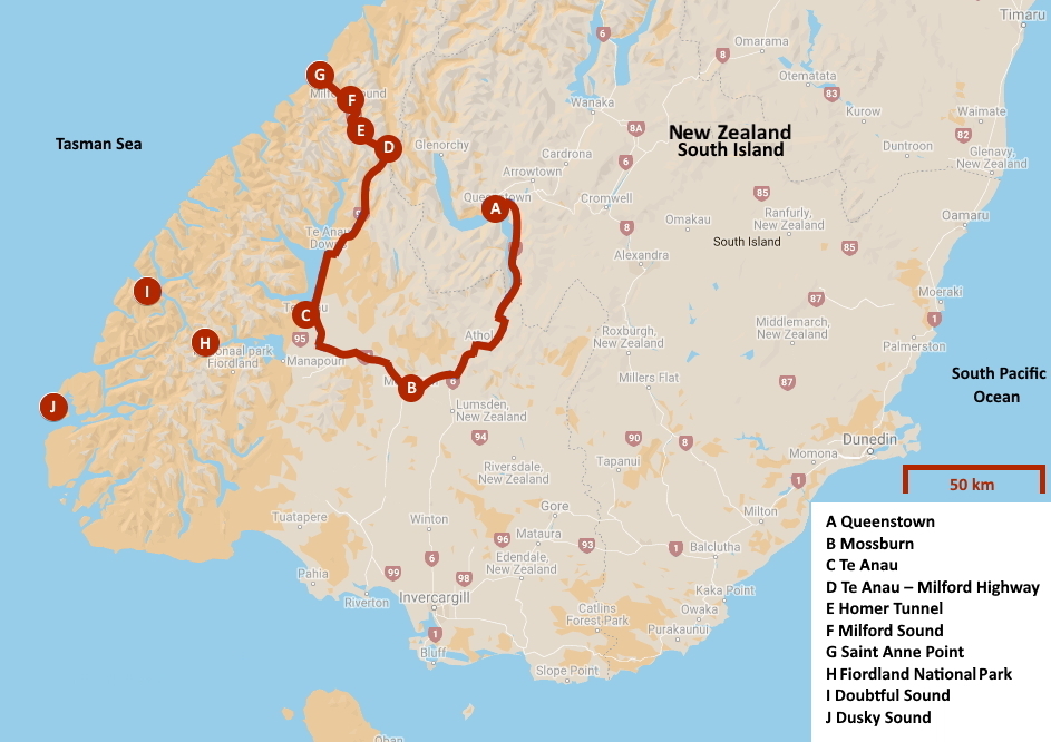
We start the journey south on the familiar SH6. Initially, it's nothing more than a winding coastal road clinging nervously to the steep slopes of The Remarkables. Until Lake Wakatipu, around Kingston, gives way to vast meadows. Whole herds of sheep graze on the green grass.
When it comes to precipitation, Fiordland is a record holder – up to eight thousand millimetres per year
Clouds continue to dominate the landscape, slightly too many to be reassuring. Because when it comes to rainfall, Fiordland holds the record. Some places receive up to eight thousand millimetres per year. But for now it remains bone dry.
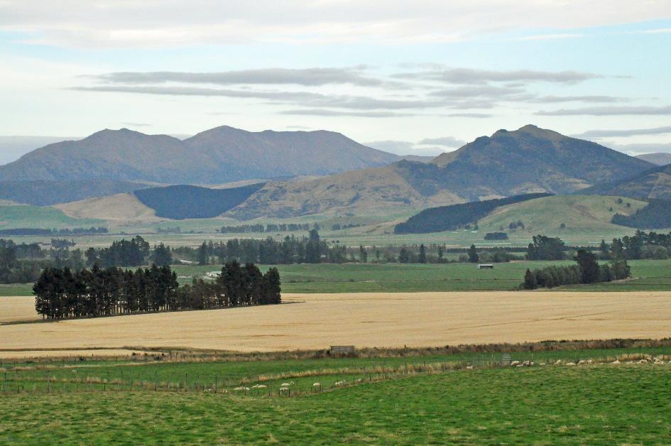
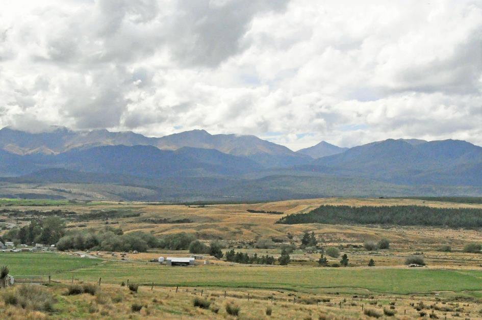
The gateway to Fiordland is what the four hundred residents of Mossburn call their tiny spot on the map. A bit premature, as we are still surrounded by an extensive plain. For the national park, it's more than fifty kilometres to the west. Nevertheless, it cannot be denied that almost everyone who visits Fiordland passes through Mossburn. And they capitalize on that.
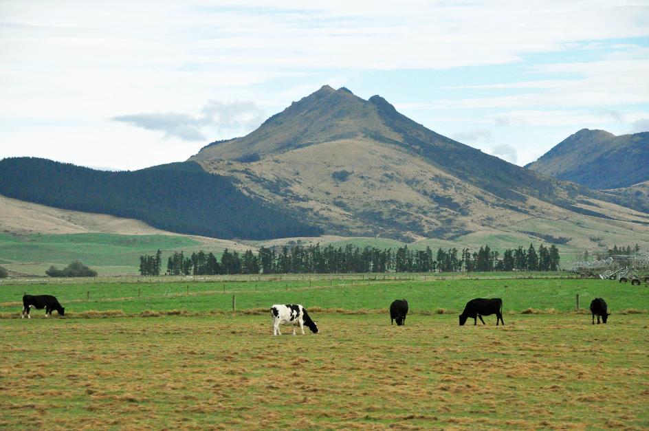
But Mossburn still has an ace up its sleeve. The statue of a robust stag in concrete reminds us of that. Mossburn has declared itself the Deer Capital of New Zealand. More precisely, the Venison Capital of New Zealand. Because, of course, it's all about the production of deer meat.
When the Scots introduced red deer here in 1871, it was a form of entertainment for them. The irony is that today, you can find purebred Scottish red deer nowhere else but here.
Hunting red deer is long prohibited, but breeding and consuming them are allowed. In the 1970s, commercial herds of hundreds of animals started appearing here. Live animals were captured in the wild – helicopters were even used – and then used for breeding.
Nowhere else but here will you find purebred Scottish red deer.
With a livestock of almost a million, it has become a significant industry. Not just for meat consumption, though. Because immature antlers, appearing adorned with a layer of velvet, are highly sought after in China, particularly for medicinal preparations.
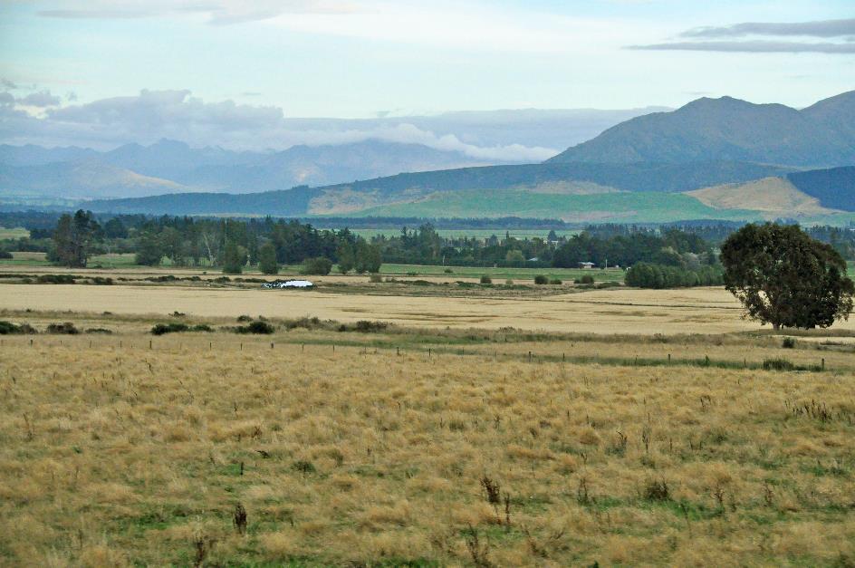
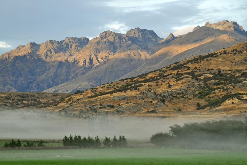
Red tussock replaces the green grass more and more
Occasionally, the sun breaks through the clouds. We continue northwest through the broad valley of the Oreti. Gradually, the landscape becomes more rugged. Red tussock replaces the green grass more and more.
It's quarter past ten when we reach Te Anau, a village of 1,600 residents on the shore of the lake with the same name. They call themselves the gateway to Fiordland here – where have we heard that before? But a glance into the diligent Visitor Centre reveals that they are indeed actively living up to that status.
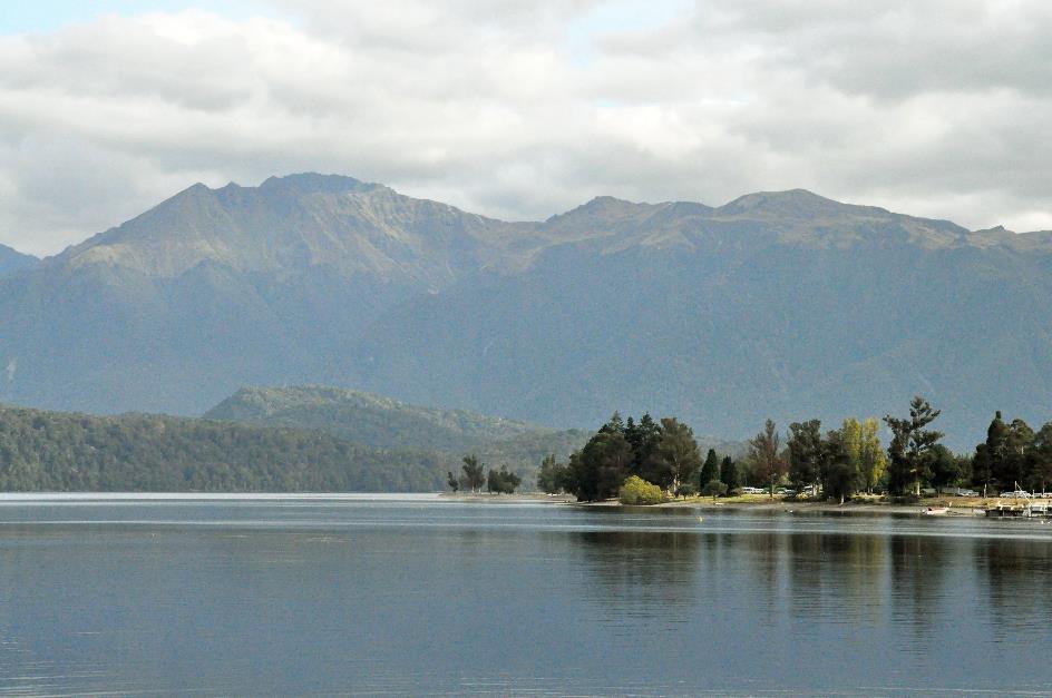
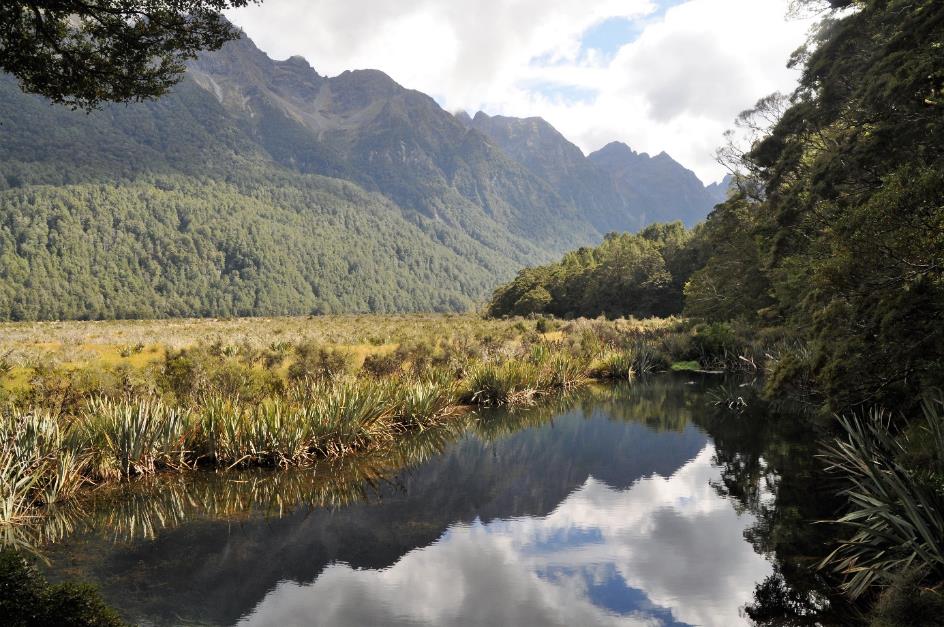
Lake Te Anau
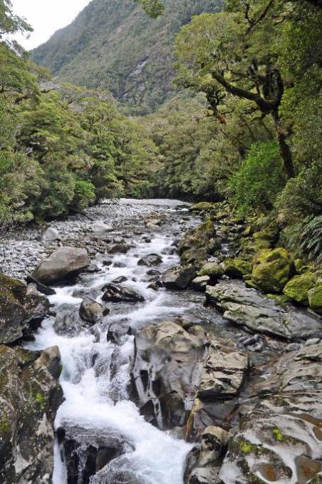
Thus, we learn that in Fiordland, you can find the oldest rocks in New Zealand, some dating back to 350 million years. Granite, gneiss, gabbro, and diorite are typical examples. They slowly crystallized from magma, making them extremely hard. Fortunately, this hardness contributes to the spectacular landscape of glacier valleys and fjords, as erosion has little impact on them.
However, the Māori offer a different explanation. According to them, the giant Tute Raki-whanoa was at work here. With his adze, he carved out these fjords like channels in the landscape. He started all the way in the south and improved as he progressed northward. The most northern fjord, Milford Sound, was his greatest achievement.
Even more everyday phenomena receive the attention they deserve here. Sandflies, for example. You can encounter them anywhere in New Zealand, but Fiordland stands out in terms of their numbers. Like mosquitoes, only the females target us because they need proteins and other nutrients from our blood to produce eggs. One bite is enough to produce 100 eggs, resulting in approximately 50 new bloodthirsty critters that can attack us.
One bite is enough to produce 100 eggs, resulting in approximately 50 new bloodthirsty critters that can attack us
Similar to mosquitoes, sandflies don't sting but bite, as they lack a stinger. Using their mouthparts, they create a small wound and then slurp up the blood that flows out. However, these sandflies are not amateurs. To prevent our blood from clotting immediately, they inject anticoagulants beforehand. As if that's not enough, they stimulate our histamine production. Our blood vessels then widen a bit, and voila, the blood flows even more smoothly. All of this naturally irritates our skin tissue. A red spot, slight swelling, and a good dose of itching are the consequences. Time to quickly find our DEET repellent.
Lake Te Anau
We leisurely stroll along a pebble beach by the glacier lake. Te Anau, with its 344 km², is the largest lake on the South Island. It is also one of the deepest. Even though this beach is situated 210 meters above sea level, the lake reaches over 200 meters below sea level at its deepest point.
The deep side valleys that have formed are the only inland fjords that New Zealand possesses
However, it's not the depth that makes this glacier lake remarkable. Three extensions on the west side indicate that the glacier once had side glaciers on that side. The deep side valleys that have formed are the only inland fjords that New Zealand possesses.
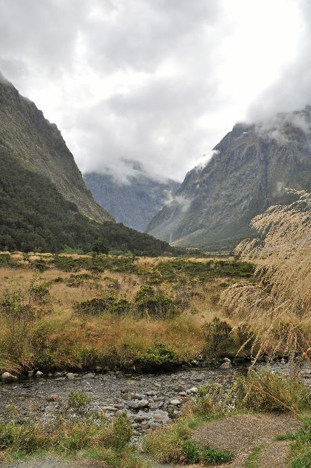
Now we have a round trip of 240 km ahead of us, heading to and from Milford Sound. A journey to the heart of Fiordland, that's how the local tourist service describes this fascinating route. Rudyard Kipling, on the other hand, referred to it as the eighth wonder of the world. There are no gas stations along the way, and restaurants are scarce. So, it's an early lunch for us at eleven.
We drive north through gently rolling hills. Generally, SH94 follows the coastline. White arrows on the road remind us frequently that driving on the left is the norm here, as this is a predominantly tourist route. There are hardly any homes or farms in this area. Those who appear here do so solely to enjoy Fiordland.
It seems as if nature has rolled out a green carpet for us right through the mountains
It's overcast but sunny. Remote patches of wild nature alternate with hilly grasslands where only sheep seem to find their satisfaction.
It doesn't take long before a change occurs. Gradually, the landscape becomes more rugged. Dense forests encroach on both sides of the road. Te Anau Downs briefly offers a last glimpse of civilization. Then, the wilderness beckons.
The lake is now behind us. Gradually, the impressive Eglinton glacier valley emerges on the horizon. It seems as if nature has rolled out a green carpet for us right through the mountains. The SH94 climbs gently for thirty kilometres, almost in straight strips, gradually ascending over the flat valley floor. The braiding river with its constantly changing pattern of water channels accompanies us as an inseparable companion.
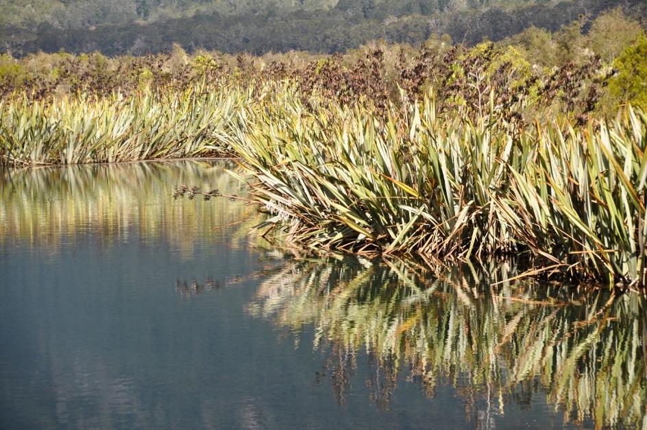
Mirror Lakes
But she is capricious, this Eglinton. In the past, she has been known to shift her course when a deluge swept through the valley. The Mirror Lakes bear witness to this. These horseshoe-shaped lakes were left orphaned in a meander when the river chose a broad channel on the opposite side of the valley.
When there are no more mice available, the rats and the stoats turn their hungry gaze to the native species
This spot compels us to make a photo stop. A short walk through a southern beech forest brings us to the water's edge. Here too, rats, stoats, and possums continue to take their toll on the native wildlife. What's more, every three to five years, during the so-called mast years, this situation escalates. Southern beech trees then produce an exceptionally large number of seeds, attracting mice in abundance. Rats and stoats, in turn, do not miss this opportunity – they fancy a mouse. When there are no more mice available, they turn their hungry gaze to the native species. Birds, in particular, unwillingly become their victims.
Mirror Lakes
On a sunny, windless day like today, the Mirror Lakes do exactly what is expected of them – perfectly reflect the Earl Mountains on their smooth water surface. However charming, they can't truly captivate us, these ponds with their densely vegetated shores full of flax. Our minds are still captivated by the majestic backdrop of Lake Matheson. A bit blasé, indeed.
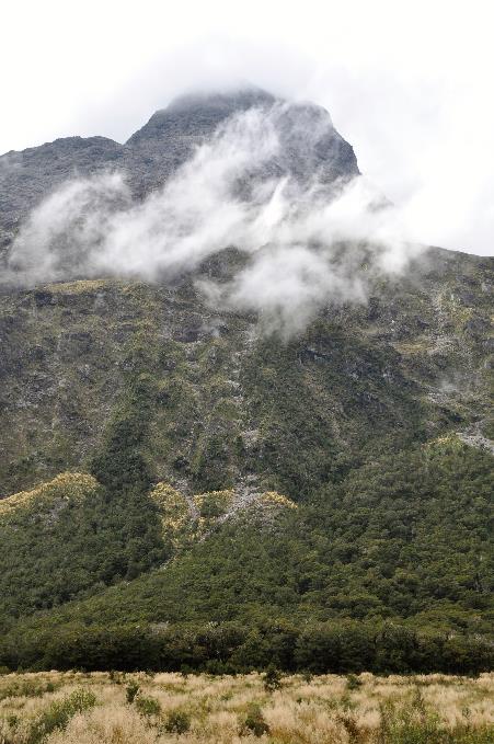
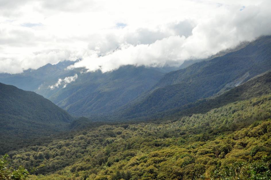
Climbing higher into the mountains through endless forests, we once again cross the 45th parallel, but there's no fuss made about it here. Nature has plenty to offer. A few lakes come into view – Lake Gunn, Lake Fergus. They supply water to the Eglinton.
Approaching The Divide, the watershed between the Pacific Ocean and the Tasman Sea, we reach the lowest pass in the Southern Alps at 531 meters.
Trekkers recognize this place as the starting point of the famous Routeburn Track – or the endpoint, depending on how you walk. Like the Tongariro Crossing on the North Island, this is one of New Zealand's iconic long-distance hikes. Normally taking two to three days to complete the 32 km trail, unless you participate in the Routeburn Classic, an annual event for seasoned mountain runners. In 2017, a record time of 2 hours, 37 minutes, and 51 seconds was clocked.
Shortly after, we gaze down upon a valley filled with green treetops, as if surveying a forest of giant broccoli
Hollyford Valley
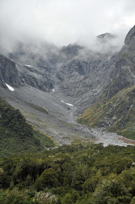
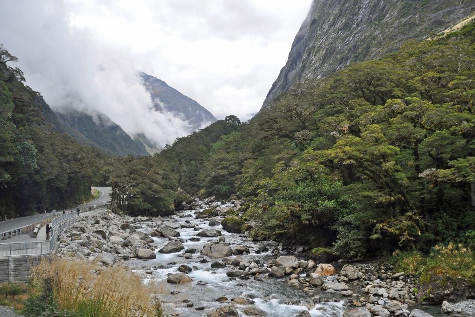
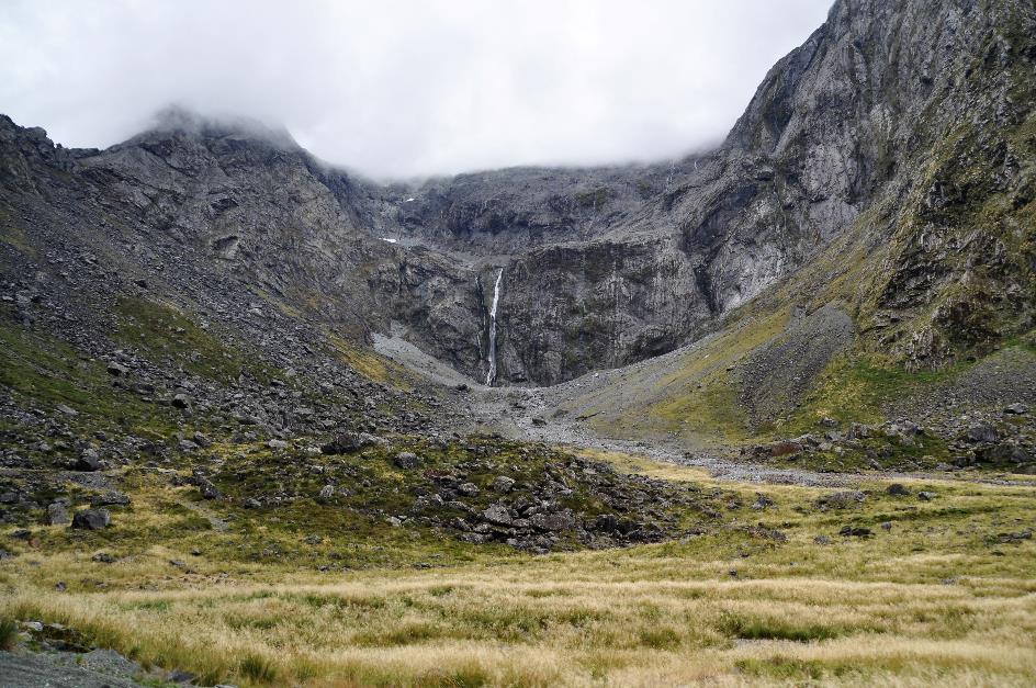
Promptly, we embark on the steep descent to the Hollyford River. Shortly after, we look down upon a valley filled with green treetops, as if surveying a forest of giant broccoli. Puddles on the road suggest it may have rained recently. Upstream, we now travel alongside the Hollyford River. The clear river water cascades over rocks, creating white foam. Almost vertically, the mountain walls rise on either side above our heads. In the narrow canyon, there's sometimes barely enough space for a road along the river.
Hollyford River |
|
Hollyford River near Monkey Creek |
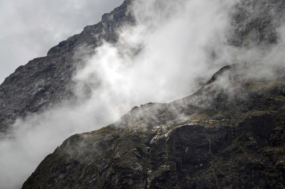
High above our heads, clouds cling to the rock face. It seems almost certain that rain will fall from them shortly. The fact that it has been dry for so long is highly exceptional. Rain is the norm here. On average, more than 8,000 mm of water falls from the sky annually – ten times the amount in Belgium.
Constructing this road was therefore an immense feat. It took place in the 1930s when the government had no difficulty attracting workers to these perilous areas. These workers were usually victims of the Great Depression.
Hollyford River near Marian Corner
The working conditions must have been surreal. Rain was a daily occurrence, and floods and avalanches were constant threats. Construction efforts were repeatedly destroyed. It's not surprising that there were fatal casualties, but what is surprising is that there were only three throughout that time.
The road didn't open until 1952. Only during the summer, as it remained closed in winter. It wasn't until the late 1970s, after much insistence from the tourism industry, that the government was convinced to keep the road open in winter as well.
If the avalanche risk is too high, the road is closed at Marian Corner
Avalanche danger still exists today. Since a fatal accident in 1983, it has been strictly monitored. If the avalanche risk is too high, the road is closed at Marian Corner. Even at low risk, the advice is not to stop for over twenty kilometres for safety reasons, no matter how beautiful the surroundings. A stationary vehicle is, of course, an easier target for avalanches.
Monkey Creek
In Monkey Creek, on the other hand, it is allowed to make a stop. The valley is wider there, and there is even a small parking lot. We soak up the alpine atmosphere amidst the barren mountain peaks with their white veils of clouds.
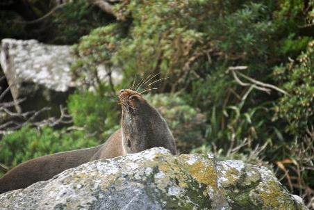
In theory, you can encounter keas here, but today they are not around. It's a pity because these endemic birds are the only alpine parrots in the world. They are known for their curiosity as well as their extraordinary intelligence. They don't shy away from solving logical puzzles, as experiments have shown.
For a long time, they were the subject of intense controversy. It was believed that they attacked sheep, especially at night. With their sharp claws and beaks, it was thought they would bore through the wool and feast on the layer of fat on the poor sheep's back. Until 1970, there was even a bounty on killing a kea. But nowadays, they are protected, even if they mess around with rubber seals on cars or run off with the contents of your backpack.
With their sharp claws and beaks, it was thought the keas would bore through the wool and feast on the layer of fat on the poor sheep's back
The clock is ticking towards 13:32, the exact moment one week ago when the terrible terrorist attack occurred in Christchurch. Out of respect, everyone in New Zealand observes two minutes of silence. So do we, in our bus. Our thoughts go to the 50 victims and the 49 wounded. Also, to the victims of the terrorist attacks in Brussels in 2016. Because the irony of fate is that today marks exactly three years since bombs exploded at Zaventem airport and Maalbeek metro station.
The workers lived in tents in an area where there was no direct sunlight for six months a year
|
|
|
When William Homer reached the mountain pass in 1889, later named Homer Saddle, he immediately proposed the idea of digging a tunnel straight through the mountain. He believed it would significantly shorten the distance to Milford Sound. He was right, but it would still take almost half a century before any action was taken on that idea.
Initially, in 1935, five men armed with shovels, pickaxes, and wheelbarrows tackled the granite. They lived in tents in an area where there was no direct sunlight for six months a year. They constantly dealt with a flood of meltwater in the tunnel. Eventually, the water pumps had to remove forty thousand litres of water per hour.
Nevertheless, they succeeded in reaching the other side in 1940. Then, the Second World War threw a wrench into the works. As if that wasn't enough, a heavy avalanche destroyed the eastern portal of the tunnel in 1945. In 1953, the tunnel finally opened.
During winter and spring, the risk of avalanches is too great for cars waiting inside
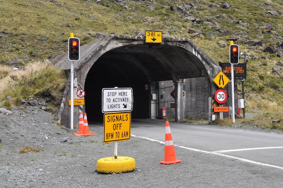
Homer Tunnel – Eastern entrance
Just 4 minutes and 34 seconds of patience, signals the digital board at the eastern portal. During the busy summer season, the Homer Tunnel operates as a one-way road. While small cars can pass each other in the narrow tunnel, campervans or buses certainly cannot. However, during winter and spring, the traffic lights are switched off. The avalanche danger is then too great for waiting cars.
Soon after, we enter the claustrophobic tunnel. It surprisingly descends steeply. Over a distance of 1,270 meters, we will descend from 945 meters to 820 meters – a gradient of about 10 %. Lighting is barely present, with a light fixture hanging about every forty meters or so. Only in the glow of the bus's headlights does the rough, unfinished granite become visible.
Three minutes later, we emerge on the west side. Hairpin bends quickly take us downhill. Scattered in the landscape, we notice many conspicuous boulders covered with brown-red green algae – the trentepohlia we encountered on the moraine of the Franz Josef Glacier.
Clouds grip the mountaintops here as well, but it remains dry. Occasionally, the sun pierces through the clouds. Nothing but good news, especially considering that on this side of the mountain range, only 6,400 mm of rain falls per year – only eight times more than in Belgium.
The Chasm – Cleddau River |
|
|
It's not the waterfall, but the enchanting forest that makes The Chasm worthwhile
The Chasm
Soon, the Cleddau joins us. The fast-flowing river will accompany us down to Milford Sound. At The Chasm, it forcefully squeezes through some rock crevices with a lot of noise.
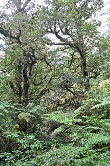
However, it's not the waterfall that makes the obligatory photo stop at The Chasm worthwhile. It's the enchanting forest, that fairy-tale world of gnarled tree trunks, towering ferns, mosses, epiphytes in all shapes and colours, and beard mosses hanging like mysterious curtains from the branches.
The Chasm |
|
|
What's rustling in the undergrowth? It's not a hobbit, it's not an elf, it's not an orc, it's a... Chinese tourist. His hand just barely peeks above the foliage, and with some effort, we manage to pull him out. Apparently, in his quest for the perfect photo, he took one step too many backward. Fortunately, there were bushes to break his fall; otherwise, he would have tumbled into the Cleddau ten meters below, probably more dead than alive. Bewildered, he mutters a thank you, dusts off his clothes, and makes a hasty exit.
Satisfied, we continue our journey – satisfied because abundant rains create such a formidable nature here, satisfied because those same rains happen to be absent today, allowing us to fully enjoy this nature.
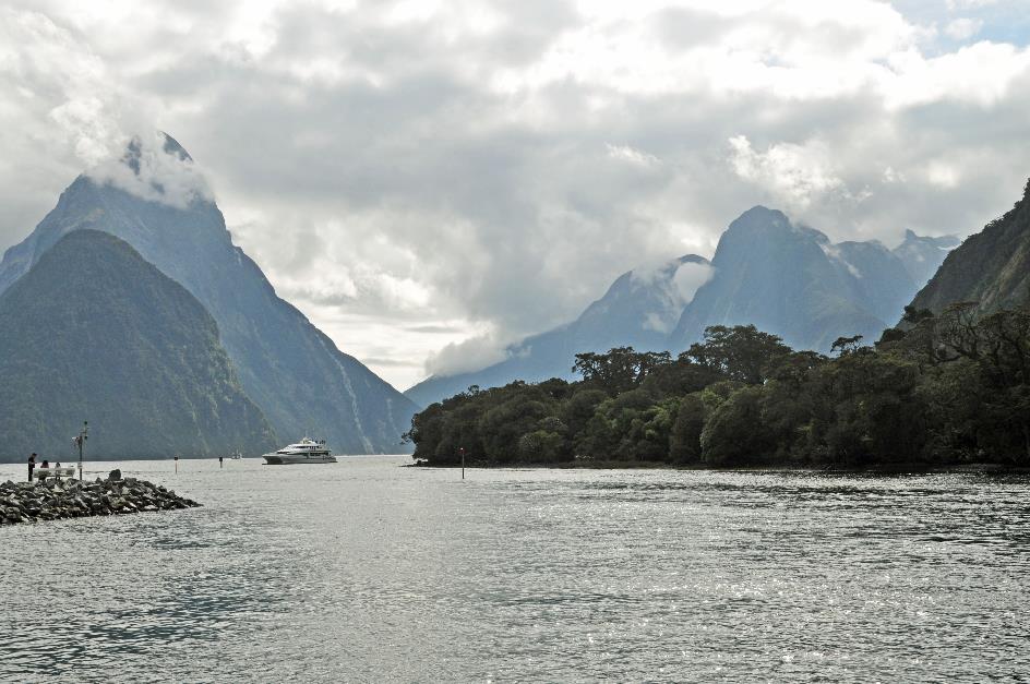
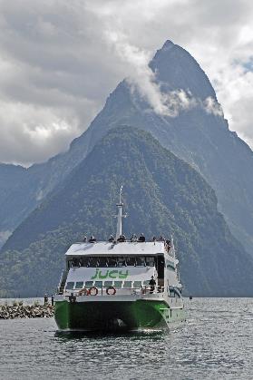
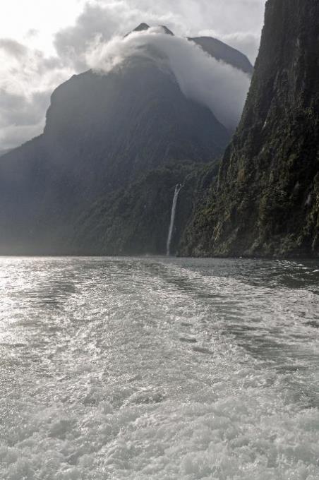
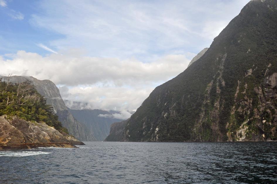
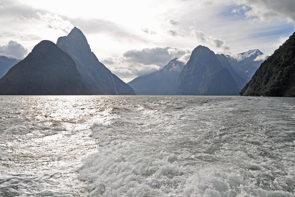
Milford Sound, Mitre Peak (on the left)
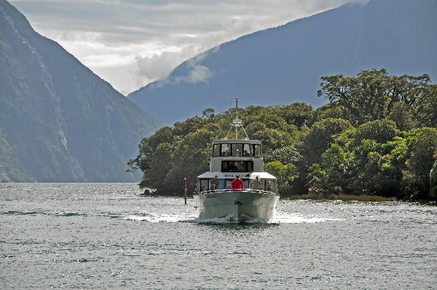
It's quite sunny as we make our appearance on the pier in Milford Sound. Small cruise ships come and go. The boat trip through the 15 km deep fjord is, without a doubt, one of the most popular trips in New Zealand.
Every year, nearly a million tourists make the long journey to this remote fjord. Apparently, not everyone is thrilled about it. In February 2004, intentionally thirteen thousand litres of diesel were discharged into the water. Unknown individuals connected a high-pressure hose to the fuel tank of one of the cruise boats, causing the dirty substance to be forced out. Probably an act of ecoterrorism, according to the police. Without much damage, though, as the sludge was cleaned up fairly quickly.
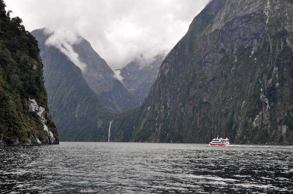
Just after three, we board the Mitre Peak. It's a small but very manoeuvrable boat. Captain Kaho welcomes us. His assistant Aaron turns out to have been to Belgium twelve years ago. Ostend, Bruges, Ghent, Brussels, Namur – those are some names he remembers. What impressed him most was the ancient urban architecture and the beautiful canals of Bruges. But he struggled a bit with the vast choice of beers.
The boat trip through Milford Sound is, without a doubt, one of the most popular trips in New Zealand
Mitre Peak |
|
|
What makes Milford Sound unique is the remarkable layering of the water. Prolonged rains constantly wash tannin-rich water from the forests into the fjord. This rainwater mixes very slowly with the denser seawater, creating a dark upper layer, up to six meters thick, that allows little light to pass through.
This combination of cold water and darkness attracts deep-sea creatures. Species that normally inhabit several hundred meters below the surface can be found here at depths of just a few dozen meters. The Kiwis have even built a special underwater aquarium for encountering these creatures.
So much for the theory. However, it has not rained in the past ten days. There is no longer a dark layer of rainwater; as it has almost completely dissolved. Hopefully, this will help us observe the dolphins better later on.
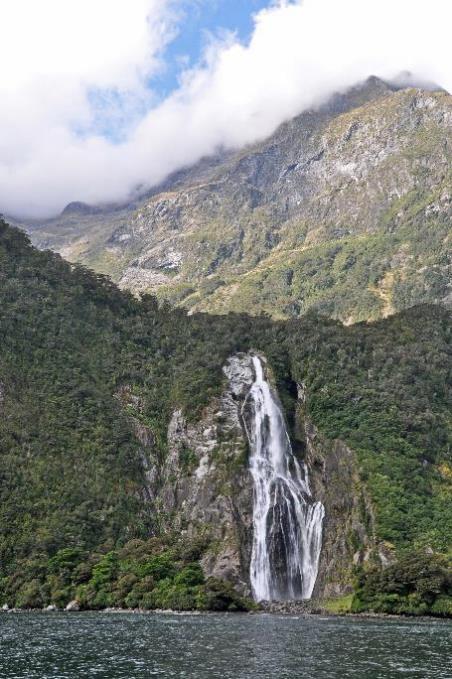
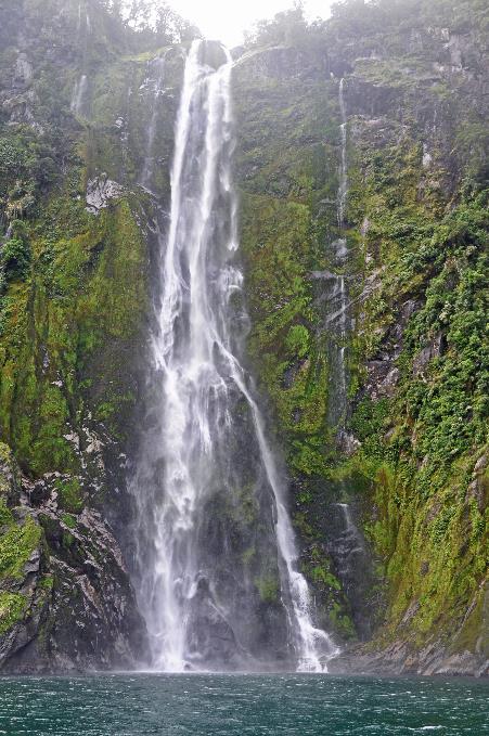
Soon, the Bowen Falls come into view. Over a height of 162 meters, the water plunges from a hanging valley into the fjord. Aaron doesn't miss the chance to emphasize that it is more than three times higher than Niagara Falls. The crystal-clear river provides the local community with drinking water and, through a tiny hydroelectric power station, electricity.
It was here, in the 1970s, that a tiny population of kākāpōs was discovered
Bowen Falls |
|
Sinbad Gully |
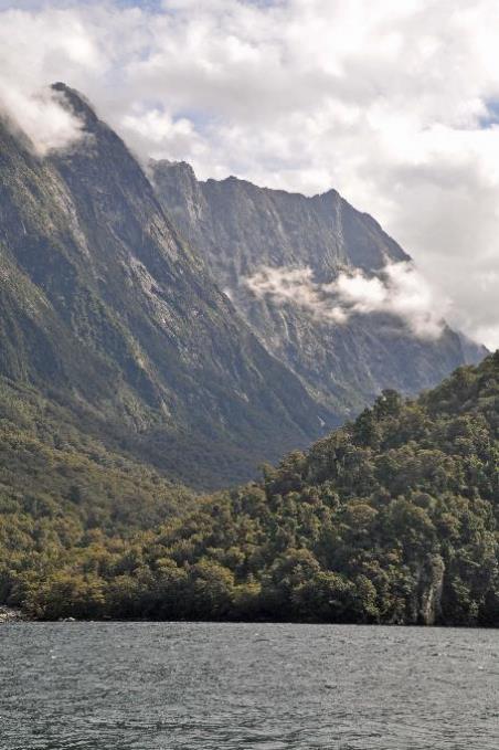
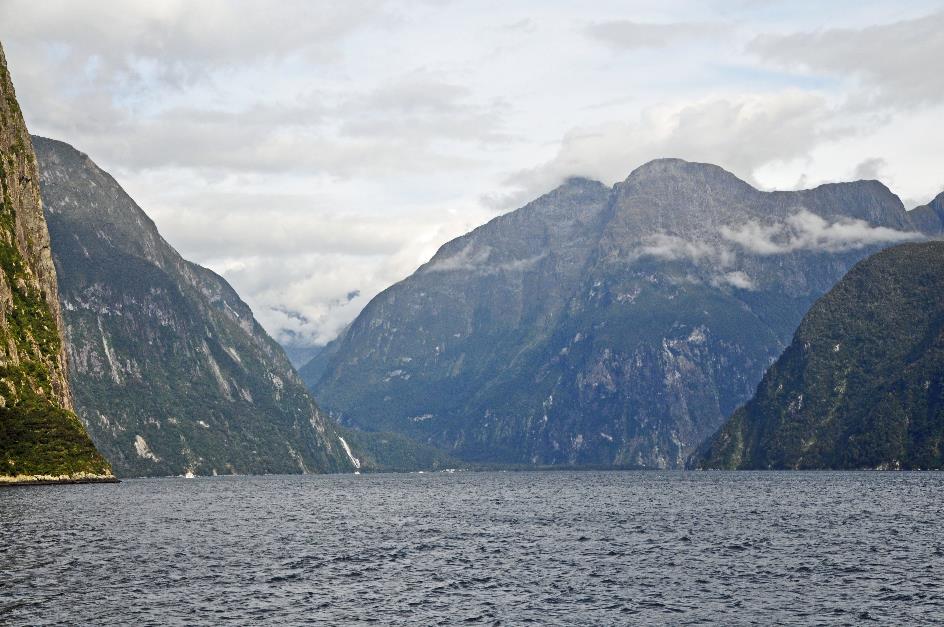
Another hanging valley is Sinbad Gully, on the other side of the fjord. The steep slopes rise from twelve to fifteen hundred meters above the valley floor. Like a gigantic horseshoe, they embrace the gorge. Dense rainforest covers most of the terrain, with only the almost vertical rock walls remaining bare.
In the 1970s, a tiny population of kākāpōs was discovered there, according to Kaho. Unfortunately, they were all males. It's a cruel game that evolution has played with this endemic ground-dwelling parrot. Among all parrots, it is the heaviest and the only one that cannot fly. That's what happens when you live on an island with plenty of food and few predators – you become fatter and fatter, gradually losing the ability to fly. But it makes you vulnerable when suddenly predators appear.
If a kākāpō feels threatened, it stands still and relies on its camouflage colours. This strategy is very effective against native birds that hunt by sight. However, it is useless against exotic mammals that hunt by smell.
Kākāpōs don't have stable relationships like other parrots. Once the female is fertilized, the male doesn't care about the offspring. The female is left alone. Foraging takes a long time, and during all that time, her eggs or chicks are unprotected. Moreover, it takes a long time for those chicks to grow large enough to leave the nest. Obviously, the nest doesn't get cleaner during this period. It's easy for a mammal to find it by smell.
In short, the kākāpō was nearly extinct. Fortunately, there was still a population of about two hundred individuals – both males and females – on Stewart Island, although this group was also threatened.
But the Kiwis went all out to save the species. They brought the kākāpōs together on three small islands and started monitoring them intensively. This includes protecting nests against rats, providing additional food to adult animals, individually feeding weak chicks, strengthening the gene pool through targeted mating, and applying artificial insemination. In June 2017, the number of kākāpōs was precisely 154. Each of them has a name and wears a transmitter.
The flora here is exceptional too, says Kaho. More than seven hundred different plant species have been counted in and around Milford Sound. Many of these plants cannot be found anywhere else in the world.
Mitre Peak dominates the scene on the left. Its peak does indeed resemble a bishop's mitre, hence its name. With a height of 1,683 meters, it belongs to the big players here. At first glance, it may not seem particularly high, but we must not forget that these mountains stand right by the sea.
If you were to drain the fjord, you would be looking at a mountain of more than 2,100 meters
Milford Sound, Mount Kimberley ‘The Lion’ (on the right)
Moreover, Milford Sound is approximately 450 meters deep here. If you were to drain the fjord, you would be looking at a mountain of more than 2,100 meters. That makes it one of the highest mountains in the world rising straight from the ocean floor, according to Kaho. With such a bold claim, they would have a good laugh in Hawaii if they heard it. After all, if you include the height below the water for Mauna Kea, you're looking at a mountain of 10,230 meters – five times that of Mitre Peak.
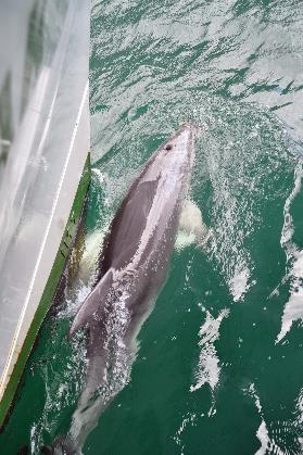
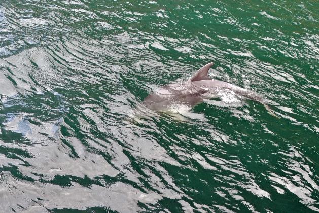
Suddenly, some bottlenose dolphins come to steal the show. Cheerfully, they surf along with the boat's wake. Playfully, three of them frolic around the bow, sometimes showing their white bellies as they swim upside down. But there are many more dolphins around the boat. Aaron estimates that he has spotted about a dozen dorsal fins.
Bottlenose dolphins are born underwater, which is quite challenging for a mammal
Bottlenose dolphin |
|
|
Among all dolphins, bottlenose dolphins are by far the most widespread and familiar species worldwide. You can find them in all seas globally, except in the Arctic and Antarctic waters because it's a bit too cold for them there. They can grow to be two to four meters long, with an average weight of 250 kg. Fish is the main item in their diet, consuming 8 to 15 kg per day. They also enjoy shrimp, as well as soft-bodied animals like cephalopods and cuttlefish. However, they are selective eaters, as they only swallow the soft parts. This is due to the fact that they belong to the toothed whale family and have teeth. Baleen whales, on the other hand, filter their food from the water and must swallow it whole.
Bottlenose dolphins are born underwater, which is quite challenging for a mammal. To avoid the risk of drowning shortly before birth, dolphin calves are born tail first. Furthermore, breathing is a conscious process for dolphins. Every time a bottlenose dolphin rises to the water surface to breathe, it is a deliberate decision, unlike humans who breathe automatically without thinking.
Evolution has found a brilliant solution for this
Sleeping therefore poses a problem for dolphins. On the one hand, the dolphin brain needs sleep, and on the other hand, it must remain active to ensure regular breathing. Evolution has found a brilliant solution for this. Dolphins, like whales, sleep with one hemisphere of their brain at a time. This way, one hemisphere can rest while the other stays conscious, regulating breathing.
Speaking of intelligence, bottlenose dolphins are known for their high intelligence. For example, they use sponges to protect their sensitive noses when foraging for food on the seabed. They are considered one of the most intelligent species, with only the Amazon river dolphin being thought to be smarter. And most people.
Milford Sound – Coppers Point
Even in terms of social behaviour, dolphins stand out. They often work as an efficient team to encircle a school of fish. Even altruism is not foreign to them. This was demonstrated in a spectacular way in October 2004. Four swimmers were threatened by a large great white shark off the coast of Ocean Bay near Whangarei. For forty minutes, seven bottlenose dolphins formed a protective circle around them. After which, the shark reportedly withdrew without any harm, if we are to believe The New Zealand Herald.
On the opposite side of the fjord, Kaho points to Mount Kimberley. However, it no longer bears that name. Nowadays, it goes by the name The Lion because its shape is supposed to strongly resemble a reclining lion.
Even altruism is not foreign to dolphins
At Copper Point, where the fjord is at its narrowest, it is still 500 to 600 meters wide. The waterfalls here come in various forms – the water of Fairy Falls cascades straight down like in a tight tube, while at Bridal Veil Falls, it fans out like a wide veil.
Then the fjord makes a right angle, heading directly north. The mountains become less steep. On the right, the rocks of Dale Point protrude into the sea like a sharp point. They mark the end of the fjord and the beginning of the Tasman Sea. The water here is not deeper than thirty to seventy meters because as usual there is an underwater ridge at the beginning of the fjord.
Milford Sound from the sea
Gradually, the walls of the fjord now widen, as if forming a funnel to guide the right path to the fjord from the sea. A lighthouse has been erected on Saint Anne Point to recognize this spot easily. Its beam of light can be seen fourteen kilometres deep into the sea. On the left, the pebble beach of Anita Bay stretches out, where Māori used to search for pounamu, the green stone.
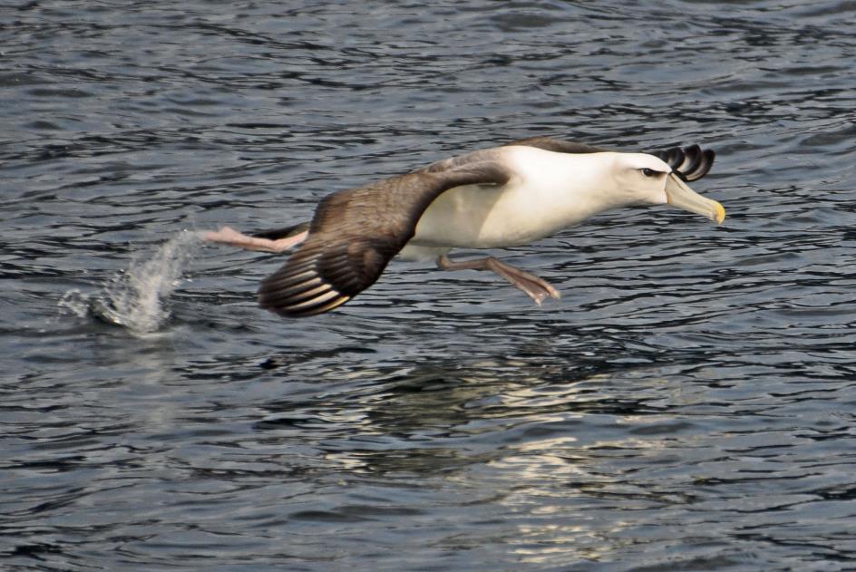
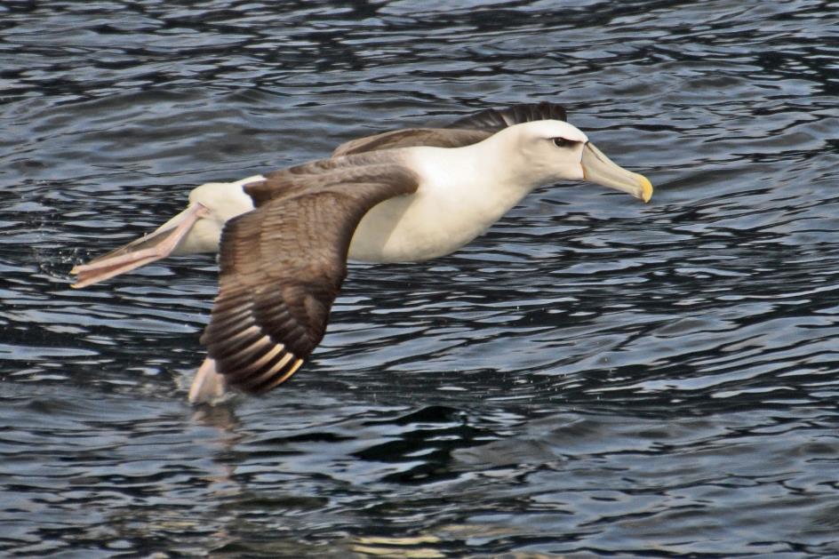
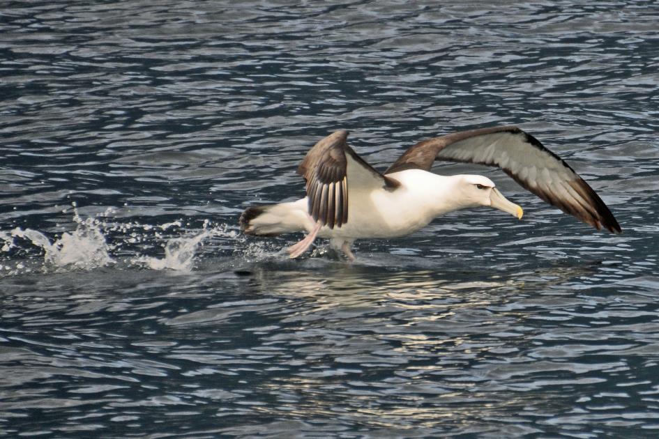
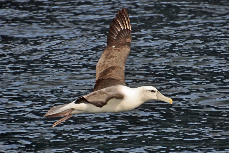
For the white-capped albatross as well, the main islands are too unsafe due to the numerous predators
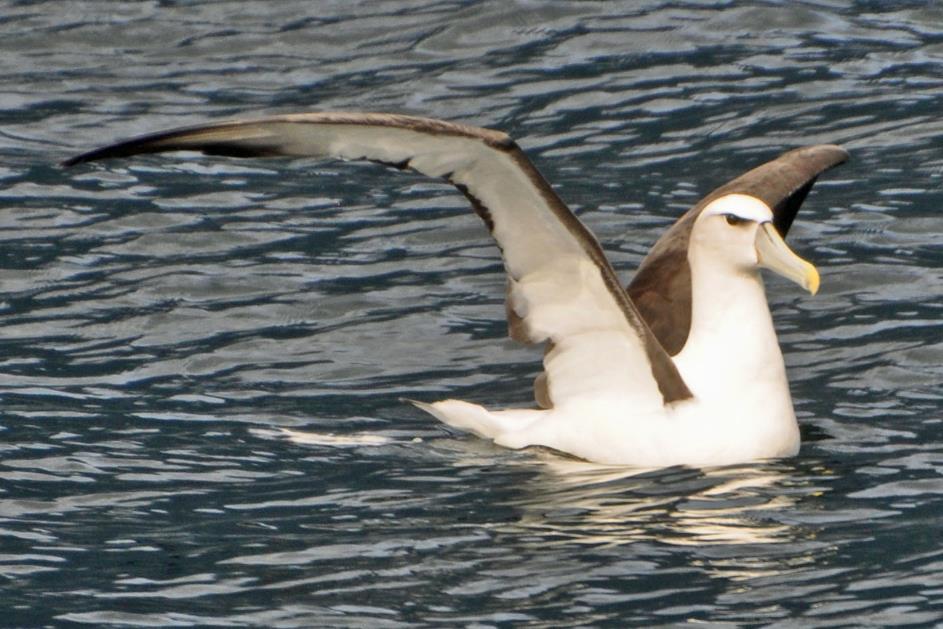
White-capped albatross
Lonely on the water, a large bird moves steadily with the waves. It's a white-capped albatross, Aaron explains. The first Dutch sailors thought its plumage resembled a seagull, hence its English name mollymawk, derived from the old Dutch mallemok, meaning crazy seagull.
Most likely, it has its nest on one of the smaller islands, avoiding the main islands due to the many predators. However, the majority of its life is spent at sea. It feeds on invertebrates from the sea and quenches its thirst with seawater. Needless to say, this leads to a considerable intake of salt. A salt gland at the base of its beak enables it to extract excess salt from its body. Tubes on either side of its beak excrete the salt without the risk of it reaching its eyes – a characteristic feature of seabirds, earning them the collective name tubenoses.
Albatrosses are exceptional flyers, adept at utilizing updrafts to cover vast distances effortlessly, often gliding without flapping their wings. They can maintain fully stretched wings for hours, thanks to a sheet of tendon acting as a shoulder-lock that locks the wings when fully extended.
However, this efficiency comes with a trade-off. Landing and taking off are quite a challenge for them. We can witness this when our friend on the water begins to feel uneasy about our presence. Taking off clearly is a clumsy affair, with wings barely generating any lift and legs dragging across the surface of the water. Weighing three to five kilograms, it is not an easy task to lift yourself out of the water.
Weighing three to five kilograms, it is not an easy task to lift yourself out of the water
|
|
|
White-capped albatross
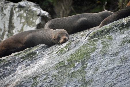
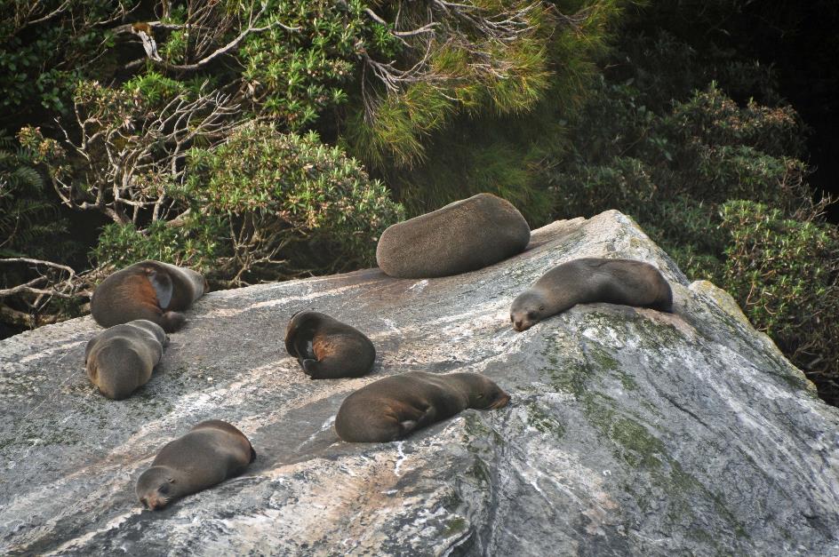
Along the northern flank of the fjord, we return inland. Opposite Copper Point is Seal Rock. About seven fur seals are lounging on a massive rock. They show no interest in us.
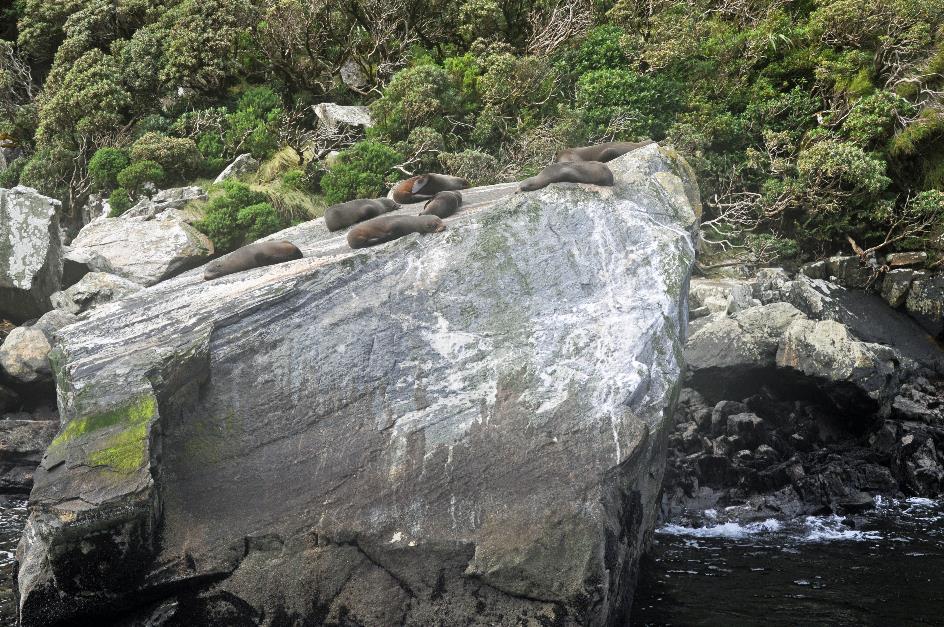
Seal Rock – Fur seals
Those are young bachelors who have been pushed out by the dominant male in the group. He doesn't want to risk them challenging his leadership or mating with his females once they are old enough. For these young fur seals, there's nothing else to do but wait their turn. They'll spend a few years strengthening themselves until they are strong enough to form their own harem.
They'll spend a few years strengthening themselves until they are strong enough to form their own harem
Seal Rock – Fur seals (m)
|
|
|
From a height of 151 m, the water of Stirling Falls tumbles down from a hanging valley. Undoubtedly, this is Captain Kaho's favourite waterfall because he can navigate his Mitre Peak right under the gushing water. There's plenty of spectacle, as those standing on the bow get a shower.
Stirling Falls |
|
Mount Kimberley ‘The Lion’, Waterfall from Harrison River |
That water is undoubtedly cold, as it originates from a real glacier. It nestles against the flank of Mount Pembroke, standing at 2,025 m, one of the highest mountains in the vicinity of the fjord. Nowadays, this modest glacier is the only one that can be observed from the fjord. Unfortunately, it's beyond our reach. Clouds obstruct the view from Harrison Cove.
Milford Sound
But that can't spoil the fun. Satisfied, we turn our backs on the West Coast and begin the long journey back to Te Anau.
Jaak Palmans
© 2024 | Version 2024-02-05 14:00
Continue reading in (9/11)
A touch of Scotland