A gift from the Māori
New Zealand | Anno 2019
Tuesday, March 12 | Rotorua – Tongariro National Park
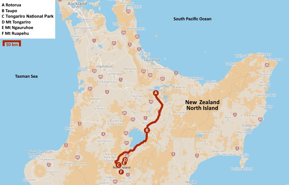
Tuesday, March 12 | Rotorua – Tongariro National Park
Generously, the morning sun casts its russet rays into the hotel room. How much sunshine will remain once we're a thousand meters high on the volcanic plateau is still uncertain. Yet, we are hopeful because in the Tongariro National Park, we have a substantial hike ahead.
Under a sunny, cloudless sky, we set off shortly after eight towards the south. Youths in school uniforms stroll along the streets, chatting. The low sun's cutting light casts misty plumes in a bright, white glow all around. A more fitting farewell scene for this fascinating city is hard to imagine.
We have almost two hundred kilometres ahead of us. Plenty of time to delve into New Zealand and its history of origin.
Discovering the mysterious southern continent was the main task given to Abel Tasman in 1642 by the Dutch East India Company
Discovering the mysterious southern continent was the main task given to Abel Tasman in 1642 by the Dutch East India Company. The Dutch were diligently seeking new markets as they couldn't establish themselves on the coasts of America and Africa. The Spaniards and the Portuguese held sway there. Therefore, their focus shifted to the Far East and the mysterious southern continent, an unknown continent believed to be located in the southern hemisphere. It was thought to be abundant in gold, silver, and spices, at least according to Marco Polo.
Abel Tasman followed a more southerly course than anyone before him. This led to the discovery of Tasmania, which he modestly named after his boss – Van Diemen's Land.
Barely a month later, he sighted a “great, lofty land” as he called it. It must have been the impressive New Zealand Alps on the South Island that he gazed upon. He himself believed it to be Staten Island. A significant blunder, as Staten Island is located on the southern tip of South America, on the completely opposite side of the Pacific Ocean, over nine thousand kilometres away.
Once the Dutch set out a sloop, the Māori attacked with their wakas. Four Dutchmen lost their lives
Further north, the two ships anchored in the sheltered surroundings of Golden Bay, hoping to obtain fresh food and water. However, they did not account for the local Māori. As customary, the Māori initiated their greeting ritual to gauge the intentions of these strangers, including the sound of trumpets.
Thinking they could do the same, the Dutch promptly had their trumpeter at work. Not a wise decision, if you ask us, and we would know, as we barely survived a similar pōwhiri ourselves yesterday.
Responding to trumpet calls with trumpet calls is, for the Māori, a declaration of war. Attacking the large ships with their small wakas was, of course, beyond their reach. However, as soon as the Dutch launched a sloop, chaos ensued. The wakas attacked, and four Dutchmen lost their lives.
It turned out that this contact, however brief, was enough to introduce the first European ship rats to New Zealand
Abel Tasman promptly lifted anchor, giving the idyllic Golden Bay the name Murderers' Bay. It turned out that this contact, however brief, was enough to introduce the first European ship rats to New Zealand.
It would take more than a century before Europeans would engage with New Zealand again. This required the uneducated son of a poor English farmer, who worked his way up from a ship's boy on a coal ship to an officer in the British Navy. His appointment with history came in 1769 when the British Navy gave James Cook command of a scientific expedition to Tahiti.
The official intention was to observe the rare Venus transit on June 3, 1769. On that day, Venus would pass as a black dot across the sun – a phenomenon that occurs only twice a century. By measuring this movement very precisely, you can determine the distance between the Earth and the sun. However, this must be done from multiple locations simultaneously, thousands of kilometres apart. One of these places was Tahiti.
Ultimately, what Captain Cook discovered was not the sought-after southern continent but the unknown New Zealand
Once the observations were completed, Cook embarked on the secret part of his mission – mapping the southern continent. Because that mythical continent still haunted the minds of mercantile Europeans.
What Captain Cook ultimately discovered was not the sought-after Southern Land but the unknown New Zealand. It took him six months to map sixteen thousand kilometres of coastline in detail, including the strait between the two islands that now bears his name.
Kāpene Kuki was the name that the Māori gave to Captain Cook, the man who put their land on the map. Cook had hardly any trouble with the local population all that time. To prevent communication problems like those with Abel Tasman, he had taken Polynesians on board in Tahiti.
It took James Cook three years to sail all the way around Antarctica, definitively relegating the fertile southern continent to the realm of legends
A few years later, Cook would be the first to cross the Antarctic Circle. It took him three years to sail all the way around Antarctica, definitively relegating the fertile southern continent to the realm of legends. If there was a continent to be found there, it must be located between the polar ice, was his conclusion. Although he never laid eyes on that white continent. A remarkable finding, because we now know that he must have approached Antarctica to within a few kilometres.
Losing a third to half of your crew to scurvy on such a long voyage was not surprising at the time. Except for James Cook. Only four of his men died out of a total of 112. And not even from scurvy. His miracle cure? Sauerkraut – easy to preserve, rich in vitamin C.
It didn't take long for the first settlers to appear spontaneously in New Zealand. So it became a completely different development model than Australia, which emerged from a penal colony for English prisoners.
The New Zealand Company played an important role in this. Workers in Britain were promised work in the new colony. Once they earned some money, they could also buy a plot of land there. The New Zealand Company had 'acquired' that land from the Māori in ways that were not always kosher.
Missionaries also appeared on the scene – Anglicans, Methodists, Catholics. They had been unsuccessful with the Australian Aborigines, but their conversion work was more successful with the Māori. The first mission station was established in 1814.
It was these missionaries who put the Māori language in writing. Because before that, the tradition was purely oral. In 1820, the first dictionary with grammar appeared. The new alphabet counted no more than fifteen letters, ten consonants, and five vowels. These vowels can be short or long – a or ā. Meanwhile, Māori has even secured a permanent place on Wikipedia. Currently, mi.wikipedia.org has 7,147 articles.
As British subjects, the Māori would now enjoy the protection of the British crown – in exchange for a few “minor concessions”
A true British colony, New Zealand was not yet. In 1840, that changed. Governor William Hobson managed to persuade a number of Māori tribal chiefs to sign the Treaty of Waitangi. As British subjects, they would henceforth enjoy the protection of the British Crown – in exchange for a few “minor concessions”. They had to recognize British sovereignty and accept that only the British government was authorized to purchase land in New Zealand. Consequently, the New Zealand Company also found its path blocked.
More than five hundred tribal chiefs signed the treaty, primarily those from coastal areas, as the British saw no value in venturing inland to gather signatures. The South Island barely came into the picture. Ninety percent of the signatures came from the North Island. As far as signatures were concerned, of course, because most tribal chiefs could neither read nor write. A fingerprint or a cross often sufficed.
Soon, disagreements arose. The treaty consisted of only three articles, yet that was enough to differ in interpretation. The provisions regarding land transfer were particularly loosely interpreted by the British.
In 1845, war ensued, with British troops and allied Māori on one side, and Māori and allied British settlers on the other. In essence, it was a civil war. In 1872, the last rebels were defeated. A massive confiscation of Māori land by the British was the result.
It would take over a hundred years before a permanent tribunal was established in 1975 to examine violations of the Treaty of Waitangi. Some areas have since been returned to the Māori. Tensions have eased, but the process has not been smooth.
The signing of the Treaty of Waitangi is still considered the founding moment of New Zealand
Nevertheless, the signing of the treaty is still considered the founding moment of New Zealand. The day it happened, February 6, has become a national holiday.
Meanwhile, outside the window of our bus, the Wairakei geothermal power station has appeared. Because, we almost forgot – we are still following the Thermal Explorer Highway, upstream along the Waikato. Our route is right on the geological fault line between the Pacific Plate and the Indo-Australian Plate.
This is not only the oldest geothermal power station in New Zealand but worldwide. Hot steam from underground is forced through a dozen turbines under high pressure. Together, they generate 181 MW. The fact that the condensed steam can be pumped back into the ground makes the process theoretically sustainable.
Waikato River
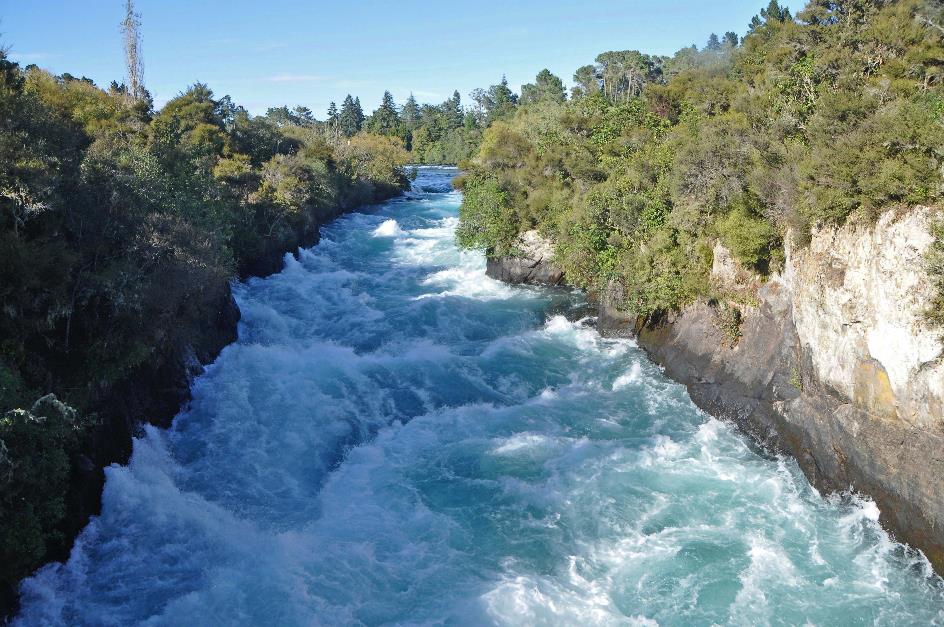
With their height, the Huka Falls make little impression – barely nine meters. Nevertheless, it's worth taking a moment to visit the waterfalls. If only because of the thunderous roar with which the broad Waikato River forces its way through the narrow gorge. Or because of the beautiful colours that arise in that tumult, including a rainbow.
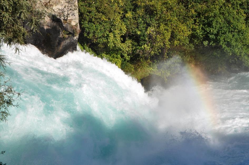
Huka Falls
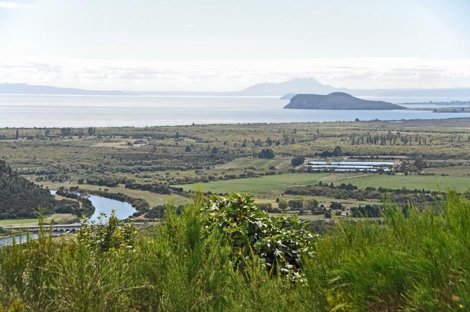
Gradually, an enormous body of water emerges on the horizon. That is Lake Taupo, the largest lake in New Zealand. With an area of 616 km², it is slightly larger than the Isle of Man. Not bad for a caldera.
It must have been an enormous explosion when the supervolcano erupted, creating this gigantic basin. 1,170 km³ of matter was ejected into the air, enough to bury the entire United States under a layer of 12 cm of dust. Even on Chatham Island, a thousand kilometres away, a layer of volcanic ash eighteen centimetres thick was deposited.
Lake Taupo is a taonga, one of the many precious treasures that the Māori cherish in their tradition
Lake Taupo, formed by a supervolcano
All of this occurred approximately 26,500 years ago. This super-eruption firmly holds the top spot on the chart of the most powerful eruptions in the last seventy thousand years.
And that was just the beginning. Since then, there have been 27 more eruptions – one wonders how all this information has been gathered. The most recent eruption dates back to around 180 AD. Geologists attribute the prolonged red hue in the sky during that period in both ancient Rome and China to the last eruption of Taupo.
So much for the bad news. The good news is that since then, there has been no activity from this supervolcano. Therefore, we can stroll carefreely in the warm and sunny Taupo, the town where the Waikato River originates from Lake Taupo.
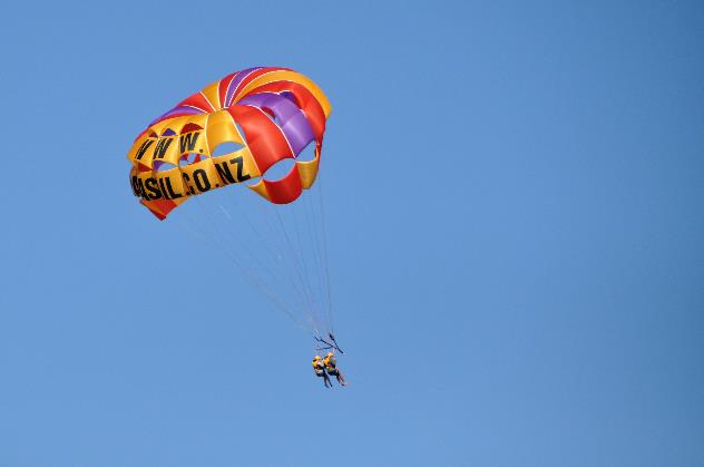
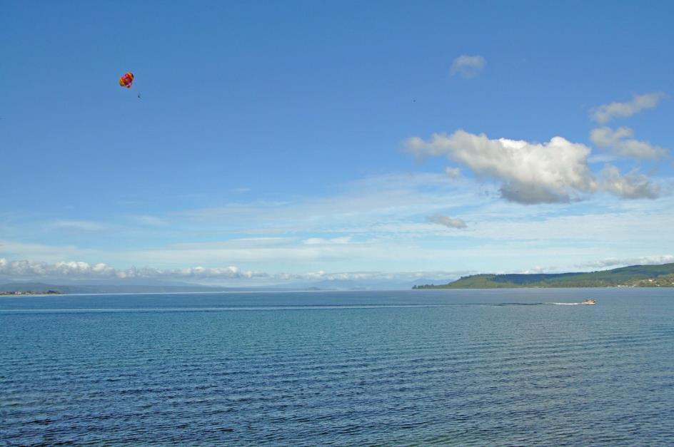
Parasailers |
|
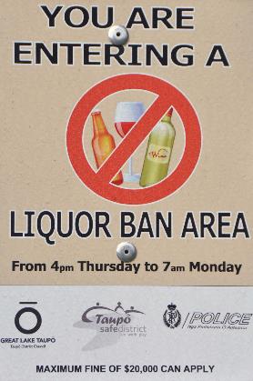
Liquor ban area |
Here, we acquaint ourselves with the concept of the Liquor Ban Area – a zone in the city centre where, from Thursday evening at 4 p.m. until Monday morning at 7 a.m., carrying or consuming alcohol in public is prohibited. Only on licensed terraces are you allowed to do so. Fines can go up to $20,000.
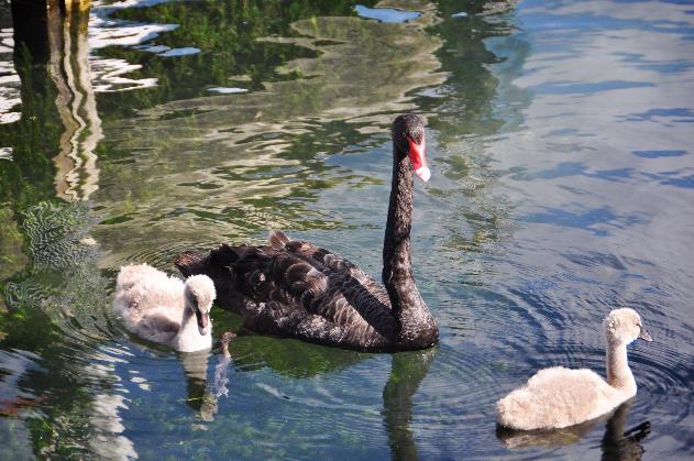
Black swan with chicks |
|
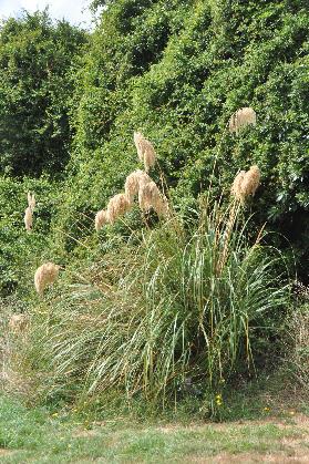
Toetoe |
The lake invites water recreation, as evidenced by the numerous small yachts in the marina. Parasailing is one of those sports, with a speedboat zooming by with two passengers on the kite.
Fishing is also popular here, as the lake is home to a significant population of rainbow trout introduced by Europeans in the 19th century. Naturally, trout cannot establish themselves here, as they would have to work against the current through the Huka Falls. That's an impossible feat. For the same reason, there are no eels in the lake.
For the Māori, Lake Taupo has always been a taonga, one of the many precious treasures they cherish in their tradition. It was only fitting that the lake was formally returned to the Māori as part of the restoration efforts. In theory, the Māori can charge entrance fees for recreation on the lake. However, the water in the lake remains the property of the government, as it is deemed too precious. Downstream, hydroelectric power stations on the Waikato River generate a whopping 13 % of New Zealand's total electricity production.
Te Ponanga Saddle – Lake Taupo
It is gradually time to explore the volcanic plateau in the heart of the North Island. In Tūrangi, we definitively leave Lake Taupo behind. From Te Ponanga Saddle, we cast a final glance at the massive lake with its turbulent geological history.
Tongariro National Park
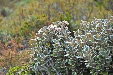
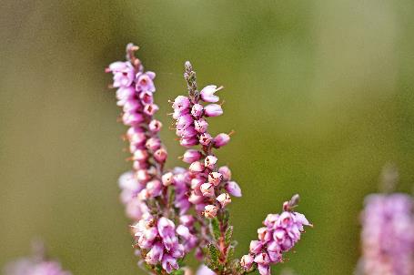
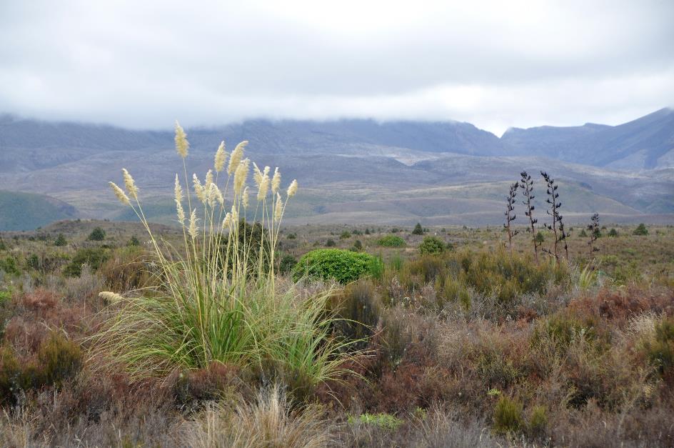
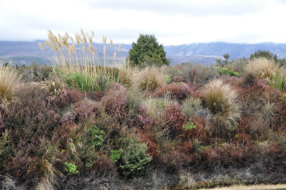
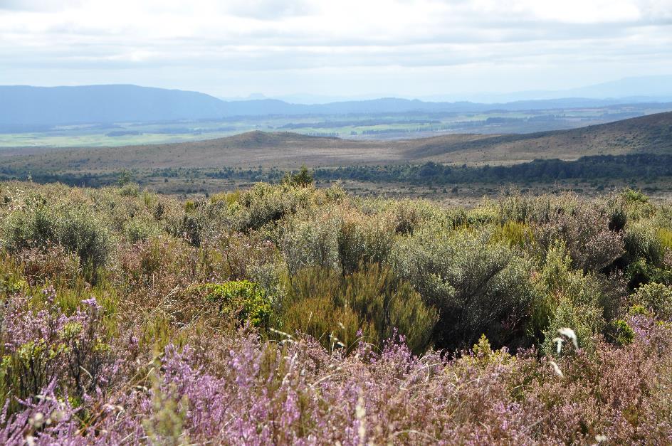
Gradually, the dense forests give way to open spaces. Pale plumes of toetoes sway gently in the wind. Flax is noticeable with its meter-long, dry flower stems towering above the foliage. Trees are scarce; the plateau is dominated by green broom and flowering heather.
Tongariro National Park
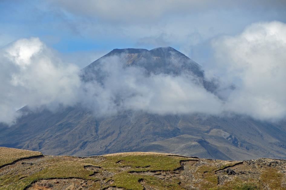
Just after twelve, Mount Tongariro makes its appearance in the distance on the left. Alongside Ruapehu and Ngauruhoe, it is the undisputed star of the national park named after it. In 1887, the Māori gifted this area to the government, under the strict condition that it would be maintained in its natural state. This prevented sheep farms from gaining a foothold, creating a national park with an area of 796 km², recognized by UNESCO as a World Heritage Site in 1990.

Flank of Mount Tongariro with crater and fumaroles
The top of Mount Tongariro we currently don’t see as it is shrouded in clouds. However, we can observe the flanks of the volcanic cone, including several fumaroles on the slope.
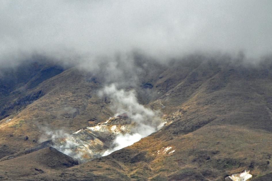
Flank of Mount Tongariro – Fumaroles
There is no doubt that these seemingly calm volcanoes are indeed active. After all, we are still on the geological fault line where the Indo-Australian Plate pushes down the Pacific Plate. This phenomenon is called subduction. Due to the friction between the plates, rocks melt, creating magma that seeks its way upward. It accumulates in a magma chamber until the pressure is high enough, and the bottle's cork pops. With all the consequences that follow.
It was quite a shock for the students of Tamatea Intermediate School from Napier
It was quite a shock for the students of Tamatea Intermediate School from Napier on November 21, 2012. As part of their school trip, they had embarked on the Tongariro Alpine Crossing. Nothing unusual, as this wildly popular day hike attracts sixty to seventy thousand adventurous hikers every year. However, for these students, it seemed like a nightmare when a side crater of Tongariro erupted. The ash cloud reached 1.6 km high. Fortunately, they escaped unharmed.
A very different outcome occurred for train passengers on Christmas Eve 1953, traveling from Wellington to Auckland to greet the newly crowned Queen Elizabeth II. It wasn't a violent eruption, but it was enough to breach the wall of the crater lake of Ruapehu. A mixture of water, ice, snow, and debris cascaded down at a speed of several tens of kilometres per hour. This lahar destroyed the Waiouru railway bridge moments before the express train crossed it. 151 train passengers lost their lives.
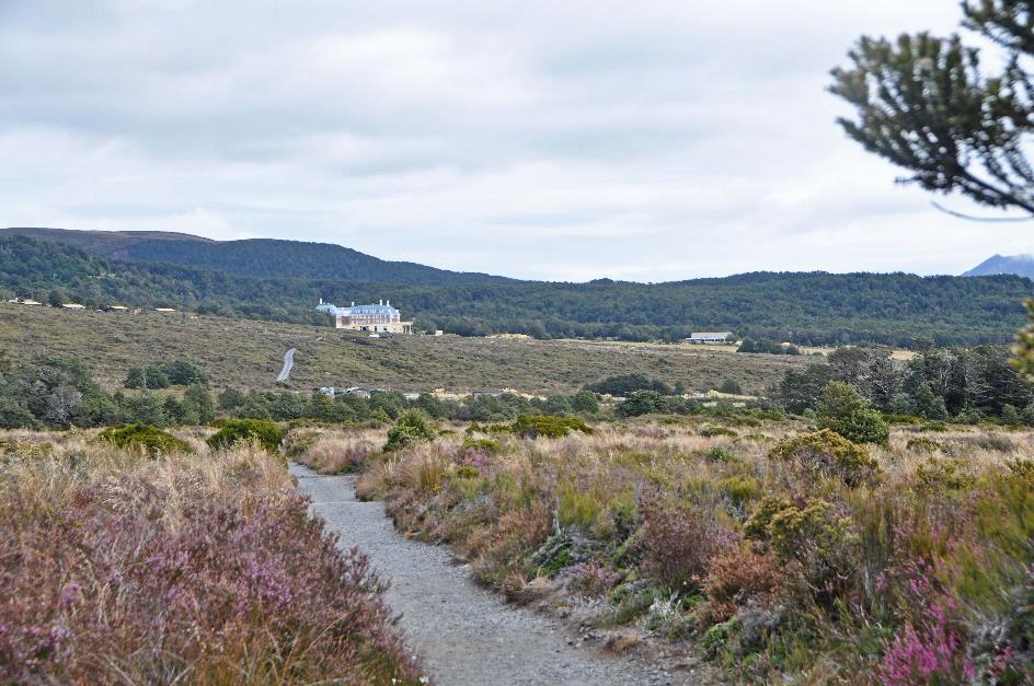
The hotel still exudes the grandeur of the roaring twenties
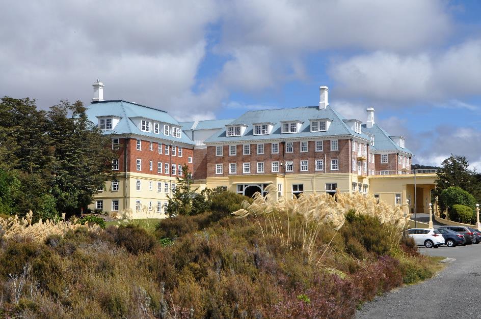
Chateau Tongariro Hotel
It's twenty minutes to one when we are dropped off at the northern flank of Ruapehu, in front of the doors of Chateau Tongariro Hotel. Here, in the heart of the volcanic plateau, we are situated 1,125 meters above sea level. There is no sign of habitation as far as the eye can see. It took until 1925 for a road to connect this place to the inhabited world. Before that, reaching here was only possible through a laborious journey on foot or horseback.
It proved to be quite a challenge to secure funding for building a hotel in this location. But on August 1, 1929, it finally happened. Chateau Tongariro Hotel opened its doors to guests – initially without furniture in the rooms, as that would take a few more months.
Although the original splendour has faded somewhat, the hotel still exudes the grandeur of the roaring twenties. Nostalgia drips from the draperies in the lounge. Calm piano music resonates through the space, the fire crackles softly in the fireplace, the staff glides silently over the thick carpet, and guests sink deep into the plush seats. In the Ruapehu Lounge, you can enjoy your high tea with a view of one or two volcanoes, following the rules of art.
A sign reminds us of the dress code before entering the dining room. We straighten our T-shirt and fumble with our pants. Maybe we should have worn those other shoes this morning after all.
|
|
|
After the buffet lunch, we settle briefly in our room, just to check if the furniture is still there. No signal available due to atmospheric conditions, reads the TV screen. We couldn't care less, but it speaks volumes about the remote location we find ourselves in.
A volcanic mudflow cannot reach us here, only debris thrown by a volcano
Instructions for a potential evacuation are available. If the siren sounds, we must immediately head to the assembly point in front of the hotel—except if it's a lahar. In that case, the opposite instruction applies—stay inside. The hotel is in a Lahar Safe Zone, which is a relief. It means a volcanic mudflow cannot reach us here; only debris thrown by a volcano.
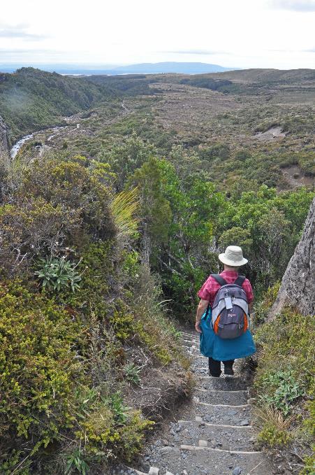
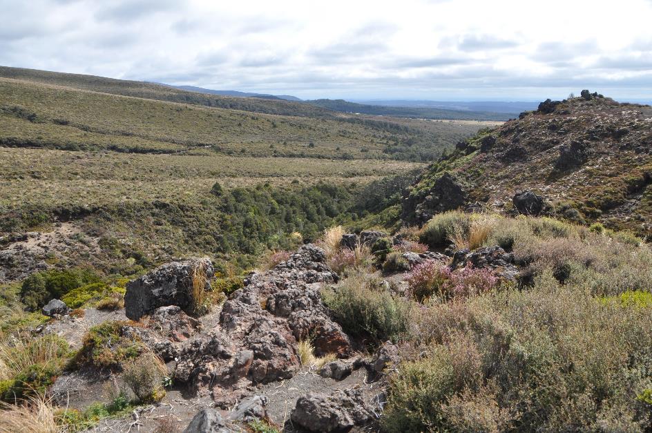
Gradually, we are eager to explore this beautiful environment on foot. At half past two, we set out on a journey of about 6.5 km to Taranaki Falls. The weather is good, with dense clouds hanging in the sky, but the sun manages to break through regularly. It is primarily the waving plumes of toetoes that stand out above the alpine shrubbery.

Ngauruhoe obscured by clouds
Once again, it proves to be an excellent hiking trail. In the past, this was one of the horse tracks used by tourists to explore the surroundings. The path will lead us across the lava slopes of Ruapehu, the highest mountain on the North Island at 2,797 meters. We cannot currently see its peak from here; it is hidden behind the slope to the right. The same applies to Tongariro and Ngauruhoe, but in their case, it's clouds that are causing us trouble.
Tongariro National Park – Volcanic plateau
To the left, we gaze as far as the eye can see over the central volcanic plateau. Trees are scarce, and the low shrubs barely obstruct the view. It is primarily the waving plumes of toetoes that stand out above the alpine shrubbery.
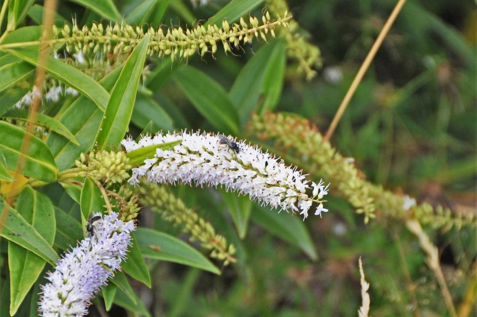
Koromiko
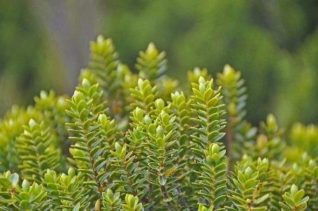
Among the flora here, the mānuka is prevalent—a shrub valued by the Māori for its antiseptic qualities and by Europeans primarily for its honey. The koromiko is also noticeable alongside the path. Its small, white flowers bloom like a dense ear of wheat around a stem.
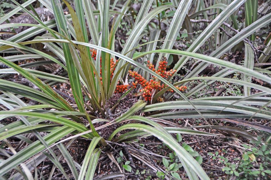
Astelia grandis
The path then leads us into a forest, where moss and epiphytes abound. In damper areas, in the shade of the foliage, plants with long spear-shaped leaves occasionally appear. It resembles flax, but that can’t be true, because this plant bears clusters of orange berries in its heart. Later, we'll learn that it is an astelia grandis, specifically the female version, as this plant is dioecious. Male plants do without these beautiful berries.
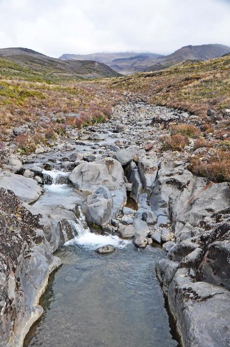
Like a thick tongue filled with jagged chunks of debris, the solidified lava points in the direction of the valley
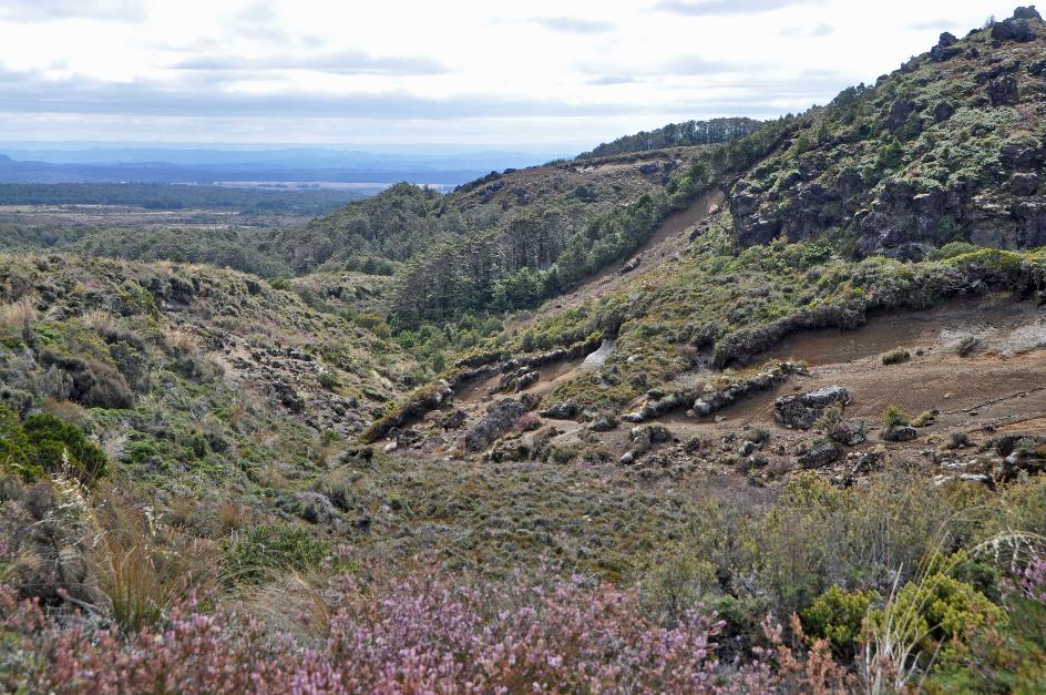
Remnant of an ancient lava flow
Here, we reach the edge of an old lava flow, not too far from our hotel. At some point in the past, lava from Ruapehu flowed to this point. Nowadays, the solidified mass points like a thick tongue filled with jagged debris towards the valley.
|
|
|
Directly in front of us lies Ngauruhoe, the youngest of the three famous volcanoes. Barely 2,500 years ago, it made its debut as a fresh fire-breather. But it quickly established its fame. It erupted forcefully at least every nine years until, for unclear reasons, the volcano called it quits in 1975.
Unfortunately, its summit is hidden behind clouds, although they seem to be playing a game with us. They constantly tease our curiosity, revealing small pieces of the flank. And then the unbelievable happens. The top of Ngauruhoe emerges entirely from the clouds. It is a perfect volcanic cone, just as we learned about it in our schoolbooks back then.
Then the unbelievable happens. The top of Ngauruhoe emerges entirely from the clouds

Ngauruhoe
Ngauruhoe
Ngauruhoe also served as a perfect model for Mount Doom, according to Peter Jackson when he filmed The Lord of the Rings. It is within the fiery depths of this volcano that Lord Sauron – the bad guy in the movie – forged the One Ring, the ring that rules all other rings. Nothing and no one can destroy the One Ring. Except, of course, the fire of Mount Doom.
Wairere River, Ruapehu hidden in the clouds |
|
Descent to Wairere Valley |
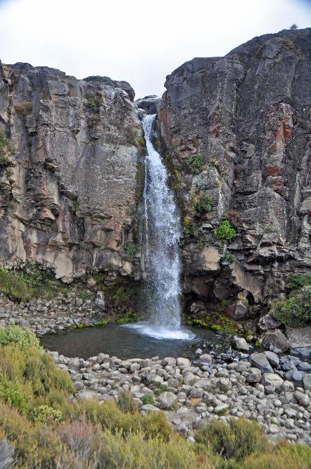
Where our path intersects with the Wairere, a sturdy bridge spans the babbling stream. In theory, we should be able to see Ruapehu in the distance to the right, but it seems to be hiding behind clouds as well. A steep staircase leads us down to the Taranaki Falls. From a height of twenty meters, the Wairere cascades into an idyllic blue-green pool.
False beeches are a typical tree species of the southern hemisphere; fossil remains have even been found in Antarctica
Forest of southern beeches |
|
Taranaki Falls |
||
|
|
|
||
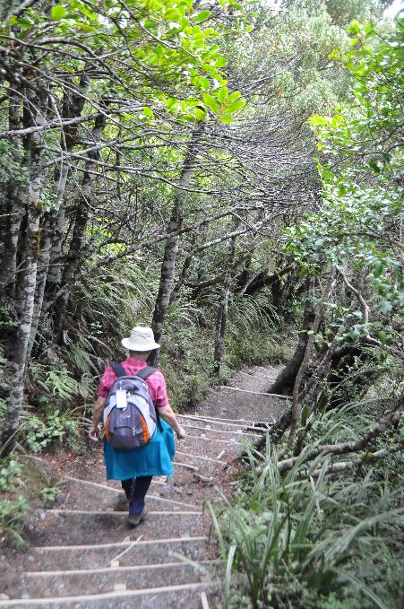
Once again, we find ourselves in an impressive forest, this time of southern beeches. This tree species is typical of the southern hemisphere; fossil remains have even been found in Antarctica. As a matter of fact, these false beeches share no genetic similarities with true beeches, which are exclusive to the northern hemisphere.
As we emerge from the forest, we once again look out over the plain. A beautiful piece of nature unfolds before our eyes. In the distance, the hotel beckons to us. It can hardly be located in a more picturesque setting.
Red tussock
Among the low shrubs, the red tussock stands out, an endemic grass species. Thick bundles of reddish-brown stems, over a meter high, reach out here and there.
Survival isn't easy for this red tussock when it comes to reproduction. Its seeds are coveted nibbles, and rabbits and other mammals won't just leave them lying around. Natural evolution has equipped the plant with a clever survival mechanism. Patiently, the plant works on seed production for several years until, at a certain point, it disperses its seeds massively across the environment. So massively that there are always some left.
Natural evolution has equipped the plant with a clever survival mechanism
Once it has taken root, it becomes a persistent presence. The resilient tussock can endure various challenges, weathering the elements, even on nutrient-poor soils. However, under this pleasant autumn sun, that likely wasn't a concern today.
Jaak Palmans
© 2024 | Version 2024-01-31 14:00
Continue reading in (4/11)
Mother Earth's precious treasures