Demons in the snow
Chile – Argentina | Anno 2017
Friday, November 10 | Torres del Paine – Puerto Varas
Saturday, November 11 | Puerto Varas – Bariloche
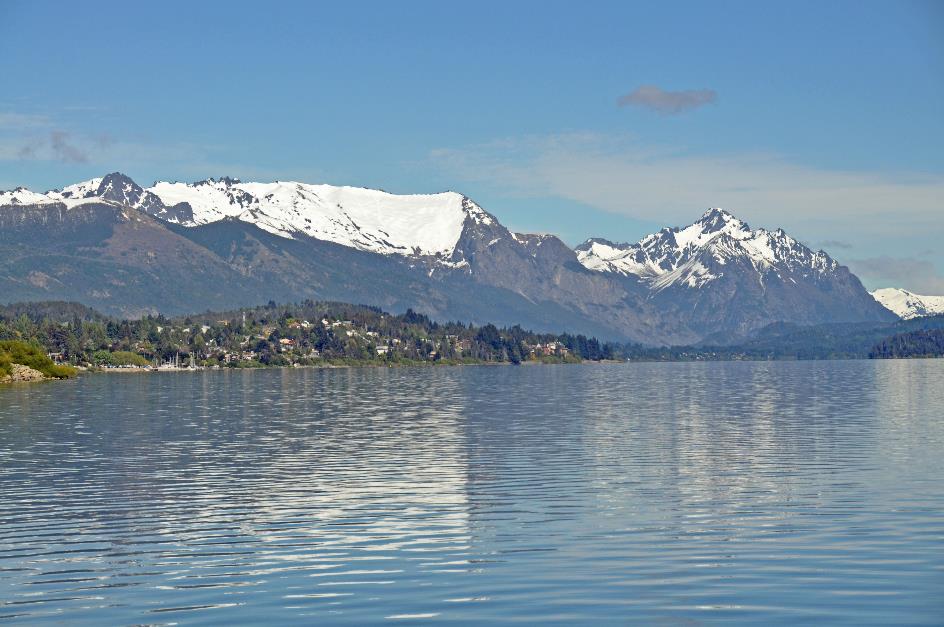
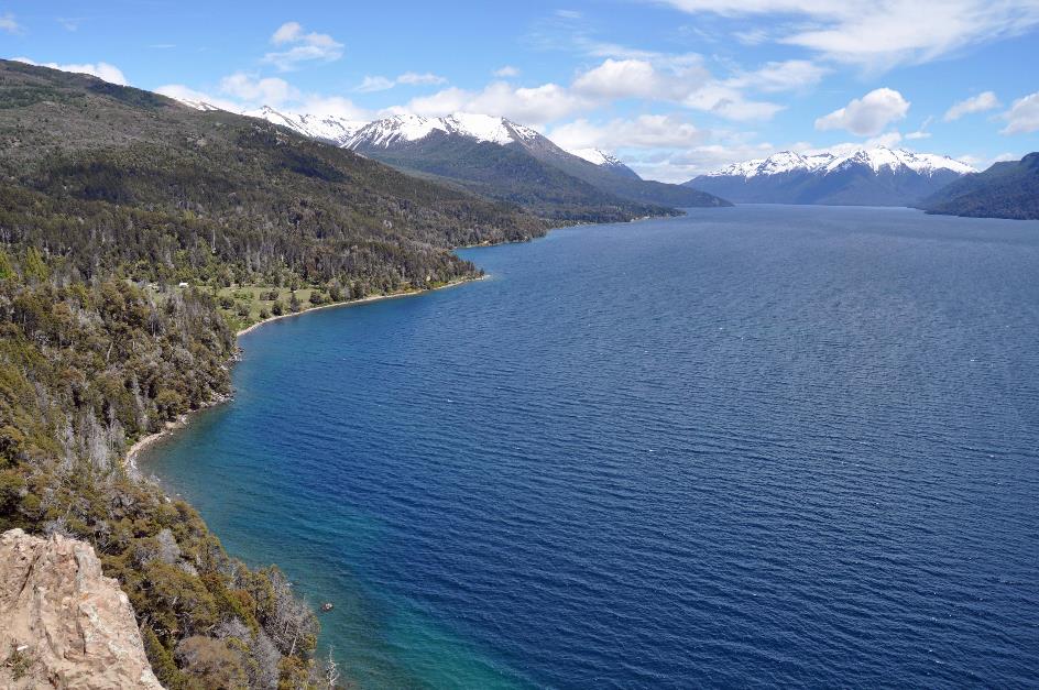
Sunday, November 12 | Nahuel Huapi NP
Monday, November 13 | Bariloche – Buenos Aires
Friday, November 10 | Torres del Paine – Puerto Varas
Just before three in the morning – yawn – we are on board Gustavo's bus, with some coffee or juice in our stomachs and a breakfast pack under our arms. Our destination is the Punta Arenas airport, in the far south, about 320 km south of Torres del Paine. In principle, our flight to Puerto Varas departs from there just before ten.
Outside, it's pitch black. There's a strong Patagonian wind. Stars twinkle brightly through the thin clouds. Orion is high in the night sky. A reddish moon is also present, low on the horizon but sharp in this clear atmosphere. It's in its last quarter, with its right half illuminated. It takes some getting used to because on the northern hemisphere, it's exactly the opposite.
It must be that Gustavo is convinced that there is no second Gustavo approaching from the other direction
It must be that Gustavo knows this route like the back of his hand. And that he is convinced that there is no second Gustavo approaching from the other direction. Because we're zooming at forty, fifty kilometres per hour over the winding, unlit gravel roads. Occasionally, a hare timidly crosses the road in the light of the swinging headlights. A few raindrops fall for a moment.
It's half past four when we make a stop in the sleepy Puerto Natales to refuel. We have another 240 km to go to Punta Arenas. It will be faster via the excellent Ruta 9. Although Gustavo has the rising sun in his eyes almost continuously.
As the morning begins to dawn, we can observe that also in Chile the steppe is a familiar sight. The green grasslands stretch endlessly in all directions, devoid of any trees or shrubs worthy of the name.
On the horizon, some windmills appear. Only now do we realize that we've hardly seen any windmills in Argentina or Chile. With those legendary winds that can blow you off your socks in Patagonia, there must be a lot of energy to harvest. Travel guide Lorenzo can only agree, but the explanation is obvious – gas and electricity companies do everything to protect their monopolies.
In the distance, the Strait of Magellan makes its appearance, discovered by Ferdinand Magellan in 1520. Until the opening of the Panama Canal in 1914, this would become the main sea route from the Atlantic to the Pacific. Not because this passage was shorter, but because it was a lot safer. With an average of two hundred days of storms per year, it was no fun to sail around Cape Horn.
With an average of two hundred days of storms per year, it was no fun to sail around Cape Horn
However, Magellan himself would not benefit much from his discovery. Barely half a year later, he died in a fight with the local population in the Philippines.
It's nothing more than a small ripple on the water surface, seen from here. Yet, the tiny Isla Magdalena is a popular tourist destination in the Strait of Magellan. Magellanic penguins feel at home there. Sixty thousand pairs nest there.
A little after seven, we approach Aeropuerto Internacional Presidente Carlos Ibáñez del Campo, just north of Punta Arenas. Well in time for a flight that will only take off just before ten. Gustavo will return to Puerto Natales on his own with his bus, while Lorenzo will visit his family here in Punta Arenas.
We, on the other hand, have Puerto Montt as our destination, a port city on the Pacific Ocean, more than 1,300 km to the north. Outside, it's quite sunny now, with only a light cloud cover. We take our seats in the waiting area, slightly surprised hearing an old rondo by Thijs Van Leer echoing through the speakers.
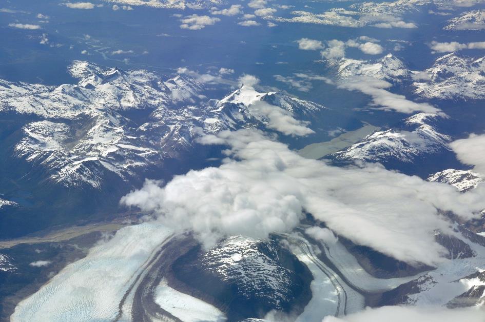
Andes
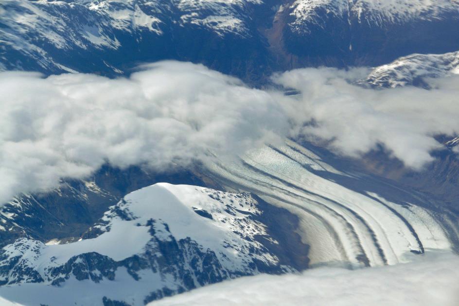
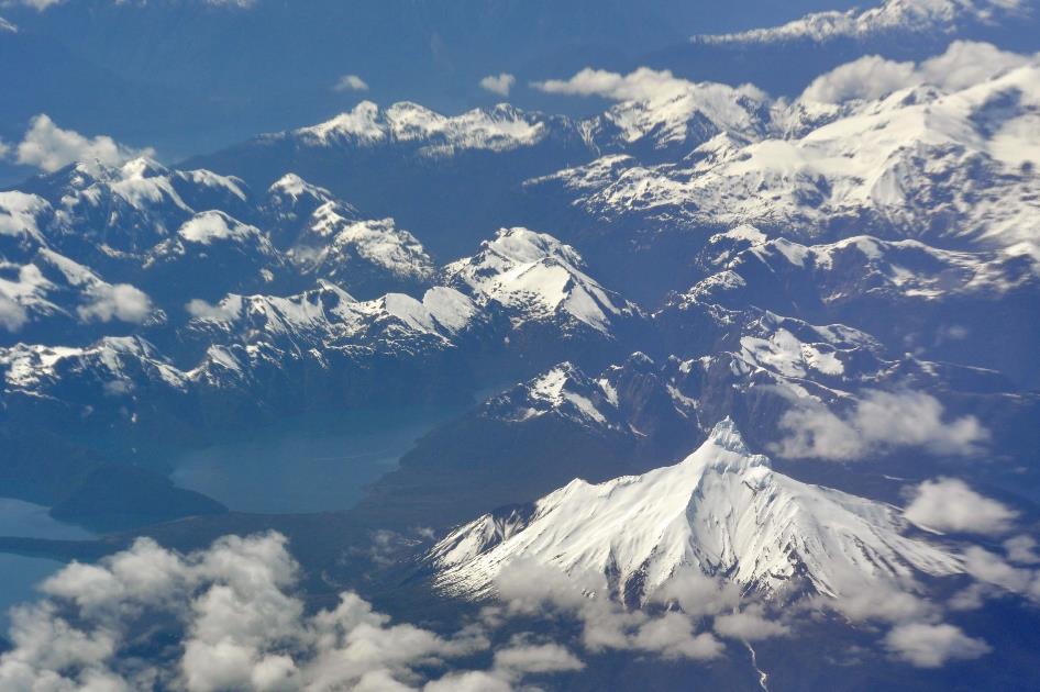
It's half-past nine when we finally board a Latam Airbus A321 bound for Santiago de Chile – fortunately, with a layover in Puerto Montt. Thirty minutes later, we bid a final farewell to the southern region of Patagonia. In the distance, the Strait of Magellan stretches out to the right. However, this view is short-lived as clouds obscure the land from view. It seems as though we are flying above a pristine white ice field that extends to the horizon.
Andes
About an hour later, the clouds finally grant us an extensive view of the Andes, with its deep blue mountain ranges, sharp white peaks, and numerous glaciers carving broad S-shaped curves through the landscape.
Andes
Eventually, we fly off the coast heading directly north above the ocean. Then, a white cone emerges on the horizon. That must be Osorno, a perfect volcano as you only see in textbooks. Only Mount Fuji surpasses it, according to the Japanese.
Shortly before noon, we land at Aeropuerto El Tepual, about fifteen kilometres west of Puerto Montt. Not even twenty-five minutes later, we are on board a bus with Christian at the wheel and Patricio behind the microphone. Puerto Varas, about twenty kilometres north of Puerto Montt, is our final destination today.
Welcome to Northern Patagonia, Patricio begins. Welcome also to Puerto Montt, a bustling industrial city with 230,000 inhabitants. This is the capital of the Los Lagos Region, the Chilean Lake District. On average, there is a thousand millimetres of rain here each year. Perfect, that's just the message we were waiting for.
Osorno
But that should not discourage us, he continues with a grin, because the weather forecast for the coming days looks promising. Not for nothing are we at about the same latitude as Rome and Barcelona.
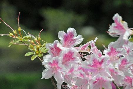
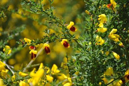
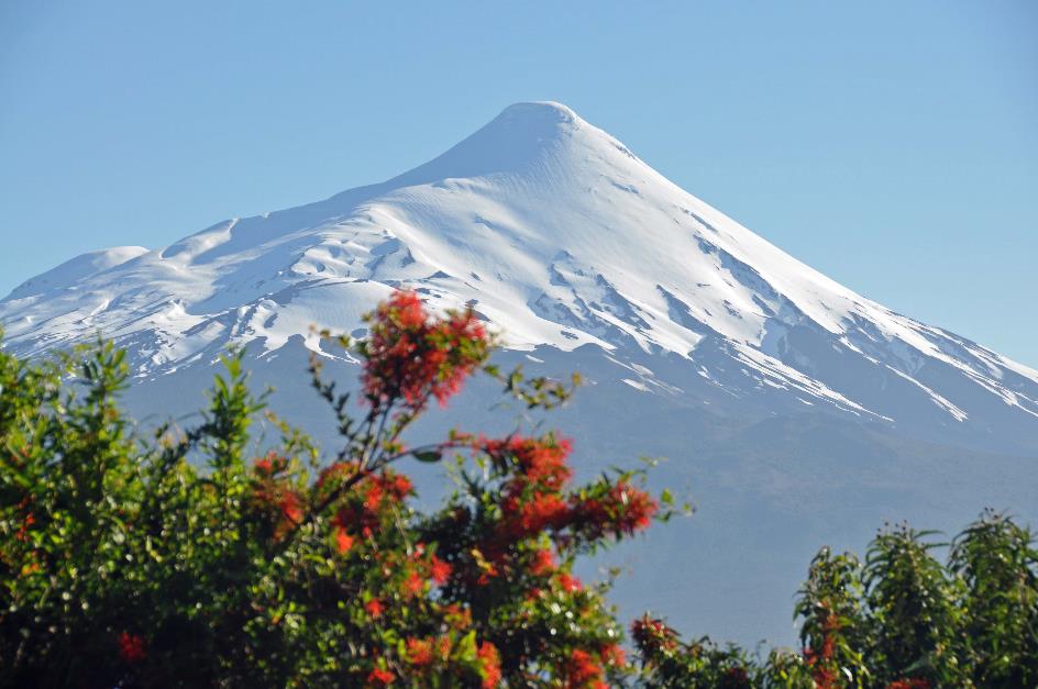
But if you ask us, this gently rolling landscape certainly has nothing to do with Patagonia. Cultivated fields, planted trees, green pastures, brown cows, yellow broom – we feel completely back in Belgium. Fortunately, the white peak of Osorno can be seen in the distance, and the scarlet firebush blooms abundantly here and there. This is Chile, there can be no doubt about it.
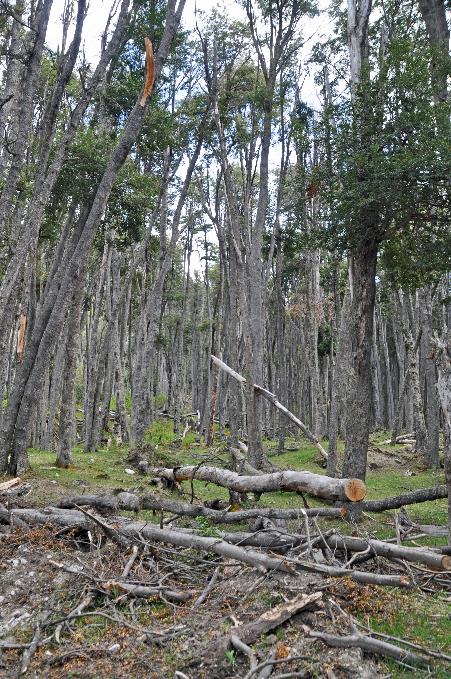
German immigrants settled here in 1853 at the explicit request of the Chilean government. The goal was to colonize the area in a deliberate attempt to connect the south of Chile to the rest of the country. The first 212 settlers established themselves on the shore of Lake Llanquihue. Puerto Varas emerged from that settlement.
Before that, only a temperate rainforest grew here, with trees up to twenty meters high, and occasionally some bamboo or sugarcane. The newcomers began clearing and burning the land to shape it to their liking. Over time, enough open space emerged for their cows and sheep. About a century later, the original dense forest had almost completely disappeared, and this semi-European landscape had taken its place.
Since then, Puerto Varas has grown into a decent city of 45,000 inhabitants. While Puerto Montt relies mainly on its industry and port, Puerto Varas depends solely on agriculture and tourism.
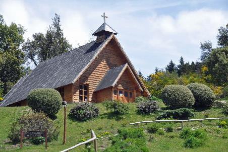
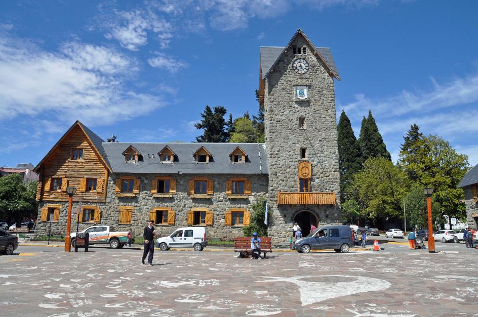
Fabricio treats us to a brief bus tour of the city before we drop off our bags at the hotel, a stone's throw from the Iglesia Sagrado Corazón, together with Osorno the icon of the city. A quick lunch at Cassis Cafe restores our metabolism – we have been on the move for almost twelve hours. The portions are tasty and overly generous.
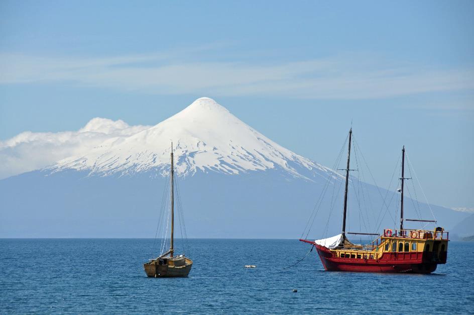
Then we descend to the lake shore. A light wind blows over the rippling water towards us. Across the lake, the perfect white cone of Osorno stands out as a postcard motif against the blue sky. Further to the right, partially obscured by clouds, we see the craggy silhouette of Calbuco. It is said to have erupted not so long ago.
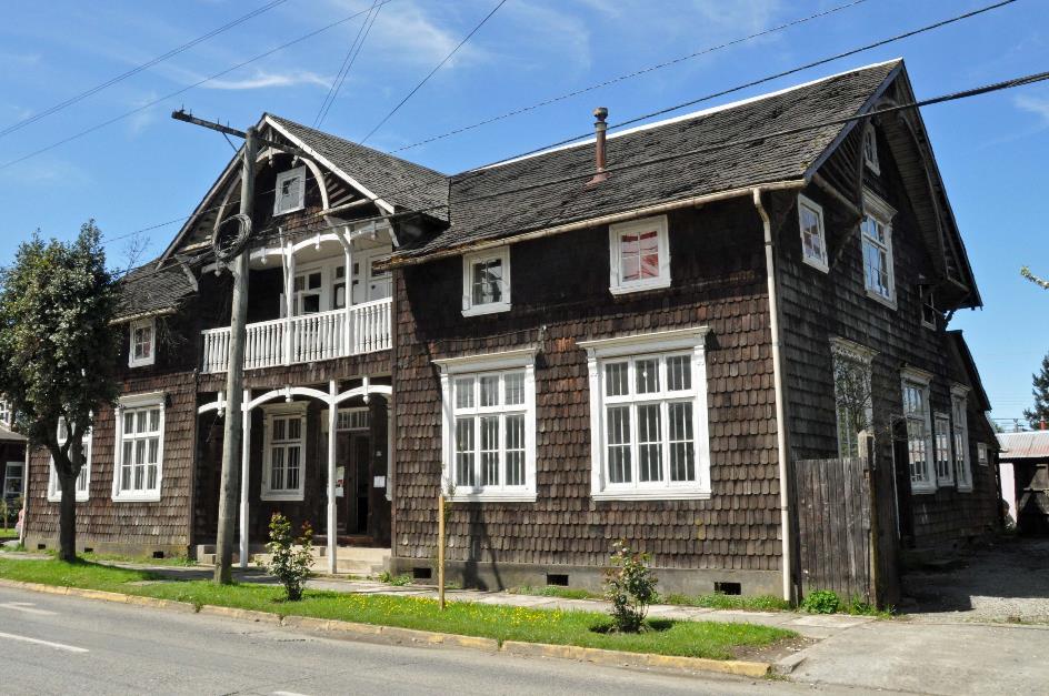
That German immigrants have left their mark here and there in the city was to be expected. Reportedly, there is even a Circuito Patrimonial, a walking route along the finest examples of that German colonial architecture.
That German immigrants have left their mark here and there in the city was to be expected
But there is some uncertainty about it. Patricio denies its existence emphatically. Due to lack of interest, that signposted route would have been closed down a few years ago. People at the Corporación de Desarrollo Turistico y Cultural are also at a loss. In principle, that route still exists, but only one map remains, and it is pinned to the wall with thumbtacks. Our suggestion to take it off the wall leads to slight panic. Eventually, a booklet emerges from a back room and is handed to us with some hesitation. The perfect guide, it turns out, including a map and descriptions.
Casa Kuschel
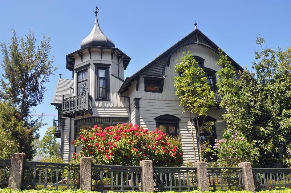
Along the Turismo – nomen est omen – we climb above the city. There we immediately come across Casa Kuschel, built in oak in 1915. In an eclectic style, as we read, with neoclassical and neo-Gothic elements and Byzantine inspiration. That's quite a mouthful. We are especially struck by its ostentatiousness, with that bizarre turret on the corner. Nowadays, it houses an office. Whether the historical monument is properly maintained is an open question.
A wall of concrete panels next to a railway line, that's the ideal substrate for a dose of rebellious graffiti. Fifteen-year-old Raúl thinks so too. He is at work with his spray cans on a wooden gate, even in broad daylight. We watch amused. Beautiful, we acknowledge, but is it allowed? No, is the honest answer, this is illegal, but no one cares.
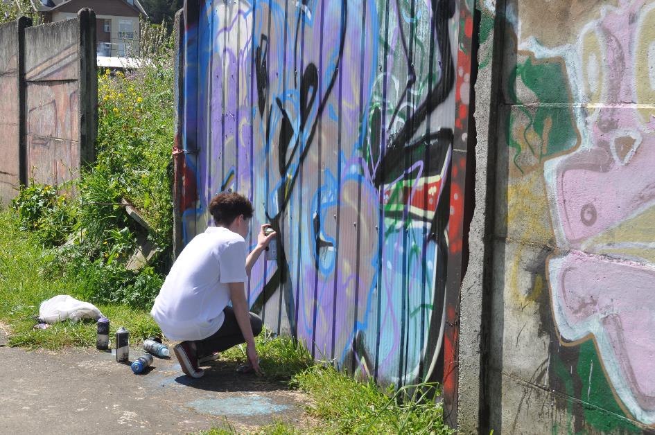
Raúl at work
Promptly, Raúl takes out his little video camera. Because he not only creates graffiti, he also makes a video about making graffiti. Are we willing to provide commentary on his work for the camera? Shortly after, he is the one asking the questions, and we are the ones providing the answers.
Much more modest is the neoclassical architecture of Casona Alemana. Two chimney sweeps are at work on the roof. The ecru walls and the roof of red corrugated iron are in excellent condition. Apparently, this monument is well-maintained.
In the shade of a tree, an old man watches our every move closely. He wants to know where we come from. Bélgica, is our short answer, because we don't know much more Spanish, and he doesn't speak a word of English.
But that doesn't stop him from inviting us inside with friendly gestures. Politely refusing is not an option. We shuffle inside over the beautiful wooden floor, while in the background, someone closes a door – probably his wife, muttering something about strange guests in the house.
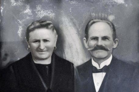
Casona Alemana – Couple Klenner-Kaschel |
|
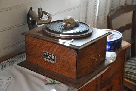
Gramophone 'His Master's Voice' |
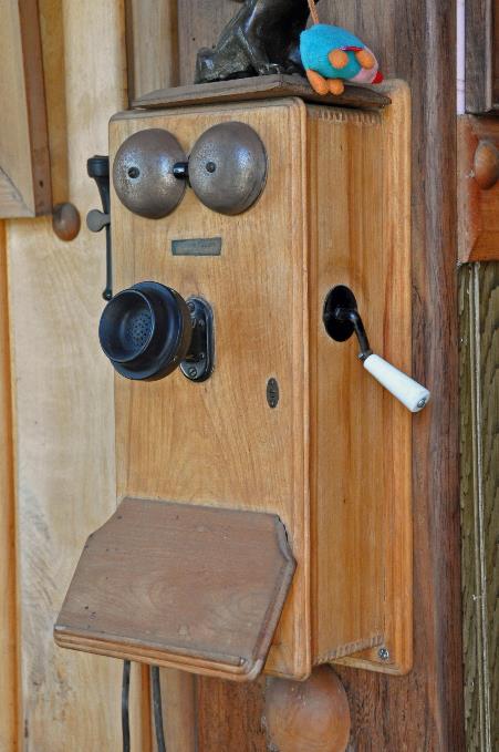
It won't be a smooth conversation. Nonetheless we understand he bought this house twenty years ago. Gesturing animatedly, he shows us how, back in the day, you had to wind up the old telephone against the wall before starting a conversation. With the loose earpiece against his head, he simulates a hilarious conversation with the next train station using the fixed microphone against the wall.
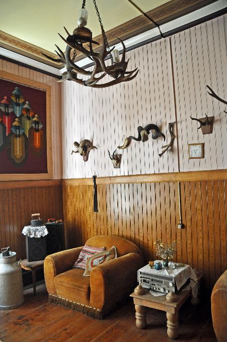
On the nameplate of the antique gramophone, we recognize the image of Nipper, the dog listening to a phonograph – emblem of His Master's Voice. Countless antlers adorn the walls, although some of these animals seem to exist only in Europe. The Klenner-Kaschel couple poses elegantly in a black-and-white photo. They were the ones who had this charming house built in 1914, right next to the brand-new railway. But the biggest surprise is right above our heads – romantic depictions of the four seasons on the wooden ceiling.
Casona Alemana – Antlers adorn the walls |
|
Old telephone |
It cannot get any better, especially considering that Casa Jüpner across the street looks somewhat dilapidated. That’s a pity, because the walls and roof are entirely covered with tiles made of the famous fitzroy cypress wood. This wood is easy to work with and resistant to rot and wood-eating insects – all a carpenter needs. The popularity of this wood was such that the trees had to be protected from logging, as they were on the verge of disappearing in this region.
The Spaniards called these gigantic trees alerces, the tallest in South America, reaching heights of up to 70 meters and diameters of sometimes five meters. The oldest living specimen is estimated to be four thousand years old. The comparison with North American sequoias – also from the cypress family – is evident.
We continue our stroll along the old railway line, as it is not coincidental that most of these Monumentos Nacionales are located there. Although the dilapidated Casa Maldonado does not seem worthy of that title. In the not-so-distant past, it must have been a beautiful residence with its dormer and veranda, but nowadays, the decrepit building is not even inhabitable. It's a shame because it dates back to 1890, making it the oldest member of this exclusive club.
Casa Yunge is the only property still owned by a descendant of the original family
Casa Yunge
Casa Rehbein seems to be heading for a bright future. It now houses a dental practice, and scaffolding surrounds the wooden residence. Similarly, the recently restored Casa Götschlich is thriving. The same applies to Casa Yunge, the only property still owned by a descendant of the original family, currently in the hands of Augusto Yunge.
The plans for the famous Marienkirche in Reutlingen, Germany, were on the architects' table
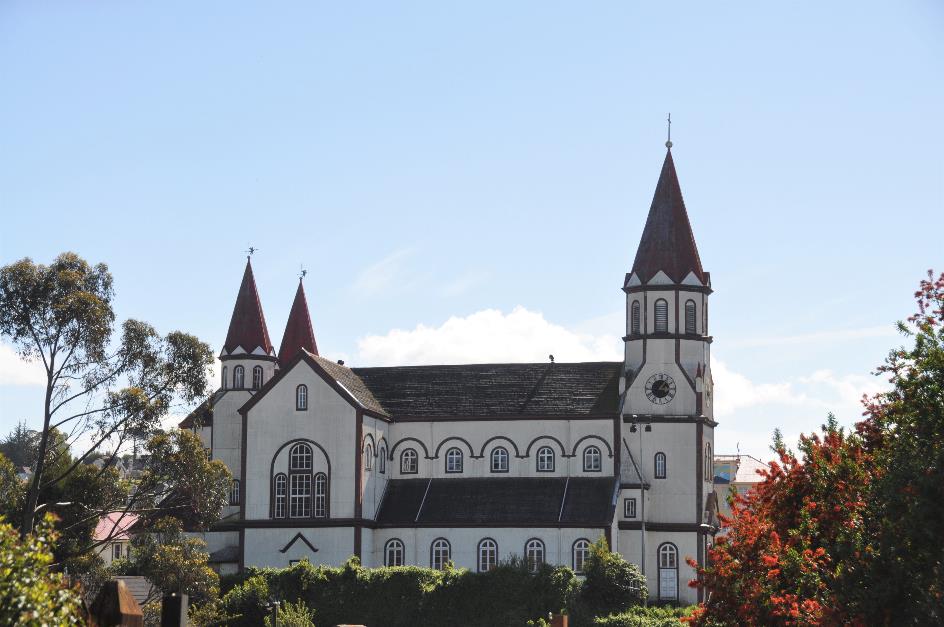
Iglesia Parroquial Sagrado Corazόn
The Iglesia Parroquial Sagrado Corazón is visible from nearly everywhere in the city. It doesn't surprise us anymore that this church also has German roots. The plans for the famous Marienkirche in Reutlingen, Germany, were on the architects' table.
Iglesia Parroquial Sagrado Corazόn
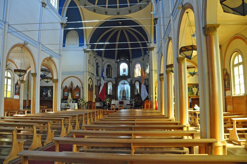
Apart from its structure, this Baroque church has little in common with its Gothic predecessor. It is a relatively simple church, built with local materials such as the fitzroya tiles on the roof. The abundance of light coming through the windows is striking, as are the two large flags flanking the altar – the Chilean flag on the left and the Vatican flag on the right.
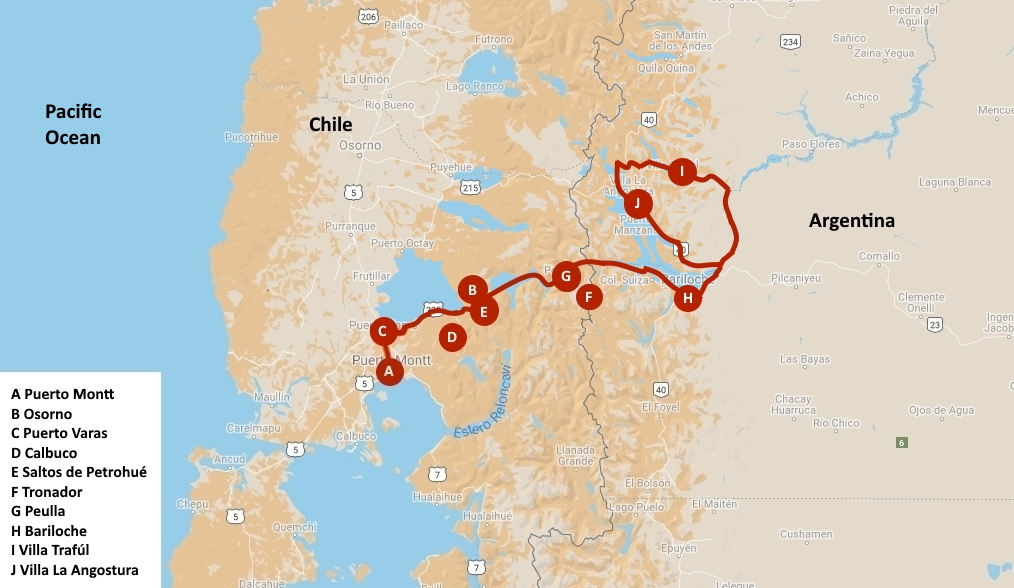
Saturday, November 11 | Puerto Varas – Bariloche
Today, we embark on a bus journey to a lake, where we'll take a boat to cross it. Then, another bus ride to another lake, followed by a boat crossing. Afterward, we'll take a bus to yet another lake, take another boat, and finally, we'll travel by bus to our hotel in the Argentinean town of Bariloche.
This bizarre route from Chile to Argentina through the Andes has been in use for centuries
This journey captures the essence of life in Los Lagos, the Lake District. This peculiar trip with three lake crossings is not even exceptional, as this route from Chile to Argentina through the Andes has been in use for centuries. It was historically used for transporting sheep wool from Patagonia to the seaport of Puerto Montt. The Jesuits also utilized it for their missionary activities in Patagonia. Infrastructure development began in 1880 to support caravans, and today, it's a route frequently taken by tourists, including cyclists.
However, any delay could have a cascading effect on the entire journey. The plan is to arrive in the Argentinean town of Bariloche at a reasonable hour tonight. The weather seems favourable, with a bit of chill in the air, but the sun is shining brightly in a cloudless sky. The black-faced ibises on the hotel roof bask in its warm glow. Patricio describes the day as exceptional, considering that the spring in this region has mostly been characterized by rain. It seems luck will be on our side.
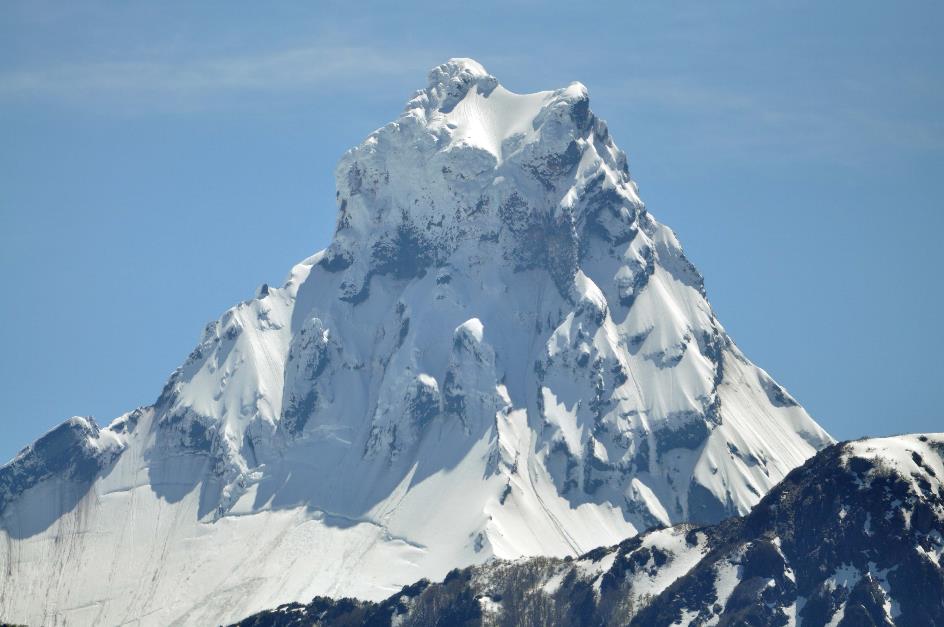
The Mapuche people called this mountain Peripillán, Demon in the Snow
Osorno
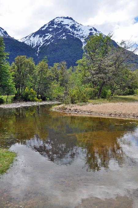
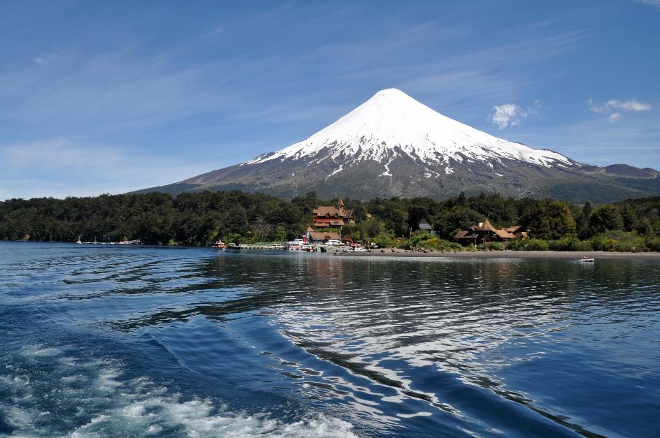
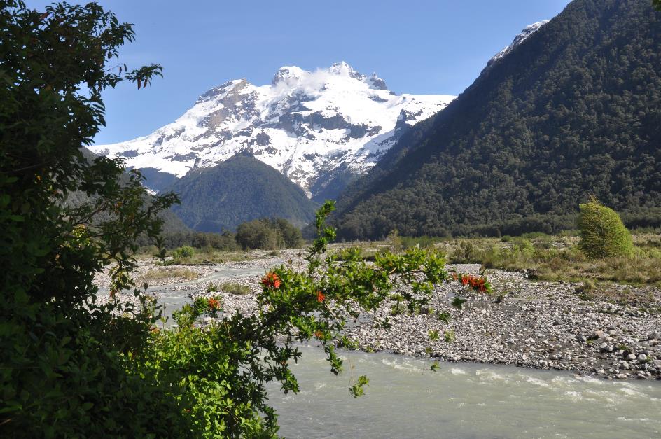
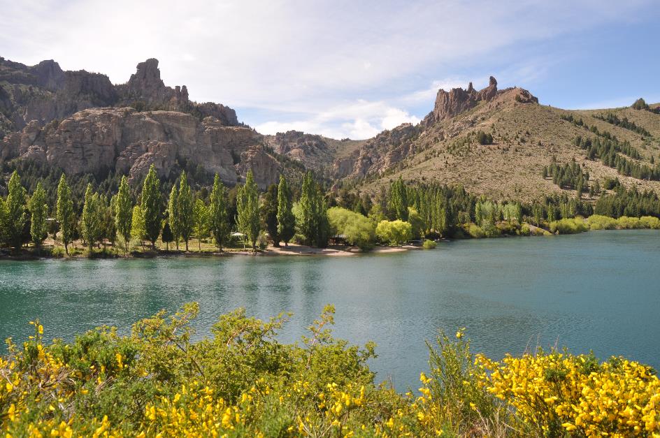
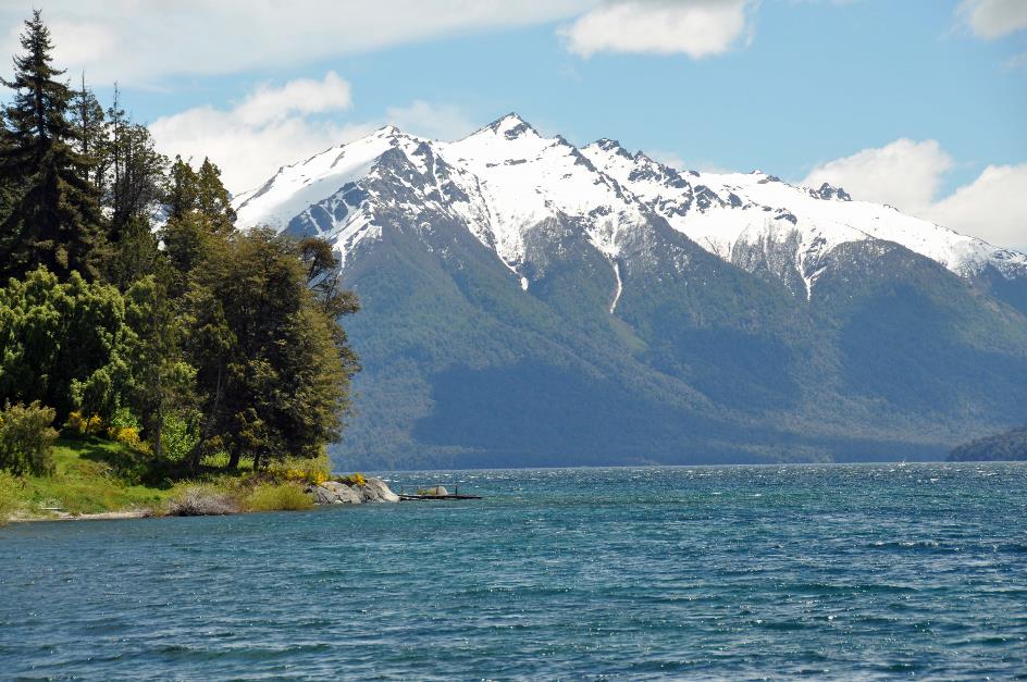
Just after eight o'clock Arnoldo, the driver, sets the bus in motion. Red firebushes and yellow broom are in bloom on the shore of Lake Llanquihue. It has a surface area of 877 km² and in the Mapuche language its name means deep place. They certainly had a point because in some places, the lake is 350 meters deep.
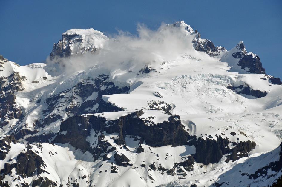
However, it's the stately Osorno on the opposite side of the lake, 2,652 meters high, that steals the show. The calm, blue water of the lake, the cloudless blue sky, and the snow-white cone lying in the midst of it all have something soothing. Nevertheless, the Mapuche called this mountain Peripillán, Demon in the Snow.
That shouldn't come as a surprise. With eleven eruptions between 1575 and 1869, it is one of the most active volcanoes in southern Chile. Charles Darwin coincidentally observed an eruption in January 1835 from the island of Chiloé, just off the coast of Chile. The Spaniards named the volcano Osorno after the Spanish city Osorno la Mayor.
Since 1869, there have been no eruptions of Osorno. This cannot be said for Calbuco. On April 22, 2015, around six o'clock in the evening, it suddenly erupted after more than forty years of inactivity. Patricio vividly remembers the cloud that reached 14 km high and could be seen up to Puerto Montt.
But it wasn't over. The next morning, a second, much more intense eruption occurred. Four thousand people were evacuated within a radius of 20 km. The last eruption took place a week later on May 1.
Although there were no casualties, the damage was enormous. On this side of the volcano, there was a layer of ash 15 cm thick, while on the other side, it was three to four meters. One of the rivers was blocked and even changed its course.
An earthquake is coming, they thought at the time. No one expected it to be a volcanic eruption
Since the beginning of this century alone, Calbuco has erupted more than ten times. Can these eruptions be predicted? Not yet, at least not with scientific certainty, according to Patricio. However, residents of Alerce had heard strange noises in advance. An earthquake is coming, they thought at the time. No one expected it to be a volcanic eruption.
It also happens that caterpillars and earthworms come above ground a few days before an earthquake. This was the case, for example, with the very strong earthquake that struck the coastal region between Valparaíso and Concepción in 2010 with a magnitude of 8.8 on the Richter scale.
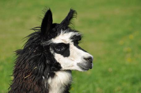
But you can't rely on such vague indications. With 90 active volcanoes in the country, unexpected eruptions are a phenomenon Chileans must learn to live with. The llamas seem to agree, grazing on a pasture beside the road. Watch out, they spit, warns Patricio. We inquire if we can spit back. He grins.
|
|
|
|
|
|
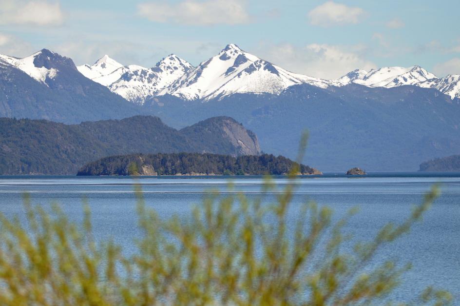
This leads us to Ensenada at the eastern end of Lago Llanquihue. It's a stunning location, precisely halfway between Osorno and Calbuco. On the eastern horizon, a third volcano, Puntiagudo, makes its presence known.
Six kilometres further, the road ends at the western end of Lago Todos Los Santos, the smaller sibling of Lago Llanquihue. Both lakes are separated by a narrow strip of land. However, this wasn't always the case. About twenty thousand years ago, they formed a large glacial lake, almost a hundred kilometres long. A volcanic eruption disrupted this, scattering lava blocks into the lake and creating the land bridge.
A volcanic eruption disrupted this, scattering lava blocks into the lake and creating the land bridge
Ensenada originated at this spot. In 1902, there was already a post to support trade caravans. However, this magnificent location has its downside. With every eruption of Calbuco, it takes its toll. Recently, in 2015, the area had to be temporarily evacuated.
Calbuco
Upstream, we follow the Río Petrohué over the isthmus. One might think that this river connects both lakes, but that turns out not to be the case. It bypasses Lago Llanquihue and flows southward, directly into the Pacific Ocean.
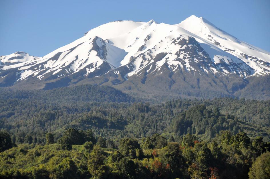
Almost unnoticed, we enter the Vicente Pérez Rosales National Park. We notice this by an information panel and an unmanned office next to the road. This is the oldest park in Chile, established in 1926. With an area of 2,530 km², it's just the size of the Grand Duchy of Luxembourg.
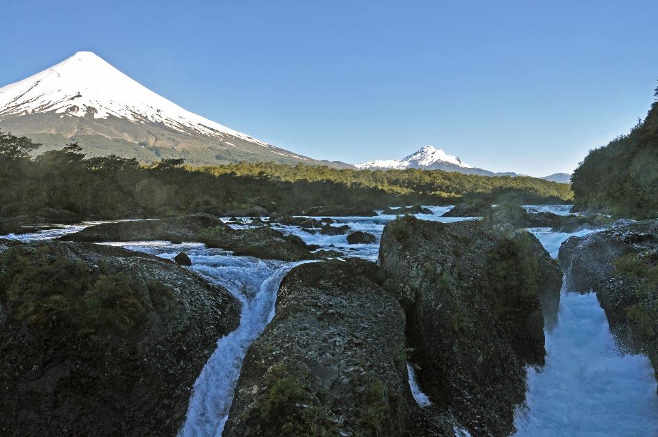
While Arnoldo takes our luggage to Petrohué to load it onto the boat – no time to waste – we stroll along a path down the slope to the river. There, the Petrohué Waterfalls await us.
It's as if a giant hand has generously scattered basalt rocks over the river. And in a sense, that's true
Vicente Pérez Rosales National Park – Petrohué Waterfalls
Río Petrohué, La Picada (on the left)
Hand over hand, the thunderous roar of the water increases as we approach. In the morning shadow of the mountains, the water plunges through four narrow channels. The drop is not very significant, but the enormous basalt blocks make it challenging for the river. They are scattered in a chaotic manner, as if a giant hand has generously scattered them over the river.
And in a sense, that's true. Because above this scene, the white Osorno plays the innocent against the backdrop of a steel-blue sky. However, it was about seven thousand five hundred years ago that he produced the fatal lava flow. The contact with the water caused it to solidify into the basalt blocks from which we now look down on the swirling water.
Meanwhile, Arnoldo has reappeared. He brings the news that the boat in Petrohué is delayed by an hour. It's not great news, but it gives us some extra time around the waterfalls. Time, for example, to stroll to the Laguna de los Enamorados, the Lagoon of the Lovers. It turns out to be a tiny lagoon, hardly worth the effort.
La Picada
Patricio points out another snow-covered volcano, the fourth one today. However, La Picada is not a real volcano. It's more the weathered remains of the caldera of a volcano that must have exploded long ago. But nature doesn't stop there. Because, precisely on that caldera, about twenty thousand years ago, the Osorno settled – like a new pimple on the Earth's crust.
Mirador La Maquina also offers beautiful views of the azure blue water that turns into foaming white between the basalt rocks. From the shore, we can observe four volcanoes – Osorno, Puntiagudo, La Picada, and Calbuco.
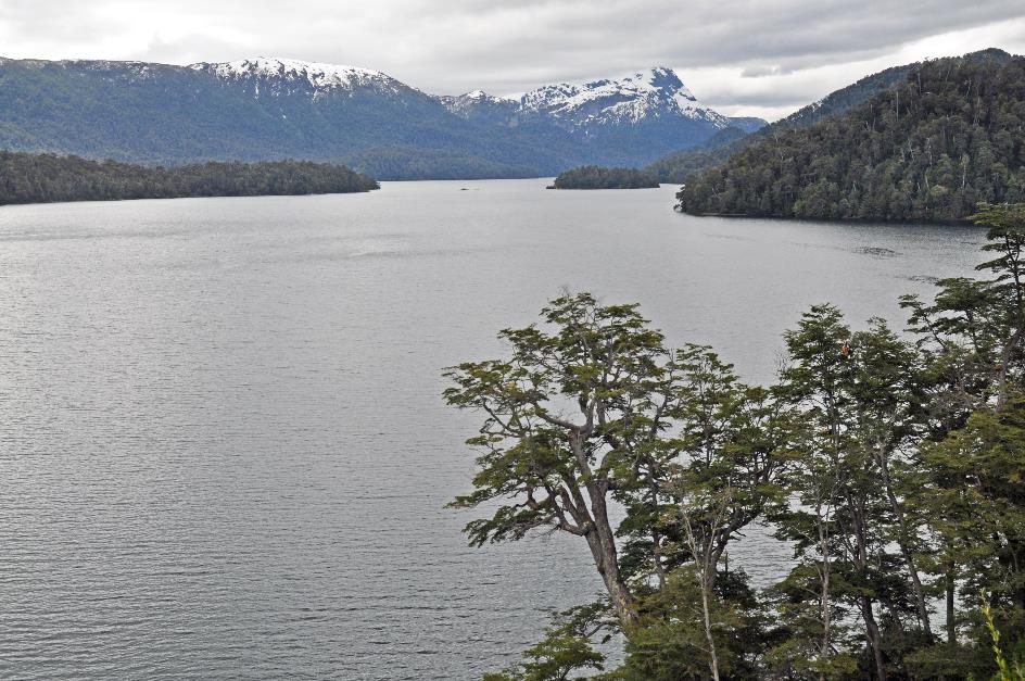
Just after eleven, we arrive in the tiny Petrohué on the western shore of Lago Todos los Santos. Jesuits 'discovered' this lake on November 1, 1670, hence its name. It is often called Lago Esmeralda because of its emerald green color on sunny days – like today.
Here, the road literally comes to an end. Only with a boat can we continue the journey
Here, the road literally comes to an end. Only with a boat can we continue the journey. The catamaran Lagos Andinos is almost ready to depart, waiting for us. Using a crane, the last of the twelve luggage containers, each about 2 m³ in size, is hoisted on board and securely strapped to the aft deck. Our suitcases are in there, we hope. We bid farewell to Arnoldo and Patricio.
Petrohué, Lago Todos los Santos, Osorno
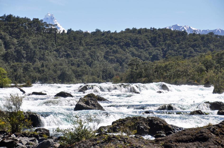
Just after half past eleven, the moorings are released for a journey of an hour and three-quarters. We leave Petrohué behind. Gradually, Osorno shrinks on the horizon. Other white peaks take its place. For example, the Puntiagudo, the Sharp Peak, a volcano that has not erupted for seven thousand years. In the past, its pointed summit was even sharper, but in 1960, an earthquake trimmed it a bit.
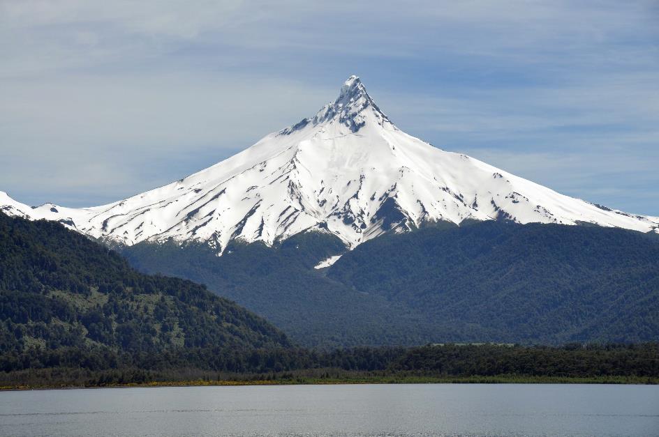
Puntiagudo
Thick, evergreen forests cover all the slopes. This is thanks to the frequent rains, as it rains three hundred days a year here. This results in 3,500 mm of precipitation. On average, one day out of six, it does not rain here – like today.
Lago Todos los Santos
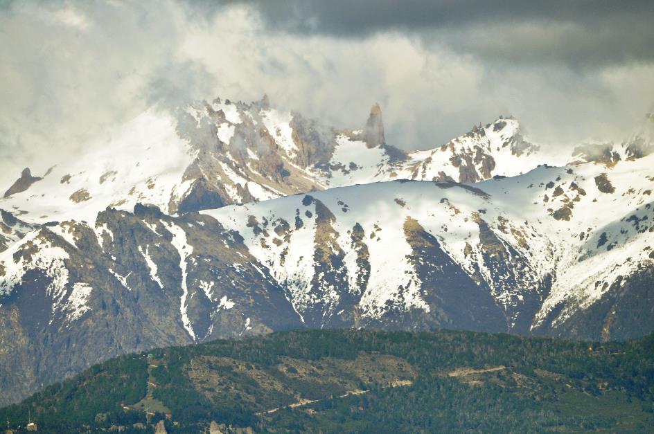
El Tronador, the Thunderer, shows itself for a moment. At 3,554 m, it is the highest mountain in the surrounding area. Its Tomez peak forms the border between Chile and Argentina. Seven glaciers cling to its slopes, but all seven are in decline.
El Tornador
Its name is due to the rumbling that regularly occurs when the earth on its slopes starts sliding or when seracs tumble down the glaciers. It used to be a volcano, but its last eruptions are already a million years behind us.
Río Peulla, El Tornador
It is quarter past one when we disembark in Peulla – a small place amidst the Andes, with about a hundred inhabitants mainly engaged in livestock and tourism. A bus is available, but we choose to walk to Hotel Natura. A fifteen-minute stroll in this beautiful nature suits us well. However, it backfires on us as we appear as the very last ones to arrive at the restaurant – everyone else took the bus. Our last Chilean pesos are spent, as the Argentine border is not far away.
Then Christian appears on the scene, our guide for the remainder of this journey. And a blue bus makes its entrance, driven by Elias. Christian calls him the best driver in Peulla and its surroundings – not exactly an Olympic achievement, it seems. Together with a German-Swiss group, we board.
Shortly after three, the bus finally sets in motion, wobbling along the unpaved road for a 27 km ride. The journey lasts precisely forty seconds before Elias stops in front of an inconspicuous building. This is the Argentine border post; our documents need verification. Shortly after, a truck appears with ten luggage containers securely strapped in its cargo bed. Apparently, it will lead the way for us.
Quickly, we retrieve our passports, and queue up for a stamp in our passports. However, we didn't account for one thing
Quickly, we retrieve our passports, check if we haven't lost our Tarjeta Unica Migratoria, and queue up for a stamp in our passports. However, we didn't account for one thing – a large group of tourists from Argentina has just arrived. They all stand in line on the veranda of the building. Inbound travellers, as it turns out, require a lot of paperwork, and the internet connection doesn't always cooperate.
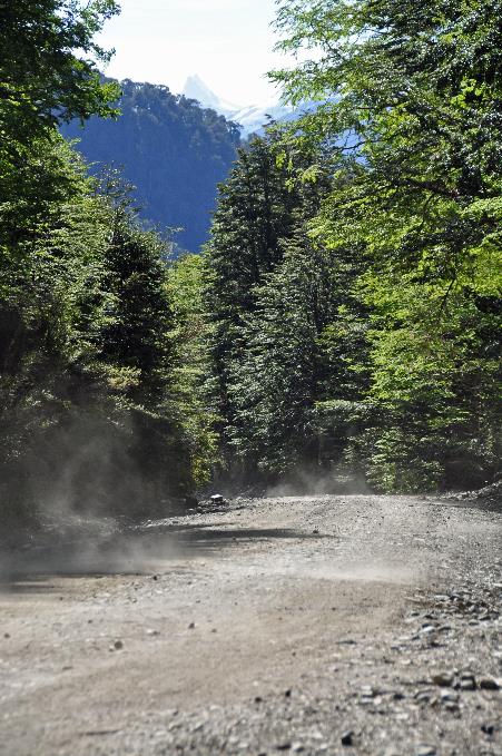
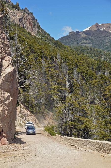
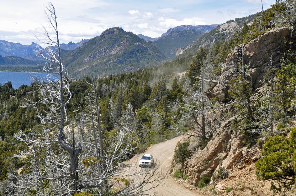
It's almost half past four when we continue our journey – with three more bus rides and two boat trips ahead. Through an imposing, densely forested landscape, we travel upstream along the Río Peulla. The gravel road is in poor condition but completely dry.
For kilometres, it feels like we are driving through a green tunnel where the bus barely fits. Crossing paths with another vehicle is literally impossible here. Fortunately, we encounter no oncoming traffic. Perhaps they have agreements about that?
|
|
Andean condor |
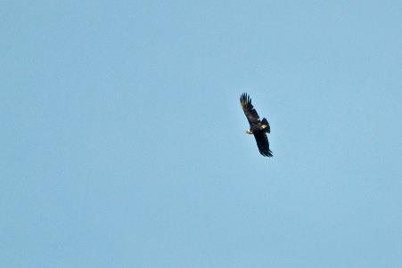
We make a stop at Cascada Las Mellizas. Christian has spotted an Andean condor, almost invisible high above our heads. Proudly, he reports that the wingspan of this scavenger is three meters, surpassed only by the great albatross. With its characteristic white collar, it distinguishes itself from the Californian condor.
Next, the Tronador makes its appearance. At the foot of one of its glaciers, Río Peulla is formed. The river carries glacier water to Lago Todos los Santos, giving the lake its emerald green color.
From a bridge, Christian points out a small waterfall, declaring it our last Chilean waterfall. With a hint of pathos, they named this bridge Puente del Despideda, the Farewell Bridge.
The climb to the highest point of Paso Pérez Rosales can now begin – from 340 to 1,000 meters above sea level. Occasionally, we catch glimpses below the trees of the shimmering stream of Río Peulla, meandering in its overly broad riverbed. If it rains here, driving must be a hellish experience. Could we have underestimated Elias as a driver after all?
Paso Pérez Rosales |
|
|
A dense forest of towering alerces covers the mountain ridge. You can almost compare this to a rainforest, says Christian. In the past, these trees were sought after as building material for the German colonial homes in Puerto Varas. Nowadays, these distant cousins of the sequoia are protected and may not be cut down.
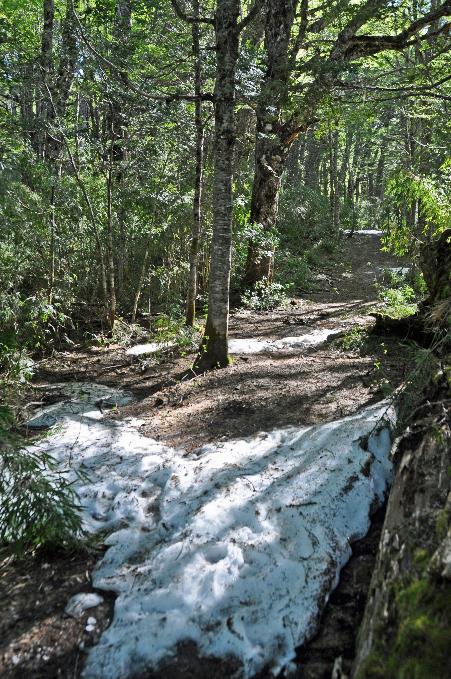
We reach the summit around half past five. Large patches of snow lie scattered between the trees. Technically, we are now in Argentina. You notice it immediately because the gravel road has become considerably worse.
By the way, Christian informs us that this road is also used in winter. Snowploughs keep the passage clear. It does take a bit more time to cover this route during winter, he adds somewhat unnecessarily. Our respect for Elias grows rapidly.
Lago Frías, El Tornador
Fifteen minutes later, we find ourselves on the shores of Lago Frías, surrounded by abundant greenery. Steeply forested rock walls descend like fjords to the turquoise water. This meltwater is supplied by the Río Frías from the glaciers of the Tronador. High above our heads, a few Andean condors tirelessly circle. There is a light cloud cover, but it is sunny.
An Argentine border office is the only form of human presence. Our suitcases have already been taken out of the containers. They undergo a random manual inspection. Then, under the supervision of Eduardo and Diego, they are placed on a conveyor belt aboard the waiting catamaran. Diego appears cheerful, wearing a light short-sleeved shirt, as if strolling on Copacabana Beach – not that of Lago Frías.
Apparently, Che Guevara and Alberto Granado also made use of this passage through the Andes in 1952
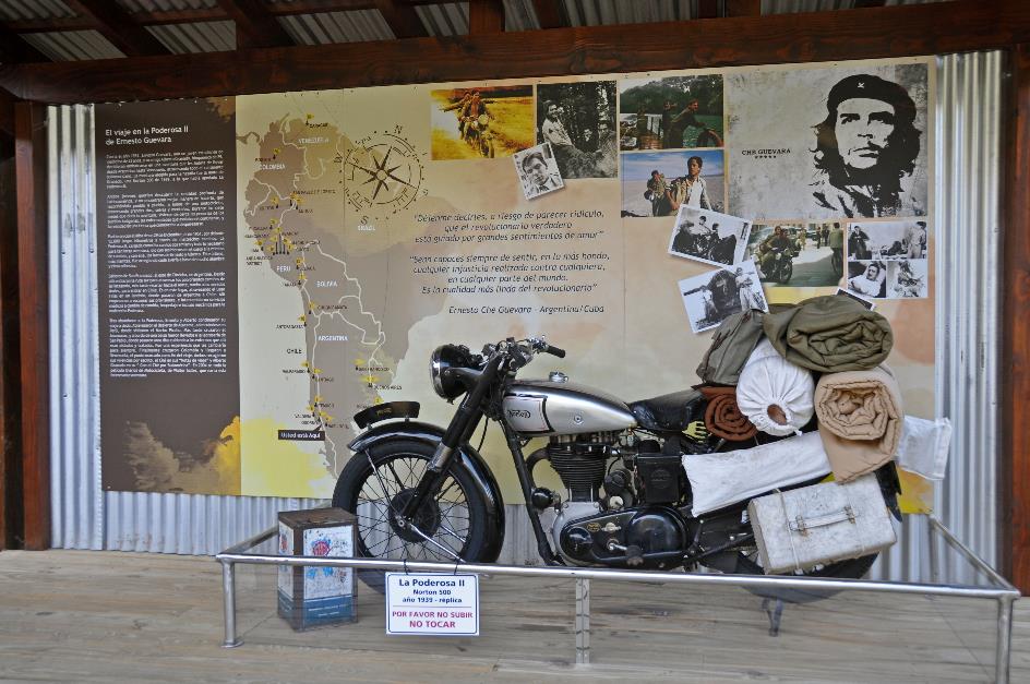
Poderosa II – Ernesto “Che” Guevara and Alberto Granado
Meanwhile, a small pavilion with some memorabilia catches our attention. There's a Norton 500, an identical motorcycle to the Poderosa II, the Mighty, with which Ernesto "Che" Guevara and Alberto Granado made their famous journey in 1952. For six months, they roamed through South America, covering a distance of twelve thousand kilometres. Apparently, they also made use of this passage through the Andes. In 2004, the movie The Motorcycle Diaries brought their adventure to life.
Eduardo explains that they were actually expecting us at four o'clock, not at six. They had to let the boat that was supposed to take us to our final destination in Bariloche depart earlier. No worries, the boat will return to pick us up, but it will be around eight o'clock.
Just after half-past six, our catamaran sets sail. It's a short voyage, barely fifteen minutes, as the oval-shaped Lago Frías is only four kilometres long. Two buses and a truck await the travellers and their luggage on the pebble beach of Puerto Alegre.
It's only a three-kilometre bus ride to Puerto Blest. There, we'll have to wait for an hour for the boat. Two beautiful ashy-headed geese provide some entertainment.
A large catamaran, the Gran Victoria, finally appears just after eight o'clock. The luggage swiftly goes under sail on the foredeck. Barely twenty minutes later, we set sail. On the left, Isla Centinela slides by, the island where Perito Moreno is buried.
In complete darkness, we dock at Puerto Pañuelo, the Handkerchief Harbour on the shores of Lago Nahuel Huapi. A well-oiled machine now comes into operation. Half a dozen numbered buses are ready to depart. It takes no more than fifteen minutes to get over a hundred passengers with their correct luggage on the right buses.
Welcome to Argentina, says Gonzalo, our third guide today, while Martín, our fourth driver today, quickly sets course for Bariloche. Just after ten, he drops us off at the door of our hotel.
À la carte dining is the rule here, and the late hour doesn't change that. But it must be said, the dishes are served promptly. We willingly succumb to the Andean cheese soup with spicy shrimp – a surprising but tasty combination.
Sunday, November 12 | Nahuel Huapi NP
San Carlos de Bariloche has a population of one hundred and five thousand inhabitants. They refer to it as the Switzerland of South America, Gonzalo remarks. Many houses seem to have been plucked right out of Switzerland or Germany.
Continuing his story, Gonzalo mentions a recent trend: microbreweries. While driver Hugo navigates the weathered concrete of the bustling main street, Gonzalo explains that almost every month a new microbrewery opens, bringing the current total to 35. In addition to beer, the local chocolate is also widely renowned. In our opinion, Bariloche is more like the Belgium of South America than Switzerland or Germany.
Vuriloche was the term the Mapuche used to refer to this region from the other side of the Andes. It means people behind the mountains, and Bariloche retained its current name from that reference.
Immigrants of German, Swiss, and Italian origin laid the foundation for the alpine atmosphere in the town
Once again, it was a German, Carlos Wiederholt, who became the first Westerner to settle here in 1895. Subsequently, immigrants of German, Swiss, and Italian origin followed, solidifying the alpine atmosphere in the town.
Formally, the founding of Bariloche took place in 1902. However, it wasn't until the arrival of the first train in 1934 that the city received its true boost. This railway connected Bariloche directly to Buenos Aires, covering a distance of 1,600 km that took about forty hours to traverse. A gruelling journey, indeed, but it didn't deter tourists from Buenos Aires.
In the 1990s, long-distance train journeys became financially unviable, leading the Argentine government to abolish them. Now, the only available train route is the weekly journey to Viedma, the capital of the Río Negro province, which is still 800 km away. The trip takes eighteen hours and requires a lot of patience, with stops in the most inconspicuous settlements in the Patagonian steppe along the way.
Last season, the region experienced the best snowfall in the last twenty years
Bariloche at the foot of Cerro Cathedral
Tourism is the focal point in Bariloche, not only in the summer but also in the winter. The presence of the white snow-capped peaks rising behind Bariloche contributes to this. It is the largest ski resort not only in Argentina but in all of South America. Gonzalo points in the distance to Cerro Cathedral. Its numerous sharp peaks give it the appearance of a Gothic cathedral.
The ski resort is particularly popular among Brazilians, but Argentinians also flock here in winter. Last season even saw the best snowfall in the last twenty years recorded. Additionally, the lowest temperature ever was noted, reaching –21 °C (–6 °F). Even at the end of the season, there is still more than two meters of snow – a paradise for skiers.
Cerro Cathedral
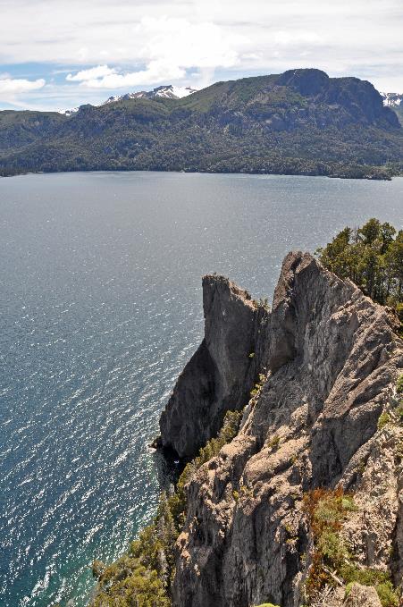
But that is not why we have come. Gonzalo has in store for us the Circuito Grande, a journey of over two hundred and fifty kilometres through the Parque Nacional Nahuel Huapi. It is the oldest national park in Argentina, established in 1903 by Perito Moreno. With an area of 7,172 square kilometres, it is approximately three-quarters of the size of the island Cyprus.
La Cuarenta has a status comparable to that of Route 66 in the United States
It is sunny and warm this morning, with only a bit of chill brought in by the wind. We briefly follow Ruta 40, a national icon known as La Mítica Ruta de Argentina, with a status comparable to that of Route 66 in the United States. La Cuarenta traverses Argentina from the far north to the deep south, spanning 5,191 km, making it the country's longest road. Its highest point is 5,000 meters above sea level – surpassed only by the Himalayas.
Along the lake's shore, Ruta 40 takes us through Dina Huapi, an inconspicuous village of almost four thousand inhabitants. In the Mapuche language, it means Danish Island. Unlike Germans, it was Danes who were the first Westerners to settle here. With a bit of imagination, you can see it as an island, as the village is enclosed by the lake and two rivers. Tiny chapels of Guachito Gil reappear along the road.
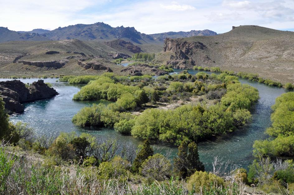
Later, we leave Ruta 40 behind and follow the Limay downstream through its broad valley. It is a mighty river, carrying the crystal-clear water from Lake Nahuel Huapi to the Atlantic Ocean. Along the way, it powers five hydroelectric power stations, totalling 4,100 MW.
Like a gigantic amphitheatre, the mountains embrace a meander of the river
Valle Encantado – Limay, Anfiteatro
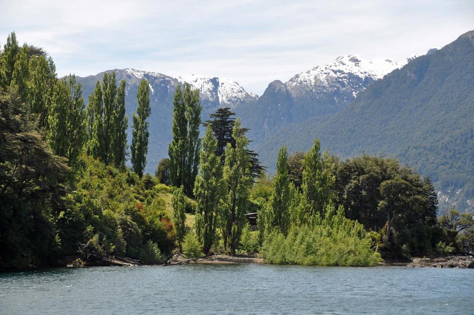
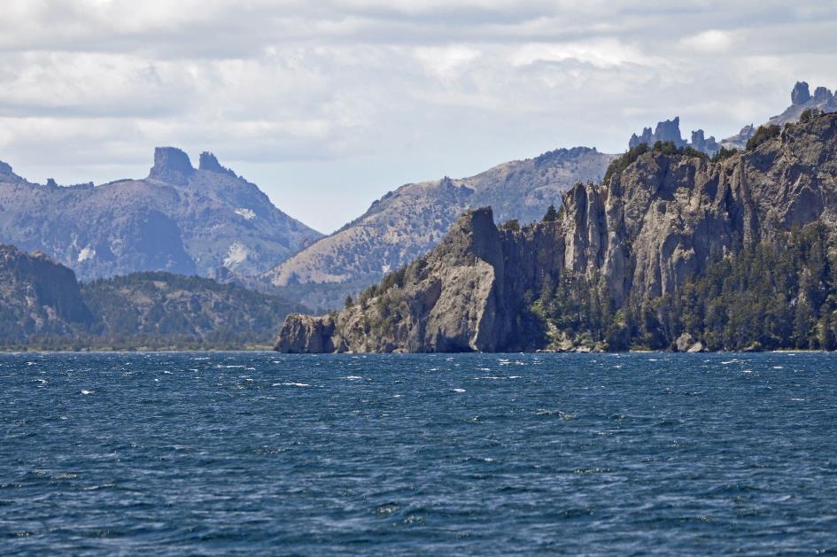
It's not the river but an actual glacier that carved out this broad, U-shaped valley. This colossal work of nature was completed some 22,000 years ago. We can witness the beauty it has produced with our own eyes in the Anfiteatro. Like a gigantic amphitheatre, the mountains embrace a meander of the river. Willows and poplars thrive along the shore, while the barren slopes are adorned with steppe vegetation. Here and there, rugged rock formations resist the forces of erosion.
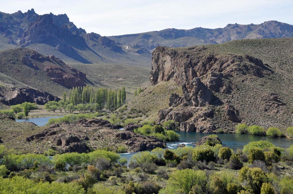
Valle Encantado
All those poplars along the river manage to impart an exotic touch to the otherwise barren landscape. They are, in fact, imported specimens. In just thirty years, they have matured into robust windbreakers, a feat that the local cypresses take nearly seventy years to achieve.
Valle Encantado
They call this valley Valle Encantado, because of its marvellous rock formations. For a brief moment, an Andean condor makes itself noticeable high above our heads. These condors have their nests in small cavities high on the cliff walls, easily recognizable by the white streaks of excrements below the opening.
The impact of the eruption of the Chilean Puyehue-Cordón Caulle was felt here in 2011. A layer of ash, 25 cm thick, settled over the region. The Bariloche airport had to close due to this eruption. All tourists had to be evacuated overland.
Lago Trafúl
Where the Trafúl flows into the Limay, Hugo takes an unpaved road, and we enter the Parque Nacional Nahuel Huapi. Upstream, we now follow the fast-flowing Trafúl. In the mountains the snow is melting, the water in the river is very high.
Originally, the Tehuelche, the giants who made a significant impression on the Spaniards, lived here. As nomads, they hunted guanacos and birds and lived in caves. Rock drawings up to 2,000 years old have been found, depicting hunters chasing guanacos, but also addressing abstract themes.
Gonzalo attributes this to the Conquista del Desierto, the ruthless campaign carried out by the Argentine army to ‘clear’ the steppe of indigenous people
However, nowadays, you will find very few descendants of the Tehuelche in Argentina. Gonzalo attributes this to the Conquista del Desierto, the ruthless campaign carried out by the Argentine army between 1878 and 1883 to ‘clear’ the steppe of indigenous people. But alcohol and infectious diseases introduced by the Europeans also took their toll.
Covering six thousand hectares (15,000 acres), La Primavera is a ranch that belongs to Ted Turner, the founder of CNN. He gifted himself this farm about twenty years ago. Since then, he shows up every April to do some fishing. The water is then at its coldest, and the fish swim close to the water's surface.
Ruta 65 |
|
Mirador Del Viento |
Shortly after noon, we reach Lago Trafúl, at an altitude of 750 meters above sea level. This is where the Trafúl River originates. Nahuel Huapi boasts more than three hundred lakes, but only in this lake will you find salmon. They were introduced here by Europeans. They opted for sebago, a subspecies of the Atlantic salmon that thrives in freshwater. Because a salmon that immediately heads to the sea and only returns for spawning is not very useful for sport fishing.
Lago Trafúl
Gradually, the unpaved road now climbs above the lake. Mirador Del Viento certainly lives up to its name – you are almost blown off your feet. It's a bitterly cold wind, with air that has significantly cooled in the west between the mountains and is driven upward against the steep cliff wall here.
Mirador Del Viento certainly lives up to its name – you are almost blown off your feet
Mirador Del Viento
But the windy ascent is worth it. From an elevation of 102 meters, we can almost survey the 38 km long lake in its entirety. The sun shines abundantly, and the faint clouds pose no challenge to its radiance. The shallow water at the shore is astonishingly azure-blue.
About five kilometres further, a few houses appear, a stretch of paved road, and even a paved footpath. This must be Villa Trafúl, a village of 400 inhabitants on the shore of the lake with the same name.
When Nahuel Huapi was created as a national park in 1934, it was not an uninhabited area. However, those who lived there had their rights respected. Keeping livestock, cutting down a tree, building a home, setting up tourist bungalows – in principle, it is all possible. But the government must grant permission in advance. Agriculture, on the other hand, is entirely prohibited.
The rest of the year, chopping wood is one of the main activities for the residents
|
|
Villa Trafúl – Church |
Villa Trafúl has seized its opportunities. If you come here in January or February, you can hardly move through the crowds. They flock in large numbers from Buenos Aires, attracted by the many outdoor activities – camping, fishing, horseback riding, rafting, and more.
The rest of the year, it's a relatively calm atmosphere. Chopping wood is then one of the main activities for the residents. They don't need a mayor. If problems arise, they are resolved through mutual agreement. According to Gonzalo, from Monday to Friday, the children stay in what he calls a school hotel and what we all know as a boarding school.
All the streets are named after birds. Restaurant Ñancú Lahuén, on the other hand, is named after a flower, specifically the valeriana carnosa, a fleshy valerian with medicinal properties. We savour an excellent salmon trout there.
Hardly have we left Villa Trafúl behind, when the asphalt gives way to gravel once again. Yellow broom, introduced by European immigrants in the past, is in bloom along the trail. Day-trippers enjoy their sunny Sunday here and there.
Dense forests have taken over the scenery. It's a world of difference from this morning when we were surrounded by a dry steppe landscape.
You might think these coihues are weaklings, but nothing could be further from the truth
Coihue (false beech) |
|
Puerto Arrayán |
The evergreen coihue is ubiquitous here. It's a false beech, like the lenga and the ñire from Tierra del Fuego, but a sizable one. It can reach a height of forty meters, and some specimens are 300 years old. Its wood is highly suitable for furniture and construction work, but here in the park, the trees are protected.
Many trees lie broken, either due to the intense wind or simply due to old age. You might think these coihues are weaklings, but nothing could be further from the truth. They have been around for over 160 million years. They even existed in Gondwana, the supercontinent from which Australia, Africa, and Antarctica emerged. That explains why distant relatives of the coihue can be found as far as in Australia, New Zealand, and New Caledonia.
Lago Espejo
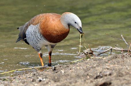
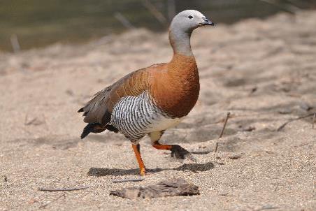
Shortly before three, we reach Puerto Arrayán. It's nothing more than a campsite at the western end of Lake Trafúl. A pair of ashy-headed geese stroll along the beach. Until a bird of prey appears high above our heads. Promptly, the ashy-headed geese make a hasty retreat.
Ashy-headed goose (f) |
|
Ashy-headed goose (m) |
But it's the arrayán that particularly interests us, the Chilean myrtle. The whimsically shaped, pale-brown tree is said to have served as a model for the forest where Walt Disney brought Bambi, the white-tailed deer, to life. Gonzalo immediately dismisses our expectations with a laugh. Expecting to see an arrayán in Puerto Arrayán is rather naive. For that, you have to wait until Villa La Angostura.
Expecting to see an arrayán in Puerto Arrayán is rather naive
Layers of ash remind us once again of the 2011 eruption. Everyone had to wear a dust mask back then, Gonzalo recalls. The economic damage was immense, especially hitting the tourism industry hard. Livestock, too, suffered severe blows. Grazing cows not only ingested food but also ash, and many perished. However, no corpses of wild animals were found. The reason is obvious – they could escape, unlike their domestic counterparts that were confined.
Bamboo grows conspicuously in various parts of the forests. Its origin lies in the tropical period that Patagonia experienced 65 million years ago. The stalks are not hollow inside, as one might expect, but solid.
These bamboo plants produce seeds only once in their lifetime, typically after about seventy years. It seems as if all the plants in a certain region coordinate this, as they simultaneously bloom and then die. This leads to fields full of dead bamboo sticks, with new young plants in between.
About four years ago, this happened in Bariloche. Bamboo plants died en masse, leading to unexpected consequences. A horde of rats was attracted to this massive supply of decaying organic material.
Although these rats quickly succumbed to acute bulimia, their brief presence was enough to spread infectious diseases. They carried the hantavirus. While it did not reach epidemic proportions, fortunately due to not many infections, those unlucky enough to be infected faced a high mortality rate.
Especially when the rats had been in a closed space during the winter, the risk was significant. Because the hantavirus could survive in that closed space even without rats. Anyone entering their summer residence without a mask could pay for it with their life.
Anyone entering their summer residence without a mask could pay for it with their life
Meanwhile, Hugo gradually climbs away from Lake Trafúl. Beside the road, Gonzalo points out a handful of Mapuche houses. About forty thousand Mapuche people still live in Argentina, and half a million in Chile. They are relatively small people, especially when compared to the Tehuelche, the 'giants' that impressed Magellan.
However, neither the Incas nor the conquistadors ever subdued the small Mapuche. The Argentine army, on the other hand, succeeded. Moreover, during the Conquista del Desierto, it was close to wiping out the Mapuche. Not everyone saw this government initiative as civilizing the steppe; some outright called it genocide of the local population. The 'conquered' land was given to white settlers – usually friends of the government. It would develop into Argentina's granary, contributing to the golden years around the turn of the century.
To this day, the marginalization of the Mapuche continues, Gonzalo sighs, as we reach the 930-meter-high pass just after half-past three. The Mapuche's attempts to repurchase thousands of hectares of land from Benetton have been in vain. Benetton had bought the land in the 1990s for sheep farming.
Santiago Maldonado disappeared without a trace until his body was found in the Chubut River on October 18
In 2016, the Mapuche resorted to occupation. A few months ago, on August 1, the Gendarmerie put an end to it. One of the protesters, Santiago Maldonado, disappeared without a trace. ¿Dónde está Santiago Maldonado? was the question that gripped the whole country for almost three months until his body was found in the Chubut River on October 18. Fifty-five experts were involved in the autopsy, Gonzalo emphasizes. Yet, the how and why of his death remain unresolved.
Five minutes later, we reach the comfortable Ruta 40 or the Camino de los Siete Lagos, as this stretch is called – The road of the seven lakes, because lakes abound here. To the left, one of those lakes already appears, Lake Correntoso.
The farmers who inhabited the estancia in this valley were clever, Gonzalo knows. After the eruption of Puyehue-Cordón Caulle, they didn't hesitate to sell all their cattle. Cows grazing themselves to death on volcanic ash – that didn't happen to them.
Mirador Lago Espejo
Just before four, we stop at Mirador Lago Espejo. When Enrique Wolff – the explorer, not the footballer – showed up here in 1895, he was quite impressed by the perfect reflection on the flat water. So much so that he came up with the name Mirror Lake.
Today, there is little evidence of that. Grey rain clouds have taken control and driven away the sun. The brisk wind has crinkled the water surface into ripples. A few day-trippers are kayaking.
Lago Espejo – Bamboo |
|
Villa La Angostura – Quetrihué – Arrayán tree |
Via Ruta 40, we continue our journey southward. To the right, the familiar Lake Nahuel Huapi makes its appearance, while to the left is Lake Correntoso. Like through a funnel, we drive towards the narrow isthmus between the two lakes, barely three hundred meters wide.
Rio Correntoso cuts through this isthmus, connecting both lakes. It's an excellent spot for fly fishing, according to Gonzalo. Indeed, in 1948, a woman here managed to catch a trout weighing an impressive sixteen kilograms. Now, that seems like a thing of the past, with fishermen settling for catches of no more than two to three kilograms.
And so, we enter Villa La Angostura, with its population of fifteen thousand, founded in 1932. They call themselves the Jardín de la Patagonia, the Garden of Patagonia, surrounded as they are by forests, lakes, and mountains. The alpine atmosphere, reminiscent of Bariloche, is palpable among the wooden buildings. A crowd of tourists is also present.
Finally, we will see it – the famous arrayán that inspired Disney. Gonzalo leads us to the Quetrihué Peninsula. In Mapuche, it means the Place of the Arrayán. However, it's a bit disappointing – there's exactly one arrayán. Gonzalo assures us that a complete forest can be found here, but it's at the very end of the peninsula, a walk of more than ten kilometres.
So, we'll have to settle for this one, rather modest specimen
So, we'll have to settle for this one, rather modest specimen. The Chilean myrtle is a peculiar tree, with its smooth, orange-brown bark, twisted trunk, and irregular branches. It grows only about twenty centimetres annually and never exceeds 20 meters in height. However, it can easily live to be a hundred years old. In late summer, beautiful white flowers appear among the foliage, and in the fall, blue, edible berries follow.
You can still pick up feather-light pumice stones on the beach of Bahía Brava. After the eruption of 2011, the bay's water was filled with them. Day-trippers sit on the beach, enjoying a quiet Sunday afternoon. Some stand in the rather cold water, but swimming seems out of the question.
Further along the beach lies Hotel Los 3 Mosqueteros. Nothing special, except that it is operated by a Belgian, Michel Raemdonck. However, it is his brother, Jean-Pierre, born in 1938 in Brussels and settling in this region in 1960, whose name captures the imagination. They call him the pioneer of Cerro Bayo. He almost single-handedly developed the ski resort in the nearby mountains in the 1960s. It was by no means easy because Villa La Angostura was still a very remote place at that time. Even the trip to Bariloche used to take four days – on horseback.
Even the trip to Bariloche used to take four days – on horseback. It now takes us precisely an hour and a half
Just after half-past five, driver Hugo initiates the return trip to Bariloche. Meanwhile, the sun has once again broken through the clouds. It takes us not four days, but precisely an hour and a half to reach the sunny Bariloche via the excellent Ruta 40.
Monday, November 13 | Bariloche – Buenos Aires
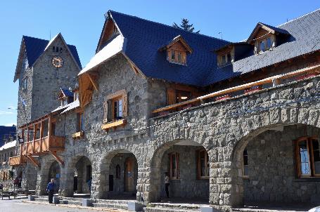
It's another radiant morning, with an almost cloudless, blue sky. We have a few hours left before returning to Buenos Aires. Enough time to briefly explore Bariloche, starting with the Centro Cívico, the historical centre of the city. It's a unique piece of heritage, recognized as a national monument since 1987.
Bariloche – Centro Cívico
Comfortably basking in the generous sun, the modest government buildings showcase a very distinctive style. Architect Ernesto de Estrada achieved this by using exclusively local building materials – tuff stone for the walls, slate for the roofs, Fitzroya wood for windows, doors, and balconies.
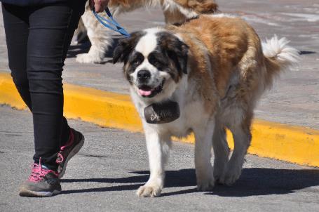
If we wish, we can take a photo with Brenda and Pedro. The alpine atmosphere is well exploited here. The two Saint Bernard dogs, along with their owners, patiently wait for photo opportunities. The obligatory barrel dangles beneath their chins – although we might doubt it contains brandy.
If we wish, we can take a photo with Brenda and Pedro – two Saint Bernard dogs
Saint Bernard dog |
|
Pañuelos blancos |
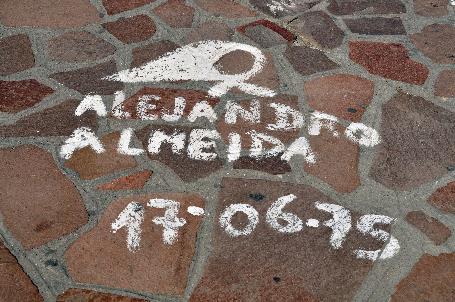
Distinctly Argentine are the white headscarves painted everywhere in the square, following the tradition of Plaza de Mayo in Buenos Aires. Each one bears a name and a date, commemorating one of the many individual tragedies – Alejandro Almeida 17-06-75, Santana Alcaraz 1976, Mauricio Weinstein 1978, ...
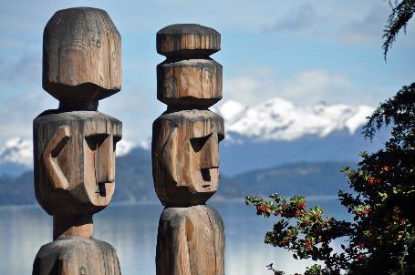
Consistently, they gaze eastward, where every morning they see Antü rise, the most significant of the Pillán, the benevolent spirits
Bariloche – Chemamüll |
|
Bariloche – Centro Cívico |
The square opens onto the lake. The soft blue water lies calm, like a weathered mirror that slightly blurs shapes and colours. Across the lake, snow-covered slopes sharply contrast against the deep blue sky.
In the 1950s, Juan Perón wanted to secretly build one of the world's first nuclear fusion reactors on that island
Lago Nahuel Huapi – Isla Huemul
On the left in the distance, we can just make out Isla Huemul, the island where Juan Perón secretly planned to build one of the world's first nuclear fusion reactors in the 1950s. A piece of madness, it cost a fortune and was doomed to fail from the outset. Nowadays, as a tourist, you can visit the ruins of the infamous installations.
Along the path, two wooden figures emerge. Larger than life, these stylized representations of a man and a woman are called Chemamüll by the Mapuche. They consistently face east, where they see Antü rise every morning – the most important of the Pillán, the benevolent spirits.
However, the cosmology of the Mapuche has long yielded to the Christianity brought by missionaries who appeared on the scene from the 17th century onwards, often meeting martyrdom.
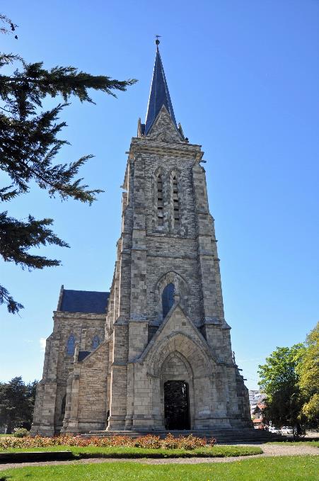
This is abundantly evident in the Catedral Nuestra Señora del Nahuel Huapi, impressive in its simplicity. The building was erected in 1946, entirely in the style of the Centro Cívico, with walls of natural stone without any plasterwork.
Catedral Nuestra Señora del Nahuel Huapi |
|
Stained glass window – 'Indians' killing missionary |
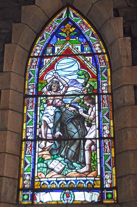
Multicoloured sunlight pours abundantly through the numerous contemporary stained glass windows. The depiction of ‘Indians’ killing a missionary is not absent among the scenes, but in vain, one searches for soldiers killing Indians.
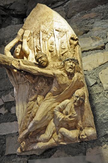
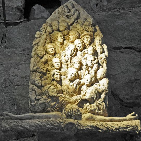
Stations of the Cross – Jesus falls the third time |
|
Stations of the Cross – Jesus dies on the cross |
Contemporary is also the highly original Stations of the Cross that adorns the walls. When Veronica wipes the face of Jesus, she wears precisely the same headscarf as Mother Teresa. When Jesus falls the third time, his fall seems to be broken by a man with glasses – undoubtedly a well-known local figure. As Jesus dies on the cross, we, along with him, look down from a bird's-eye view at his many followers who gaze up at him in despair...
It will be a short ride to the airport, barely 13 km. Tonight, at half-past eight in Buenos Aires, immediately after our landing, an introduction to the Argentine tango is on the agenda. We don't have much time to spare.
It's quarter to three when Lucas and Gonzalo drop us off at the Aeropuerto Internacional de Bariloche Teniente Luis Candelaria – a mouthful for a modest runway surrounded on all sides by the steppe.
Today, the pilots of Aerolíneas Argentinas in Buenos Aires had a meeting, Gonzalo informs us. An aftermath of the strike on October 31, apparently the negotiations are not yet concluded. It doesn't concern us directly, except that pilots don't fly when they have meetings. Consequently, a series of flights, including ours, is delayed.
An hour and fifteen minutes late, the Boeing 737-800 of Aerolíneas Argentinas takes off above the steppe. Our introduction to the tango seems to be written off, flashes through our minds, while below us, one of the hydroelectric power plants on the Limay River slides past.
Jaak Palmans
© 2024 | Version 2024-01-29 14:00
Continue reading in (7/7)