All alone in the world
USA – Canada | Anno 2005
Thursday, July 21 | Skagway – Whitehorse
Friday, July 22 | Whitehorse – Dawson City
Thursday, July 21 | Skagway – Whitehorse
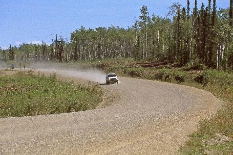
Only in August 1978 was the asphalt road over White Pass opened to traffic. This Klondike Highway is one of the few ice-free passages from the Panhandle to the Canadian interior. We gladly take advantage of it to continue our journey to Whitehorse and Dawson City. Posts along the road mark the route. They are tall enough to do their job even in a three-meter snowfall.
It takes about an hour before we reach the U.S. border post. There, they don't put any obstacles in our way. Leaving the USA is just much easier than entering. Climbing higher through no man's land, the slopes on either side become increasingly barren. Fortunately, the weather doesn't get worse in the meantime. It doesn't even rain anymore, but the granite mountain peaks remain impervious, hidden behind the clouds.
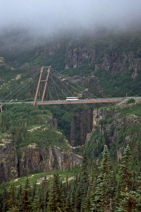
To prevent earthquakes from damaging the cable-stayed bridge, it is anchored only on the southern shore in the rocks
Cable-stayed bridge William Moore |
|
Tormented Valley |
Later, the William Moore Bridge1) emerges, named after the visionary pioneer. It is a modern cable-stayed bridge that spans the deep gorge where the William Moore Creek winds its way through. Earthquakes or landslides can occur along this fault line. To prevent them from damaging the bridge, it is anchored only on the southern shore in the rocks.
In dense fog, we cross the highest point of the pass at 988 meters. Technically, we are now in Canada, specifically in the province of British Columbia. We set our watches one hour ahead because the time difference with Belgium is now only nine hours. The fact that we are in Canada is currently only evident from the garbage bins in the parking lots, which bear both English and French inscriptions.
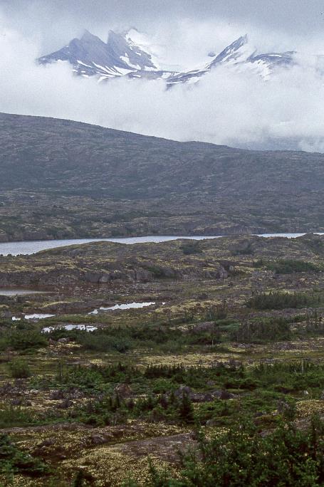
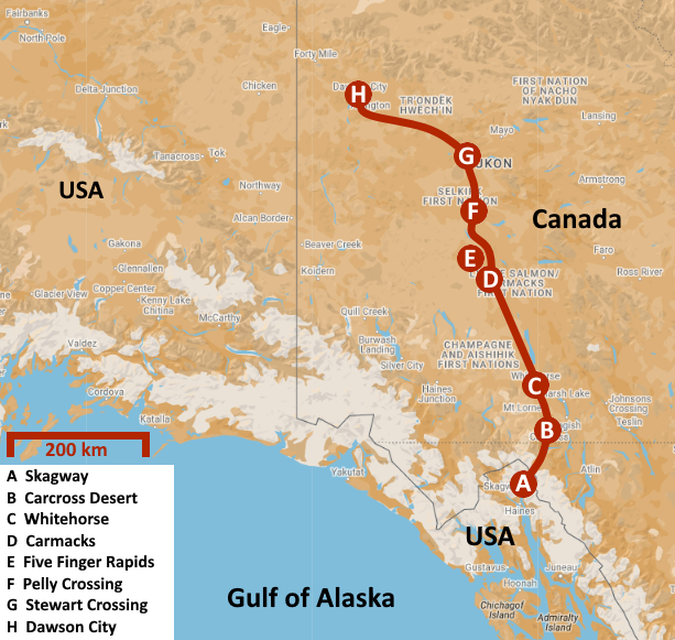
Summit Lake
As the name suggests, the picturesque Summit Lake is near the top of the pass. A unique landscape unfolds before our eyes. It is sometimes called The Tormented Valley, a subarctic alpine tundra with weathered rock formations, abundant lichens, sparse shrubs, solitary firs, irregular lakes, and in the distant background, snow-capped granite peaks. Like pearls on the necklace called Tutshi River, the lakes follow one another – Bernard Lake, Shallow Lake, Maud Lake.
After more than twenty-five kilometres of rugged nature, we finally reach the end of no man's land. The Canadian border station is located in Fraser. They want to know if we have alcohol, drugs, or weapons on board. We manage to convincingly deny it, so we can continue our journey on Canadian territory just seven minutes later. Shortly after four o'clock, we cross the 60th parallel. This means we are entering the Yukon Territory because this imaginary line forms the border with the province of British Columbia here.
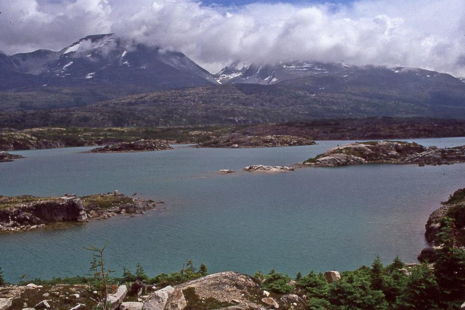
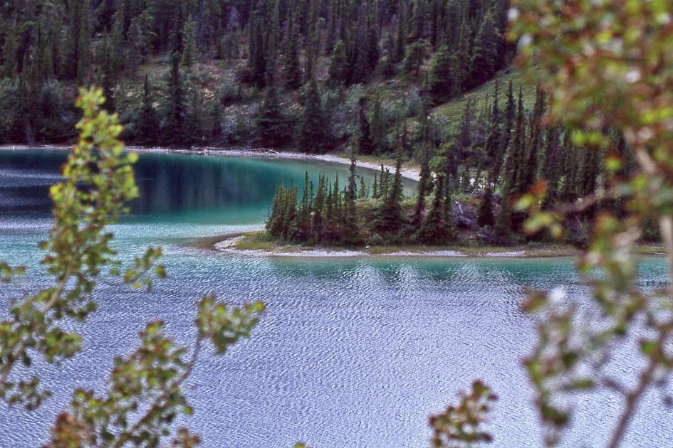
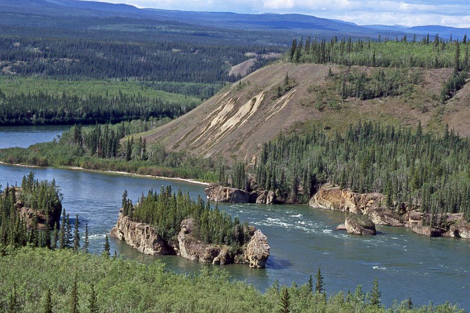
They call it the smallest desert in the world, a few hectares of sandy soil in Carcross
They call it the smallest desert in the world, a few hectares of sandy soil in Carcross. Once covered by a glacier, this area was previously the glacier lake. Nowadays, a cold wind almost permanently sweeps across this harsh landscape from Bennett Lake. This constant wind is said to prevent vegetation from taking root. It is indeed a peculiar sight, this piece of Sahara in the tundra.
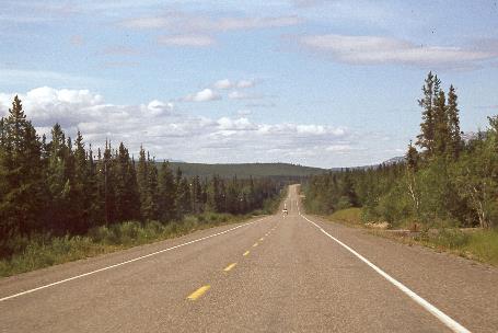
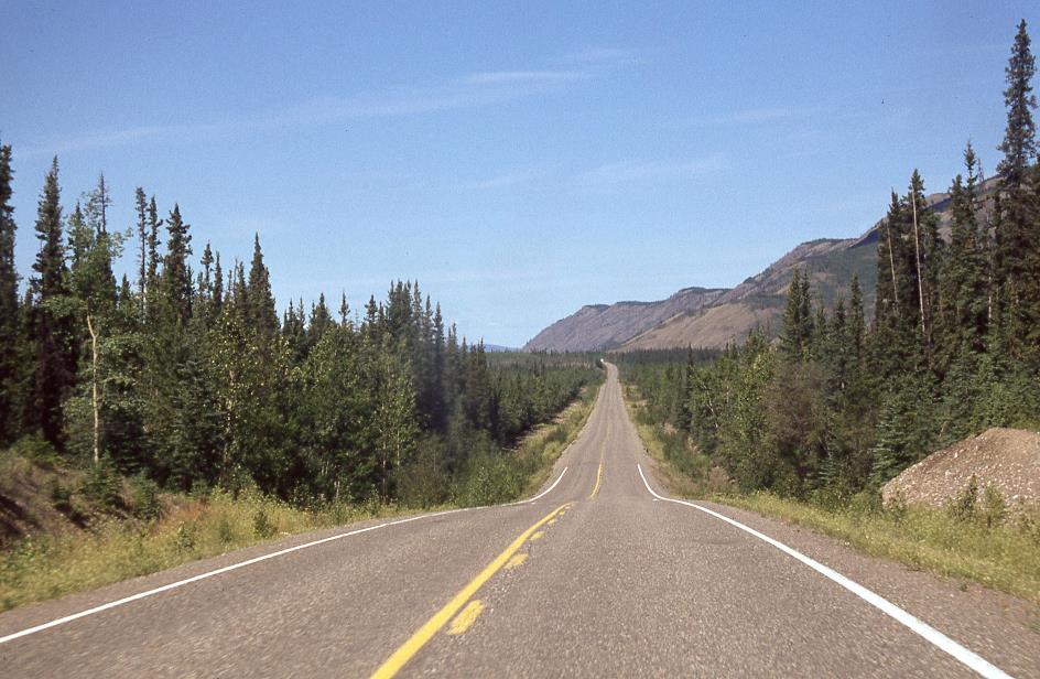
Klondike Highway
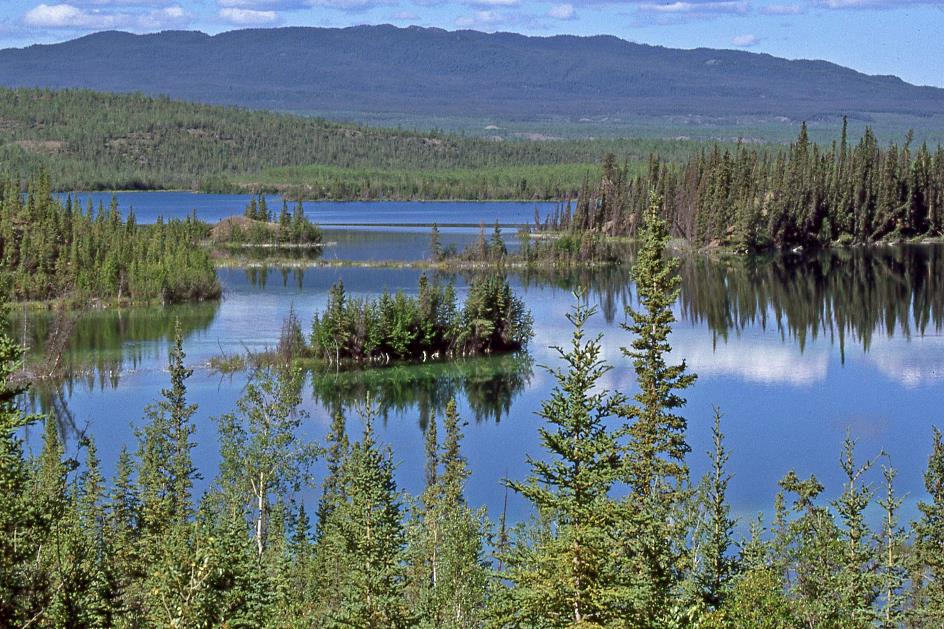
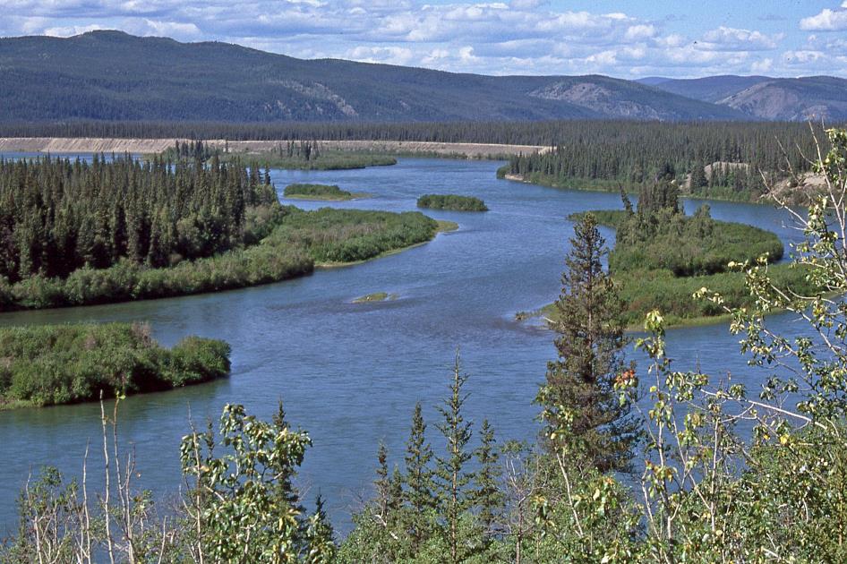
Equally remarkable is the tropical green water of Emerald Lake. Here too, you can point to a glacier as the culprit. Not only did it carve out this basin some 14,000 years ago, but it also deposited the limestone gravel that had been released by erosion from the nearby mountains. Mixed with clay, this formed a layer of calcium carbonate, a type of marl. The reflection of sunlight on the bottom of white marl gives the intense green colour in the shallow water. We can fully enjoy this spectacle as it is now quite sunny. The temperature even reaches almost 20 °C (68 °F).
Emerald Lake
Through a seemingly endless backdrop of spruce forests, the southern section of the Klondike Highway intersects with the Alcan, the Alaska Highway. The only overland connection between Alaska and the Lower 48 is this asphalt ribbon of 2,200 km, mostly over Canadian territory, stretching from Delta Junction in Alaska at one end to Dawson Creek in Canada at the other.
However, our acquaintance with it will be short-lived. We will follow the Alcan for just over thirty kilometres before continuing our journey on the northern section of the Klondike Highway. But first, we will rest for a night in Whitehorse. Because tomorrow awaits us a challenging ride. We will cover the 540 km that still separate us from Dawson City.
Friday, July 22 | Whitehorse – Dawson City
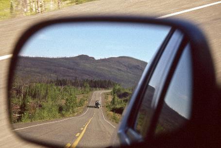
Twelve oncoming vehicles over a distance of eighty kilometres, a small sample teaches us. It's not surprising. With an area of 483,450 km², the Yukon Territory is almost as large as France. However, the territory has only about 31,000 inhabitants, with more than half of them residing in the capital, Whitehorse. In theory, each resident of Yukon has almost 16 km² at their disposal.
Klondike Highway |
|
|
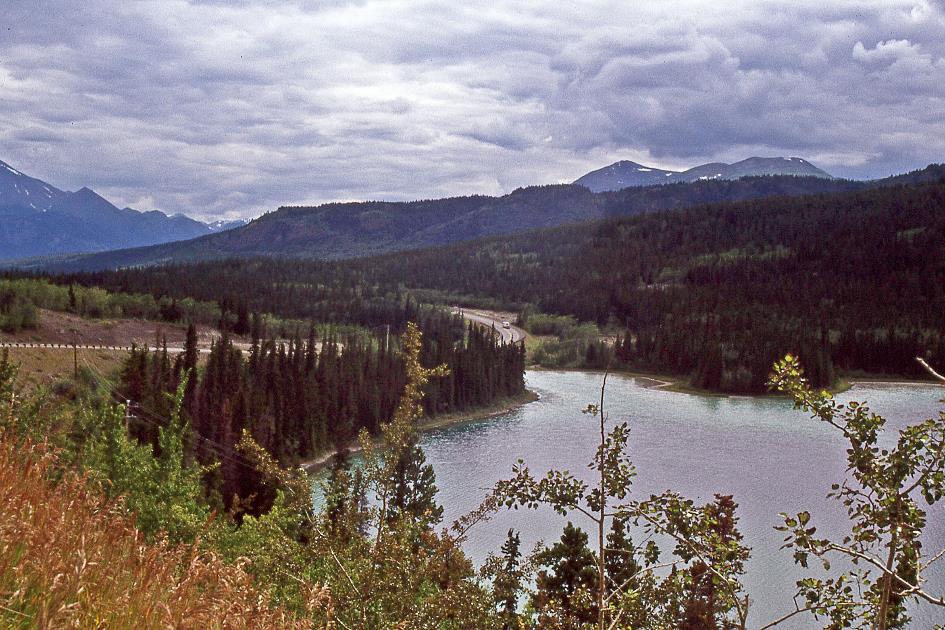
With the cruise control set at 90 kilometres per hour, we let our gaze wander over the vast landscape, with its low mountain peaks, valleys full of spruces, and numerous lakes. The entire day, this northern section of the Klondike Highway will be our habitat. In long, straight stretches, it mostly follows the upper reaches of the Yukon River. So, our route is more or less the same as that of the gold prospectors in their ramshackle boats in the spring of 1898. Although our travel conditions are probably somewhat more comfortable.
Lakes like Fox Lake bear witness to the unexpected beauty with which this landscape manages to surprise us
Fox Lake
Lakes like Fox Lake bear witness to the unexpected beauty with which this landscape manages to surprise us. Sometimes, the glimpses between the trees reveal nothing more than a wide expanse of water, while at other times, they show us a tangle of small green islands where spruces vie for space. And above all, there is that tranquil, heavenly blue water, thanks to the sun doing its best today.
Just north of the lake, fierce wildfires wreaked havoc in 1998. About 45,000 hectares (110,000 acres) were destroyed. The landscape has still not fully recovered from that trauma. Stunted, bare tree trunks are all that remains standing. Whether the white spruce will succeed in dominating the landscape again as before is doubtful.
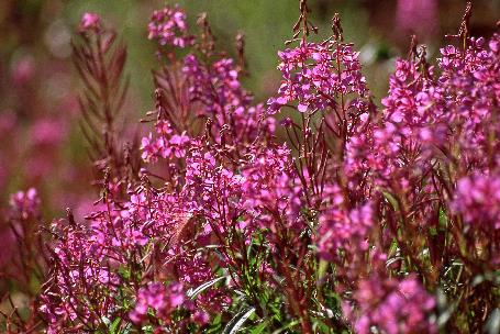
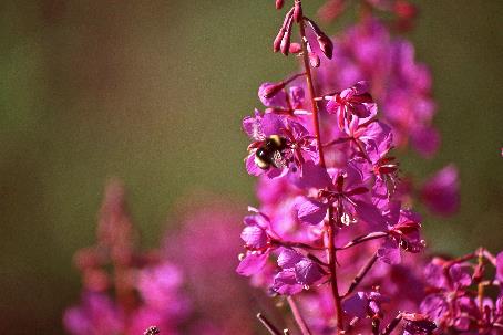
Purple fireweed is among the first plants to colonize the charred grounds
|
|
|
Purple fireweed is among the first plants to colonize such blackened grounds, and it owes its name to this characteristic. It must be that Yukon is frequently plagued by wildfires since the fireweed has earned the title of the province's flower.
Klondike Highway
You are now leaving the 911 service area, we read on an information board near Little Fox Lake. It's not exactly reassuring, although accidents are extremely rare here – due to the lack of traffic, of course.
These are not rocks defying the centuries like pimply menhirs; they are conglomerates
Just before eleven, it's a few massive rocks next to the road that catch our attention. But no, these are not rocks defying the centuries like pimply menhirs; they are conglomerates. They form when gravel stones are trapped in moist sediment of sand, silt, or clay, and then the sediment dries out and solidifies. The result of this coalescence is enormous in this case because one of these colossi is six meters high with a diameter of also six meters. Submarine landslides during the Jurassic period left these conglomerates here 185 million years ago, as the information board informs us. That's a considerable time ago; dinosaurs had only just begun their conquest of the planet back then.
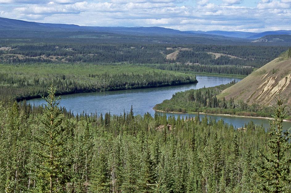
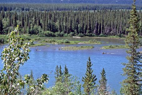
Yukon River
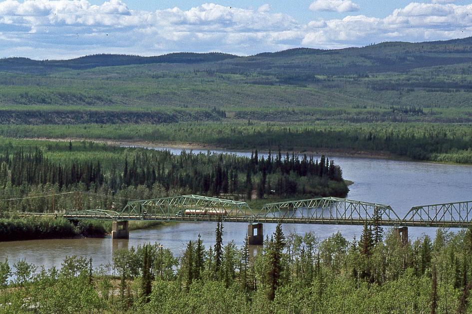
We hadn't seen it for a while, but an hour later, there it is again – the Yukon, now swelled into a mighty river, two hundred meters wide. We cross it for the first time in Carmacks, a relatively modest settlement with 400 inhabitants. After 166 km, this is the first sign of habitation we encounter along the Klondike Highway. The village is named after George Carmack, who, in 1896, unknowingly played a role in setting off the Klondike Gold Rush.
Back in the day, Five Fingers Rapids must have been a formidable obstacle for the gold prospectors in their primitive boats
Five Fingers Rapids
We climb quite steeply out of the wide valley and soon gaze into the distance at Five Finger Rapids. In the middle of the Yukon, four gigantic basalt blocks have been defying erosion for millions of years. Only five narrow passages remain open for the mighty river. Back in the day, this must have been a formidable obstacle for the gold prospectors in their primitive boats. Quite appropriately, the Northern Tutchone people called this place Tthi-chò näderhé – Standing rocks in the river.
Driving northward through the sun-drenched landscape is delightful. However, we are not quite successful at it
Driving northward through the sun-drenched landscape is delightful. However, we're not making much progress because stunning views of the Yukon Valley repeatedly compel us to stop. Zones affected by wildfires continue to unfold. Similar to Australia, wildfires here are not considered a disaster but an efficient means of forest management.
Yukon River |
|
Driftwood |
We cross the Pelly River at a spot aptly named Pelly Crossing. Just under 300 people call this place home. For us, it's the second settlement we've encountered in the past 275 km.
Pelly Crossing
Once again, we ascend from the plain, taking a brief pause to enjoy the view over the settlement enclosed by a broad bend of the Pelly River. As if lying in wait, a squadron of horseflies promptly descends on the car's body, feasting on the fresh insect carcasses.
We cross the Stewart River at a spot appropriately named Stewart Crossing. Thirty-five people call this place home. For us, it's the third settlement we've encountered in the past 346 km.
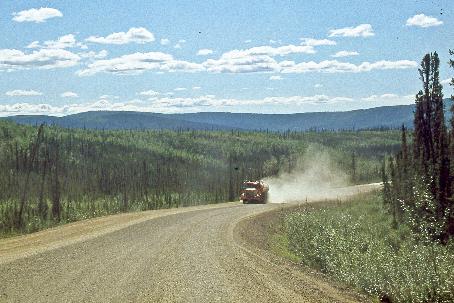
More and more frequently, unpaved stretches of gravel road replace the comfortable asphalt pavement
Klondike Highway |
|
|
More and more frequently, unpaved stretches of gravel road replace the comfortable asphalt pavement. A nearby lake is very appropriately named Gravel Lake. However, traffic is steadily increasing. We now encounter oncoming vehicles every two kilometres, more than three times as many as earlier.
Gravel Lake
Then, on our right, Klondike River comes into view. Another fifty kilometres through a valley densely covered with trees and shrubs, and our journey of more than five hundred kilometres comes to an end. Both relief and regret take hold of us.
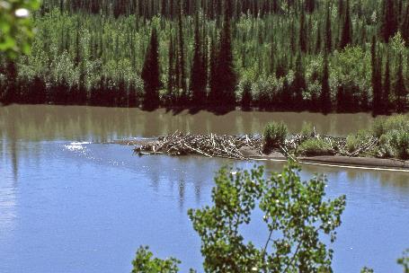
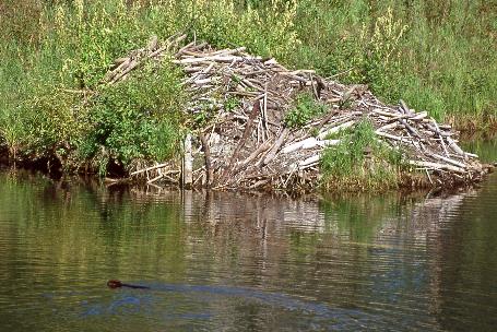
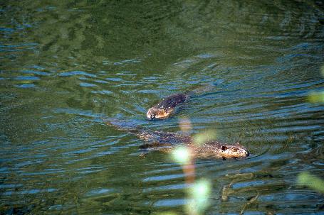
These beavers don't seem to realize that they are supposed to be mainly active at night
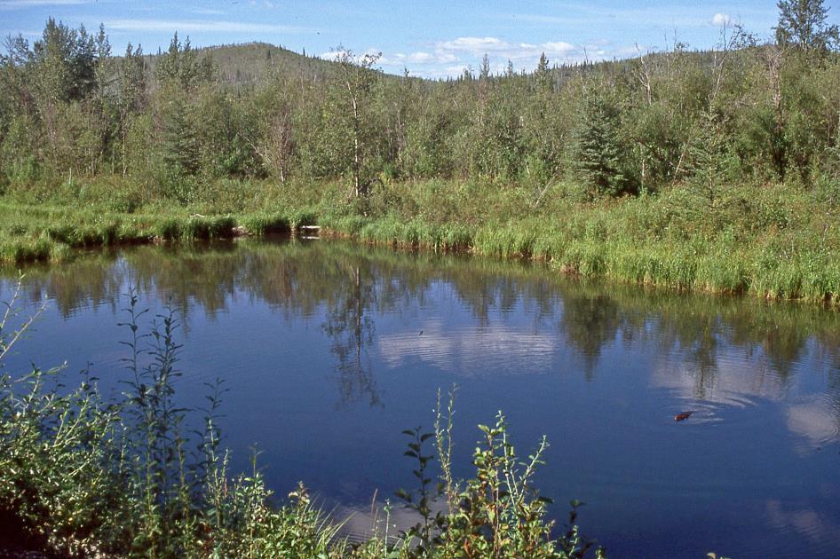
Beaver
In one of the creeks next to the road, about three Canadian beavers make their presence known. They seem oblivious to the fact that they are supposed to be mainly active at night. For minutes on end, they float on the water, occasionally slapping the surface with their flat tails to signal danger, and then diving underwater. However, our presence doesn't seem to bother them.
Open-water beaver lodge |
|
Beavers |
A bit further, there is their impressive beaver lodge. It is only accessible underwater, providing them with protection against predators. This is also the reason why they build dams. In the artificial pond created by the dam, they can construct a secure lodge. If they hear the sound of flowing water, they know there's a leak somewhere, and they venture out to repair the dam.
If they hear the sound of flowing water, they know there's a leak somewhere, and they venture out to repair the dam

Beaver
Just before six, we reach dusty Dawson City at the confluence of the Klondike and the Yukon. This is the fourth and last settlement along the northern section of the Klondike Highway. In the past, the stagecoach took seven days for this route. It took us seven hours. Before we know it, we've almost passed the town of two thousand inhabitants.
In the past, the stagecoach took seven days for this route. It took us seven hours
Even past eleven, the setting sun mercilessly shines into the hotel room. Even with closed curtains, you can comfortably read the newspaper. Apparently, at 64° northern latitude, the sun doesn't like to go to sleep in the summer. We do, after such a day.
Jaak Palmans
© 2024 | Version 2024-01-21 15:00
Continue reading in (4/4)
That Sunday on the banks of Rabbit Creek
1) In 2019, a new bridge will be built next to this existing bridge.