A nomad you remain, even after death
Kyrgyzstan | Anno 1998
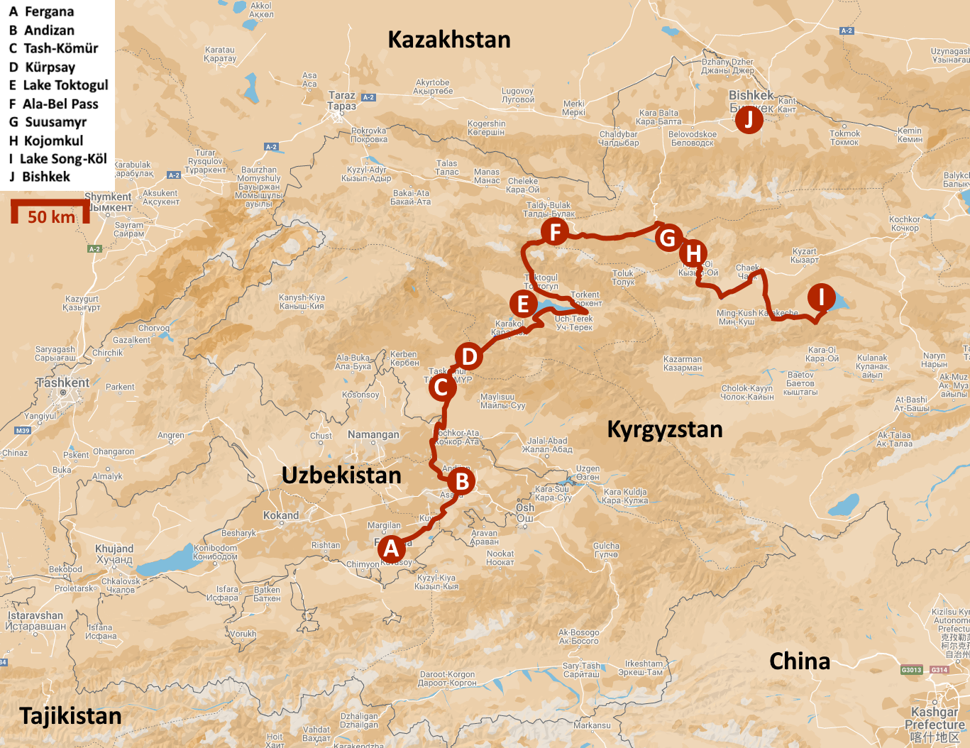
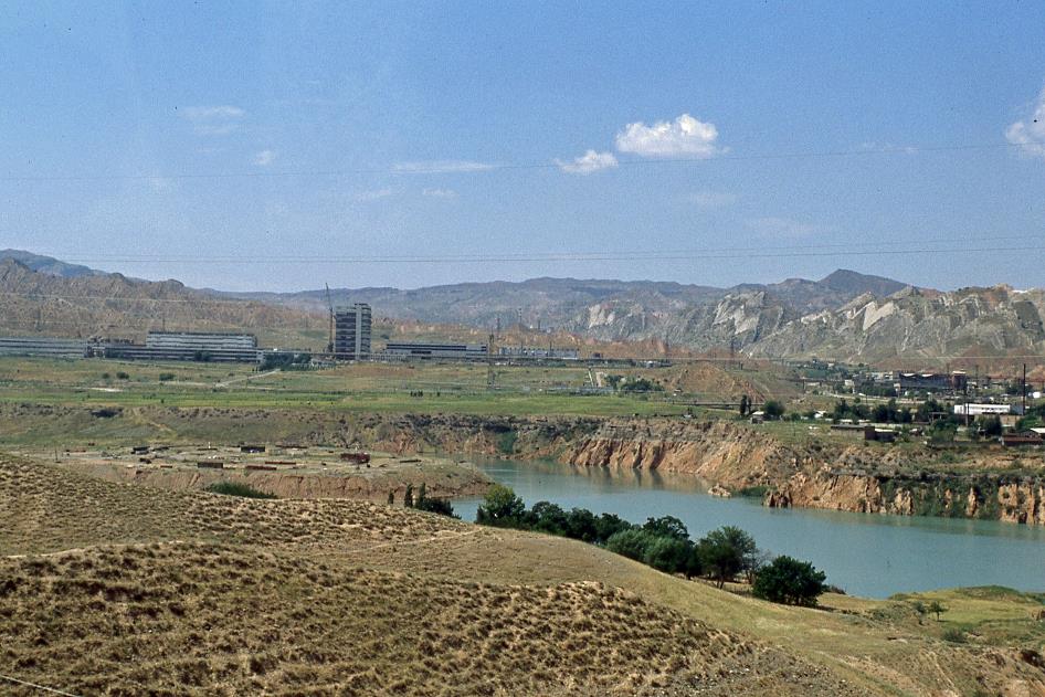
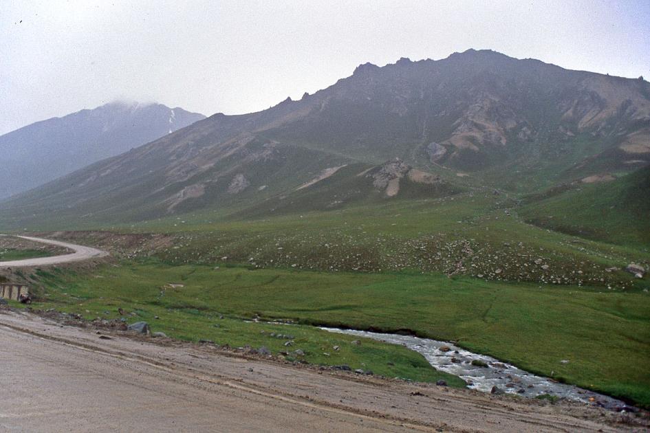
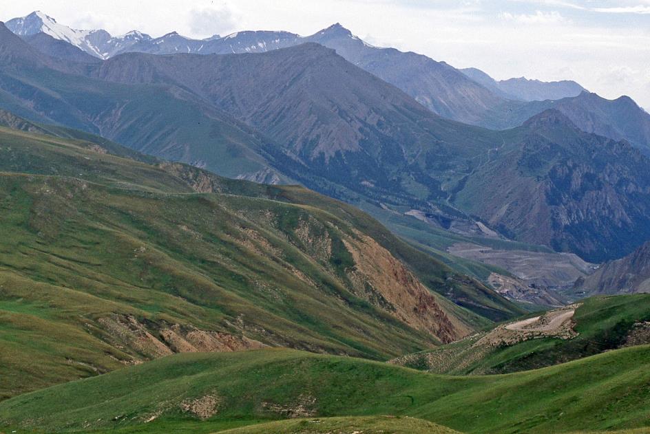
Sunday, August 2 | Fergana – Toktogul
Monday, August 3 | Toktogul – Suusamyr
Tuesday, August 4 | Suusamyr – Song-Köl
Sunday, August 2 | Fergana – Toktogul
Ten past five in the morning. They finally arrived. Normally, they would have arrived yesterday evening, John explains, but they had grossly underestimated the harsh condition of the road. Hence the delay. John will be our guide for our journey across Kyrgyzstan, from the Uzbek city of Fergana to the Chinese city of Kashgar. He wears a shirt with a palm tree pattern, a surprising outfit for a journey through the Central Asian highlands. Sasha will be our driver. Both John and Sasha are Russians who stayed behind in distant Kyrgyzstan after the collapse of the Soviet Union in December 1991. John speaks fluent English, while Sasha usually remains silent in any language.
|
|
|
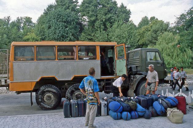
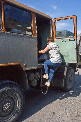
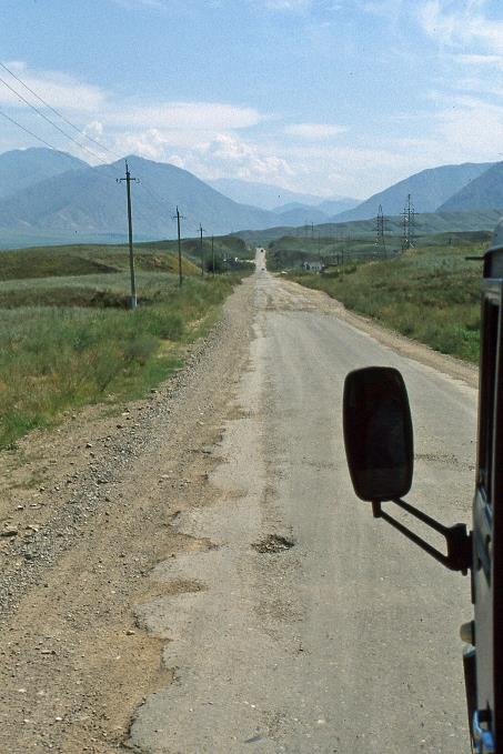
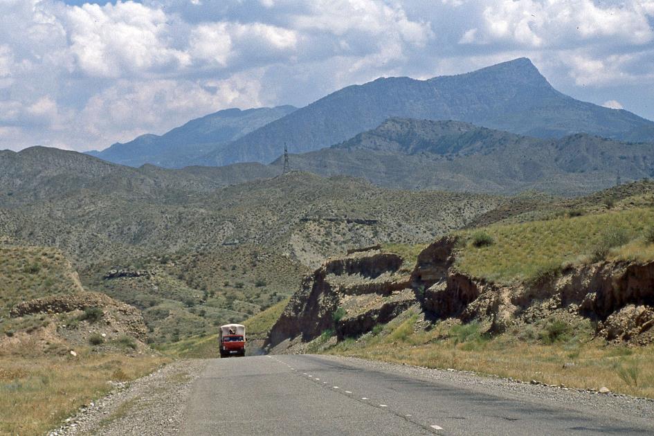
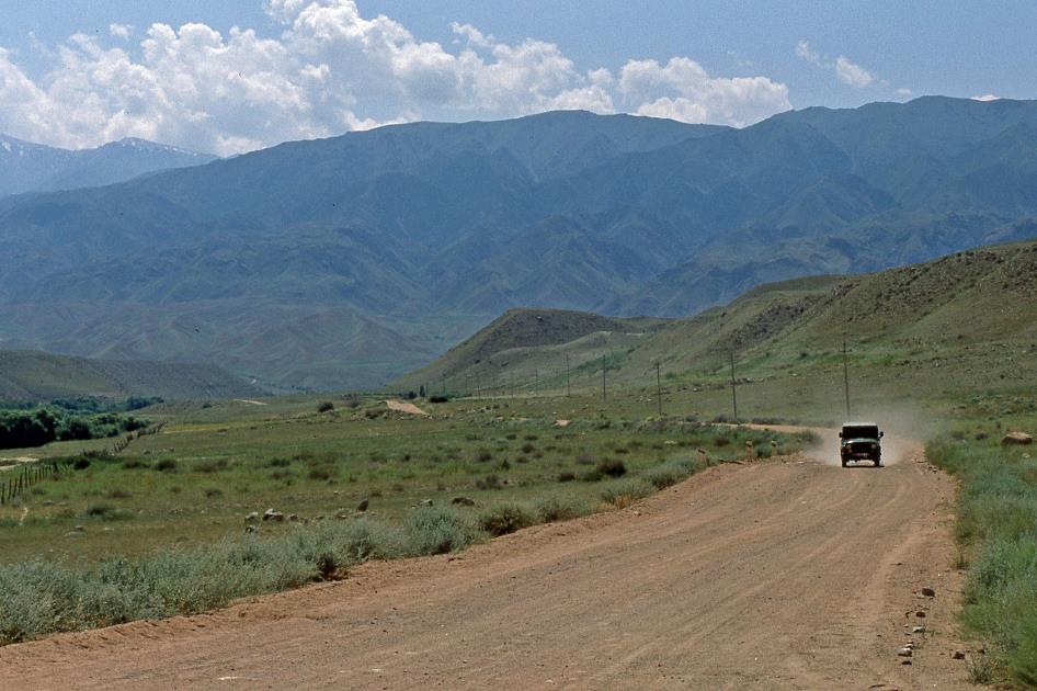
To climb aboard, we need almost ropes and climbing irons.
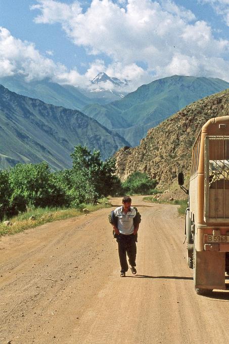
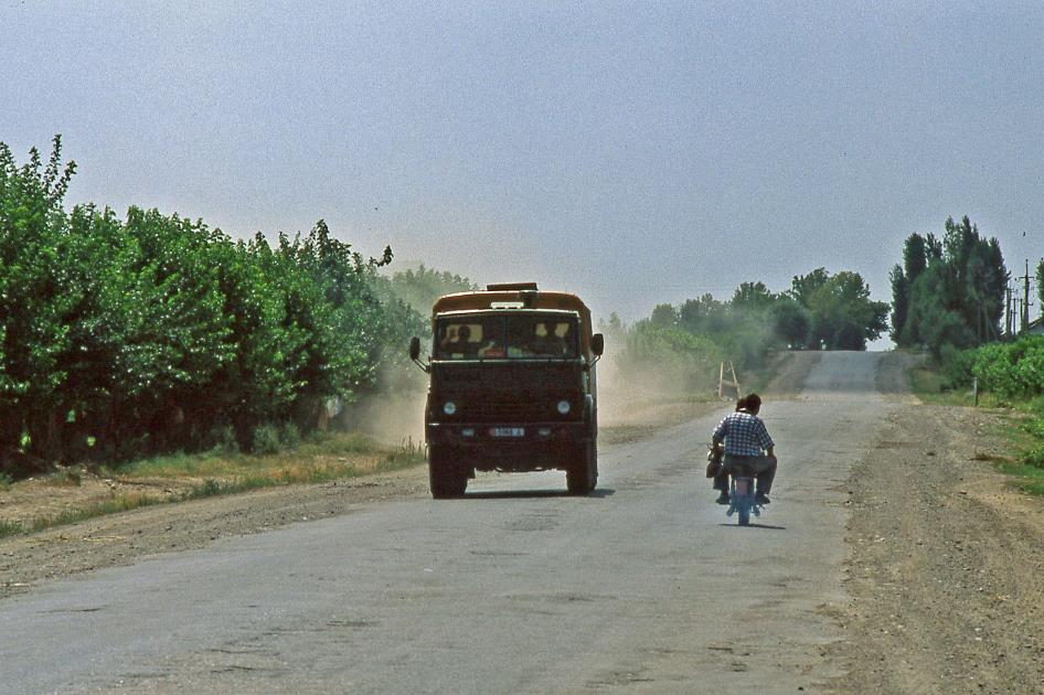
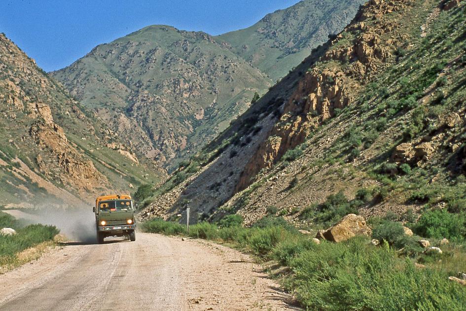
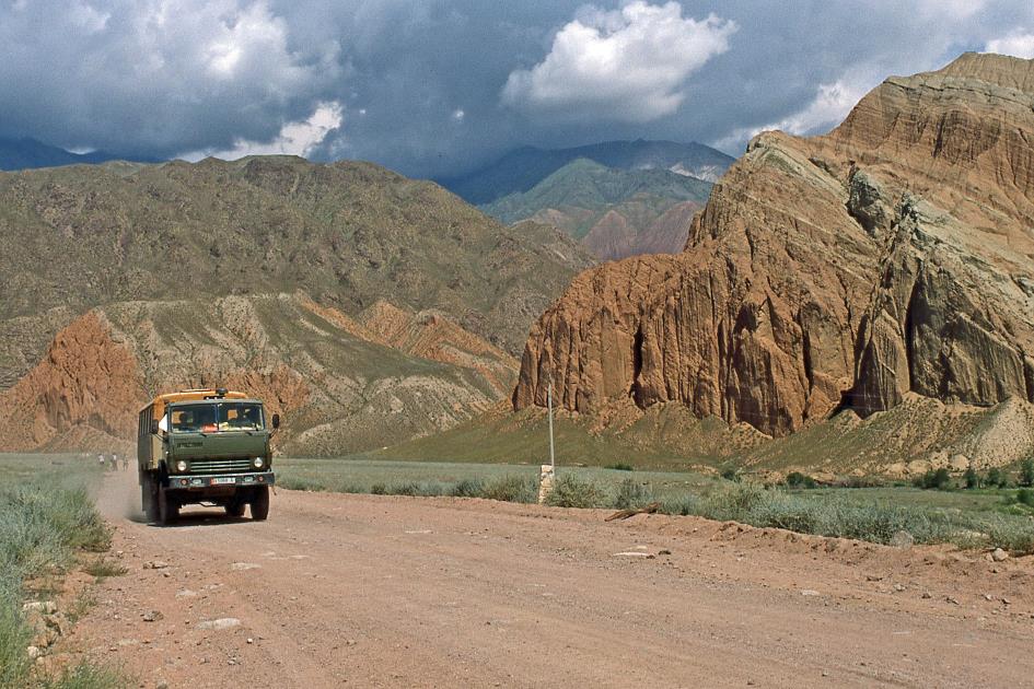
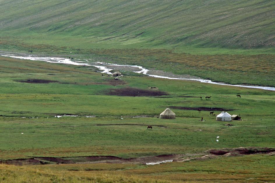
The vehicle they brought is a Kamaz, a 6WD truck with a passenger cabin instead of a cargo bed mounted on the chassis. To board, we need almost ropes and climbing irons. But it must be said, the products of the Russian truck factory Kamaz are among the most robust and reliable means of transportation you can imagine. They are supposed to withstand any extreme conditions that may occur in Central Asia. Two years ago, in 1996, a Kamaz even won the Dakar Rally for trucks. Such trucks are reportedly the only form of commercial passenger transport allowed in the Kyrgyz mountains. The immensely popular Damas minibuses you see everywhere in Uzbekistan are simply not permitted. Although it's not clear if and how that can be enforced.
For our luggage, the truck has a large open cage of wire mesh at the back. At least, that's what we thought, because just after eight, Sasha begins to neatly stack our suitcases on the rear seats in the passenger cabin. At the very top, he arranges the sleeping bags, barely avoiding the roof. Whether this precarious stacking will successfully withstand the rugged Kyrgyz roads, we dare to doubt. But John and Sasha are confident. After all, John has successfully completed this trip about twenty times this year. You don't need to tell him how it's done.
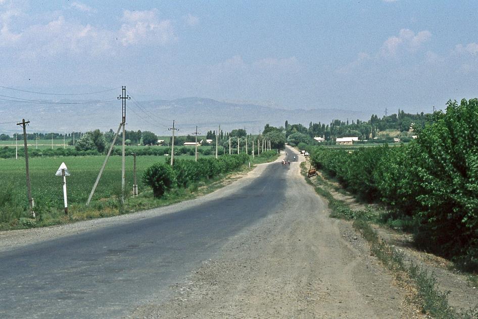
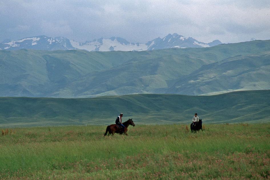
Just before half-past eight, we leave behind the Uzbek Fergana, the city that gave its name to the Fergana Valley. This is an enormous green oasis, one of the most fertile areas of Central Asia, covering an area of more than two-thirds of Belgium, at about six hundred meters above sea level. It was here that, from 100 BC, the Chinese emperors came to get the legendary Fergana horses. They were tired of the nomadic Xiongnu repeatedly raiding and plundering Chinese settlements, and then disappearing with their fast horses. The Great Wall itself proved insufficient to stop these raids; the superior horses bred in the Fergana Valley would give the Chinese army enough firepower to resist the nomads. The horses they bought, the Chinese paid for with silk. Thus, the seed was planted for the famous Silk Road, a network of trade routes between east and west.
The seed was planted for the famous Silk Road, a network of trade routes between east and west.
Originally, our journey was supposed to take us eastward for a brief visit to Osh – one of the oldest Kyrgyz cities – and Uzgen, but John opts out due to the road conditions. So, Sasha will immediately head north towards the Kyrgyz border. Our destination there is Lake Toktogul, the second-largest lake in Kyrgyzstan.
Quite delightful, yet somewhat surprising, is the fact that we still have Yegitali on board. We got to know him as our amiable guide in Uzbekistan over the past ten days. In reality, his task ended here in Fergana, the place where he lives and where he invited us to an extensive meal at his home last night. Completely unexpectedly, he expressed the wish to continue accompanying us through Kyrgyzstan to the Chinese border. A spontaneous and friendly offer that we could not refuse, especially since he indicated that he could be useful in our interactions with the local population. In a few days, we will see how prophetic those words were.
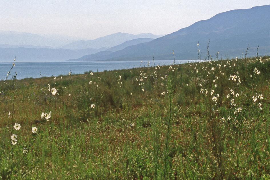
The Fergana Valley is one of the most fertile areas in Central Asia.
Yegitali is fifty-four, earning a living as a tour guide for the past 32 years. He has heaps of experience, this good-hearted man, but he also rides one of his many hobbyhorses at every opportunity – the Russians who introduced alcohol to Uzbekistan, the Russians who still have a strong influence, the undeveloped farmers and workers who dominate the communist party and even become president of Uzbekistan, the collectivized properties, the sense of responsibility that seems to have disappeared in the average citizen, the girls who are not virgins at marriage, the circumcision of boys, which is a blessing for both hygiene and pleasure…
And then there are the melons. Yegitali praises the fruits to the heavens for their alleged nutritional value and thirst-quenching ability. Yegitali cannot see a melon without buying it.
At nine o'clock, we pass through Quva, famous for its fruits, pomegranates, cherries, and peaches. It used to be an important city along the Silk Road, but that came to an end when the Mongols paid a visit to the city at the end of the 13th century. Half an hour later, we pass through Asaka. The city can boast of having Central Asia's first car assembly plant – they produce Daewoos.
The city of Andijan likes to boast about its most famous resident ever, the man who became world-famous under his warrior name, Babur. Certainly not an easy person to handle without gloves, this Babur. He was only fifteen when he conquered the city of Samarkand with his army and twenty-one when he took Kabul. From there, he regularly undertook plundering expeditions in the Indian Ganges Plain until he finally seized Delhi in 1526. Thus, he became the founder of the still-fascinating Mughal Empire. It is Babur's great-great-grandson Shah Jahan to whom we owe the magnificent Taj Mahal in the Indian city of Agra.
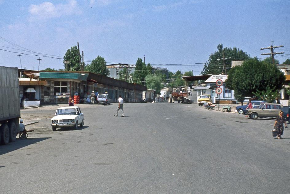
Border crossing between Uzbekistan and Kyrgyzstan
An hour later, we approach the border. It doesn't amount to much. An Uzbek military officer briefly checks our bus, is satisfied with what he sees, and lets us continue. The Kyrgyz, on the other hand, for unclear reasons, decide to withhold our visa despite our protests. This will cause issues next week when we return via Kazakhstan.
Kyrgyzstan may be a beautiful country, but they don't have melons there
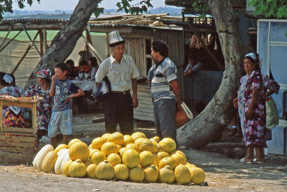
Melon vendor
And there's another problem, warns Yegitali. While Kyrgyzstan may be a beautiful country, they don't have melons there. So, we stock up on a substantial supply – watermelons, cantaloupes, sugar melons – and casually stack them on the floor.
We set our watches one hour ahead and embark on our journey across Kyrgyzstan. Back in the day, after gaining independence in 1991, the Kyrgyz were quick to mint their own currency. Thus, the Kyrgyz som became the very first local currency in the Central Asian republics and remains the strongest within the group.
Fergana Valley with cotton fields
For one US dollar, we get 9.5 som, although we won't need cash as we will be traveling through mostly uninhabited areas. In an area of just under 200,000 km² – more than half the size of Germany – there are currently 4.77 million Kyrgyz people living. That averages to about 24 people per square kilometre. In theory, at least, because in practice, the majority of them live in and around the capital, Bishkek.
The mutual intelligibility between these languages is so extensive that some consider them different dialects rather than distinct languages
The language they speak is Kyrgyz. Like Uzbek, it is one of the over 35 Turkic languages spoken as a mother tongue by a quarter of a billion people from Istanbul to Lake Baikal. The mutual intelligibility between these languages is so extensive that some consider them different dialects rather than distinct languages. Yegitali's Uzbek will, therefore, come in handy for us.
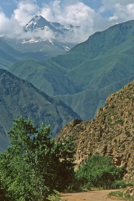
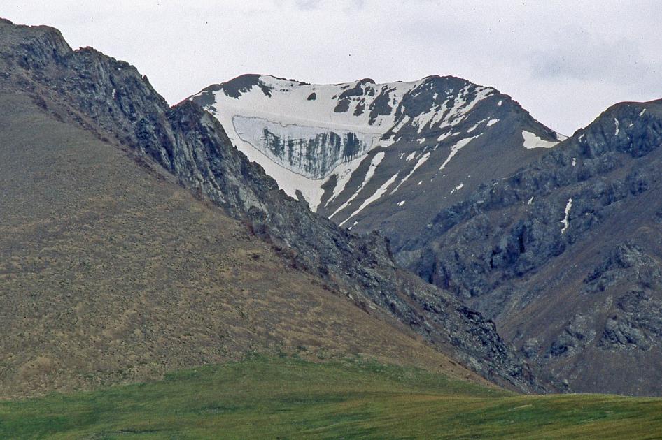
This is a unique country in many ways. No country in the world is farther from any sea than Kyrgyzstan. It is not surprising, then, that no Kyrgyz river manages to reach any of those seas. This mountainous country is sometimes referred to as the Switzerland of Central Asia, but that is an understatement. About half of Kyrgyzstan is located more than three thousand meters above sea level, and the country has many hundreds of mountain peaks higher than five thousand meters. These peaks are mainly found in the Tian Shan range, the Heavenly Mountains, at the border with China, but also in the Alai Mountains at the Tajik border.
For the ecology of the valley, the monoculture of cotton turned out to be a disaster
Cotton field
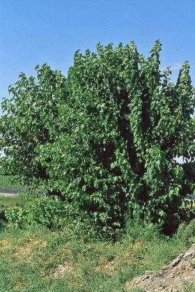
Just like in Uzbekistan, cotton cultivation is also the primary agricultural product in Kyrgyzstan. This is evident from the endless cotton fields lining the road. Typically, farmers at the edge of those fields have planted mulberry trees. Not only do these little trees protect the cotton plants during inclement weather, but they also provide an additional source of income for the farmers. This is because mulberry trees are indispensable in the breeding of silkworms. These creatures, in fact, consume nothing but the leaves of the mulberry tree, devouring them in large quantities. As long as the farmers meet their cotton quotas, the government tolerates this side activity.
The mulberry trees bring in extra income for the farmers
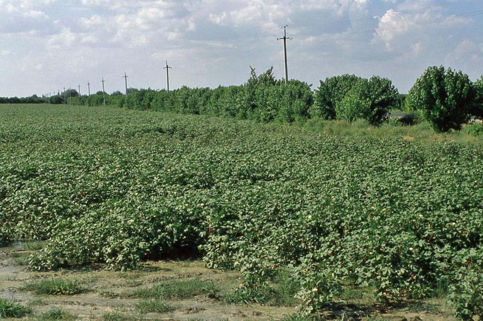
Cotton field with a hedgerow of mulberry trees
It is the numerous applications of cotton that make this white gold so popular, according to Yegitali – cotton oil, alcohol, laundry detergent, insulation material, linoleum, artificial leather, gunpowder, honey, and more. The fact that cotton production plays such a crucial role in the Fergana Valley and has almost led to a monoculture can be entirely attributed to the centrally planned economy of the Soviets. Moscow decided what would be produced where, and for the Fergana Valley, it was cotton. This turned out to be a disaster for the ecology of the valley, not only due to chemical pesticides, soil depletion, erosion, skin diseases, and allergies but also, and especially, because of the excessive use of available water. The two major rivers in the region, the Amu Darya and the Syr Darya, were nearly drained to quench the insatiable thirst of the cotton plants. A thousand kilometres away, the Aral Sea, once the fourth-largest lake in the world, shrank to a fifth of its original size.
Cotton picking is essentially manual labour, as machines cannot distinguish between ripe and unripe bolls
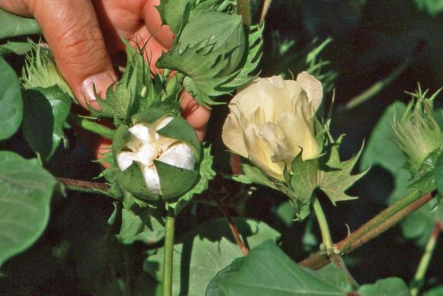
You plant cotton in April and harvest it in September. The flowers on the waist-high plants have already developed, and in about a month and a half, they will become full-fledged cotton bolls. We immediately notice the two colours in which these bolls present themselves. Most are white, but some are purple. Yegitali explains that this is due to the difference in gender.
Cotton boll |
|
Mulberry tree |
Cotton picking begins with the lower bolls, as they ripen first. Subsequently, pickers return two to three more times to pick the higher bolls. Picking is essentially manual labour because machines cannot distinguish between ripe and unripe bolls. However, there are instances of mechanical harvesting when there is insufficient manpower. In such cases, the bolls must be fully ripe from bottom to top. To achieve this, the plants are sprayed, causing the leaves to fall, the bolls to dry, and eventually burst open in the sun. It is evident that this process results in both weight loss and a decrease in quality.
One cotton boll yields five to ten grams of cotton. A picker is expected to bring in sixty kilograms of cotton every day, which translates to at least six thousand cotton bolls. Fertile soil yields five tons of cotton per hectare, while less fertile soil yields three tons. The entire Fergana Valley produces a total of 400 million kilograms of cotton.
The entire Fergana Valley produces a total of 400 million kilograms of cotton
Tash-Kömür
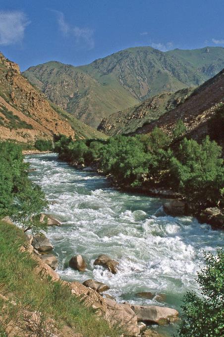
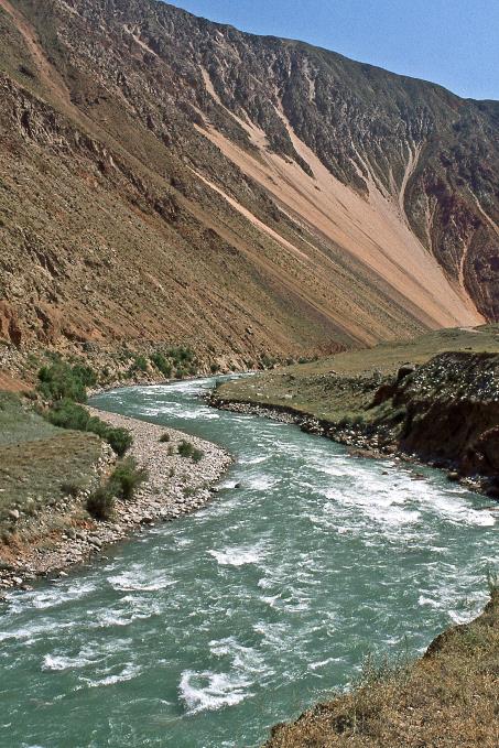
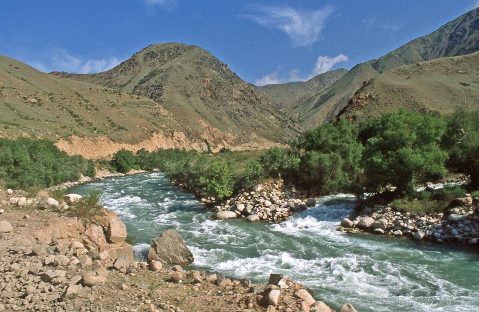
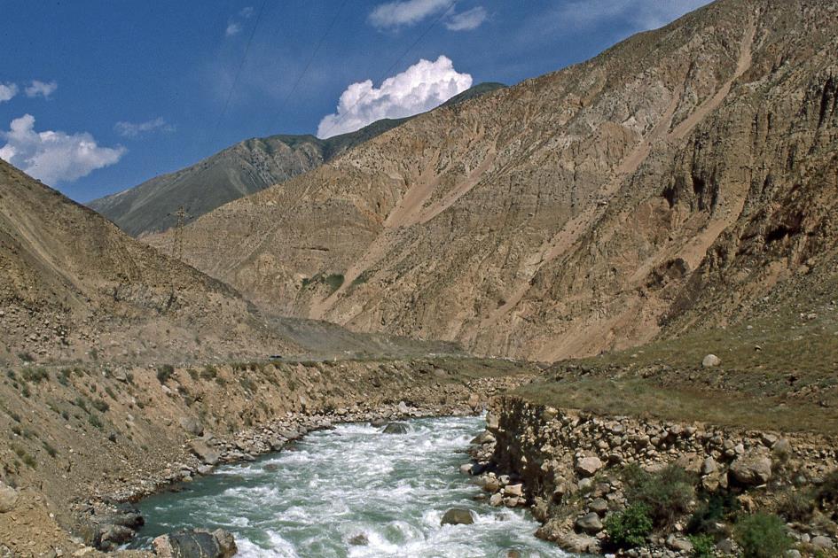
Gradually, the road begins to ascend into the mountains. As enchanting as the flat Fergana Valley may be, it is not representative of the mountainous terrain of Kyrgyzstan. Upstream, we now follow the valley of the Naryn, Kyrgyzstan's principal river. It carries the turquoise meltwater from the numerous glaciers of the Tian Shan mountain range and reaches its peak flow during these summer months.
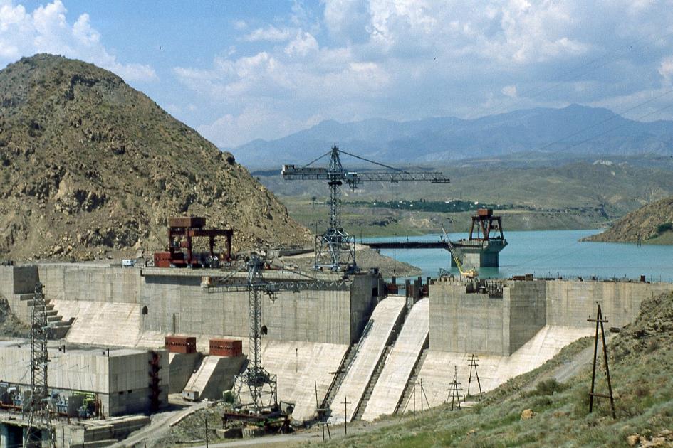
Tash-Kömür Dam
Unlike its neighbouring countries Uzbekistan and Kazakhstan, Kyrgyzstan does not have underground gas and petroleum reserves. However, the country compensates with abundant hydroelectric energy, which it utilizes to the fullest extent possible, given its financial resources and support from Russia. Currently, the Naryn River already hosts five hydroelectric power plants, with several more planned upstream along the river.
Razan-Say is the sole habitable place for dozens of kilometres around
Tash-Kömür Reservoir
Around noon, we catch sight of one of those hydroelectric power plants, namely the Tash-Kömür plant. Its three turbines are intended to generate a combined output of 450 MW. The reservoir has already formed behind the 75-meter-high dam. However, it appears that the hydroelectric power plant is not yet operating at full capacity. It seems there is still a considerable amount of work to be done. It won't be until 2001 that the plant is fully operational.
A bridge takes us to the right bank of the Naryn just before two o'clock. To our surprise, amidst this desert-like environment, Razan-Say appears, a modest settlement with a few hundred residents. The river that cascades down from the mountains seems to have deposited enough sediment over the centuries to create a fertile oasis. Trees and fields seem to thrive here, and presumably, so do the people. Razan-Say is the only liveable place for dozens of kilometres around.
Suddenly, Sasha takes an inconspicuous road to the left, ascending along the mountain stream. Is he trying to give us a first impression of what this vehicle can handle? In any case, sleeping bags are flying around, and melons on the floor are rolling in all directions. Ten minutes later, we find ourselves in a shady spot along the gurgling water, enjoying a cool breeze. It's the only place for miles where the sun isn't mercilessly scorching, and it's an excellent spot for lunch. John has brought packed lunches, but to his own surprise, he discovers that the meat has spoiled after two days in this heat. It seems like common knowledge, but apparently not for John. It's not reassuring, considering he'll be responsible for our food supply for the coming week.
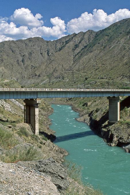
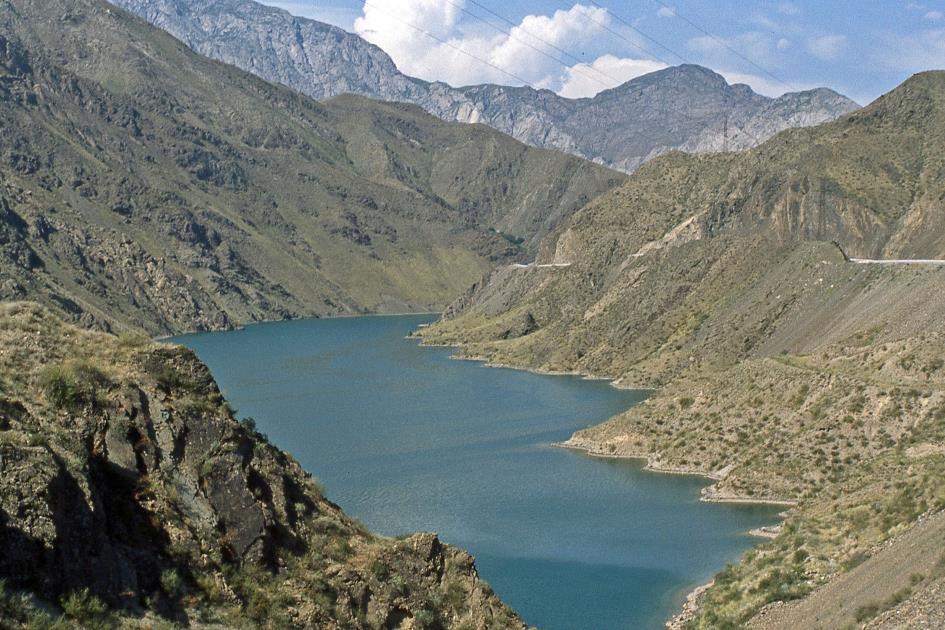
At three o'clock, we resume our journey. Barely twenty minutes later, a barrier blocks our path. Right in front of us is the dark opening of a mountain tunnel. In the distance on the left, we see the impressive Kürp-Say hydroelectric power plant with a dam towering 113 meters high. Since 1981, its four turbines have been producing 800 MW of power.
Driving forward is impossible; they are only willing to grant us passage at eight o'clock tonight
Bridge over Naryn river with the tunnel in the distance |
|
Kürp-Say Dam |
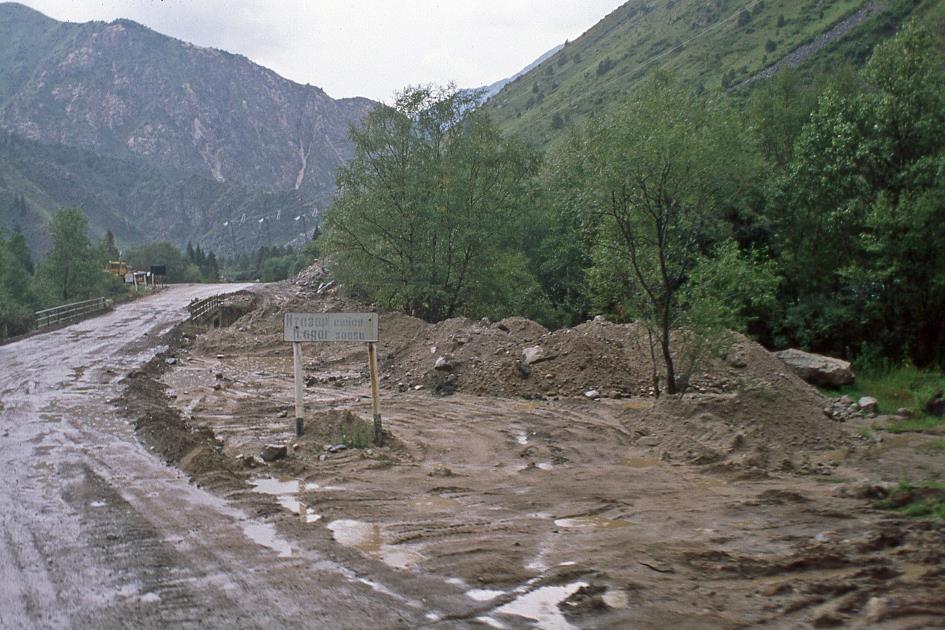
But that's not the problem. Workers are repairing the road. Driving forward is impossible; they are only willing to grant us passage at eight o'clock tonight. This means waiting for five hours in the sweltering sun. An absurd arrangement, especially considering that no apparent obstacle is blocking our way. It's clear that some negotiation is needed here. After twenty minutes of discussion, we are finally allowed to proceed. Strangely enough, a bottle of vodka as a thank-you gesture is declined, probably because it's too overtly offered.
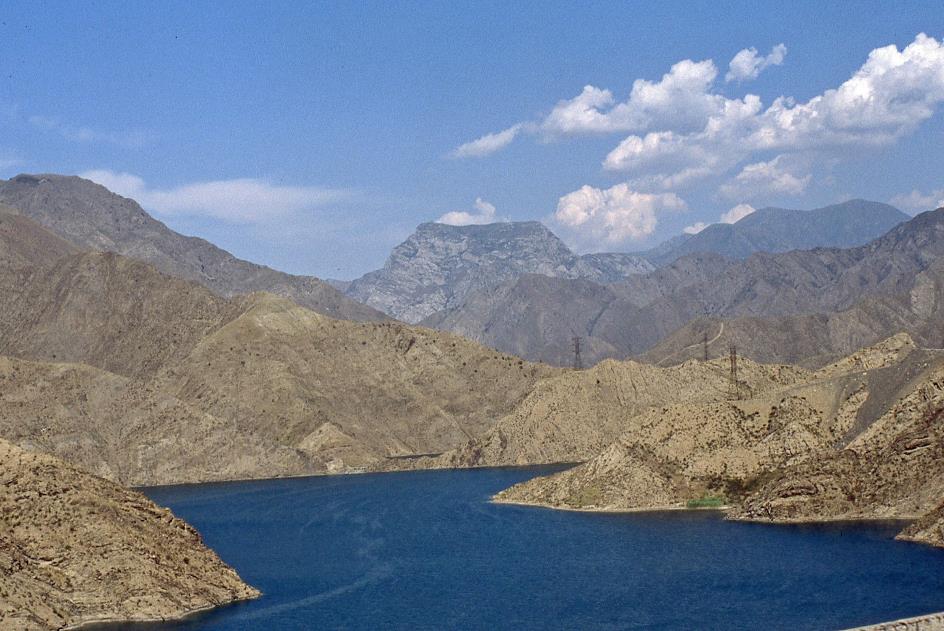
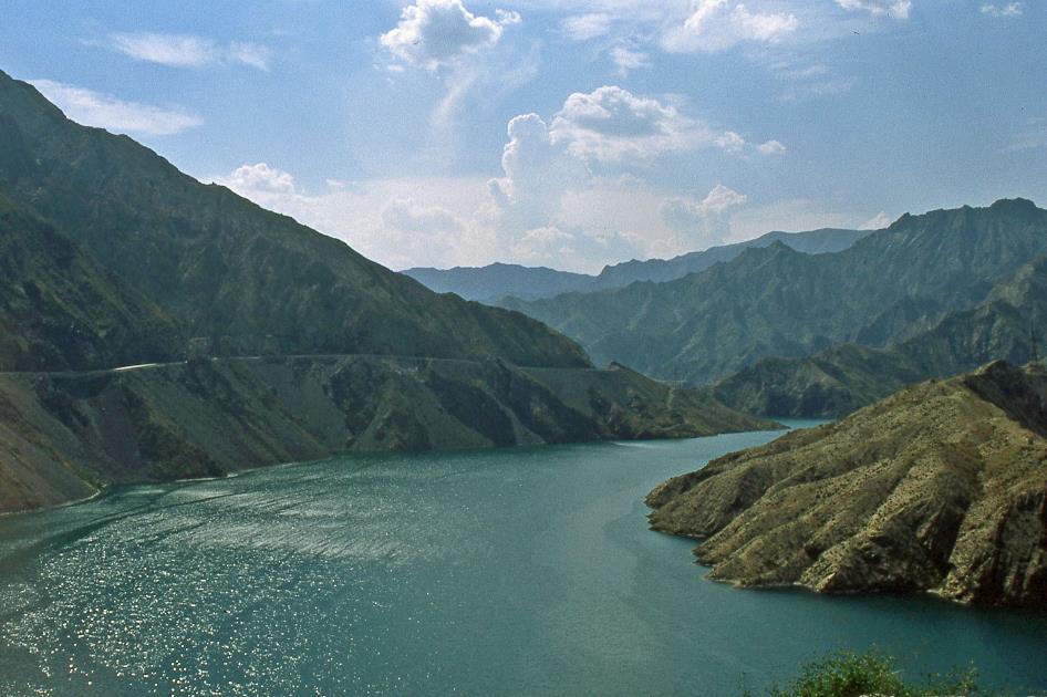
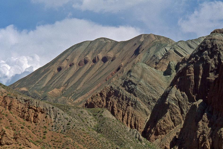
The mountains are higher and barer now, with rocky slopes descending steeply to the blue-green water mass
However, we still have to wait for quite some time before we get the definitive green light to traverse the 750-meter-long tunnel. A desolate landscape awaits us at the eastern end. The mountains are higher and barer now, with rocky slopes descending steeply to the blue-green water mass. The deep, narrow valley provides the ideal setting for a hydroelectric power plant. However, no one deemed it necessary to remove the now useless electricity pylons first. Here and there, their rusty skeletons sadly protrude above the water. Higher up, the asphalt road clings like a fragile ribbon to the mountainside, representing the only sign of life. Otherwise, the valley appears to be an inhospitable environment where neither humans nor animals would feel at home.
Kürp-Say Reservoir
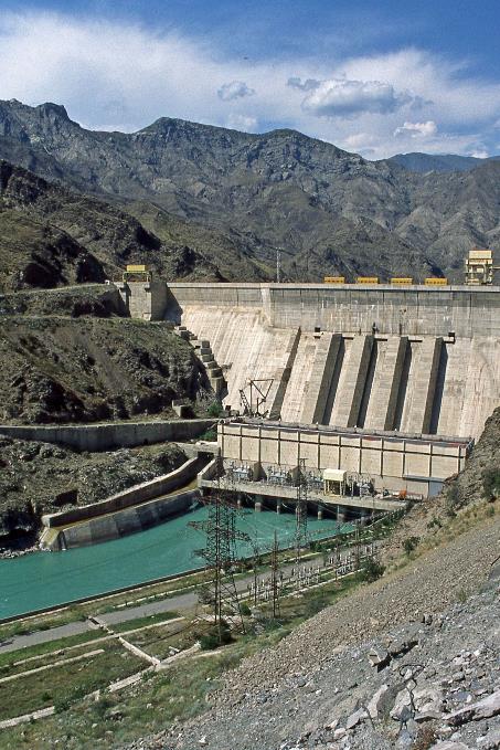
Where the road definitively turns away from the river, Kara-Köl suddenly emerges, a town with over 21,000 inhabitants. This is also a recent construction, as it was only in the 1960s that workers settled here to build the Toktogul Dam. With a height of 215 meters, it is by far the largest dam on the lower reaches of the Naryn. Its capacity of 1,200 MW is even significantly greater than that of the largest Belgian nuclear power plant. The staff responsible for managing and maintaining the power plant still resides here.
Kürp-Say Reservoir
We continue climbing through the Kara-Suu valley. Just after five, we stop at a gas station that lacks gas pumps. Diesel is poured directly into our truck's tank using a jerry can. An hour and a half later, Sasha halts again, this time in front of a building that, with some imagination, we can identify as a garage. Apparently, our truck needs a new oil filter.
When the Toktogul Dam became operational, the water from the Naryn River flooded the villages at the bottom of the valley
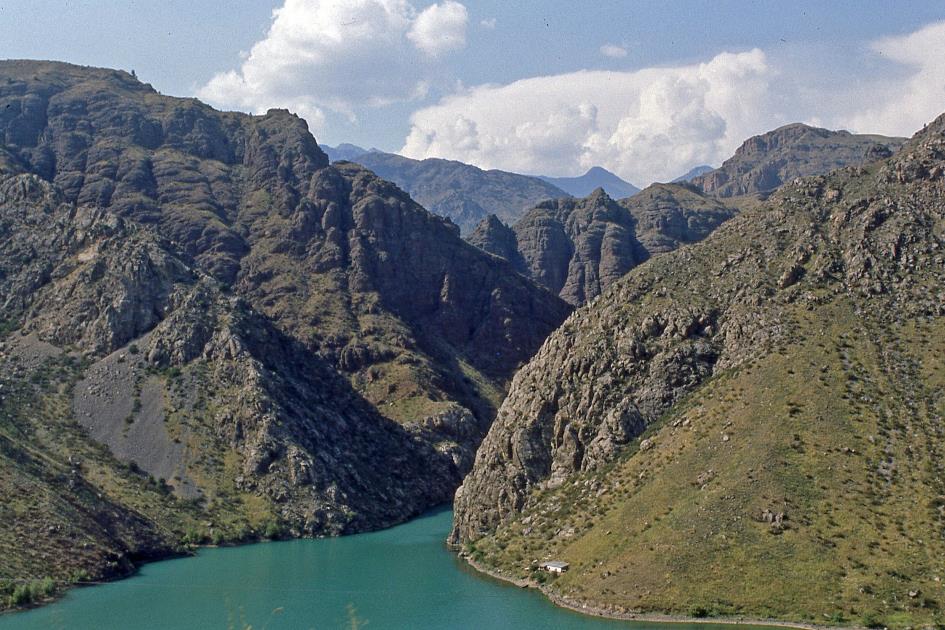
Kürp-Say Reservoir
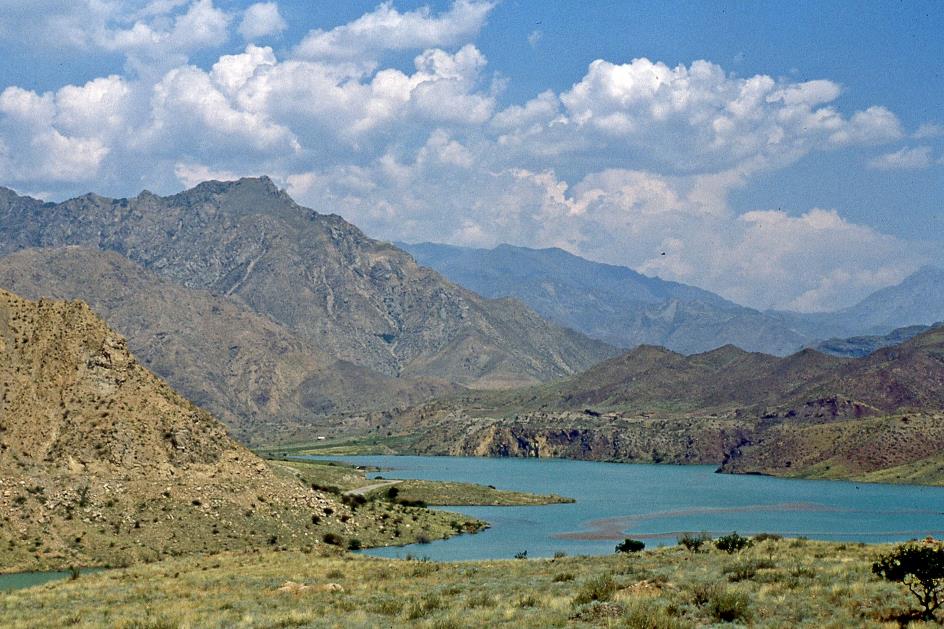
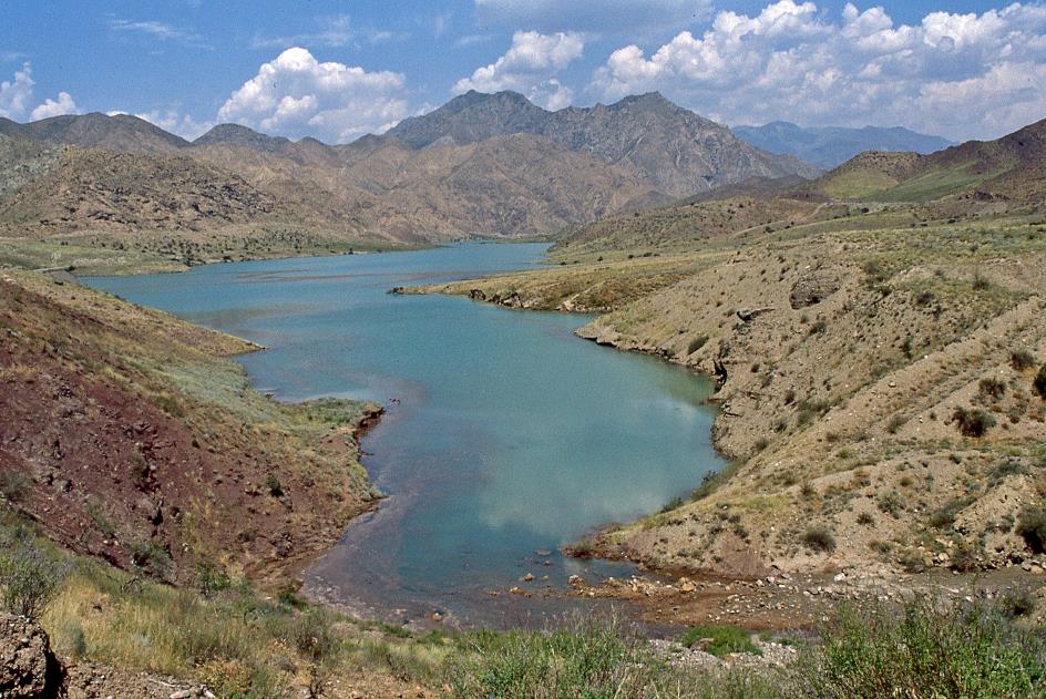
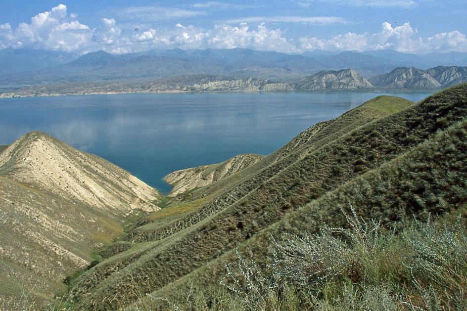
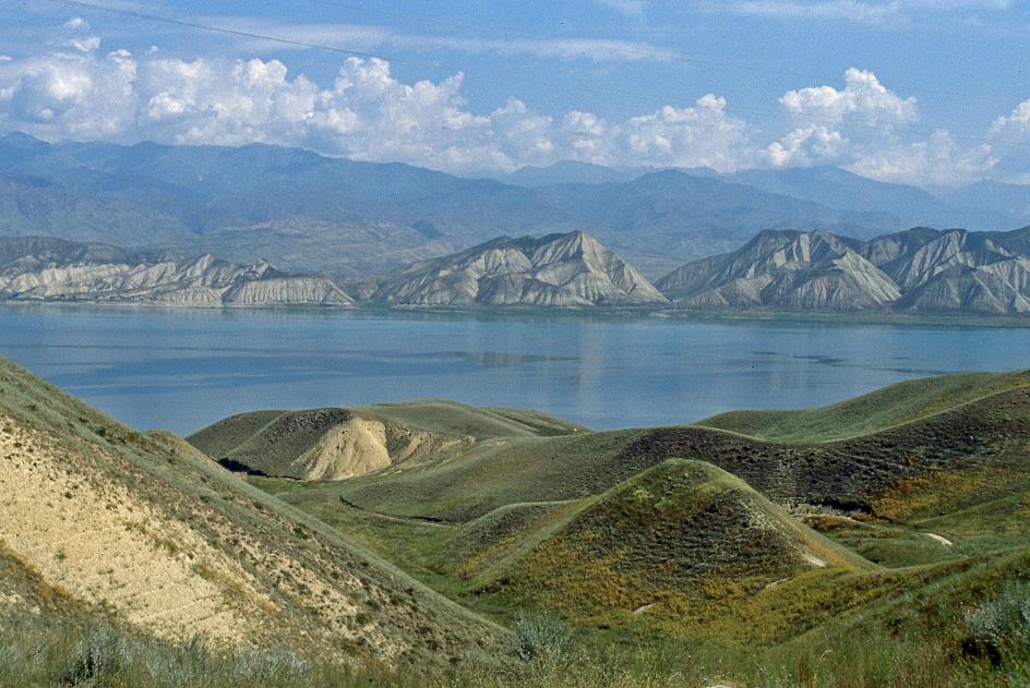
Only the Lokbel Pass, at an altitude of 1,420 meters, separates us from our destination. For Sasha and his Kamaz, it's a piece of cake. During the descent, the enormous Toktogul Lake soon emerges in the distance, 65 km long, 120 meters deep. The lake was formed from 1976 when the Toktogul Dam became operational, flooding the villages at the bottom of the valley with water from the Naryn River.
Kara-Suu Valley
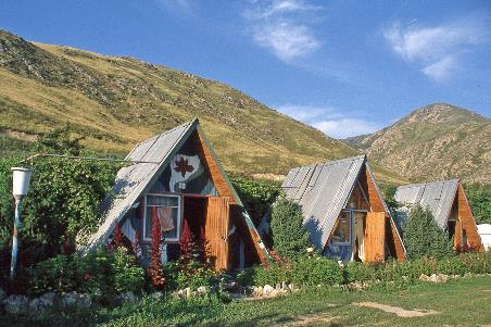
Before approaching the lake, Sasha turns onto an unpaved road to the left, searching for our overnight accommodation. It turns out to be a collection of wooden dachas with pointed roofs. Nestled in a tree-filled oasis on the southern shore, they overlook the lake. The caretaker welcomes us. In a previous life, he lived in one of the houses now submerged at the bottom of the lake.
In the kitchen, a cheerful young lady named Oksana takes charge. She's an intern in training, and this trip is her second practical exercise. She has prepared delicious chicken drumsticks for us. Apparently, she will be in charge of the food supply for the rest of the trip. A weight is lifted off our shoulders.
Man with kalpak |
|
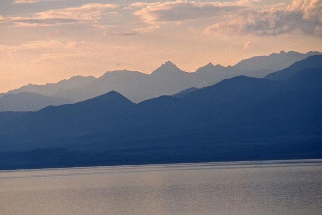
Toktogul Lake at dusk |
Later in the evening, the moon shines brightly in its first quarter in the cloudless sky. But in the east, where we need to go tomorrow, the sky is heavily overcast, and lightning flashes regularly. That doesn't bode well.
Monday, August 3 | Toktogul – Suusamyr
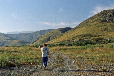
Our pessimism proves premature. A radiant blue sky greets us when we wake up, and the sun warmly beams down on the breakfast table. The warmth we experience delights and surprises us. Although we find ourselves at the same latitude as Rome, we are at an elevation of 910 meters above sea level. John reassures us not to expect too much from this sudden burst of good weather; the weather can change rapidly here, especially when we find ourselves among the mountains later.
Although we find ourselves at the same latitude as Rome, we are at an elevation of 910 meters above sea level
Lake Toktogul
Departing turns out to be quite a process. First, Sasha has to replace the oil and the oil filter of his truck. Then, the extra load comes into play – tents, mats, gas stoves, gas cylinders, water containers, food supplies, and more. Apparently, the metal cage on the back of our truck is intended for this purpose. In the meantime, a kind of service jeep has also appeared on the scene. It too is fully loaded with equipment and people. In addition to John, Sasha, Oksana, and Yegitali, it turns out that the jeep's driver and three young guys are now part of our group.
Dachas |
|
|
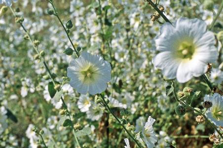
Hollyhocks |
|
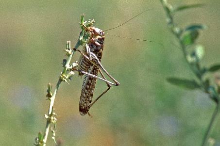
Grasshopper |
Shortly after ten, we finally set out for what will be a long day trip. As if the enormous dimensions of this artificial reservoir needed further emphasis, it turns out we need just over an hour to reach the eastern end of Toktogul Lake. There, we cross the Naryn River and follow the northern shore until we reach Toktogul
It takes us over an hour to reach the eastern end of Toktogul Lake
Lake Toktogul
The city, the district, the dam, the lake – all bear the name Toktogul. It's a tribute to Toktogul Satylganov, a 19th-century poet and composer so beloved in Kyrgyzstan and neighbouring Turkic-speaking nations that everyone refers to him by his first name. Think of him as the Pushkin and Tchaikovsky of Kyrgyzstan, combined into one person. Add to that his democratic ideals, and you'll understand why you find his name on street signs and his likeness on postage stamps and banknotes.
Toktogul Satylganov is the Pushkin and Tchaikovsky of Kyrgyzstan, combined into one person
Lake Toktogul
It's a quarter to one when we reach the city of Toktogul. According to Oksana, they mainly cultivate wheat, tobacco, and potatoes here. However, we don't need those at the moment. Diesel, on the other hand, is a necessity because our truck seems to have an insatiable thirst. And thinking of thirst reminds Yegitali of melons. He quickly produces a cantaloupe and starts cutting it for us.
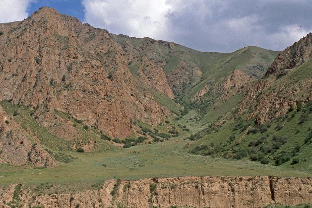
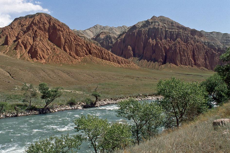
The Chychkan Valley leads us northward. Often, it's more of a gorge than a valley, with the walls rising steeply above us. On a bare, green slope, quite a distance from civilization, we recognize a graveyard. The stone grave markers we see on the slope resemble miniature castles with turrets.
A nomad you remain, even after death
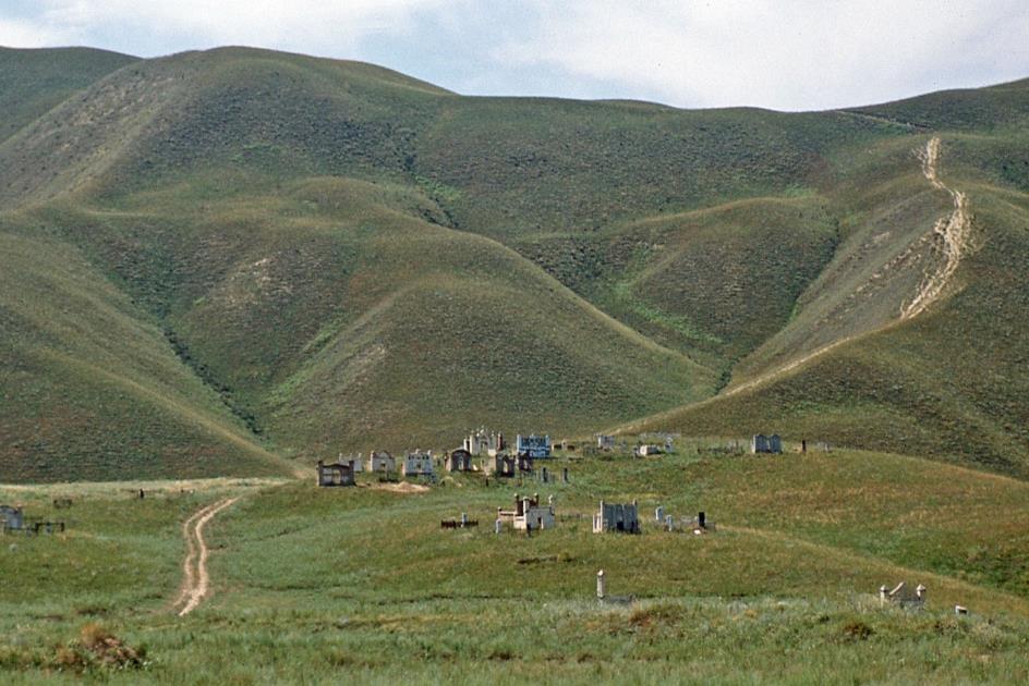
Kyrgyz burial ground
Kyrgyz people inherently have a nomadic spirit; they are pastoral nomads through and through. Only death can put an end to it. If, after death, they are assigned a permanent resting place, it might as well be an impressive structure. They invariably lie on a slope along a major road, with their feet pointing downhill. The deceased, metaphorically speaking, only needs to lift their head to see who is passing by. Because their passion for nomadic human beings persists, even when their own nomadic existence has come to an end. A nomad you remain, even after death.
Ala-Bel Pass
In a shady spot on the bank of the roaring and swirling river, Oksana serves lunch. It's already half past two, and we need to hurry as we are behind schedule. Shortly after we set off, a dark curtain of clouds covers the blue sky. It gets cooler, a strong wind whistles through the valley, and rain pours from the sky. Then thunder echoes through the valley, and lightning flashes between the mountain peaks. What falls from the sky is no longer rain; it's pure hail.
Chychkan Valley |
|
Suusamyr Valley |
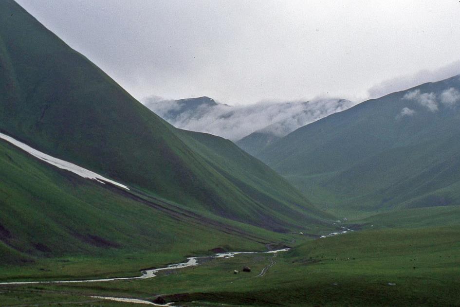
With some luck, you might encounter argalis in this area. They are the world's largest wild sheep, with massive horns. But wild boars, ibexes, and majestic eagles also call this place home. Locals say that eagles sometimes snatch lambs, as their wingspan of two and a half meters allows them to do so. And there's an abundance of rodents here, which is why they named the river Chychkan, meaning mouse in Kyrgyz. But, of course, with this weather, those animals are keeping a low profile. Only foolish tourists venture out now.
We need to cross the Talas-Ala Mountains, an extension of the Tien Shan, the Celestial Mountains
As a saddle between two mountain ranges, the valley now widens a bit. A lush carpet of green grass stretches across the slopes
Suusamyr Valley
We are climbing higher now on the dirt road as the valley swings eastward. We must cross the Talas-Ala Mountains, an extension of the Tien Shan, the Celestial Mountains. At 3,175 meters, the Ala-Bel Pass is the highest point of our route. It's a quarter past four when we swiftly cross the top in pouring rain. Then, suddenly, another problem arises. Our passenger cabin is not as watertight as hoped. Water is seeping in from several places along the roof edge. With an infectious mix of enthusiasm and resourcefulness, Oksana takes the bull by the horns. Insert a few strips of chewing gum into your mouth, chew well, distribute the pulp in small pieces, stick a ball on each hole in the wall, and there you go.
In winter, this valley is a paradise for skiers. In summer, it's the ideal jailoo
Half-nomads with yurts and livestock
With an infectious mix of enthusiasm and resourcefulness, Oksana takes the bull by the horns
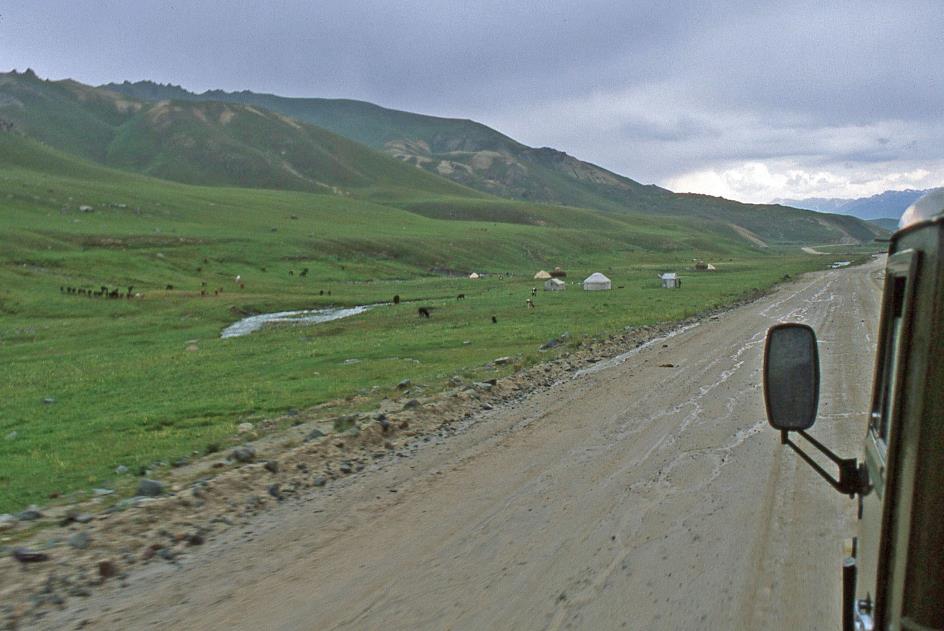
As a saddle between two mountain ranges, the valley now widens a bit. A lush carpet of green grass stretches across the slopes – a world of difference from the bare rock walls of Chychkan. In winter, with its heavy snowfall and gentle slopes, this valley is a paradise for skiers. In summer, it becomes the ideal jailoo, an alpine pasture where semi-nomads let their livestock graze during the warm months. This age-old tradition is still very much alive here, as evidenced by the numerous yurts we spot here and there.
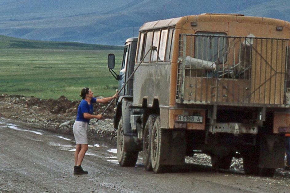
Then, Suusamyr emerges, the river that will guide us downhill. We take advantage of a break between two rain showers to stretch our legs. On the left, the Talas-Ala Mountains still accompany us, while on the right, the Suusamyr Mountains rise. Oksana, our busy bee, takes the opportunity to wash the dusty windows of the passenger cabin on the outside.
|
|
|
Then it continues downhill at breakneck speed, bumping and bouncing along the partially unpaved road. But we're not bothered anymore because we've all mastered the techniques to keep the melons and sleeping bags in check.
Just after six, Sasha deems it necessary to stop again. Entirely justified because one of the tires shows a puncture. For now, Sasha limits himself to inflating the tire again.
At around seven, we reach Suusamyr, a village with two to three thousand inhabitants. The sky looks ominously dark, which slightly worries us since we'll have to set up our tents soon. Fortunately, it's not raining.
Ten kilometres further, John starts searching the banks of the Karakol, a tributary of the Suusamyr, for a suitable camping spot. Why this wasn't planned in advance is a question we no longer ask ourselves. Meanwhile, it starts to rain gently. Sasha doesn't let it bother him and inflates his tire once again.
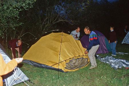
By quarter to eight, John has found the perfect spot for a tent camp. Now it's up to us. In complete darkness, we will set up ten igloo tents. The fact that we've never seen these tents in daylight doesn't make our task any easier. And the wet grass certainly doesn't add to the festive atmosphere. Fortunately, it's no longer raining.
What unfolds on the banks of the Karakol in the dark among the bushes might be labelled as chaos by an external observer. Nevertheless, the chaotic spectacle, five quarters of an hour later, leads to a fully functional tent camp. Thanks to John, who suddenly shows great activity. We are amazed at the creativity with which we have given shape to the concept of 'tent' in a rich variety of interpretations. And at the fact that we have some spare parts left over here and there.
We are amazed at the creativity with which we have given shape to the concept of 'tent' in a rich variety of interpretations
Putting up the tents |
|
Oksana and Yegitali in the ‘kitchen’ |
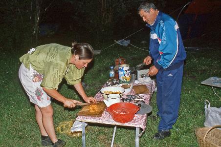
Half past nine. The tireless Oksana has prepared spaghetti on her three gas stoves. It tastes excellent. Then comes tea with honey. Shortly afterward, it starts raining again. No worries, in the meantime, the boys have set up the kitchen tent, and we all fit inside. As a consolation for the late arrival, John brings out a bottle of vodka. At eleven o'clock, silence descends upon the camp.
Tuesday, August 4 | Suusamyr – Song-Köl
Just before six, the camp comes to life. The valley awakens in the chill of the shadow, the morning sun still hiding behind the mountains. The overnight rains have left their mark; everything feels damp and cold. Our enthusiasm for the morning sanitary rituals is at a low ebb. A quick wash, and we're good to go.
Breaking down, that's something we excel at compared to building up
Breakfast |
|
Doing the dishes in the Karakol |
The two drivers slept in the truck, and the three guys in the jeep. Barely having opened their eyes, they blast the Spice Girls across the terrain. With more or less united forces, we start dismantling the tents and packing them away soaking wet. Sasha deems it the moment to repair his inner tube.
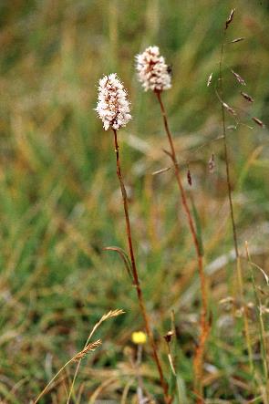
Oksana insists we wash our hands because we've picked poisonous flowers
|
|
A poisoned gift |
Just before half-past seven, our kitchen princess has breakfast ready – bread, cheese, sausage, hot porridge with raisins, cookies, tea. Meanwhile, Sasha has the wheel ready. The truck gets a thorough cleaning inside and out. Gradually, the warm rays of the sun reach the bottom of the valley. That observation alone makes the surroundings warmer and drier. As a token of appreciation, we present Oksana with a bouquet of freshly picked flowers from the surroundings. She accepts it gratefully with a broad smile, only to promptly insist that we wash our hands immediately because we've picked poisonous flowers.
Kökömeren Valley
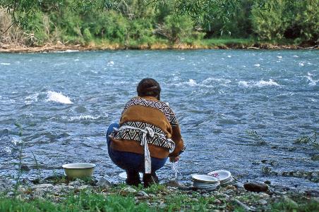
The last chores are finished. Squatting, Oksana washes dishes and utensils in the icy, fast-flowing water of the Karakol. Waste is carefully burned. The area is left spotless, not counting the occasional piece of used toilet paper behind the bushes.
Kökömeren Valley
Barely on our way, Sasha makes a stop in the inconspicuous Kojomkul at a monument, a dilapidated statue representing a certain Kojomkul. Apparently, this guy is so highly esteemed here that the village has adopted his name – or was it the other way around? It's clear that Kojomkul was a big man – two meters thirty, two hundred and three kilograms, shoe size 52 (UK 17½), according to the annals. His career as a heavyweight wrestler was indeed successful, and he played a significant role in the development of farms in the valley.
Kojomkul is said to have carried a horse on his shoulders for a hundred meters
Kökömeren Valley |
|
|
Some of his feats, however, are less straightforward. For instance, he is said to have carried a horse on his shoulders for a hundred meters and personally placed a 160-kilogram rock on his mother's grave. What motivated him to do such things is unclear to us. It is also unclear why he fell out of favour. In any case, he spent a year in one of Stalin's prisons in 1937. Nowadays, his past seems to be forgiven, as the sports arena in the capital, Bishkek, is named after him. Kojomkul is associated with the legendary Manas, the mythical hero of the epic that holds the same significance for Kyrgyzstan as the Iliad does for the Greeks.
The epic of Manas holds the same significance for Kyrgyzstan as the Iliad does for the Greeks
Kökömeren Valley |
|
Sasha inspects his truck |
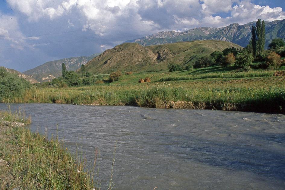
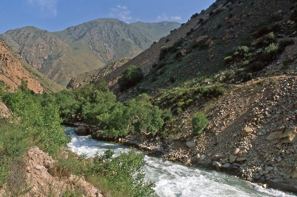
Where the Suusamyr and the Karakol converge, the Kökömeren is born. This is the river we will follow southward. A splendid day seems to be unfolding. The sky is heavenly blue, with hardly a cloud in sight. The unpaved road willingly follows the meandering curves of the river through this magnificent scenery. Below, the green meltwater forcefully finds its way over the rocky bed, classified as grade 4 to 5 for rafting, according to John. Shrubs and small trees manage to cling to the dangerous slopes. Everywhere, wildflowers succeed in adding colorful accents amid the brown rocks.
|
|
|
It must have been a hallucinatory experience to traverse such narrow paths with heavily loaded donkeys and camels
Path of the ancient Silk Road
Across the river, John points out the remnants of a branch of the old Silk Roads. Like a delicate ribbon, the narrow path adheres to the steep mountainside. It must have been a hallucinatory experience to traverse such narrow paths with heavily loaded donkeys and camels, where the slightest mistake could lead to a fatal fall.
Villages and nomads are two concepts that are at odds with each other
Kökömeren Valley
Then Kyzyl-Oi appears, a village with around eight hundred inhabitants that existed even before the Russians claimed Kyrgyzstan in 1876. This is highly unusual because villages and nomads are two concepts that are at odds with each other. Villages and farms are a phenomenon that only emerged in Kyrgyzstan in the 1930s when the Soviets began pushing for the collectivization of agriculture and forced the nomads to choose a fixed residence.
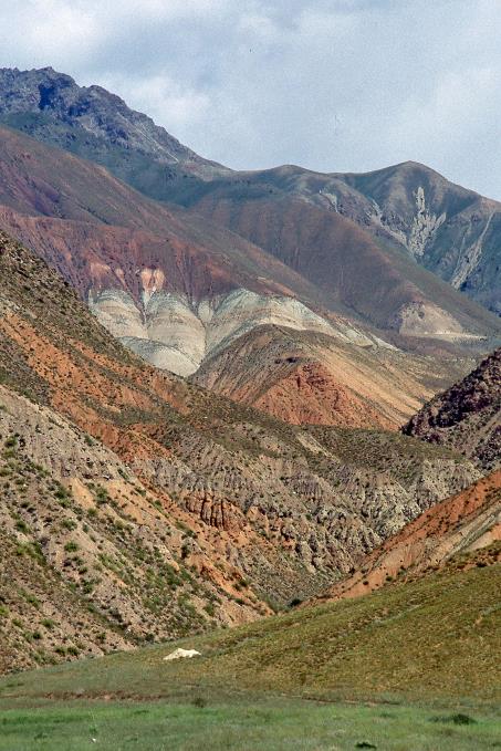
The surrounding mountains showcase a colour palette that becomes increasingly breathtaking
Kökömeren Valley |
|
|
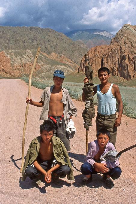
But it is the landscape that now impresses us the most. It keeps getting better. The surrounding mountains showcase a colour palette that becomes increasingly breathtaking. It's as if a painter has been given permission to give the mostly barren slopes a touch of paint – from white-grey to ochre-yellow, reddish-brown to purple-red. The red clay is highly sought after by the residents of Kyzyl-Oi because they use it to build their houses. Agriculture is also practiced here, as we encounter four young men on their way to their fields. They willingly pose for a photo. Sasha manages to chop some wood. We will need that later because we will be camping on a treeless steppe.
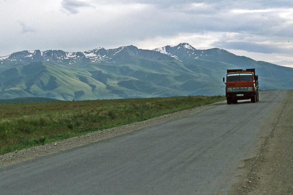
This brings us to the broad valley of the Dzhumgal, a tributary of the Kökömeren. We head directly east now, passing villages like Aral and Chayek. We are still driving towards a radiant blue sky while, behind us, the mountain peaks slowly disappear behind the clouds.
Dzhumgal Valley
For Sasha, a river crossing is a piece of cake
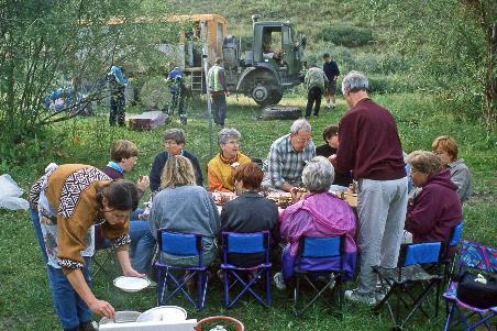
In Bashkugandy, at exactly one o'clock, we take the turn towards Song-Köl. That idyllic mountain lake in the heart of Kyrgyzstan is our final destination today. We promptly cross the Dzhumgal. There is no bridge over the water, but for Sasha, a river crossing is a piece of cake. Shortly after, he drops us off on a little island in the middle of the Karakeche, a tributary of the Dzhumgal. As we nestle in the shade of the trees, the ever-busy Oksana spreads her blanket and quickly provides us with sandwiches filled with chicken liver pâté, tomatoes, bell peppers, and cottage cheese.
Like a gigantic funnel, the barren plain converges into a narrow wedge between the mountains
Eagerly, we look out towards the barren rock masses of the Moldo Range, partially covered with snow, dominating the distant horizon
On the way to the Moldo Range
Eagerly, we look out towards the barren rock masses of the Moldo Range, partially covered with snow, dominating the distant horizon. The last phase of our journey now begins – the ascent to Song-Köl. Over a distance of 77 km, we will climb from an elevation of 1,800 m to 3,370 m. It's not particularly impressive, but you never know. We eagerly anticipate the barren rock masses of the Moldo Range, partly covered with snow, dominating the distant horizon. Somewhere there, we will spend the next two nights.
|
|
|
|
|
A perfectly straight gravel road that seems to stretch endlessly leads us southward over the vast sediment plain. Like a gigantic funnel, the barren plain converges into a narrow wedge between the mountains. This is the gorge of the Karakeche, the western gateway to Song-Köl. From the gorge emerges a crystal-clear mountain stream, peacefully trickling down over the rocks of the overly wide riverbed. It looks innocent now, but in spring, when the snow melts, a powerful river undoubtedly rushes through here.
Karakeche Valley |
|
|
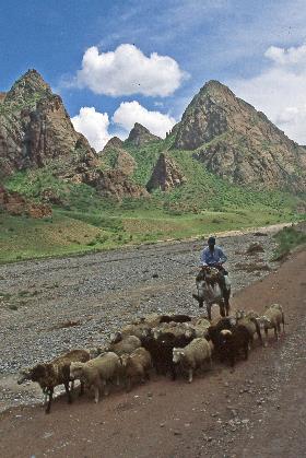
A horseback herder drives his goats along the river. Behind him rise brown-red rocks, adorned with mantles of lush green grass and small shrubs. Occasionally, a cloud drifts in front of the sun, but the sky is predominantly blue. This is rural Kyrgyzstan at its best. It remains a mystery to us why, now and then, a truck heavily laden with raw coal crosses our path.
The Karakeche open-pit coal mine is Kyrgyzstan's largest
The explanation is not long in coming. As soon as the unpaved road turns eastward, we look down on the Karakeche open-pit coal mine, Kyrgyzstan's largest. Approximately half of the national coal production comes from here, and there is reportedly more than 438 million tons still underground. Deep drilling is unnecessary; the mineral is so close to the surface that it can be easily excavated in open air. An immense black scar in this bucolic landscape is the result, a dreary, grey blot that expands year after year.
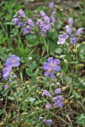
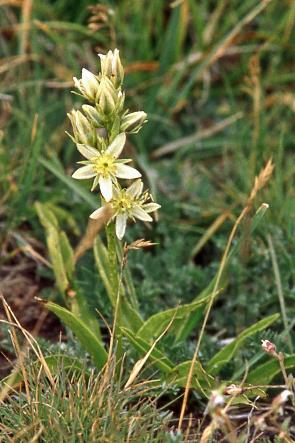
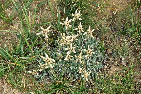
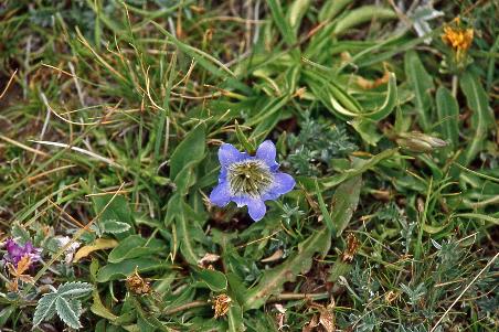
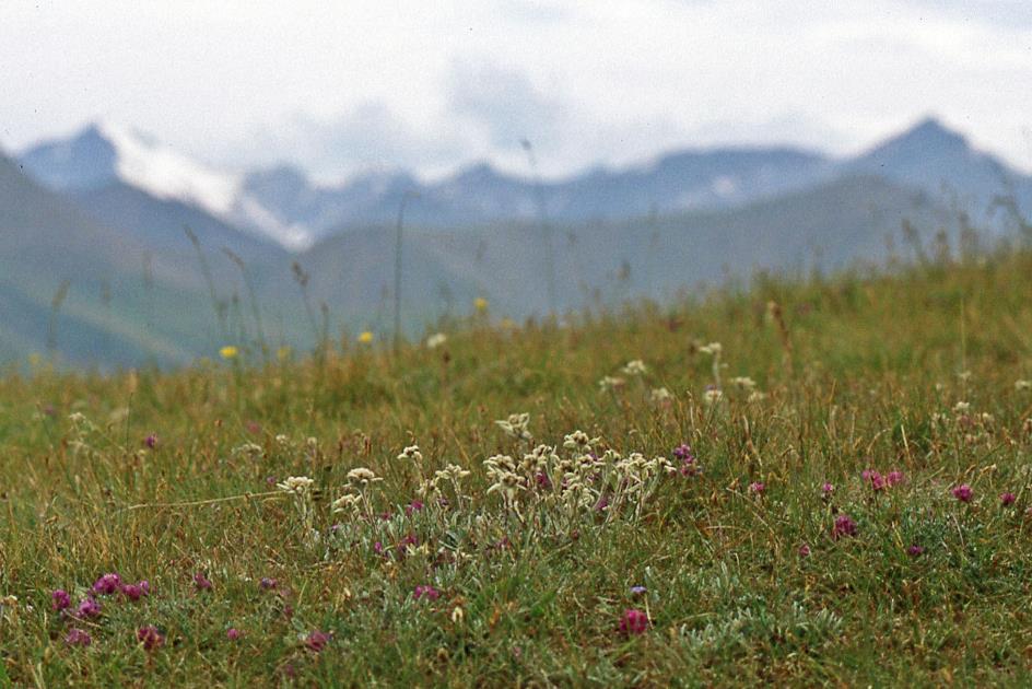
Nine switchbacks later, we reach the top of the mountain pass, 3,370 m above sea level. In the east, we already discern the vague outlines of Lake Song-Köl, and in the west, we recognize the snow-covered peaks of the Moldo Range. At our feet, thousands of wildflowers bask in the generous sun, including edelweiss and gentian, thriving abundantly.
These fertile jailoos are a favourite destination for semi-nomads from the surrounding villages
Yurts on the banks of the Karakeche
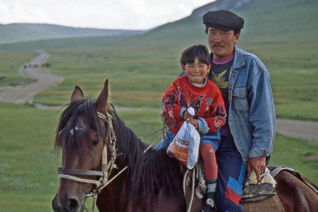
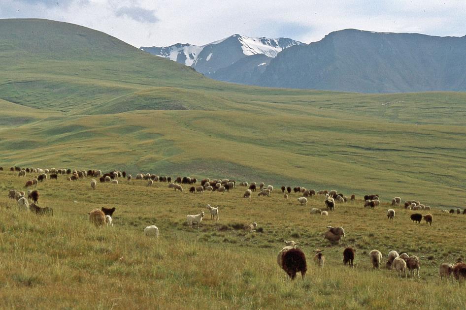
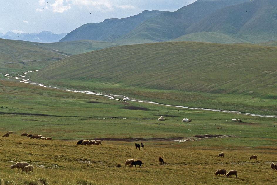
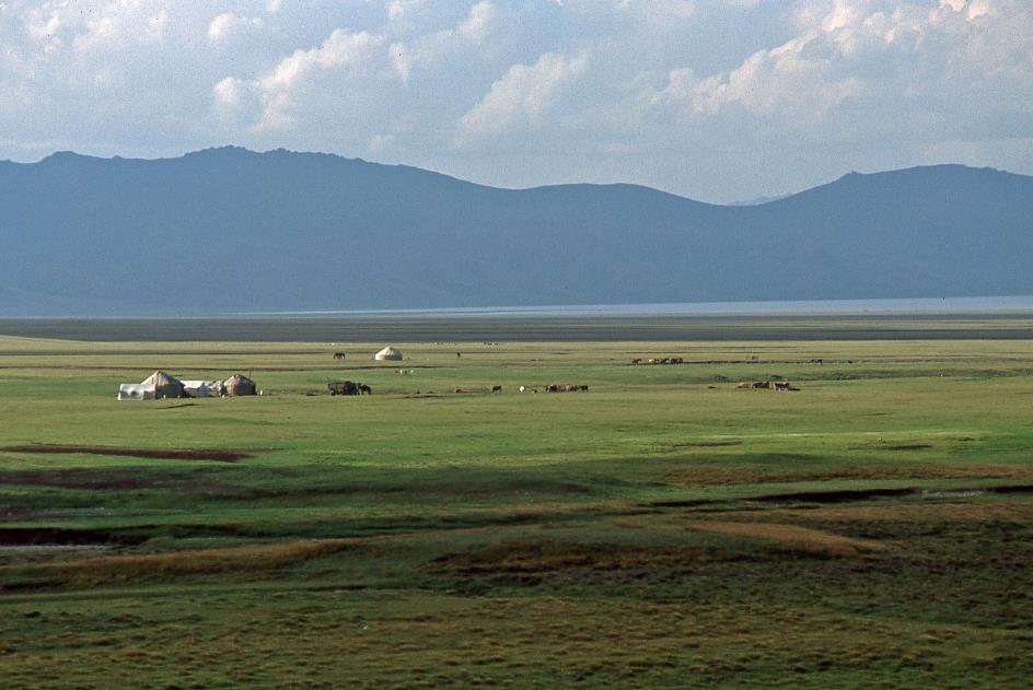
About thirty-five kilometres still separate us from our destination. Gradually, we descend the gently rolling slopes into the enormous basin, with the water mass of Song-Köl at its centre. Trees or shrubs are nowhere to be seen, but grass is abundant. Hundreds of goats and sheep eagerly graze here and there; below by the stream, we notice some yurts and a handful of horses. These fertile mountain pastures, or jailoos, with their seemingly endless food supply, are a favourite destination for semi-nomads from the surrounding villages. In the summer, they take their livestock and yurts into the mountains, staying there for several months, and in winter, they retreat to the lower valleys.
Yurts on the banks of the Karakeche
For the rest, there are no signs of civilization for dozens of kilometres in every direction. Or so we thought, as suddenly John mentions a graveyard. They are likely Scythians buried here, members of a nomadic people that controlled a significant part of the Eurasian steppe for about a thousand years, from the 7th century BCE to the 4th century CE. In the tall grass, we should recognize some burial mounds, but there is hardly anything visible. Without John's guidance, we might easily overlook them.
Edelweiss with the Moldo Mountains in the background
Our presence does not go unnoticed. Coming from who knows where, we are quickly surrounded by a few curious nomads on horseback. A boy around ten, immensely proud of his riding skills, wants to show off his tricks by making his horse move sideways instead of forward. Unfortunately, the performance ends badly; the horse, along with its rider and his ego, goes crashing down.
Edelweiss |
|
Gentian |
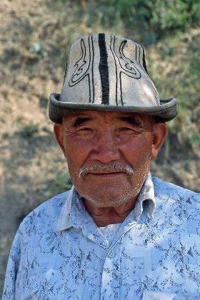
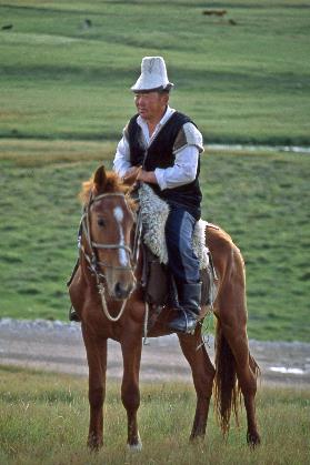
Whether we want to buy a sheep, suggests one of the men on horseback. He wears a kalpak, the typical Kyrgyz headgear made of white felt with black patterns. It is one of the holiest pieces of Kyrgyz identity. These hats are made of four pieces of white felt with traditional black motifs embroidered on them. Strict rules govern the use of the kalpak. You should never place this headgear on the ground. At night, you should place it at the head end of your bed, never at the foot end. Furthermore – not unimportant – you should never kill a man wearing a kalpak.
Whether we want to buy a sheep, suggests one of the men on horseback
Rider with kalpak |
|
|
The man's question surprises us. We are already managing melons and sleeping bags; do we now have to take a sheep on board too? A chop or a leg, we can handle that, but the whole lot? How are we going to deal with the wool and the legs? Not to mention the entrails. But Yegitali is interested and reassures us. Tomorrow the sheep will be slaughtered. He will prepare a delicious dinner with the fresh lamb meat.
That looks promising. As long as it's not beshbarmak, the national dish of Kyrgyzstan. John mentioned it disdainfully during the ride, with the usual disdain of the ethnic Russian for local customs. Literally, it means five fingers, because Kyrgyz people eat it with their hands from a common dish. It is prepared with finely chopped boiled meat, mixed with dough and an onion sauce. We don't mind that, except that guests, as a sign of respect, get a freshly cooked sheep's eye on their plate.
We don't mind that, except that guests, as a sign of respect, get a freshly cooked sheep's eye on their plate
Lake Song-Köl
At quarter past six, we reach the shore of Lake Song-Köl. A strong wind blows from the north, across the water, a cold wind indeed, considering we are at an altitude of 3,020 meters. Otherwise, it seems we have the vast, barren grassland in front of us all to ourselves, except for a few yurts with some horses and sheep a bit further away. Unexpectedly, a rain shower seems to want to spoil the party, but fortunately, it doesn't last long.
Setting up tents is something we already have some experience with. Moreover, darkness has not yet fallen. A piece of cake, or so it seems. However, it doesn't go as smoothly as planned. The terrain is not as flat as it initially appears. It's a patchwork of bumps and hollows. During a downpour, water can accumulate in those hollows. So, we look for a bump that is large and flat enough to support a tent. At the same time, we make sure not to smother any edelweiss plants under our tent. We also avoid horse droppings, but for a different reason.
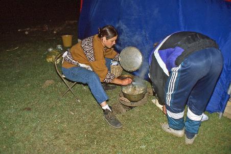
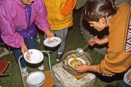
Just past half-past seven, we are done. Yegitali hasn't been idle all this time either. He has dug a perfect little toilet pit, shielded on three sides with a tarp. Oksana also got to work straight away, but she is having a tough time in her field kitchen She has dug a hole in the ground to protect the stove from rain and wind, and she has set up her gas stove with a gas cylinder in the truck's passenger compartment. Nevertheless, it's not easy to cook at an altitude of over three thousand meters. Water boils here at only 90 °C (194 °F). At this low temperature, dishes have to simmer much longer than usual before they are done.
Cooking at an altitude of over three thousand meters is not easy. Water boils here at only 90 °C (194 °F)
Cooking at high altitude |
|
Laghman |
It's half-past nine when Oksana serves us her deliciously hot laghman – Chinese noodles with lamb or beef and a variety of vegetables, cooked in a meat broth. Among the Turkic-speaking peoples of Central Asia, the dish holds about the same status as fries with stew does among the Flemish.
Among the Turkic-speaking peoples of Central Asia, the dish holds about the same status as fries with stew does among the Flemish
It's almost windless now between the tents. However, the wind over the water is still raging, sending foaming waves ahead of it. Just after ten, we go to sleep. The clouds maliciously open their floodgates, generously showering their raindrops over the mountain plateau.
Jaak Palmans
© 2024 | Version 2024-01-16 16:00
Continue reading in (2/2)
Like a winged horse